Chiprovtsi

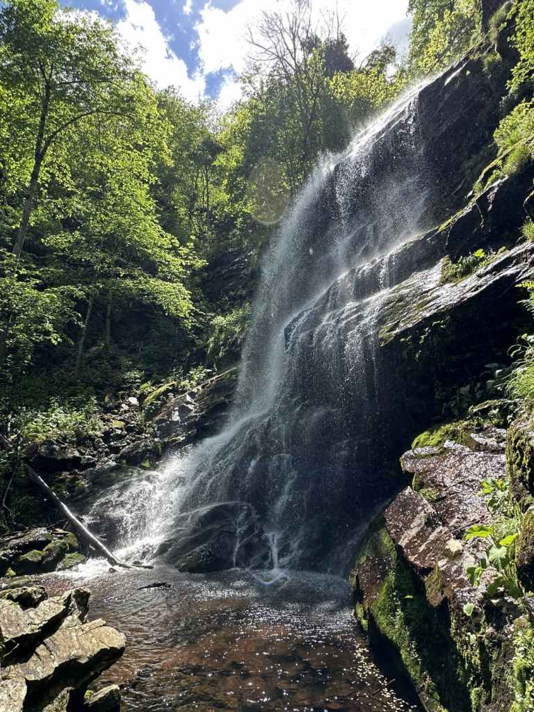
Chiprovtsi is a small town in north-west Bulgaria, between Belogradchik and Montana. It is situated on the northern side of the Balkan Mountains, very close to the Serbian border. It is famous for its carpets, but also for its waterfall, one of the most beautiful in Bulgaria. The first time I visited this waterfall, it was raining so much the air was full of water, and it was as if the waterfall was the whole forest.

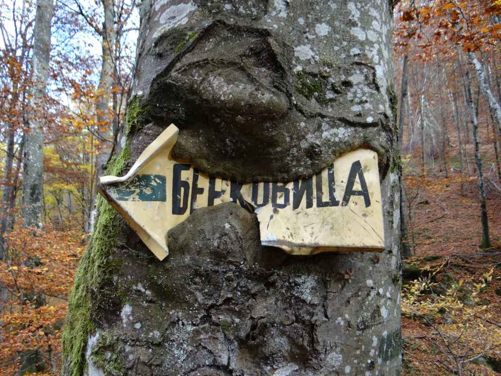
The drive from Sofia takes three hours. You must take the II-81 road in the direction of Kostinbrod and Montana. You pass through the picturesque village of Gintsi before driving up and over the Balkan at Petrohan Pass. You then descend to Barzia before passing the turning to Berkovitsa, another waterfall, on your left. Ten kilometres before Montana, you leave the II-81 and turn left where it is signposted for Chiprovtsi (35 km). You immediately cross a railway, and then the road veers left (if you go straight, you will end up in the village of Borovtsi). After fifteen kilometres, you reach a T-junction. Again, turn left for Chiprovtsi (18 km). In another ten kilometres, just after the pretty village of Beli Mel, again there is a turning on the left for Chiprovtsi (now 10 km).

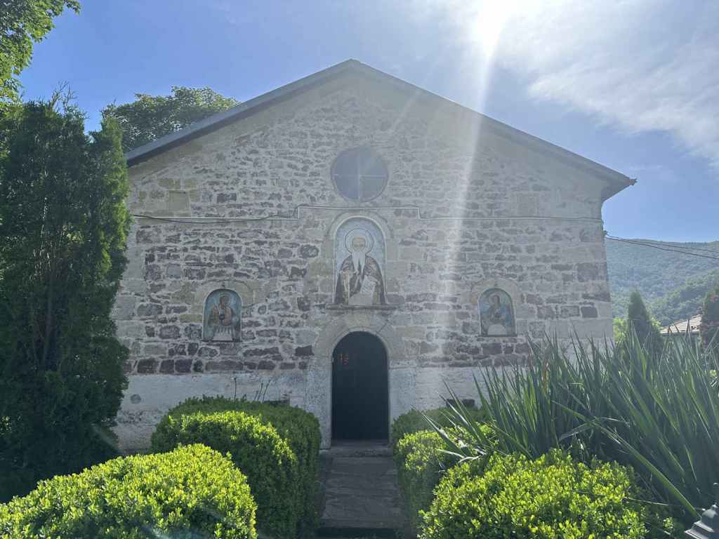
Four kilometres along this road, there is a turning on the right for Chiprovtsi Monastery (which is set back 500 m from the road). I recommend a visit to this monastery. I went before the waterfall, when it was still early, and the sunlight and spring flowers were very warming. The monastery is dedicated to Bulgaria’s most famous saint, the tenth-century hermit St John of Rila, who founded Rila Monastery.

Having returned to the road, continue in the same direction, and after 4.5 kilometres you will pass the sign for Chiprovtsi itself. 300 m after this sign, you must again turn left to enter the town (otherwise you will bypass it). You are now on Petar Parchevich Boulevard. Continue along here for 1.3 km and, after you pass the school of the same name on the right, turn left down Petar Bogdan Street (both these Peters were Roman Catholic Archbishops!). Continue for 200 m, turn right onto 23 Septemvri Street for 100 m, then left onto Tocho Voyvoda Street for another 100 m, then right onto Balkanska Street. This is the street that will take you to the beginning of the walk to the waterfall. (If you find this difficult, you can simply ask Google Maps for directions from your location to Chiprovtsi Waterfall, which should lead you through the town and out the other side. The important thing is to end up on Balkanska Street.)

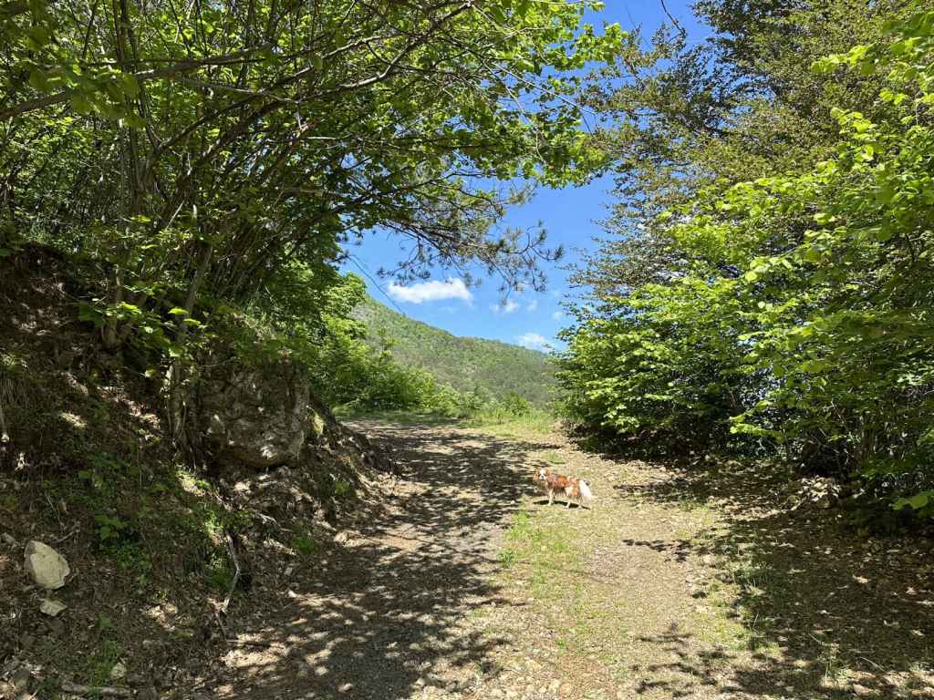
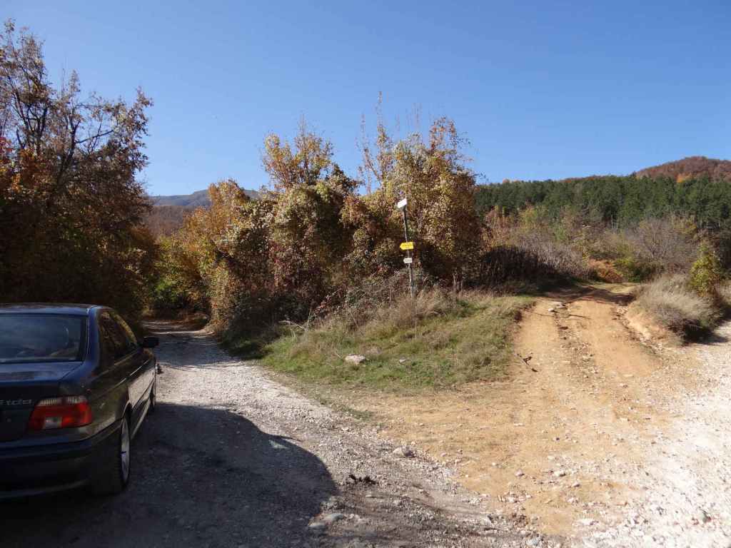
This street leaves Chiprovtsi, heading west. You must drive along it for 4.5 kilometres, at which point the road in front of you becomes a track, and the road itself turns back on itself in the direction of Jar Hut. You do not need to go there unless you want to. Park the car on the grassy verge. You are ready to start your walk.

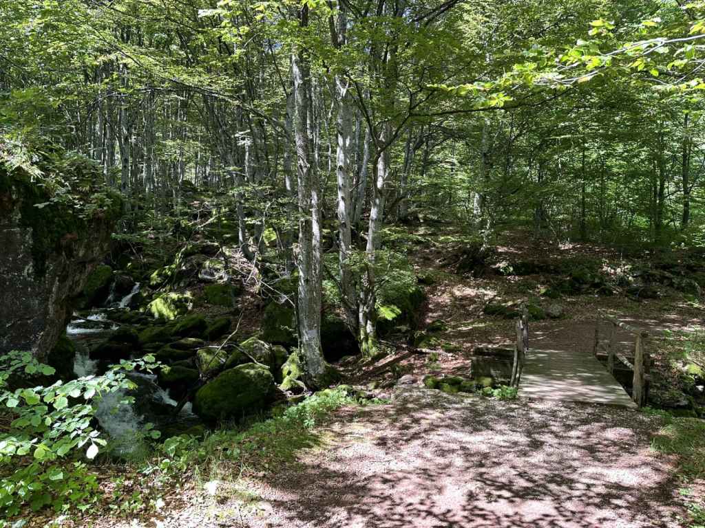
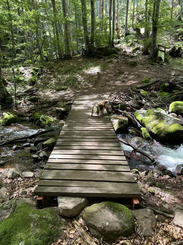
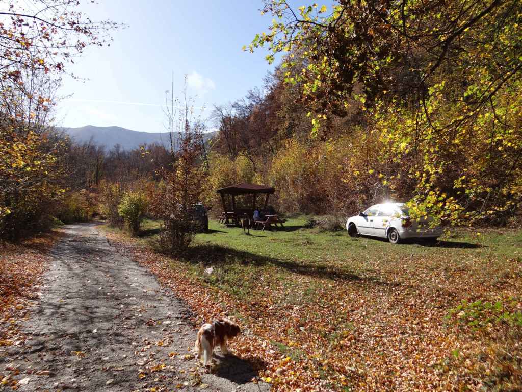
The walk to the waterfall is 3.2 kilometres and takes about an hour. Follow the track for 1.5 kilometres, at which point it divides. The left branch goes to Jar Hut, as you might expect, but you want the right branch. You will soon hear, and then see, the river on your right. This is the river that forms the waterfall higher up. Continue on the track for another 700 m, at which point there is a bridge over the river. The track now doubles back and descends on the other side, but you want to continue upstream, which means taking a path on the far (west) side of the river. There is a box with a first-aid kit and a picnic table directly after the bridge. The path is on your left after this.

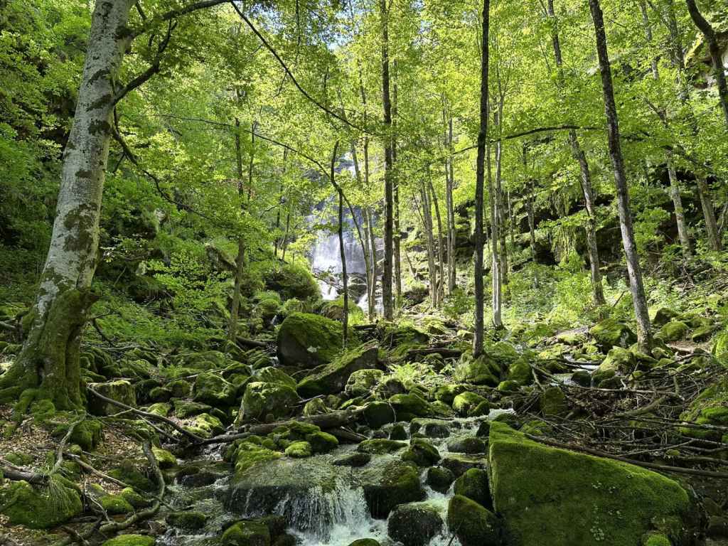
You should now have the river on your left. Walk upstream. In 200 m, a bridge of planks crosses a small tributary. Keep following the course of the other river. The path gets steeper, and at one point comes out into the open (I noticed a lot of fallen trees in May). So long as you keep the river on your left, you will not get lost. In another 300 m, there is a second plank bridge, this time over the river, taking you back to the east side. Now the river is on your right. Another 400 m, and there is a third plank bridge taking you back over to the west side, but by now the waterfall is visible through the trees. I sat with my dog for an hour and a half, and I can say the time just disappeared as I marvelled at the drops of spray, the rocks that make up the waterfall (a waterfall is water and rock), little flowers gleaming in the sunlight in far, out-of-the-way places that I could never reach. It was wonderful.

You are now only a few kilometres from the Serbian border. On the Serbian (south) side of the Balkan, there are also waterfalls, I understand, and a national park. When you have had your fill, simply go back the way you have come.

Chiprovtsi Monastery in the early-morning sunlight.
The turning for Petar Bogdan Street, with the mountains (and the waterfall) behind.
The walk to the waterfall begins 4.5 km south-west of Chiprovtsi. Simply follow Balkanska Street until the road doubles back on itself.
The track as it approaches the river.
The bridge over the river.
The first-aid kit.
The first of three plank bridges (this one over a tributary).
The second plank bridge, taking you back to the east side of the river.
One of several interesting rocks on the way to the waterfall.
Two lovers kissing!
The waterfall through the trees.
Chiprovtsi Waterfall.
A view from higher up.

Berkovitsa

Sofia irradiates roads. I discuss the three that go to the Black Sea in my description of Sopot Waterfall. Then there’s the II-16 that takes you north along the Iskar Gorge to Bov and Dobravitsa. And the E79 (or the A3 motorway) that takes you south to Ovchartsi and then Greece. The E871 heading south-west in the direction of Polska Skakavitsa and Kyustendil. And don’t forget the II-63 that takes you west to Tran on the Serbian border (I still remember visiting Bilintsi Monastery along this road and meeting the abbot, who gave us tea next to an open pit and had taken it upon himself to ‘improve’ the ancient frescoes in the church).

Well, here we are going to take the II-81, which also heads north from Sofia in the direction of Montana and Lom. It is as if Sofia has antlers – the II-81 on the left, and the II-16 on the right. What makes the II-81 famous is Petrohan Pass, which you must pass over in order to reach north-west Bulgaria (Vidin and Romania). You leave Sofia through the district of Nadezhda and cross the ring road. The II-81 starts gently enough, passing through Kostinbrod and Buchin Prohod (from here you can turn right and cut across to the II-16 if you’re suddenly overwhelmed by a desire to visit Dobravitsa Waterfall).

After Buchin Prohod, ignore the turning to Godech on the left (though this, for me, is a very attractive part of Bulgaria with the wonderful Razboishte Rock Monastery) and the ‘Historical Road’ (the main road continues left), and pass through the pretty village of Gintsi, much favoured by artists and beekeepers. The road then begins to twist and turn as it climbs Petrohan Pass. The pass is often closed in winter because of snow, but the rest of the year it’s normally fine. The top of the pass is 65 km north of Sofia. There’s a large reservoir, which I understand was once a fish farm.

The road then descends on the other side. More twists and turns (try not to get stuck behind a van!). Ten more kilometres, and you reach what in my parlance would be called a ‘roadside caff’ on the other side of the road, a restaurant much favoured by my father-in-law, I am told (he was a famous opera singer and his family hailed from Vidin) – you can always stop here to try the kebabs and meatballs. Another six kilometres, and you enter Barzia, the Gintsi of the north, so to speak. From here, a road heads right to Klisura Monastery, well worth a visit, if you have the time.

But we must continue to the town of Berkovitsa in order to reach Haidushki Waterfall. So stay on the main road. Three kilometres out of Barzia, you will see a turning on the left, marked ‘Berkovitsa, 2 km’. Take this turning, climb the hill, and soon you will reach an OMV petrol station. I have a particular fondness for this petrol station, because this is where I bought Timon, the meerkat who features in The Lion King and was once my son’s favourite teddy.

You can stop here for petrol or a coffee. After OMV, the road goes right, alongside the railway. After 1000 m, the road goes right again, over the railway, but you go left. This turning is marked ‘x. Kom, 17 km’. Another 700 m, and you must take a turning right, marked ‘Kom Peak, 14 km’. Continue along here for 2½ km, passing a stadium on your right, until you reach a fork in the road. Take the right turning, and now you have a decision.

The road you are now on leads directly to the waterfall. I can’t tell you the distance, because I parked the car by the marble (‘mramor’) factory which is in front of you and walked. But plenty of people take the car further, there being lots of picnic places and several summer houses along the way. So you have a choice. How far do you want to walk?

The car journey from Sofia to this point is about 1 hour 45 minutes (90 km). The walk in front of you is the same, 1 hour along the flat, and then 45 minutes gently climbing the mountain. You never leave the road, though it becomes progressively more rutted and covered in leaves, and I wouldn’t want to think what happens if you’re on the mountain and meet a car coming the other way. You’ve also got the question of having to turn around. So it’s really the 1 hour on the flat that can be shortened. Plenty of people drive this distance, leaving the car as the road begins to climb (this point is marked by the beginning of an ecopath, for which there is a rusty yellow sign).

If you leave the car by the marble factory, you will have a 4½-hour outing there and back, including a lunch stop. You walk alongside the marble factory for ten minutes, the road then appears to fork – actually it continues on the left (this is where many people park), while a track heads right, up the hillside. After that, you can’t get lost, unless you want to. All along the road, there are picnic spots. It’s up to you how far you take the car. But after an hour’s walking, when the road begins to climb and the waterfall is only 45 minutes away, it really is time to leave the car behind and enjoy the nature.

We went at the end of October. Haidushki Waterfall is a series of beautiful short waterfalls, and one of the few waterfalls it doesn’t matter if you go in the spring (after the snow melt) or in the autumn. Leaves carpeted the ground. The river below the waterfalls shone black. Other leaves that hadn’t reached the ground yet seemed to rain down on us, but it was the river that kept drawing my attention. Sometimes the leaves on its surface meant you didn’t know it was there, and it was easy to put your foot in it – in fact, I did precisely this: I became part of the waterfall for a moment.

It is clear when you reach the waterfall, because there are several signs. You have to descend a little. There is a shelter with some benches, a small mirador, and then the waterfall in front of you, but don’t forget the other waterfall on your right, hidden around the corner. They’re both beautiful.

If you continue upriver or downriver, no doubt you will come across other cascades. The traffic coming back into Sofia was dense, I had to drive with only one sock (the other was wet), but we had had our adventure. Life is not a choice, we only think it is – it is an experience.

The OMV petrol station in Berkovitsa (the road goes right).
After 700 m, you take a turning right, marked ‘Kom Peak, 14 km’.
The stadium in Berkovitsa.
The fork in the road – the road on your right leads all the way to the waterfall, but becomes progressively more rutted and leaf-strewn.
The marble factory on your right – we parked here.
After ten minutes, the road continues on your left, while a track heads uphill.
Autumnal colours.
The road through the trees.
One of the picnic places.
Yellow sign indicating the start of an ecopath – the road begins to climb the mountain.
The river with leaves on its surface.
The road on the mountain.
A landscape painting.
Arrival at the waterfall (which can be seen bottom left).
The roof of the shelter.
Haidushki Waterfall (left).
Haidushki Waterfall (right).
The road back to Berkovitsa (being eaten by a tree).