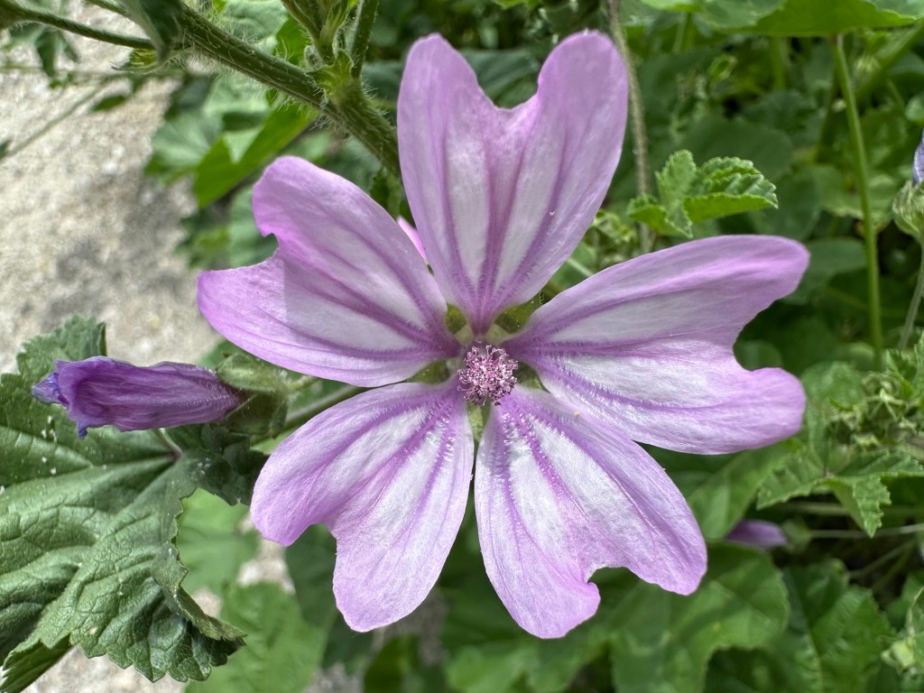
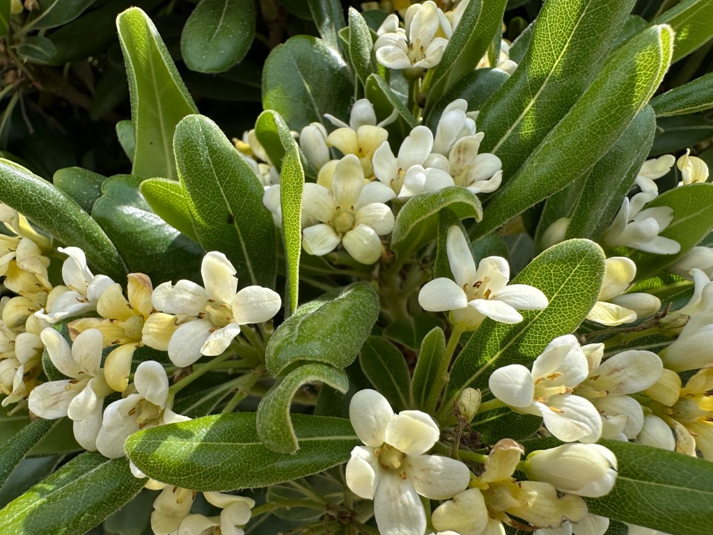
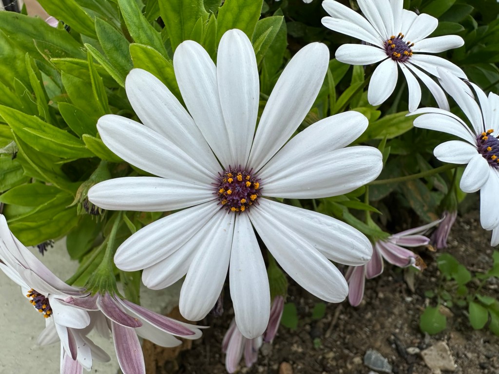
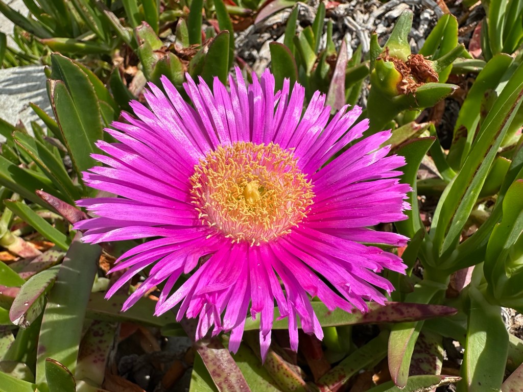
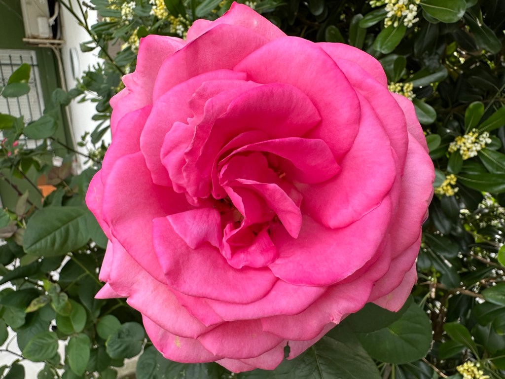
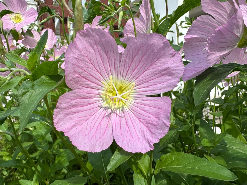
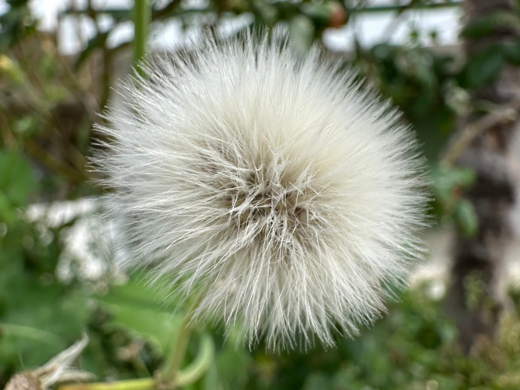
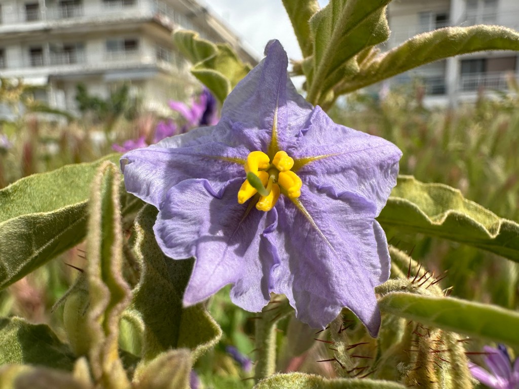
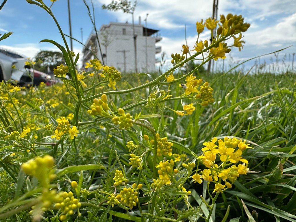
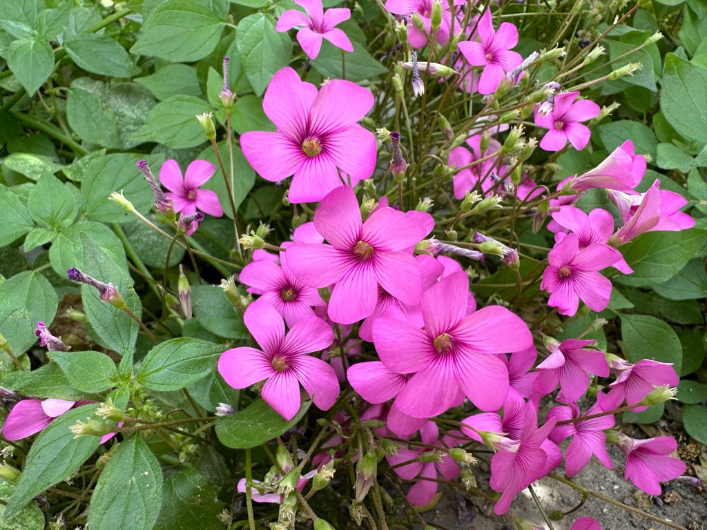
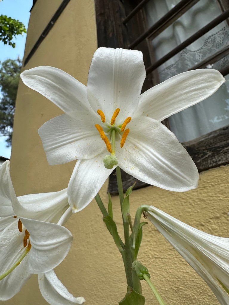
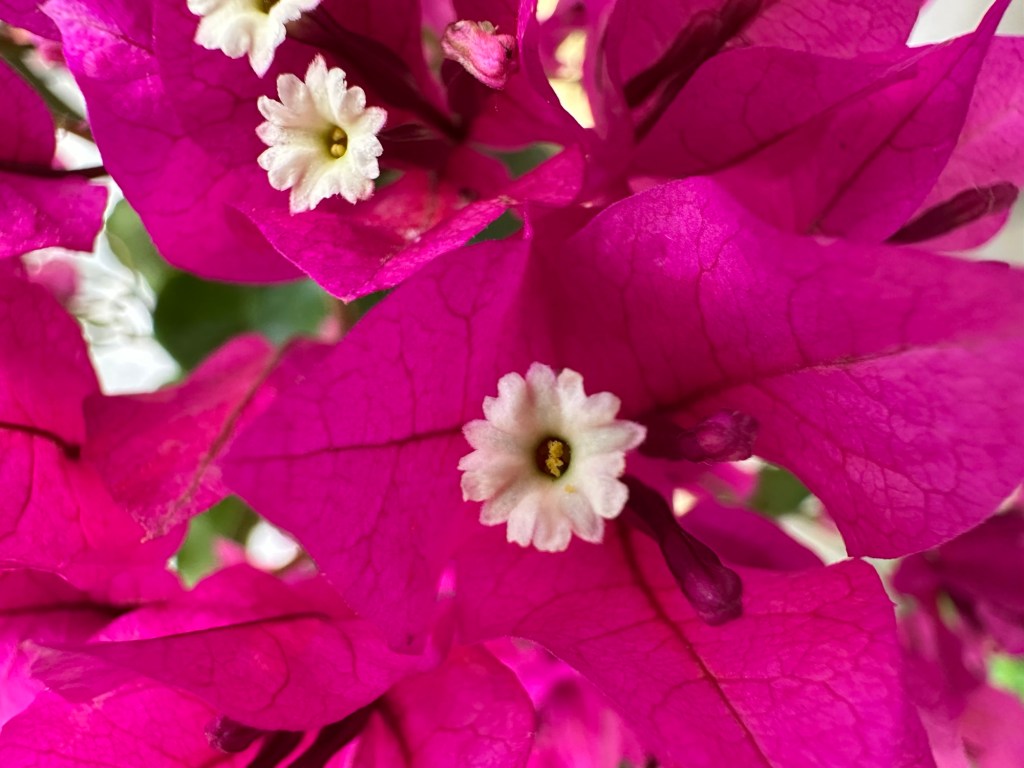
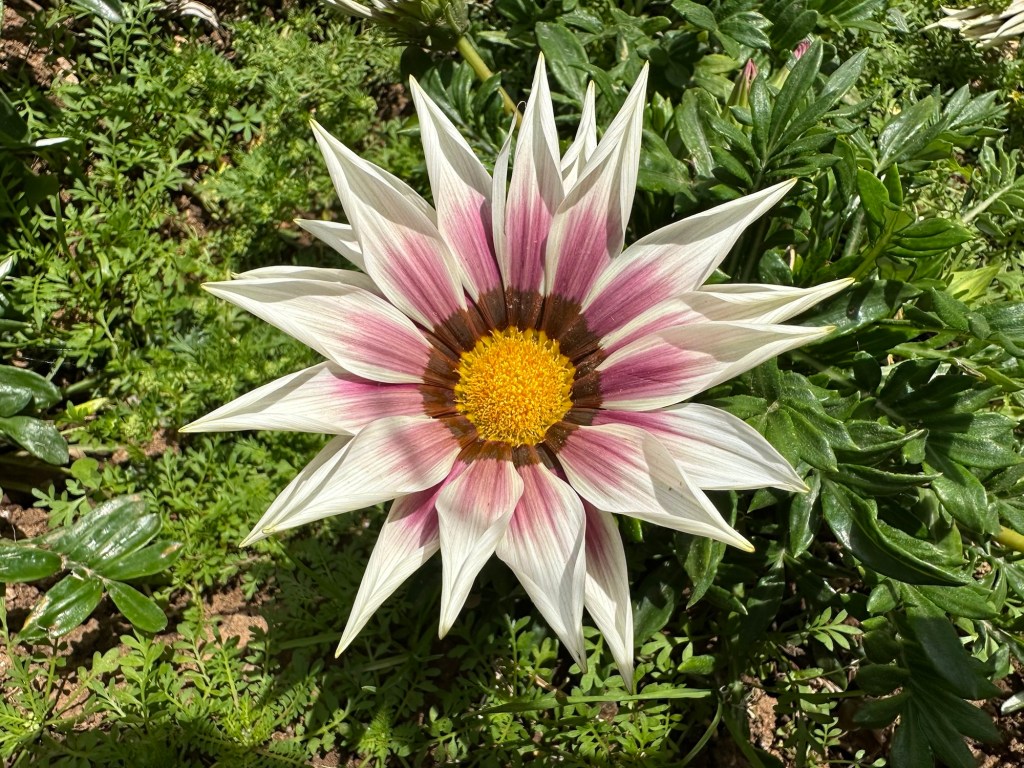
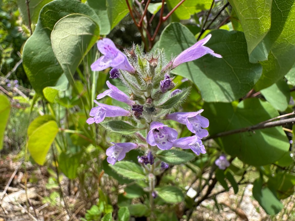
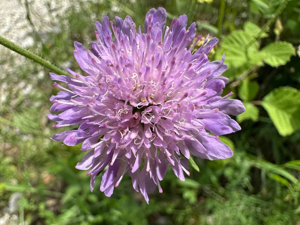
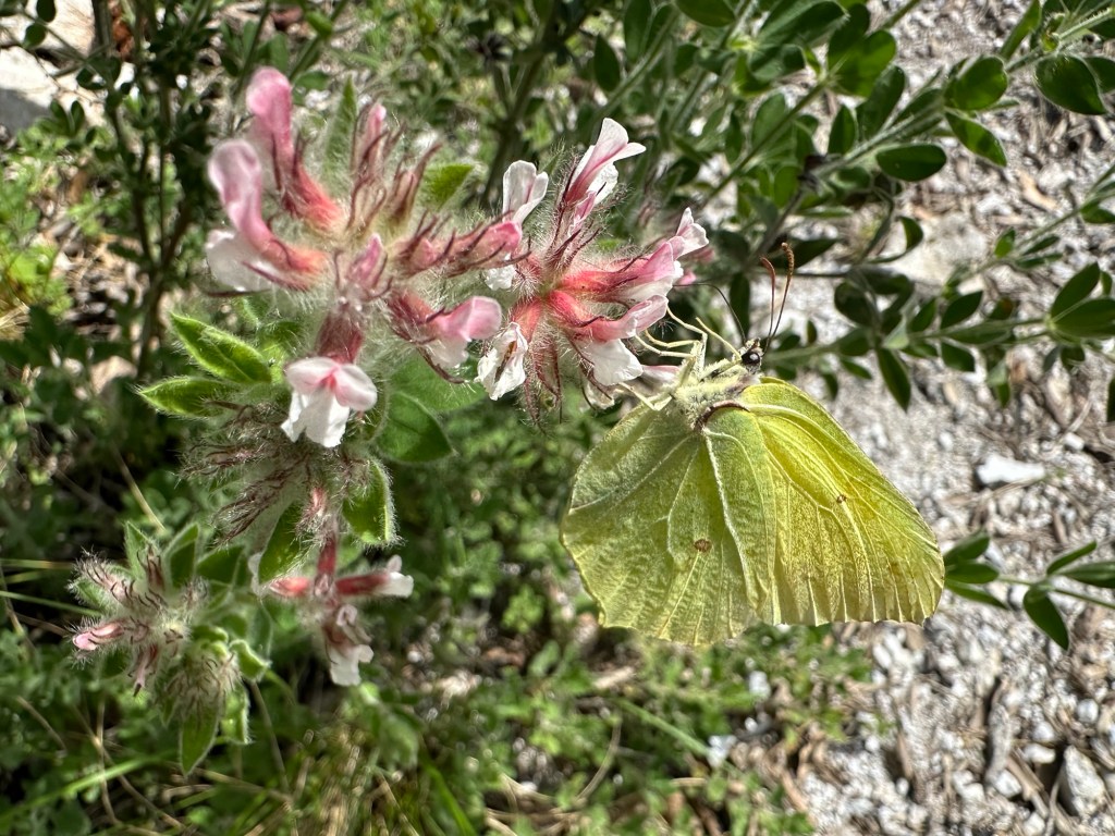
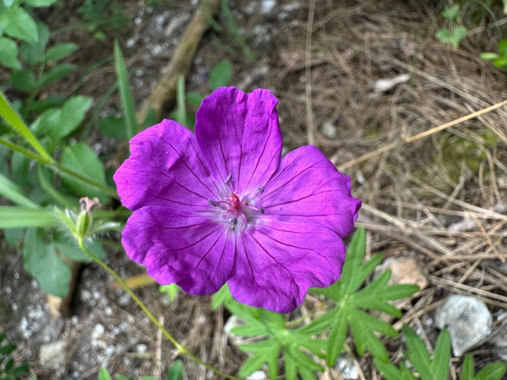
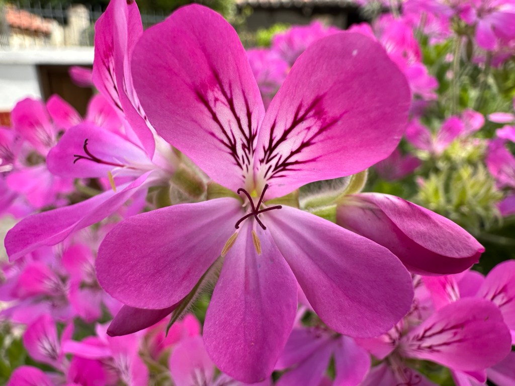
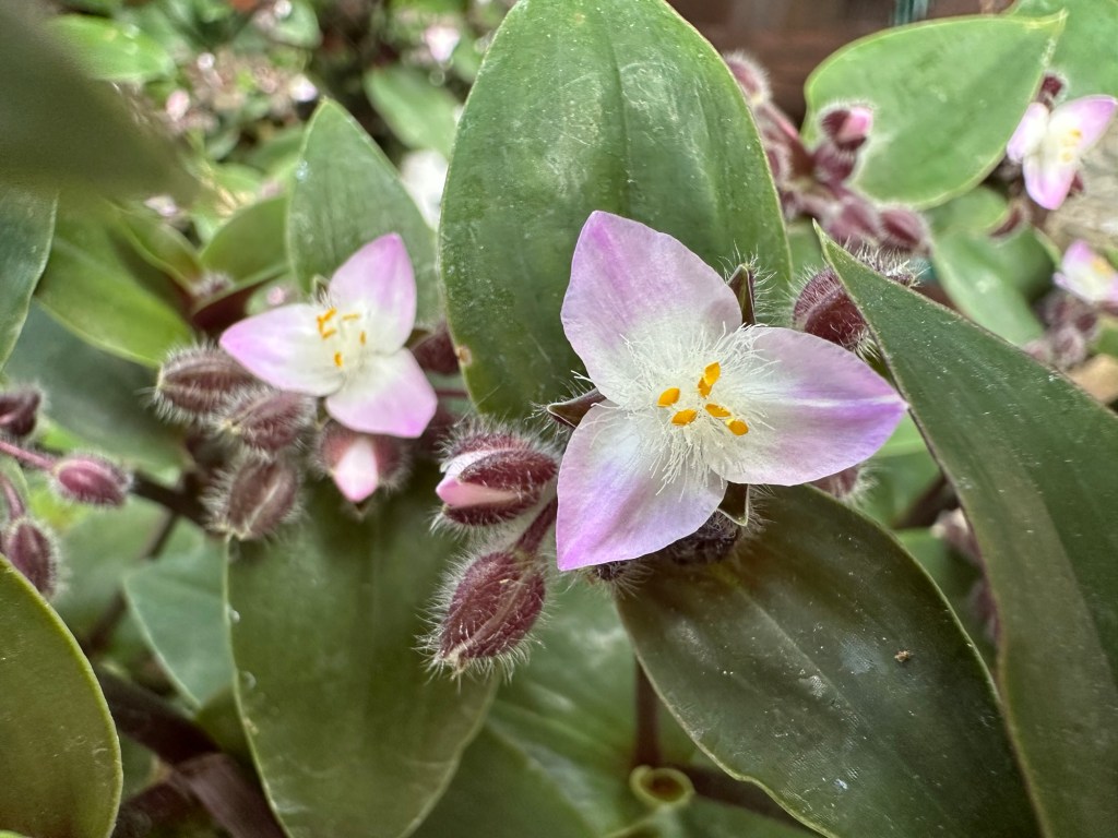
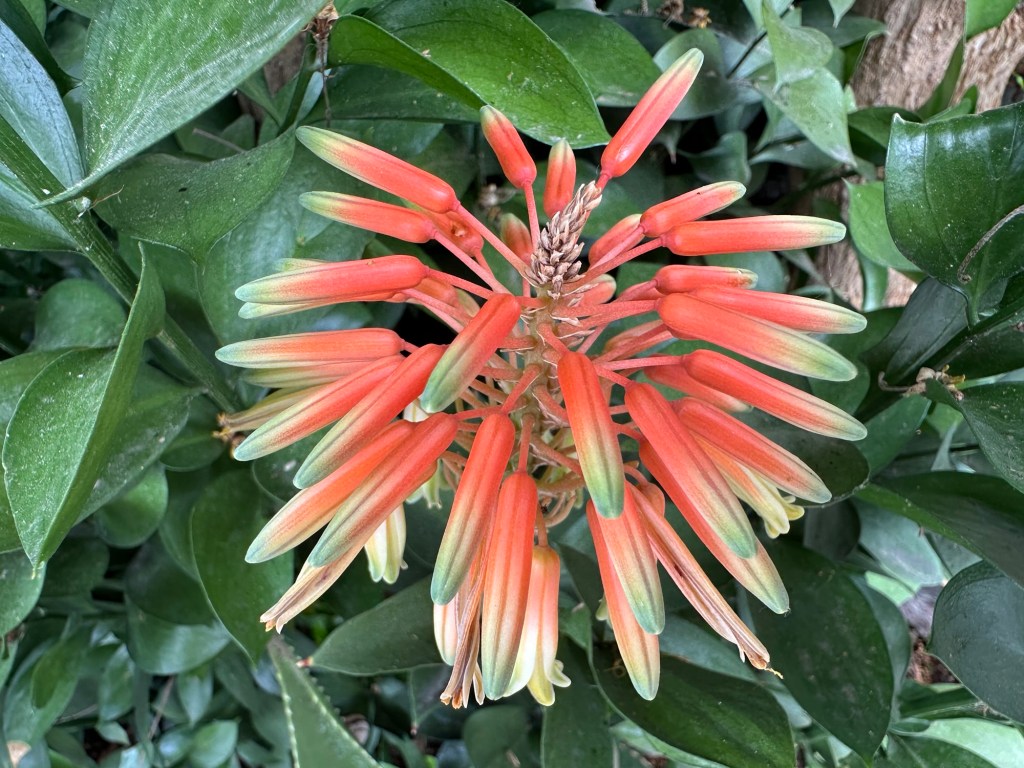
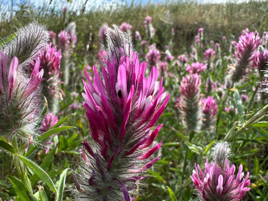
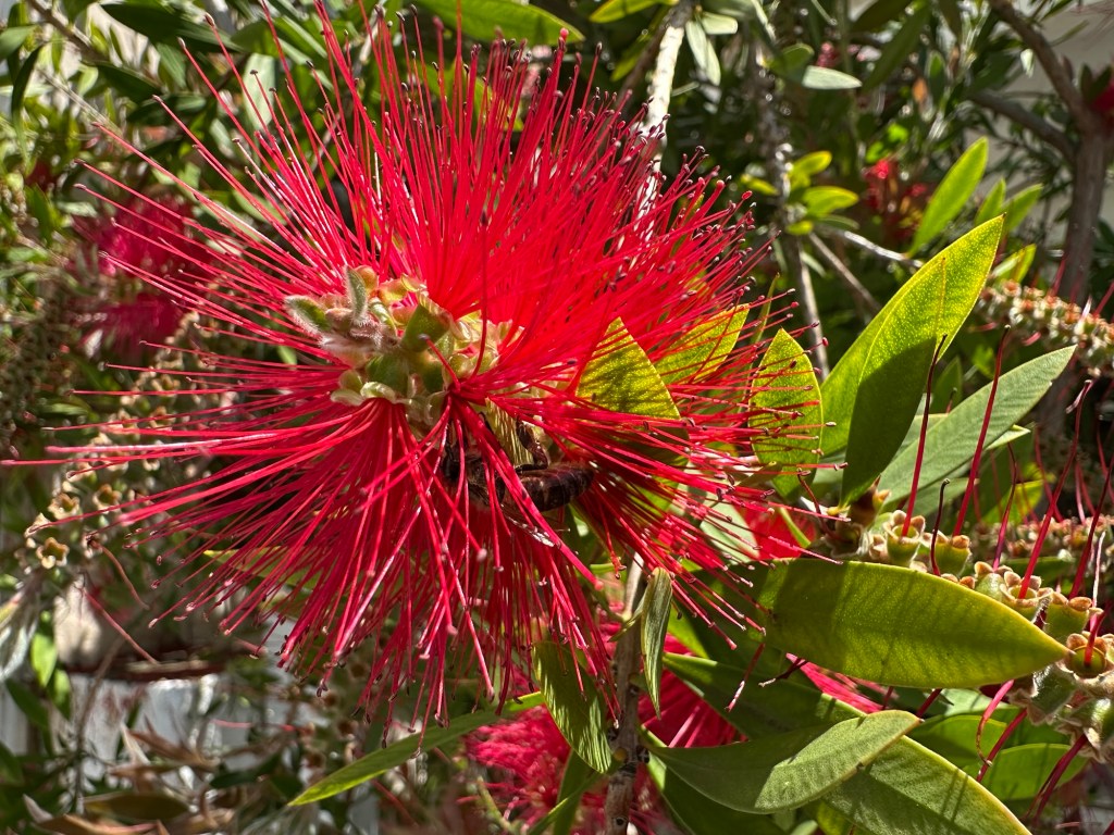
The most common colour of flowers in and around the city of Thessaloniki in Greece is pink-purple, followed by white. Many are native to the Mediterranean basin or, more broadly, to Eurasia, but several are from America (amaryllis, pinklady, pink-sorrel, silverleaf nightshade), there is one from Australia (the wonderfully named crimson bottlebrush, the last of the photos), and perhaps surprisingly there is a whole group from South Africa (Cape Marguerite, sour fig, treasure flower). Flowers are just as widely travelled as we are!
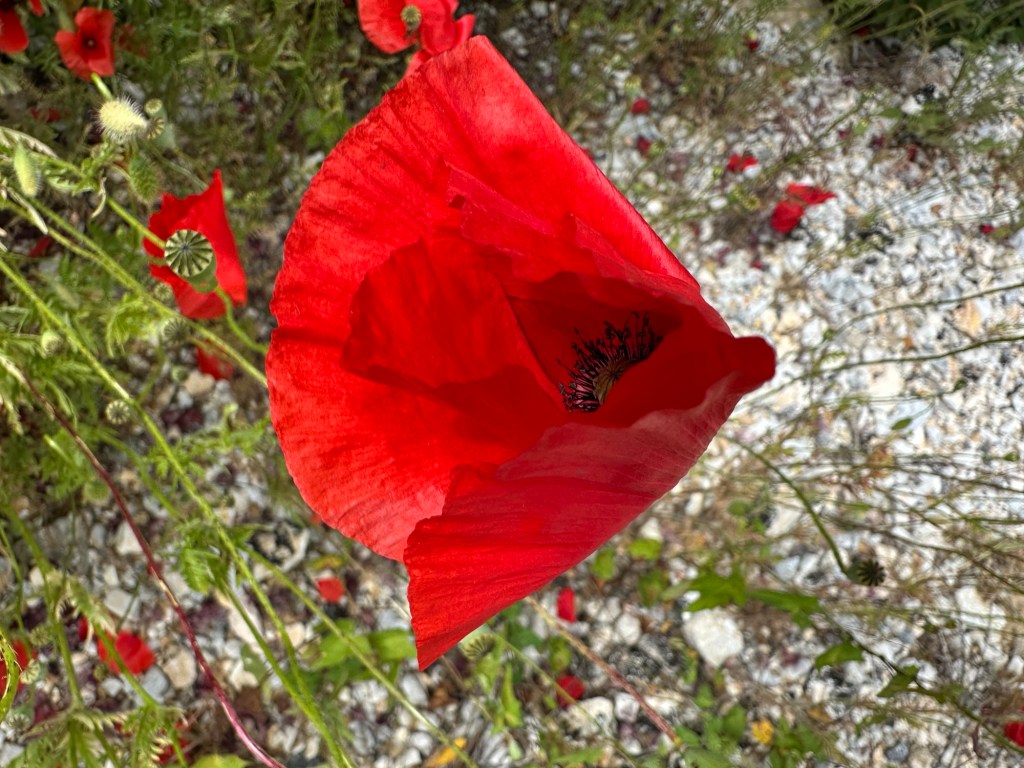
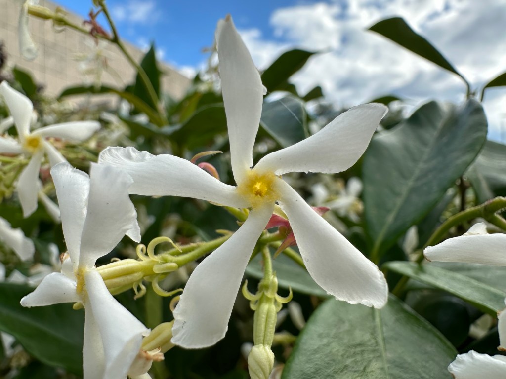
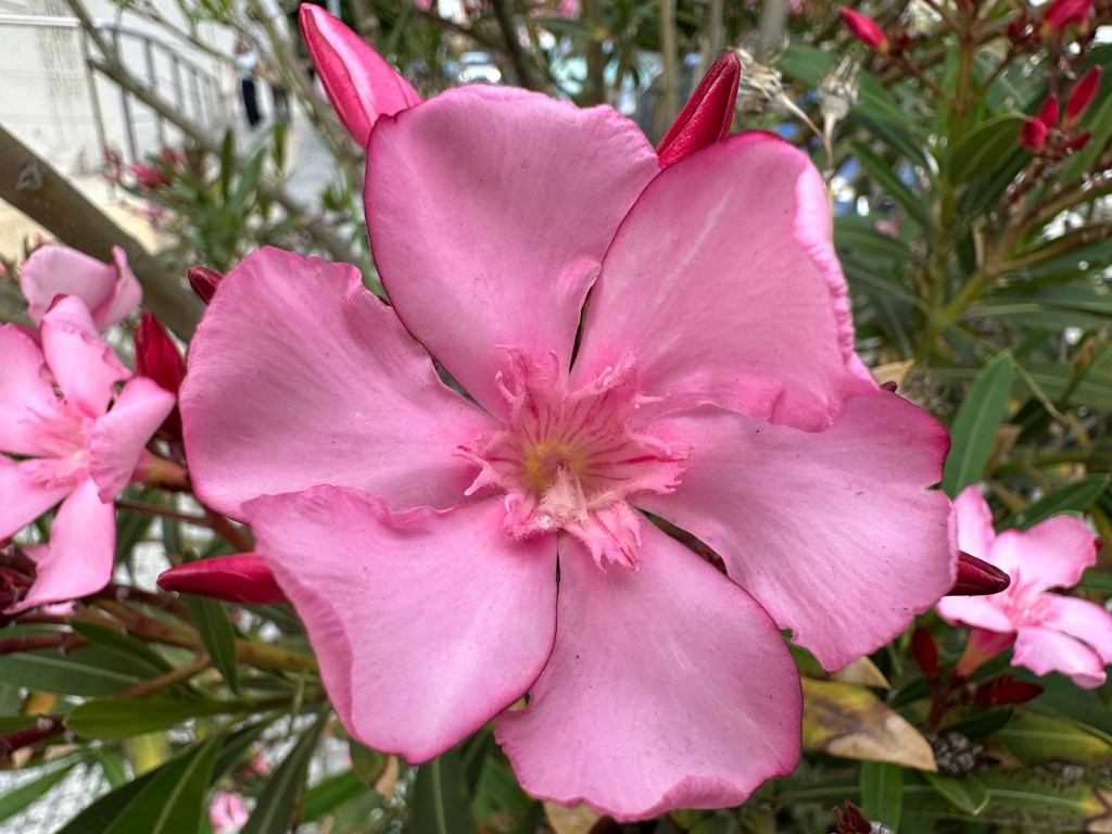
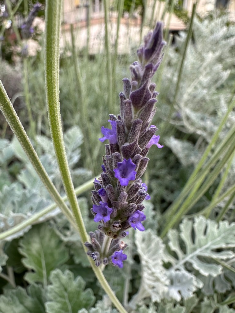
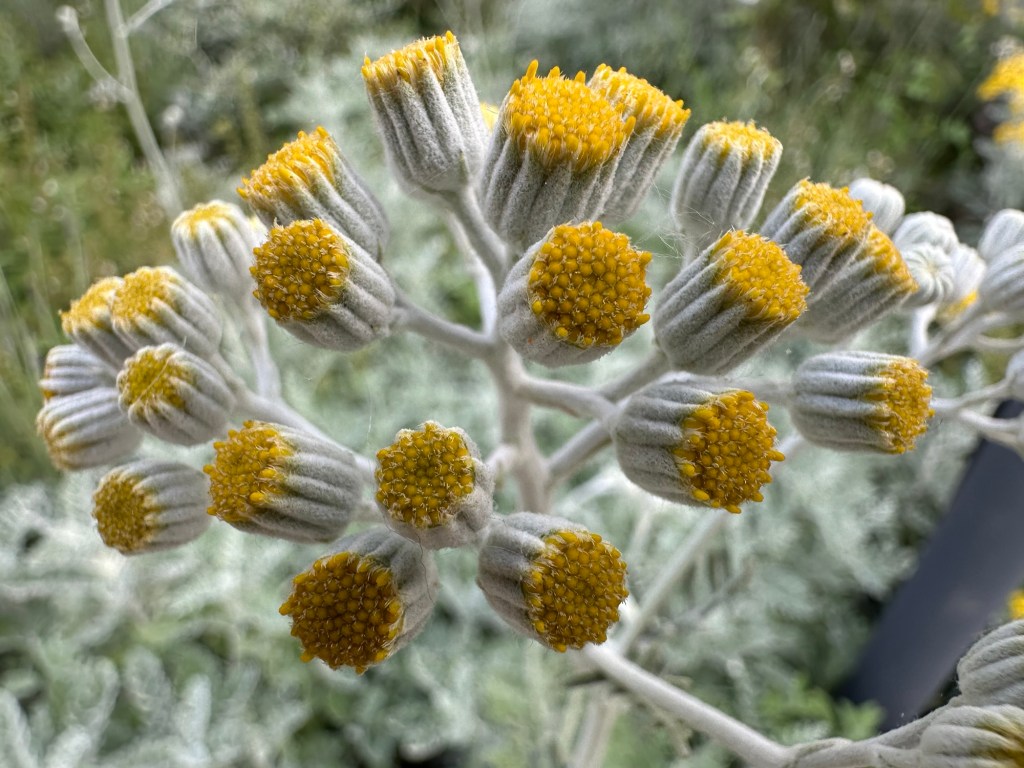
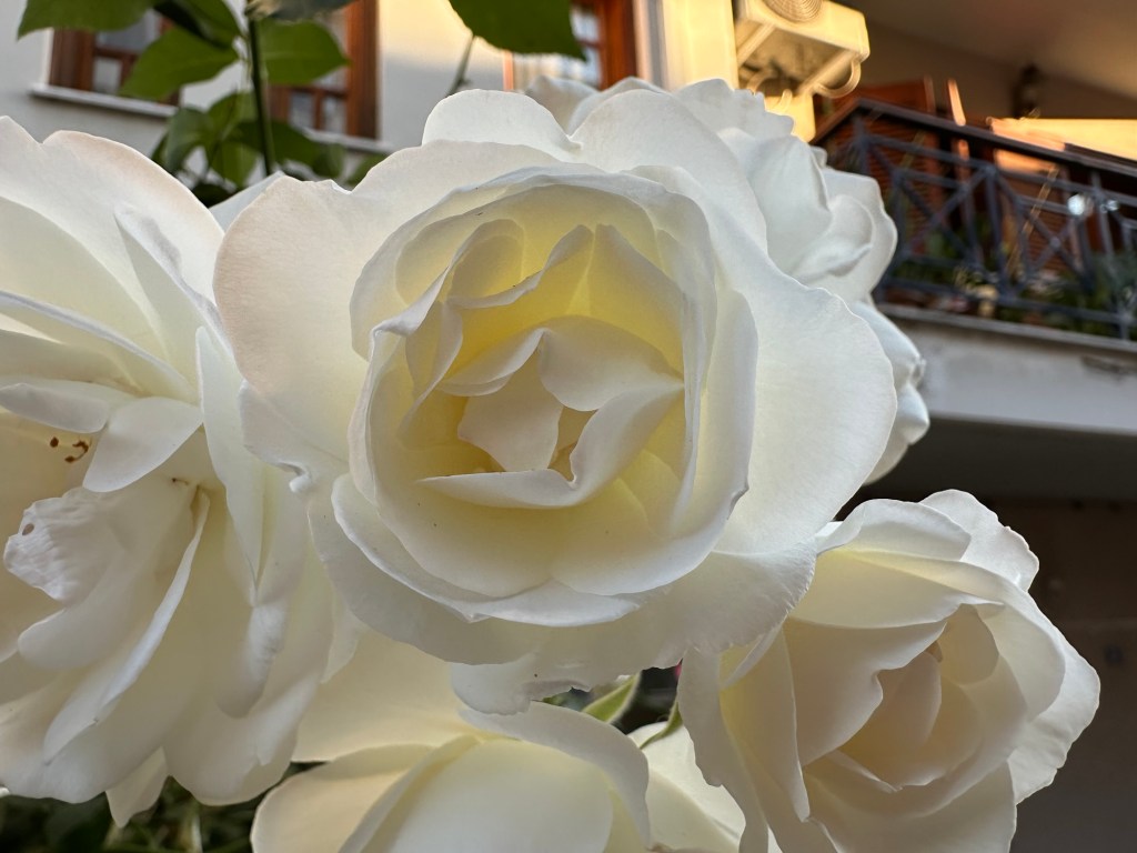
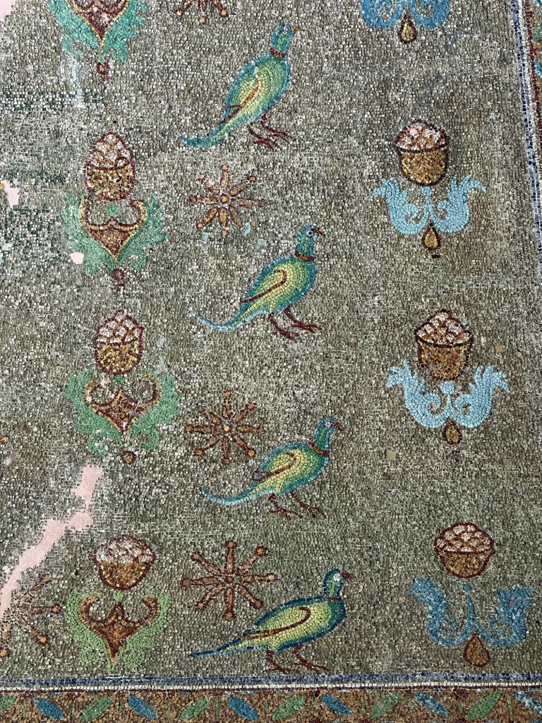
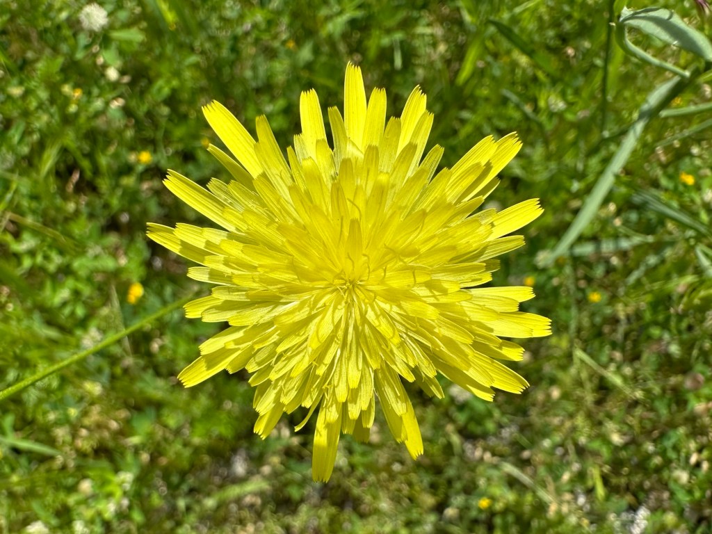
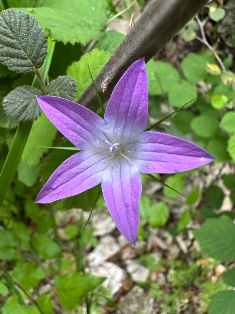
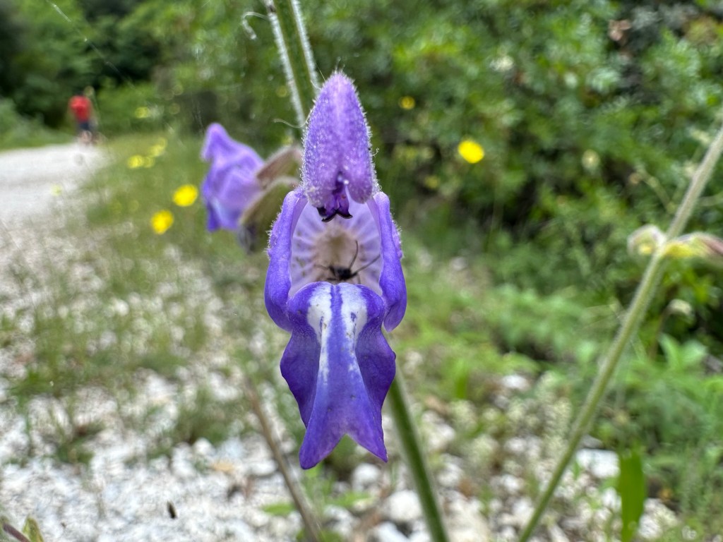
PoppyJasmineOleanderLavenderSilver ragwortWhite TowerVlatadon MonasteryRoseMallowJapanese cheesewoodCape MargueriteSour figRosePinkladySowthistleSilverleaf nightshadeWild mustardPink-sorrelAmaryllisLilyBougainvilleaBegoniaRoseRosePomegranateTreasure flowerRotundaHawksbeardBellflowerMonkshoodOrlias StreamWild basilGipsy roseCanary clover and common brimstoneBloody crane’s-billGeraniumFlowering inch plantAloe veraPurple cloverCrimson bottlebrush
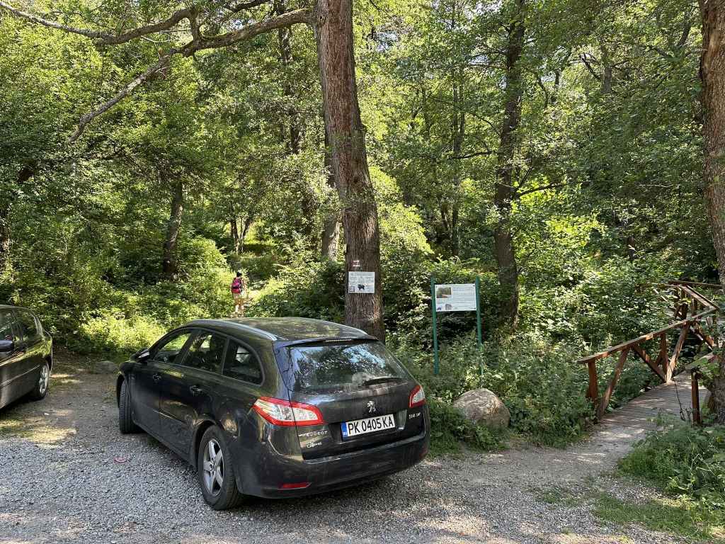
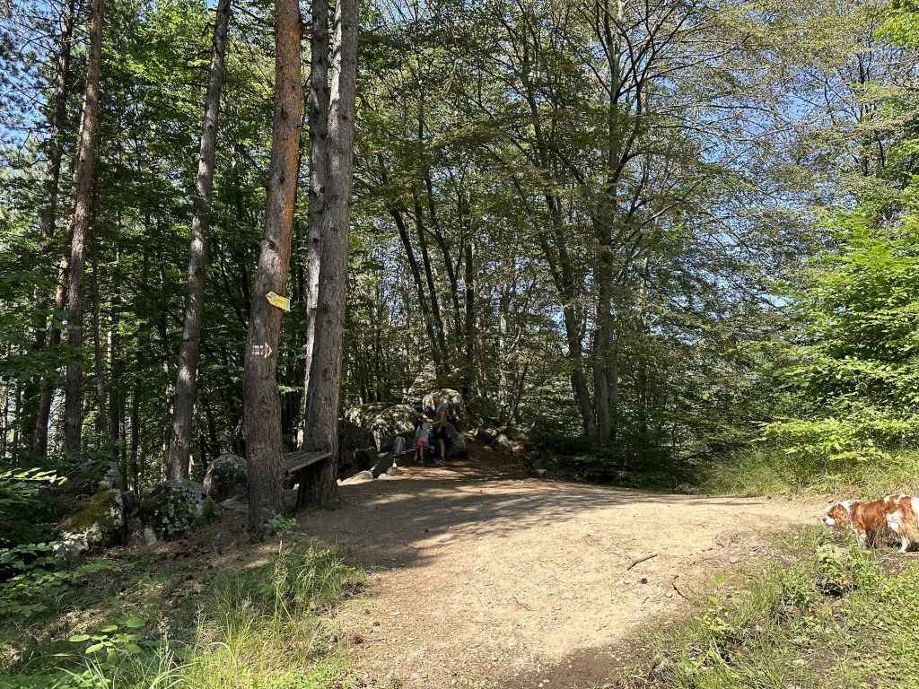
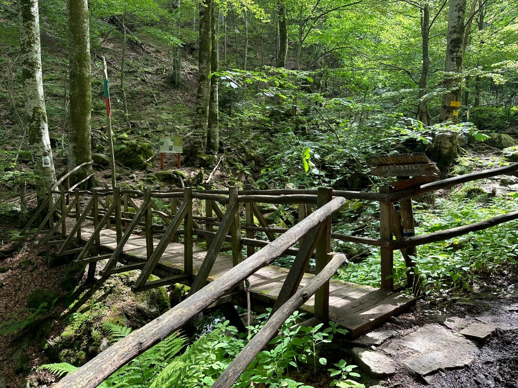
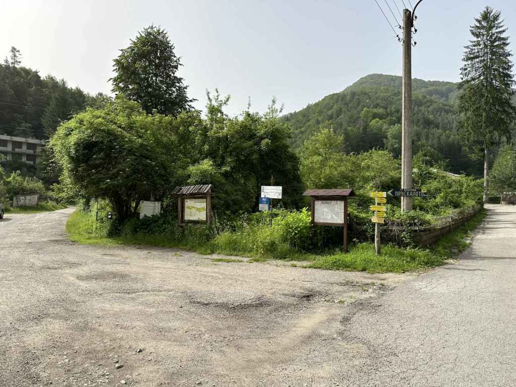
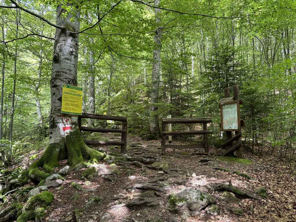
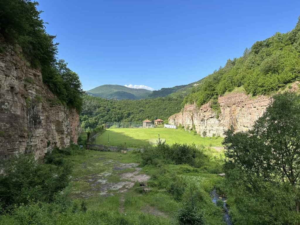
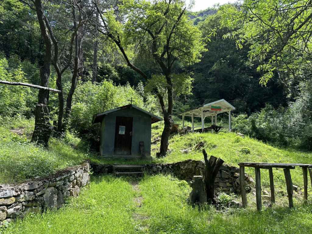
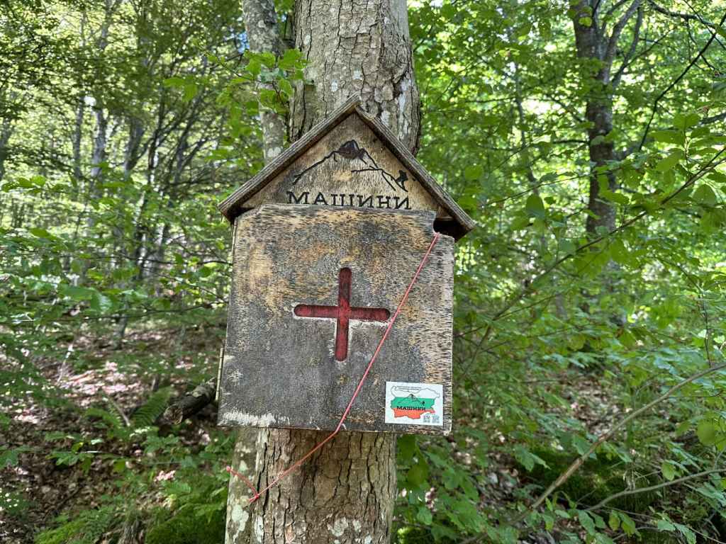
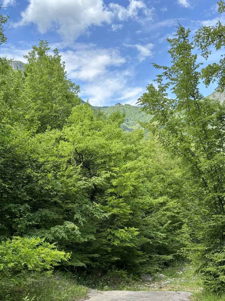
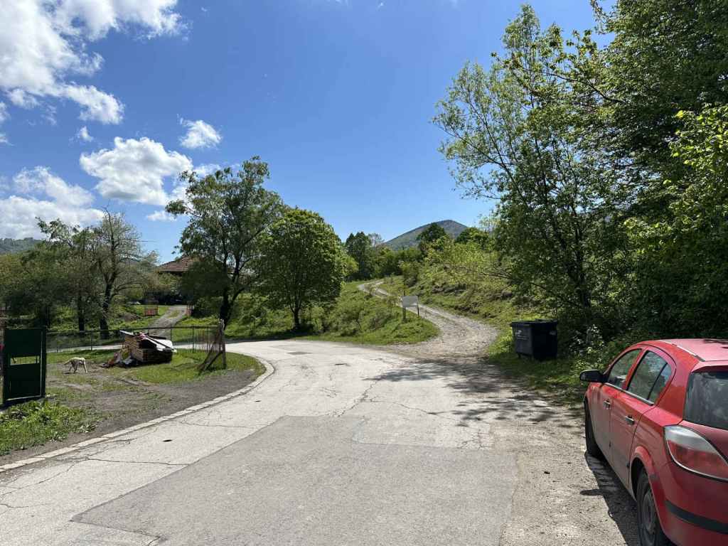
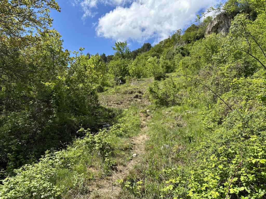
The start of the ecopath, next to the road that leads from Kladnitsa to Kladnitsa Monastery and Selimitsa Hut.
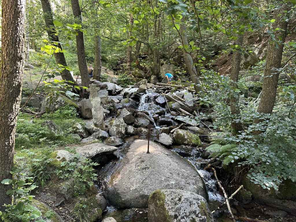
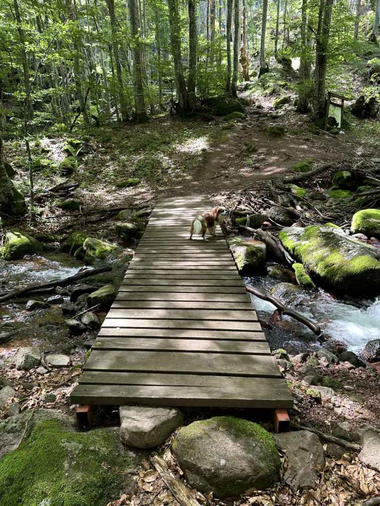
At the start of the walk, the river has three crosses fixed in the stone.
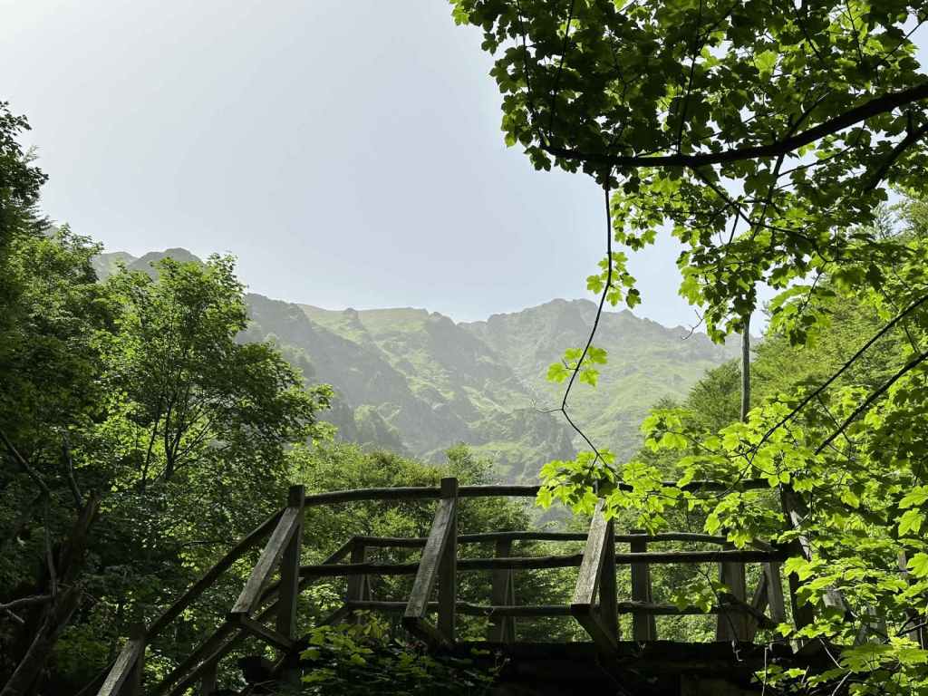
Three successive bridges take you across the river.
Having crossed the river again, you reach a small clearing. Keep straight.
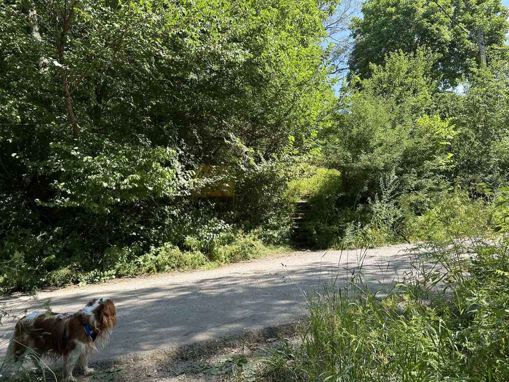
The path rejoins the road to Selimitsa Hut and continues up some steps on the other side.
Selimitsa Hut, which offers food.
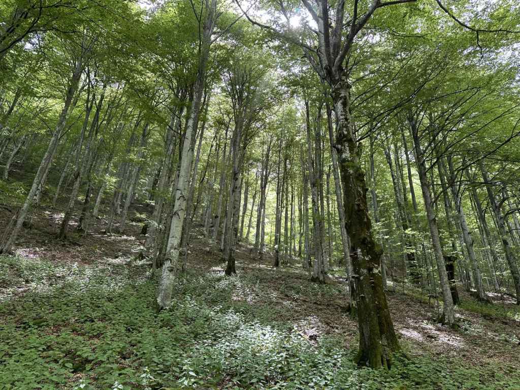
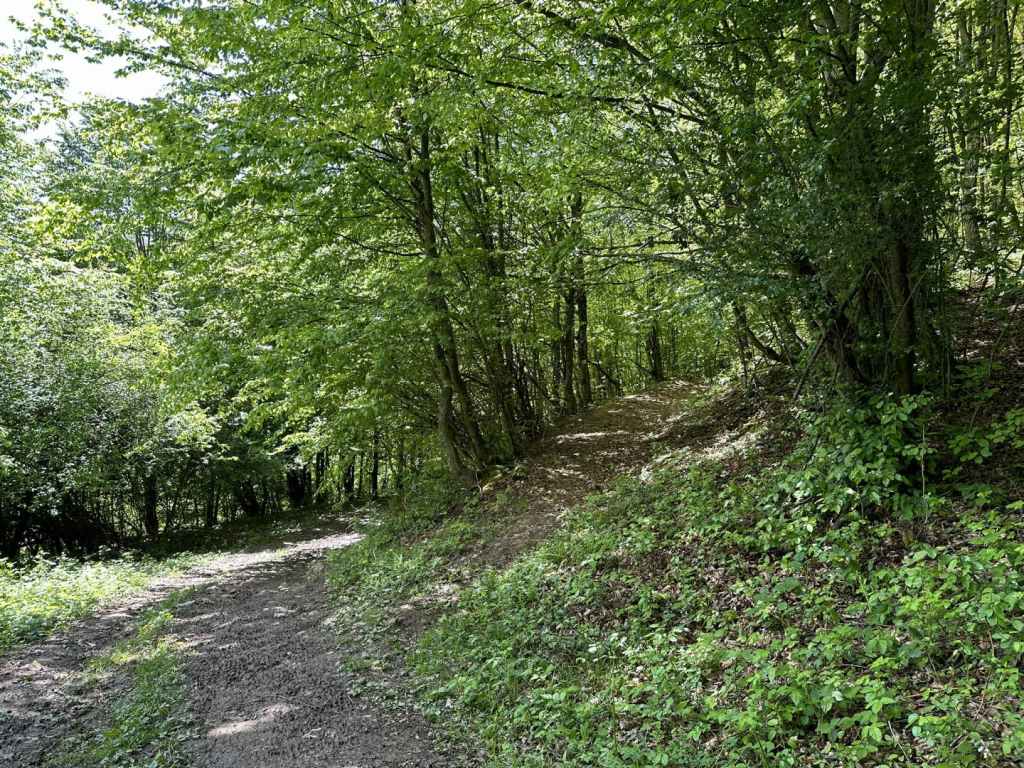
The track enters the forest.
The picnic hut on the left.
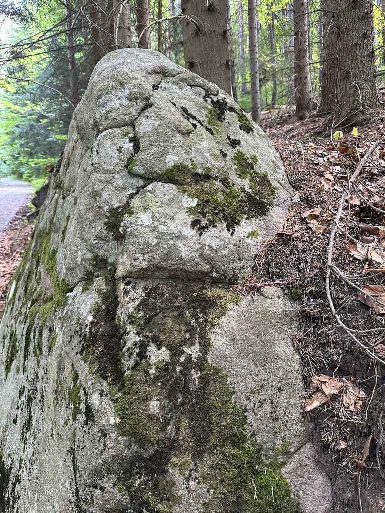
One of the boulders that line the route.
The stone run.
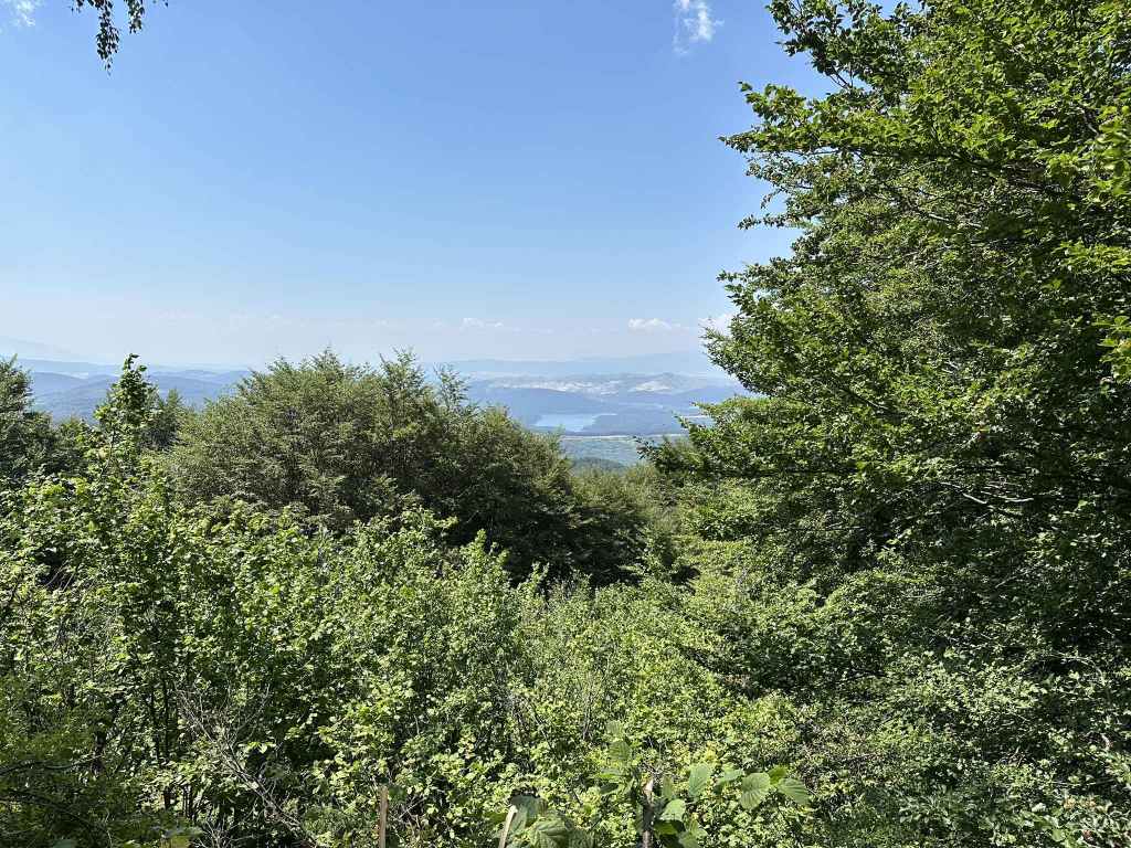
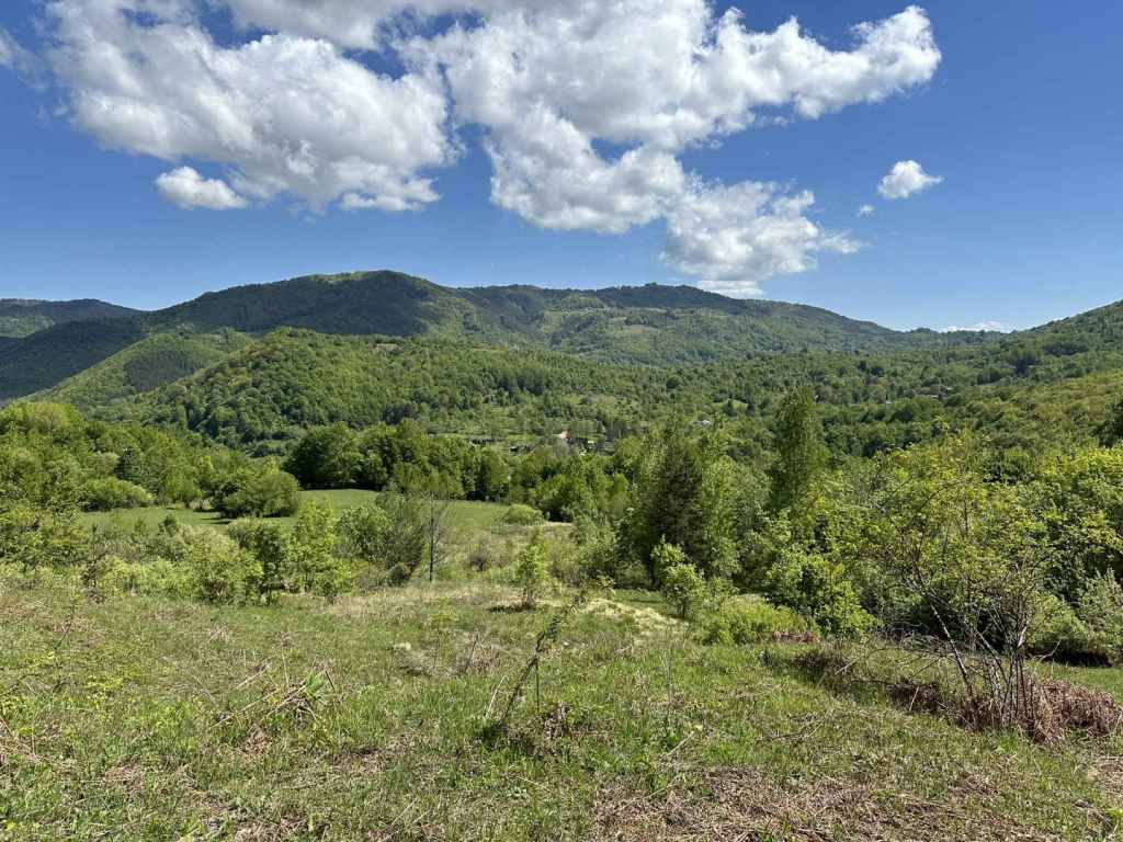
The view of Studena Reservoir.
The path reaches the top. Ostritsa Hut is on the right.
Ostritsa Hut.
The descent back to where you started.
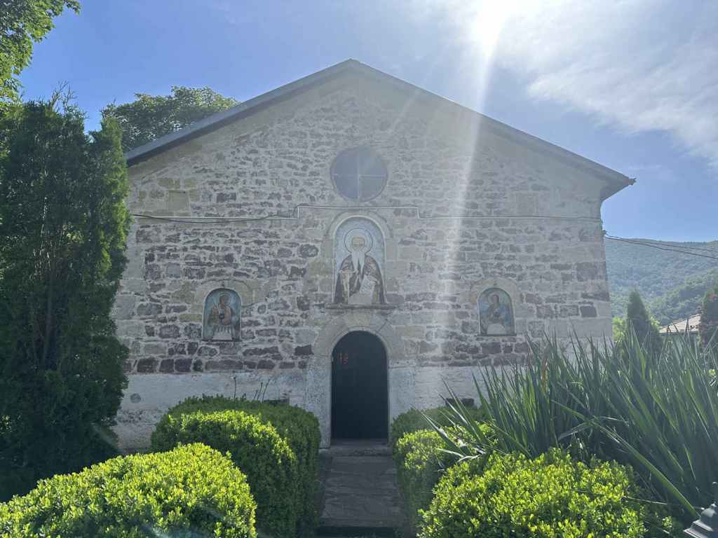
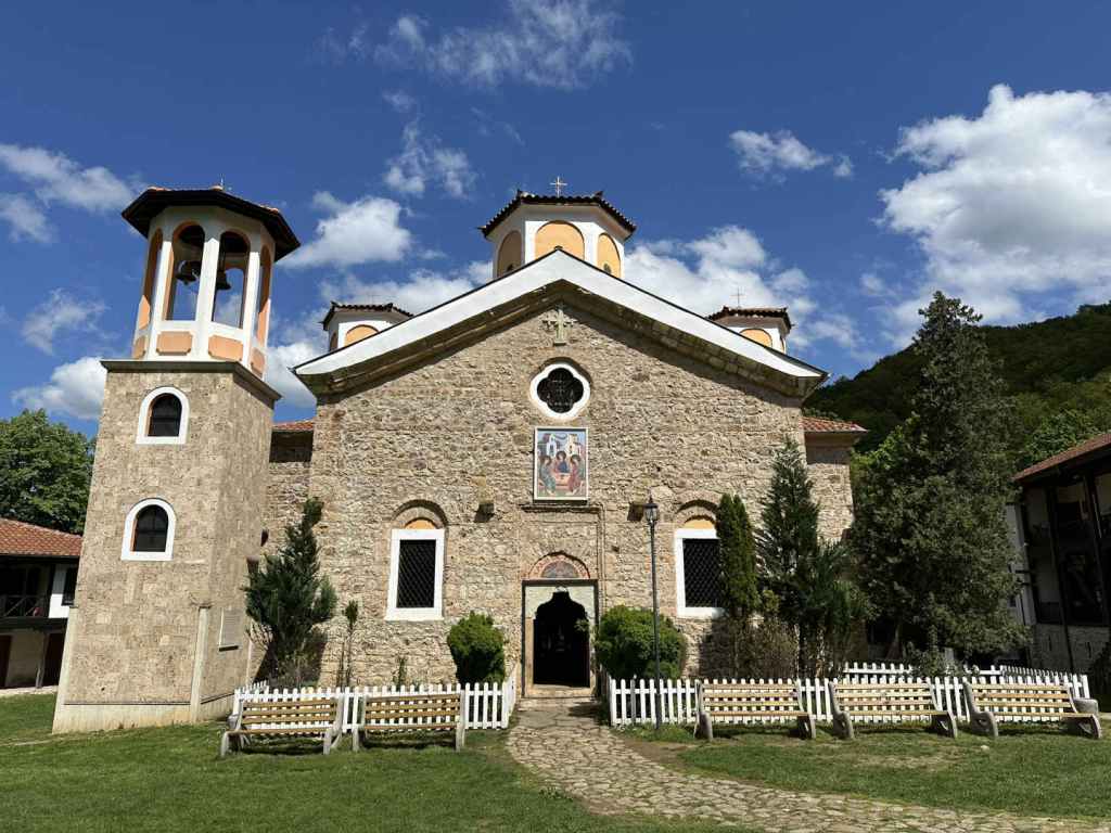
The depiction of the Trinity on the ceiling of the nave in Kladnitsa Monastery.
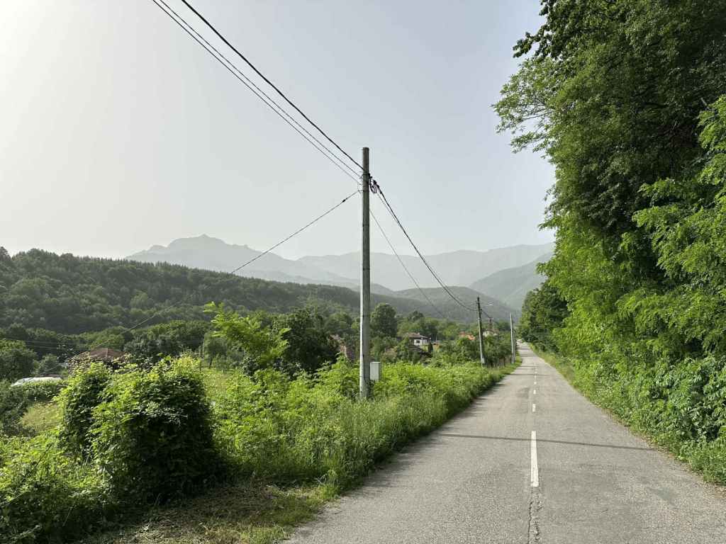
Kladnitsa, with a population of little more than a thousand, is the highest village on the west side of Vitosha. To get there by car, you must take the road from Sofia to Pernik, which passes through Knyazhevo and Vladaya before arriving at the crest of the hill and descending on the other side. As it reaches the bottom, in a village called Dragichevo, there is a set of traffic lights. Turn left here (it is signposted for Rudartsi, 4 km, and Kladnitsa, 9 km). If you continue straight, you will reach the motorway for Greece, the A3, and then Pernik.
In 1.5 kilometres, you enter Rudartsi. Stay on the same road. In another 4 kilometres, you enter Kladnitsa. 400 metres after entering Kladnitsa, the road veers left, signposted for Kladnitsa Monastery and Selimitsa Hut, and takes you uphill. After one kilometre, you leave the village of Kladnitsa and immediately enter Vitosha Nature Park. Keep going for another 500 metres. As the road turns left, you will see the start of the ecopath. 200 metres after the start of the ecopath is the slip road that leads to Kladnitsa Monastery. There is a very small area to park your car just after the start of the ecopath, otherwise people tend to park on the verge. It can be quite busy at weekends in summer.
There is a minibus that goes to Kladnitsa from the Russian Monument in Sofia once an hour, during the daytime. The 21 bus also goes there from Pernik. The buses stop in the main square in Kladnitsa, where the chitalishte (community centre) is. From here, you need to head eastwards, and soon the road will take you out of Kladnitsa and into Vitosha Nature Park.
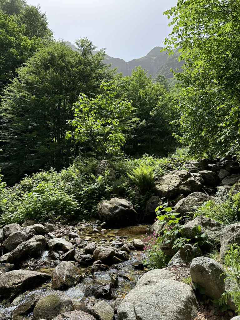
The ecopath is known as the “path of health”. It leads straight up from the road. The river should be on your right. In 200 metres, you cross the river on three separate bridges and continue on the other side. In another 200 metres, you again cross the river, but this time the path leaves the river behind and soon reaches a clearing with a bench between two tree trunks. You continue straight here (signposted for Cherni Vrah and Selimitsa Hut). In 200 metres, a small bridge takes you over a stream, and you become aware of the road you were on up on your left. The path crosses the same stream again, and 1.1 kilometres after the start of the ecopath you rejoin the road at Selimitsa Hut. There is a car park further down on your left.
The path continues on the other side of the road, up some steps, and in a couple of minutes you arrive at Selimitsa Hut, which is a popular place for eating. If you don’t have food with you, you want to bear in mind that Ostritsa Hut is not working, so this is your only chance to grab a bite to eat on the route.
The path heads behind the hut (where the kitchens are) and joins a track. At the track, turn left and continue climbing past some wonderfully located houses. 300 metres after the hut, the track veers right and enters the forest. This track will now take you to Ostritsa Hut, the highest point on this walk.
I have marked the walk as “moderate-hard” not because of the distance, but because of the elevation gain (475 metres over 4.2 kilometres). You are constantly climbing. I always think it’s a question of not being anxious to arrive somewhere, but simply going at your own pace, putting one foot in front of the other. That’s all anyone does, isn’t it? And humans have achieved great things by putting one foot in front of the other and being patient.
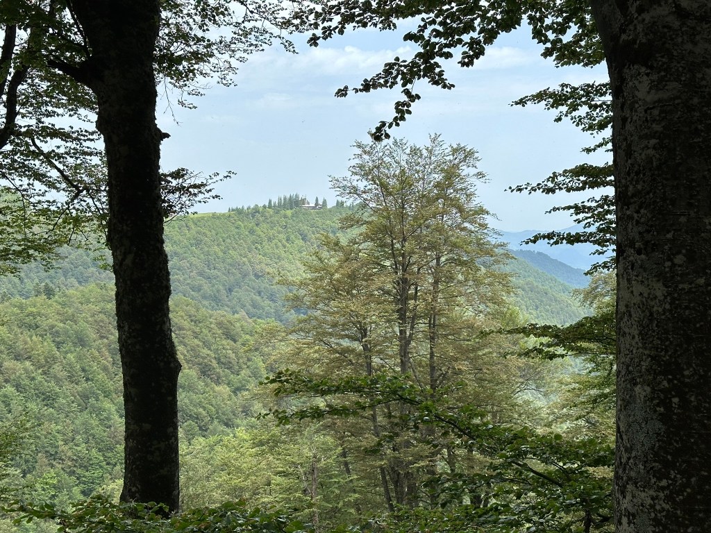
Very soon on the left is a picnic hut, with a small fountain behind it (only trickling water). Fifteen minutes after the picnic hut, there is a stone run, one of those moraine rivers that are so characteristic of Vitosha (and of the Falklands, apparently). Another 200 metres, and there is a wonderful view to the south-west of Studena Reservoir. Another ten minutes, and there is another small fountain on the right, this one without any water. One more kilometre, and you reach the top, with Ostritsa Hut on your right. You are now not far from the walk that begins at Ofeliite.
Unfortunately, Ostritsa Hut doesn’t work, but I still ate my lunch, sitting by the hut and the grassy slope that leads to Ostritsa Peak. I then headed back down the way I had come. What makes this path so worthwhile is the beauty of the path itself, which is mostly shaded, the views to the south-west, and the numerous boulders that line the route. You are also on a less frequented part of the mountain.
Back at the bottom, do make time to visit Kladnitsa Monastery, dedicated to St Nicholas, which is only 200 metres further up the road and has a very distinctive depiction of the Trinity on the ceiling of the nave.
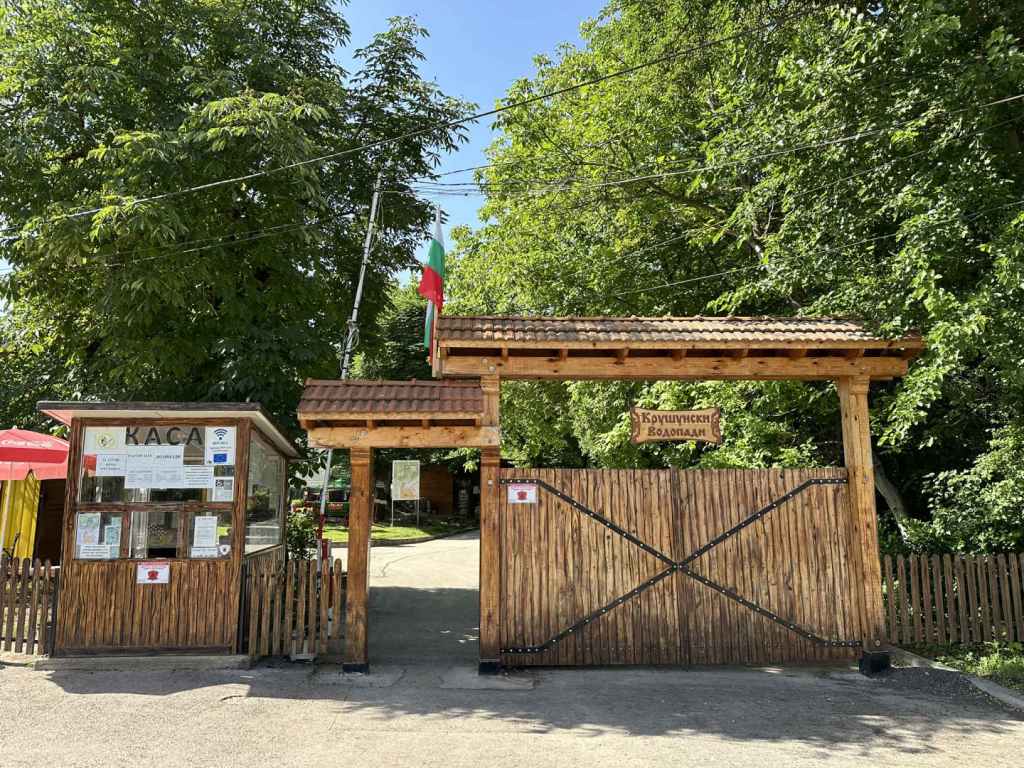
Krushuna can be reached from Sofia, via Lovech, but it’s a long drive there and back in one day. I stayed in Troyan; the other obvious starting point is Veliko Tarnovo. The village is reached from the III-301 road between Lovech and Levski. Depending on the direction you are coming from, you will turn off this road in Aleksandrovo (from Lovech) or Letnitsa (from Levski). The point is that Krushuna is not on the main road and you must leave the III-301, but once you’ve done that, it’s not far. The entrance to Krushuna Waterfalls is 400 metres south of the main square in Krushuna, it’s very easy to find, and there is plenty of parking. When I first went some years ago, it was forest, and you had to find your own way, but now it is a park, Maarata Park, with stalls, restaurants, even a hotel. The waterfall has been tamed, turned into a tourist attraction.
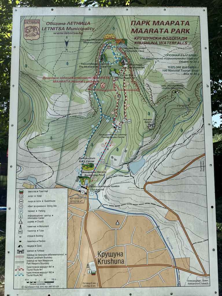
But it is still one of the most beautiful, and best known, waterfalls in Bulgaria. It’s just not wilderness anymore. You must pay a small fee to enter and to park your car (though you could just park in the village), so have some cash with you. Once inside the enclosure, there is a long straight avenue ahead of you, which goes past a hotel on the right, and then a church and a tourist guide centre, for 450 metres. At the end, on the left, is an information board with two routes that you can do, a red route and a blue one.
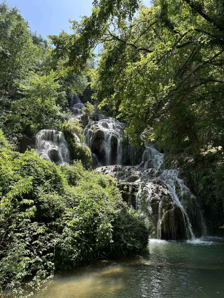
The red route is 800 metres long and takes no more than half an hour. It takes you to the Blue Pool and the main waterfall. Go left at the information board and then right. The path runs along the River Krushuna, sparklingly blue. This no doubt has something to do with the caves up above, where the water comes from. In 300 metres, you reach the Blue Pool, a very pretty sight. There are then some steps up to the main waterfall, as if you are entering the stage at a theatre. There is a viewing platform, from where you can admire the main waterfall, a succession of small falls that combine to impress the visitor. From here, make your way back on the other side of the river. When you reach a guesthouse on the left, go down the steps on your right, past a restaurant and over a bridge, and you will be back where you started.
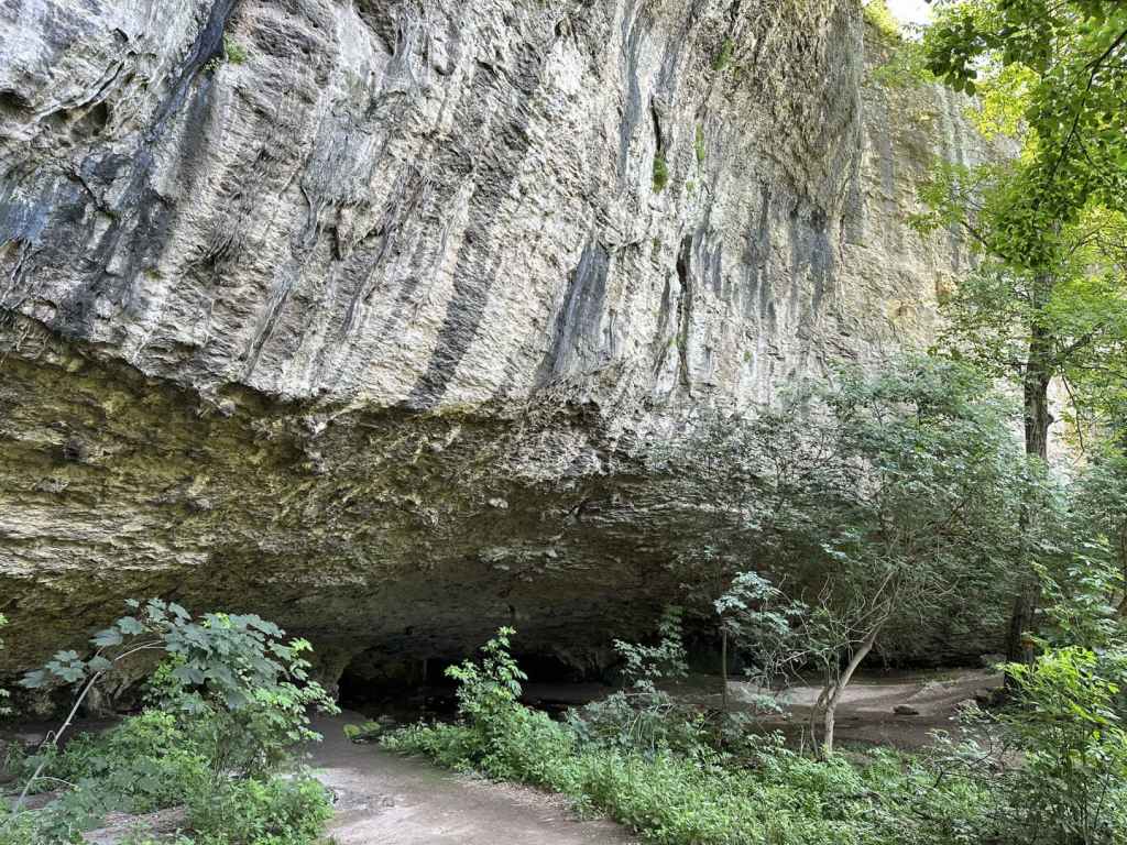
The blue route is longer and takes you above the main waterfall. It is 1.9 kilometres and takes about an hour. Go left at the information board, but this time ascend the steps on your left, which climb steeply for a hundred metres. At the top, turn right. After 300 metres, you have the option to climb the rocks on your left for a ‘panoramic view’ of the rocks and the plain that stretches as far as the eye can see. You don’t have to do this. In another 200 metres, you reach Maarata Cave on your left. Water emerges from tunnels in the rock. Let us call this river 1. You cross a small wooden bridge, and the path goes right. After 50 metres, there is a sign for the Waterfall Cave, which seems to point straight ahead, but no, it is immediately on your left. Water also emerges from this cave, much bluer this time. Let us call this river 2.
Go back to the path. In 20 metres, there is a path on the left you will come back on. Keep going past two benches and take the path on the right. This will take you to the Mysterious Waterfall, an epithet that could be applied to all waterfalls. In 20 metres, you reach a green railing. The path descends on the right for 50 metres. The railing then goes left, but you turn right here, and in 70 metres you will reach the Mysterious Waterfall, a result of river 1 (the water from Maarata Cave). It looks like a large nose covered in moss. Return to the railing and climb back up, but this time keep going straight, alongside the railing, for 30 metres, which will bring you to the top of the main waterfall, a result of river 2 (the water from the Waterfall Cave). Be very careful here, because there is a large drop.
Now go back to the path you came on, turn right, and the path will bring you in a loop back to where you stopped for the Waterfall Cave earlier. Go back to the wooden bridge by Maarata Cave and return the way you came. When you reach the top of the steps that go down to the information board where you started, there is the option to continue straight. This will take you back to the entrance, swimming pool and shops, by a different route.
I was nostalgic for the earlier wilderness. I found it strange to visit a place where there was the odd stray dog, I was given receipts (in nature?), I was addressed in Spanish and English. But then I thought the park makes it much easier for groups of schoolchildren to go there, I imagine locals might walk there on a Sunday afternoon, and I enjoyed my double espresso by the river. The waterfall has been tamed, but it is still extraordinarily beautiful.
Krushuna is only 50 kilometres from Vishovgrad, via Pavlikeni and Levski, and could be combined with a visit to this other waterfall unless you decide to combine it with Emen.
The entrance to the waterfall enclosure, Maarata Park, just south of the main square in Krushuna.
The map detailing the two routes, which for the first 450 metres are the same.
The long straight avenue.
The information board at the end of the avenue, where the two routes diverge.
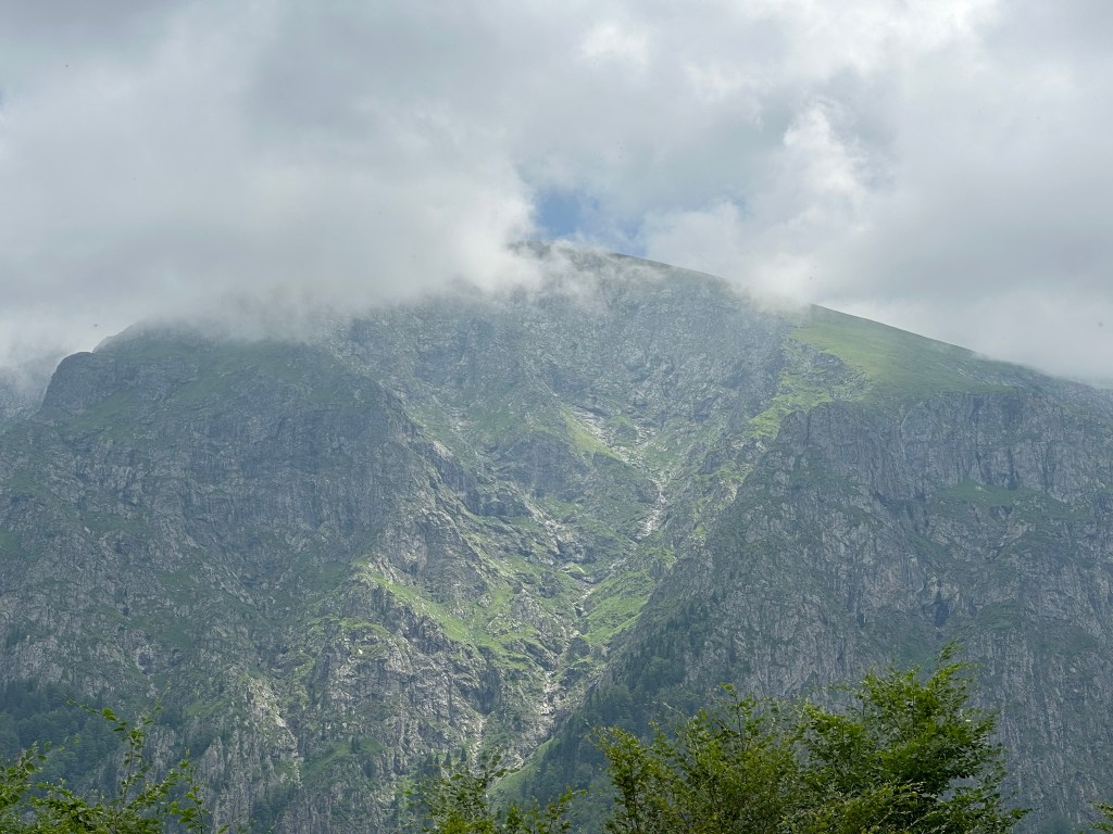
As for the previous waterfall, Vidimsko Praskalo, Dyavolsko Praskalo is accessed from the town of Apriltsi, directly north of the highest point of the Balkan Mountain, Botev Peak (2376 m). This walk will not take you to the bottom of the waterfall itself, but to a cave called Vodnite Dupki (‘Waterholes’) and to Pleven Hut, the departure point for those wishing to scale Botev Peak. It does, however, offer views of the waterfall from a distance, like the ecopath to Vidimsko Praskalo, leading through some of the most beautiful scenery in this area, with its UNESCO-protected beech forests, which makes it well worth doing. But it has an elevation gain of 636 metres over a distance of ten kilometres, which involves some steep climbs. It should only be attempted in good weather conditions.
Passing through Apriltsi on the III-607 road, in between the districts of Zla Reka and Novo Selo, take the turning marked ‘kv. Vidima 5’. This turning is next to a bridge over the River Vidima, a river whose source is the waterfall and which features very much in this walk. The road you are on takes you through the centre of Vidima and in 8.5 kilometres arrives at a hydroelectric power station. A turning on the left, directly before the power station, is the start of the ecopath to Vidimsko Praskalo. Continue past the power station on your left. The road becomes quite narrow. In 4.1 kilometres, you reach a car park on your left, with the start of the walk on your right, marked ‘Pleven Hut’. The road continues for a bit, crosses the River Vidima and ends at a second car park, where there is an aerial lift used for transporting goods to the hut.
Having parked the car, you are now ready to start the walk. Take the path that is marked for ‘Pleven Hut’. The River Vidima is on your left. In 440 metres, a path diverges on the right. This is the summer route to Pleven Hut and is the route you will come back on. Continue for another 110 metres, and there is a wooden bridge over the Vidima. A winter route to Pleven Hut continues straight, but we want the route to Vodnite Dupki, or Waterholes, cave, which involves crossing the bridge and then walking uphill through beech forest. The climb becomes quite stiff. At one point, the path doubles back on itself, heading north. It then continues south and, as it does so, you catch glimpses of the waterfall, Dyavolsko Praskalo, through the trees.
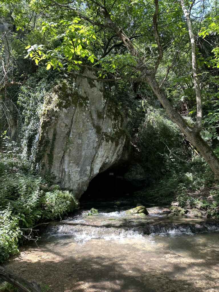
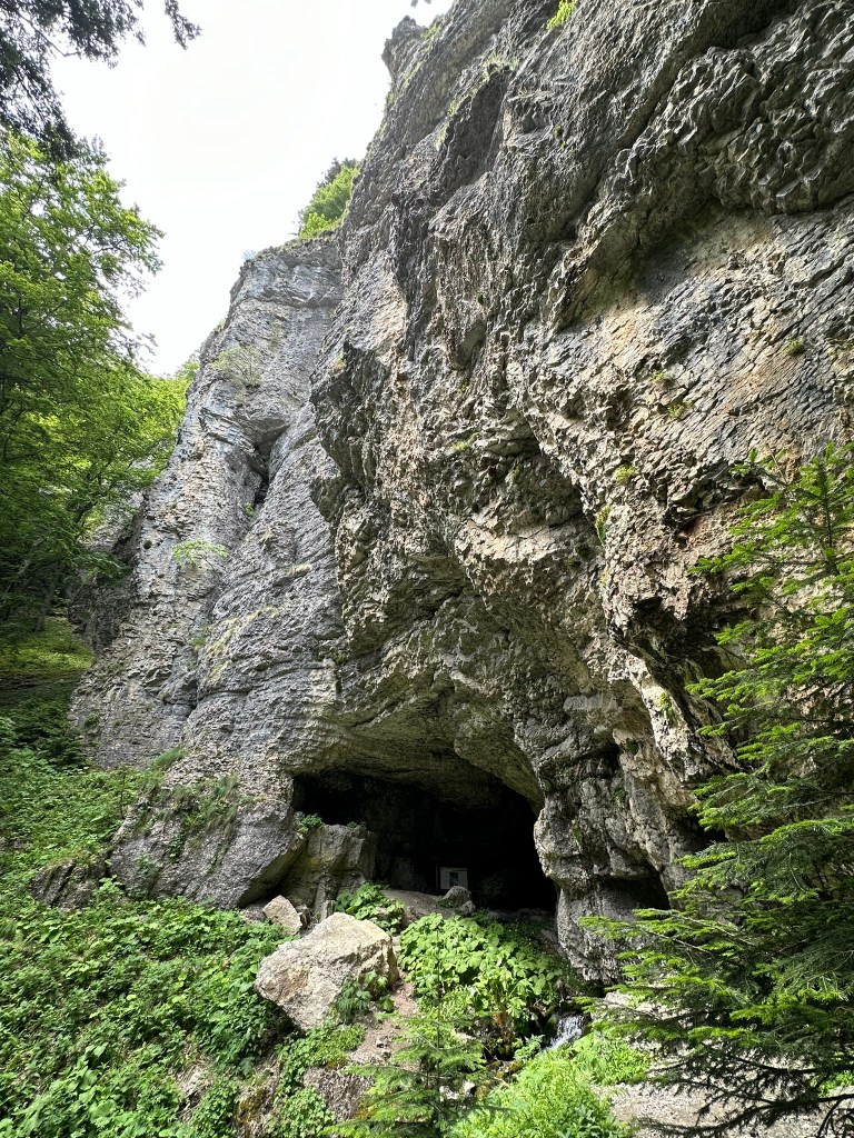
1.7 kilometres after the bridge, you come to a T-junction. The path that goes straight ahead is marked for Pleven Hut and Botev Peak. You want to go left here, to Vodnite Dupki. The path descends in order to cross a stream (soon to become the River Vidima). It climbs again on the other side and, in 300 metres, you can see Pleven Hut across the valley. The path enters the Severen Dzhendem Reserve and descends steeply, going past a moraine field on the right. 500 metres after the sign for the Severen Dzhendem Reserve, it arrives at Vodnite Dupki. As in Krushuna, a stream flows from the cave, accompanied here by cold blasts of air.
The waterfall is a short distance south of the cave. However, because this is a reserve, you are only permitted to go as far as the cave. The path after the cave is noticeably worse, even non-existent, skirting the rocks before entering the valley where the waterfall is situated and the River Vidima has its beginnings. It is best to turn back here. When you reach the T-junction where you turned left earlier for the cave, now follow directions for Pleven Hut. Unmarked paths diverge left and right, but you should look for the yellow signs to the hut. The path again descends before crossing a stream, another tributary of the Vidima. It then climbs on the other side, continuing through beech forest. 1.3 kilometres after the T-junction, you will come to a series of memorial plaques on your left, celebrating the lives of mountaineers who have walked on this mountain. You are now very close to the hut. The path, which until now has been under the cover of the forest, emerges into an open grassy area. There is a shelter for farm animals ahead of you. The grassy slope climbs steeply on your left, in the direction of Botev Peak, and is probably good for skiing in winter. The hut is to your right, behind three other buildings. You’re supposed to go straight and then turn right, with the buildings on your right. You will then reach the entrance to the hut. When I got there, they were listening to very loud, martial Russian music.
What is amazing about the hut is the view from the balcony outside the restaurant. It faces Botev Peak. You can glimpse the wetness of the waterfall to the right of the peak. Vidimsko Praskalo is hidden to the left. This view is unforgettable. I drank copious amounts of tea and exclaimed from time to time. The man running the hut had spent time in Bromley. No wonder he preferred to move back here!
When you have taken your fill, take the path that descends directly from the hut, with green markers and a wooden railing. It is signposted for the locality Mazaneto, which is where you parked the car. The path descends for 1.4 kilometres before rejoining the path you were on earlier, just below the bridge. Turn left here, and in a short while you will be back at the beginning.
The return trip from Pleven Hut to Botev Peak takes about 8-9 hours. It passes the top of Dyavolsko Praskalo, again offering views of the waterfall, but for this you would need to sleep on the mountain.
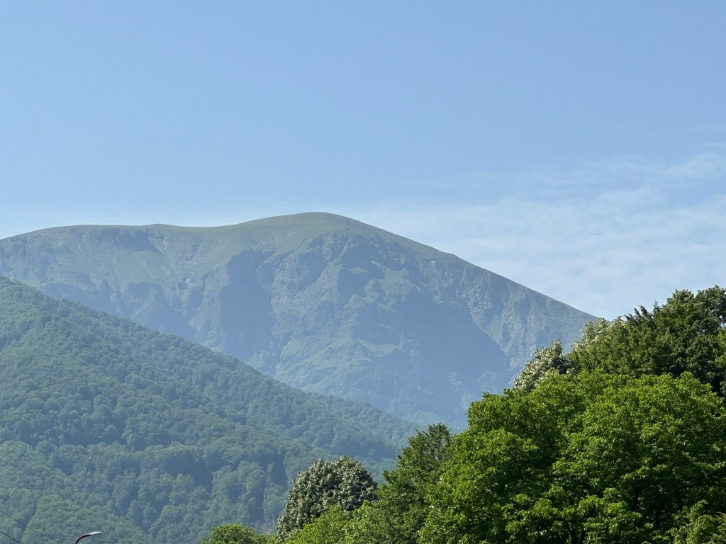
Botev Peak from the road through Vidima.
The start of the walk, marked ‘Pleven Hut’.
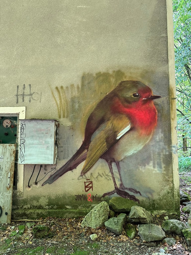
A robin next to the path.
The bridge over the River Vidima. Follow the sign for Vodnite Dupki.
The T-junction – Vodnite Dupki is left, Pleven Hut straight ahead.
Pleven Hut through the trees.
Vodnite Dupki, or Waterholes Cave.
The view from the cave.
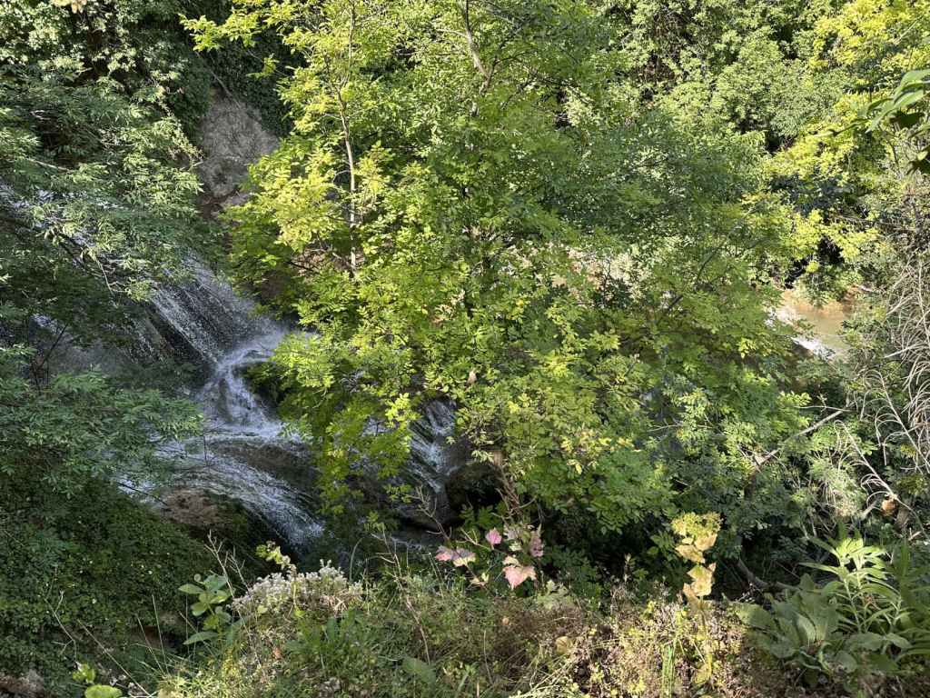
The valley with the waterfall.
Pleven Hut.
Botev Peak from Pleven Hut.
Tea with a view.
The path back to Mazaneto, where you parked the car.
This is a walk into the heart of the Balkan. It takes you to within sight of one of the tallest waterfalls in Bulgaria (most of which are in this region, on the north and south sides of the Balkan Mountain), Vidimsko Praskalo. Praskalo is the Bulgarian word for ‘spray’, ‘sprinkler’, it’s just another word for ‘waterfall’. Vidimsko refers to the nearby village of Vidima. There used to be four villages in this area: Novo Selo in the centre, Zla Reka to the west, Ostrets to the east, and Vidima to the south. In 1976, they decided to club together and form a town, Apriltsi, which was named after the April Uprising of a hundred years earlier, in which the village of Novo Selo lost 142 of its citizens to Ottoman units, who massacred the locals, causing uproar in the West. Bulgaria would become free of Ottoman rule two years later.
A bird could fly from one praskalo to another in a matter of minutes – clustered around Botev Peak there are several, Raysko Praskalo being the highest. But we are mere mortals and must use our feet. There is an ecopath that takes you, five kilometres along a track, and the final kilometre along a path, to a viewing area, from where you can view the waterfall in the distance. Believe me, it is magical, even at a distance. The waterfall is located within a part of the Central Balkan National Park known as Severen Dzhendem, and you’re not just allowed to walk freely. This is one of the routes you are allowed to do.
Make your way to Apriltsi. The town is traversed by the III-607 road. Between Zla Reka and Novo Selo (where the centre is), there is a turning marked ‘kv. Vidima 5’. Take this turning, which heads due south, offering impressive views of the Balkan. Continue on this road for 8.5 kilometres, passing through the centre of Vidima and out the other side. Just before reaching a hydroelectric power station, there is a small turning on the left with lots of signs pointing to the waterfall and the ecopath. It’s impossible to miss. Park your car here.
Now you are on foot. The road immediately crosses the River Vidima and turns right, past the power station on your right. The power station is located between the Rivers Vidima and Praskalska (‘of the waterfall’). You are now next to the River Praskalska and are going to follow it all the way to your destination.
The track you are on, wide enough for a car, crosses the river a couple of times, it even crosses a couple of tributaries and goes past some buildings linked to the water supply, but you are never going to leave it until, after five kilometres, you reach the entrance to the Severen Dzhendem Reserve. Most of the time, the river will be on your right. Sometimes the track will toy with you and make as if to climb away from the river, but it soon returns. Just stay on it, ignoring the turnings to Mecho Chakalo and Turski Rat (obviously one of the people involved in 1876) on your left. In 3.7 kilometres, you will come to a fountain on the left, with a picnic hut on the right. Another kilometre, and you will reach the buildings linked to the water supply, where it is forbidden to go too close to the river (there is another fountain here, and a viewing platform over the river). Stay on the track.
This track that has offered so much finally ends after five kilometres, and you enter the Severen Dzhendem Reserve, where there are beech forests protected by UNESCO. It now becomes a path. You have one more kilometre to go (twenty minutes). You will cross four wooden bridges. Then you will come to a fifth, higher wooden bridge, and suddenly notice the peaks of the mountain up ahead. It’s a startling view. Cross this bridge, and you will come to a small area with wooden benches, where you can sit, rest and admire the waterfall in the distance. It’s incredibly picturesque.
It is not permitted to continue towards the waterfall and, without a guide, it would be difficult to achieve. But it is enough. It’s not always necessary to reach the end, and it’s also good to allow wild animals a little peace and quiet from us. It took me two hours to reach the viewing area from the power station, and 1½ hours to come back. But I have to say I stayed quite a long time, viewing the waterfall (like a destiny) in the distance, and was reluctant to leave.
The River Vidima as it passes through Apriltsi. It goes on to join the Rositsa in Sevlievo, which itself joins the Yantra (the river that goes through Veliko Tarnovo) before becoming part of the Danube.
The road due south that passes through Vidima and leads to the Balkan.
The turning on the left for the ecopath to Vidimsko Praskalo. The road on the right continues to Pleven Hut.
The hydroelectric power station on the right.
The track following the course of the River Praskalska.
The river through the trees.
The track higher up.
The buildings linked to the water supply.
The entrance to the Severen Dzhendem Reserve, where the track ends and becomes a path.
Bovska Skaklya, because of its height and dramatic setting, is perhaps better known, but Pod Kamiko is no less beautiful and worth every bit as much effort. There is a good ecopath that takes you from the stadium in Gara Bov to the waterfall, which is on the outskirts of the village of Bov. The walk to the waterfall takes you along the valley of the River Bov, and there are many smaller waterfalls along the way, some of them quite beautiful. The return takes you along the top of the gorge and back to the stadium from the east. The scenery is spectacular, and the waterfall one of the most beautiful I have seen.
Again, to reach Gara Bov, you must take the II-16 from Sofia in the direction of Novi Iskar, Svoge and Mezdra. This road is very windy as it follows the course of the magnificent River Iskar on its way to the Danube, so even though the distance is not great, it takes its time, and there are several speed cameras. Eight kilometres after the picturesque town of Svoge – with its turning to Iskrets (from where you can reach Dobravitsa Waterfall) – you pass the sign for Bov. 1.1 kilometres after this sign, there is a turning on the right, signposted for Gara Bov (1 km) and Bov (4 km). Take this turning. You will drive along the railway, go left under the railway, pass the railway station again on your left. Continue uphill. As the road veers left, immediately on the right is the stadium. Park the car here. If you have travelled by train, exit the station, join the road as it goes uphill and in 800 metres you will be at the stadium.
The ecopath heads north-east, along the course of the River Bov. It passes along the lefthand side of the football pitch and then immediately goes over a wooden bridge. Follow the green markers. The path is very well marked. It begins to climb, with the river on your left. After 700 metres, there is a turning on the right for a monastery, but continue straight. You will see a small waterfall on the left, and then the path again crosses a bridge. Keep following the course of the river, which is now on your right.
You will pass three more small waterfalls, then come out onto a flat rocky area next to the river. More small waterfalls follow on the right (a particularly beautiful one, 280 metres after the rocky area). A few more hundred metres, and you will again cross the river, using a stepping stone. The path now becomes a track and heads away from the river, but only for a short while before veering left again and bringing you out into the open, with the river down below you on your left. The path descends, crosses another bridge and climbs up the other side. When it reaches the top, turn right. In 200 metres, you will cross a small tributary, which immediately plummets down to the river on your right. The path does a zigzag. 340 metres after the tributary, a path on the left leads to the top of the waterfall. You will come back this way, but for now continue straight. You will cross a second tributary and, in less than a hundred metres, see the waterfall straight ahead. The distance from the stadium to the waterfall is 2.9 km and takes about an hour.
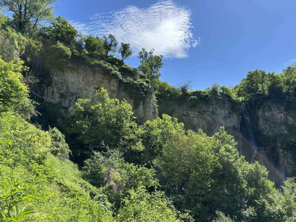
The waterfall is magnificent, especially if you go in spring or after heavy rainfall. There is a second, smaller waterfall to the left of this one, which you can see as you climb to the top of the gorge. So, when you have had your fill, return on the same path and take the path that diverges, now on your right, to the top of the waterfall. It is marked “above the waterfall”. It climbs steeply, offering views of both waterfalls, Pod Kamiko and the smaller one to its left, before taking you around the rocks, with views back to Gara Bov and Bovska Skaklya in the distance, and up to the village of Bov. You will not enter the village, but skirt along the top of the gorge. When I went in May, the path here was very overgrown. You basically want to head back in the direction of Pod Kamiko. The path takes you over the top of the smaller waterfall and joins a track. Go right here, and in a short while it will bring you to the top of Pod Kamiko. There is a wooden bridge on the left. Please do not go too close to the edge.
When you are ready, continue along the track, which passes a house on the left. When I was here, the track was blocked by cows and their calves, so I had to make a detour through one of the fields and rejoin the track a little further on with my dog. In 750 metres, the track passes a fountain on the left and then enters a field on the left, but you want to continue between a picnic area on the right and a stone cross on the left. In another 200 metres, you will come to a blue gate. Stay on this track, again avoiding the temptation to enter fields on your left.
In 370 metres, there is another fountain next to a ruined house. The path now enters a field and then continues on the right. As it descends, you will have views of Tserovo (the village before Bov) on the left. Keep descending through the forest. The path zigzags, left-right-left, and in 800 metres reaches a larger picnic area with a small chapel. This is a good place to rest. From here, the path continues left. In 750 metres, it joins a larger track by the River Treskavetz. Go right here, and in one kilometre you will be back at the stadium. The whole route is 7.6 kilometres and took me 3½ hours with ample breaks.
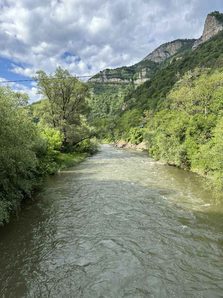
The River Iskar as it passes by Bov.
Gara Bov, the railway station.
The stadium in Gara Bov.
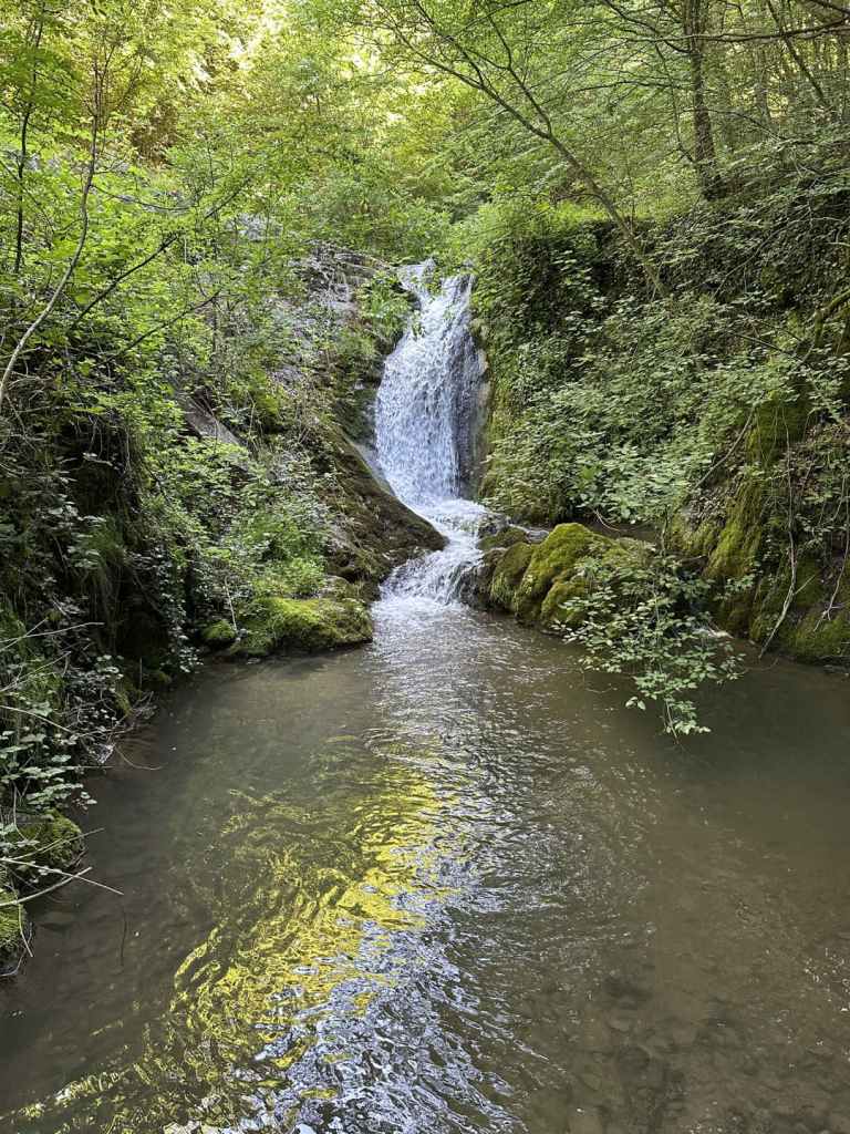
The most beautiful of the smaller waterfalls on the way.
One of the wooden bridges.
Pod Kamiko Waterfall.
A view of the top, the water glistening in the sunlight.
A view of both waterfalls (the smaller one is just visible on the far left).
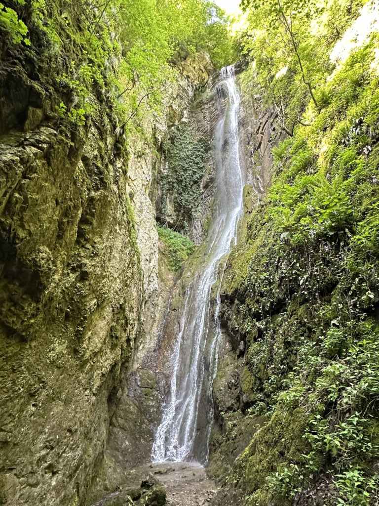
Chiprovtsi is a small town in north-west Bulgaria, between Belogradchik and Montana. It is situated on the northern side of the Balkan Mountains, very close to the Serbian border. It is famous for its carpets, but also for its waterfall, one of the most beautiful in Bulgaria. The first time I visited this waterfall, it was raining so much the air was full of water, and it was as if the waterfall was the whole forest.
The drive from Sofia takes three hours. You must take the II-81 road in the direction of Kostinbrod and Montana. You pass through the picturesque village of Gintsi before driving up and over the Balkan at Petrohan Pass. You then descend to Barzia before passing the turning to Berkovitsa, another waterfall, on your left. Ten kilometres before Montana, you leave the II-81 and turn left where it is signposted for Chiprovtsi (35 km). You immediately cross a railway, and then the road veers left (if you go straight, you will end up in the village of Borovtsi). After fifteen kilometres, you reach a T-junction. Again, turn left for Chiprovtsi (18 km). In another ten kilometres, just after the pretty village of Beli Mel, again there is a turning on the left for Chiprovtsi (now 10 km).
Four kilometres along this road, there is a turning on the right for Chiprovtsi Monastery (which is set back 500 m from the road). I recommend a visit to this monastery. I went before the waterfall, when it was still early, and the sunlight and spring flowers were very warming. The monastery is dedicated to Bulgaria’s most famous saint, the tenth-century hermit St John of Rila, who founded Rila Monastery.
Having returned to the road, continue in the same direction, and after 4.5 kilometres you will pass the sign for Chiprovtsi itself. 300 m after this sign, you must again turn left to enter the town (otherwise you will bypass it). You are now on Petar Parchevich Boulevard. Continue along here for 1.3 km and, after you pass the school of the same name on the right, turn left down Petar Bogdan Street (both these Peters were Roman Catholic Archbishops!). Continue for 200 m, turn right onto 23 Septemvri Street for 100 m, then left onto Tocho Voyvoda Street for another 100 m, then right onto Balkanska Street. This is the street that will take you to the beginning of the walk to the waterfall. (If you find this difficult, you can simply ask Google Maps for directions from your location to Chiprovtsi Waterfall, which should lead you through the town and out the other side. The important thing is to end up on Balkanska Street.)
This street leaves Chiprovtsi, heading west. You must drive along it for 4.5 kilometres, at which point the road in front of you becomes a track, and the road itself turns back on itself in the direction of Jar Hut. You do not need to go there unless you want to. Park the car on the grassy verge. You are ready to start your walk.
The walk to the waterfall is 3.2 kilometres and takes about an hour. Follow the track for 1.5 kilometres, at which point it divides. The left branch goes to Jar Hut, as you might expect, but you want the right branch. You will soon hear, and then see, the river on your right. This is the river that forms the waterfall higher up. Continue on the track for another 700 m, at which point there is a bridge over the river. The track now doubles back and descends on the other side, but you want to continue upstream, which means taking a path on the far (west) side of the river. There is a box with a first-aid kit and a picnic table directly after the bridge. The path is on your left after this.
You should now have the river on your left. Walk upstream. In 200 m, a bridge of planks crosses a small tributary. Keep following the course of the other river. The path gets steeper, and at one point comes out into the open (I noticed a lot of fallen trees in May). So long as you keep the river on your left, you will not get lost. In another 300 m, there is a second plank bridge, this time over the river, taking you back to the east side. Now the river is on your right. Another 400 m, and there is a third plank bridge taking you back over to the west side, but by now the waterfall is visible through the trees. I sat with my dog for an hour and a half, and I can say the time just disappeared as I marvelled at the drops of spray, the rocks that make up the waterfall (a waterfall is water and rock), little flowers gleaming in the sunlight in far, out-of-the-way places that I could never reach. It was wonderful.
You are now only a few kilometres from the Serbian border. On the Serbian (south) side of the Balkan, there are also waterfalls, I understand, and a national park. When you have had your fill, simply go back the way you have come.
Chiprovtsi Monastery in the early-morning sunlight.
The turning for Petar Bogdan Street, with the mountains (and the waterfall) behind.
The walk to the waterfall begins 4.5 km south-west of Chiprovtsi. Simply follow Balkanska Street until the road doubles back on itself.
The track as it approaches the river.
The bridge over the river.
The first-aid kit.
The first of three plank bridges (this one over a tributary).
The second plank bridge, taking you back to the east side of the river.
One of several interesting rocks on the way to the waterfall.
This makes for a cracking day, because you get to visit three waterfalls, two in the charming town of Teteven and one in Glozhene. It is then possible to visit the remarkable Glozhene Monastery and even to walk to Morovitsa Cave. For this reason, we got up early and left Sofia at 7.30 in the morning. We were back at 6.30 in the evening. But a word of caution: both Teteven and Glozhene waterfalls are a little famous for not always working at full capacity. We made sure to visit them in May, the ‘waterfall month’, once the snow had started melting and after a few days of rain. This made for a real spectacle.
As for Yamna, which is not far from Teteven as the crow flies, you want to take the A2 motorway from Sofia in the direction of Varna. You go past the exit for Pravets/Etropole and continue to the exit for Dzhurovo and Etropole. Shortly after leaving the motorway, you turn right to Dzhurovo and continue on this road for two kilometres until you reach a T-junction. Turn left here, which is signposted for Golyam Izvor (4 km). After another two kilometres, take a turning on the right (signposted for Golyam Izvor, still 4 km, and Teteven, 15 km). Drive through the pretty village of Golyam Izvor, staying on this road. After leaving the village, you will pass a dirt track on your left, which goes to Glozhene Monastery, our final destination. Keep straight, and in another five kilometres you will enter Teteven.
300 metres after you enter Teteven, the road veers left over a bridge, and immediately there is a T-junction. Turn right here (left will take you to Glozhene, where we will be going later). You now have the River Vit, which flows through Teteven, on your right. Drive into the centre of Teteven. In six kilometres, there is a bridge over the Vit on your right which is signposted for the waterfall, Skoka Waterfall, but do not take this turning. Keep going with the river on your right. You will pass a second bridge over the river, and then a third. Take this third one (500 metres after the first). You will cross the river and pass the town’s market on your left. Keep going straight for 300 metres. There is a little bridge, and immediately a turning on the right signposted for Skoka Waterfall. Turn right here.
Keep going on this road (avoid the temptation to go straight back over the river you have just crossed), and after 2.8 kilometres you will reach a little car park on your right. Park here. The ecopath to the two waterfalls begins here.
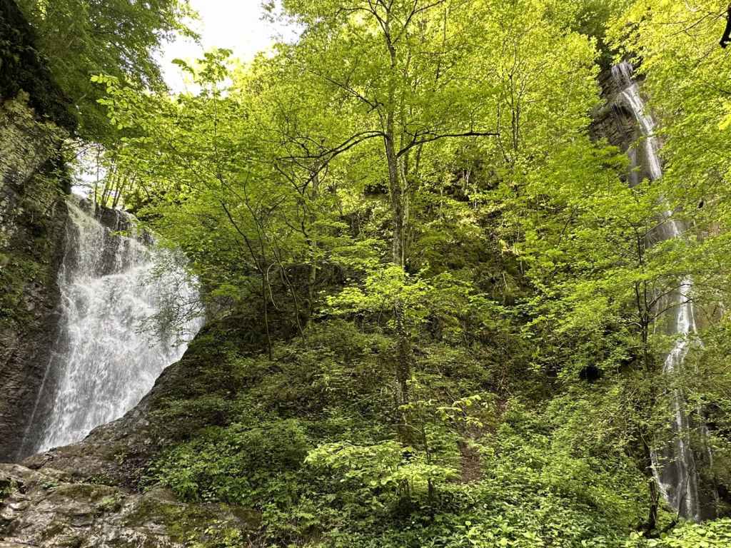
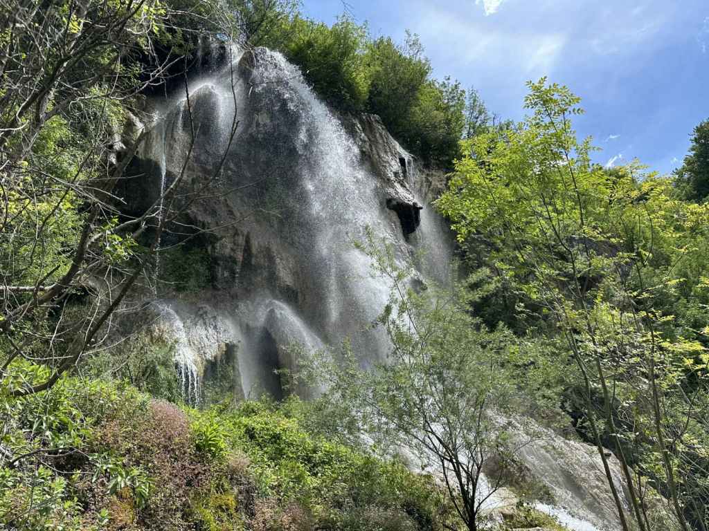
You are in for a treat. The distance to the waterfalls is short – 650 metres – and takes only a quarter of an hour, but the path is very pretty, you pass a smaller waterfall, which is still fairly impressive, and at the end of the path there is a hut with the two waterfalls behind it. Skoka is on your left and attracts most of the attention, but don’t miss the much taller Praskalo on your right. If you have chosen to go in spring after the snow melt and some rain, you will not be disappointed. It is very unusual to find two such pretty waterfalls at such a short distance from each other. I kept going from one to the other. I liked Praskalo more, it was less noisy and very spiritual. We spent about 1¼ hour walking to and from the waterfalls.
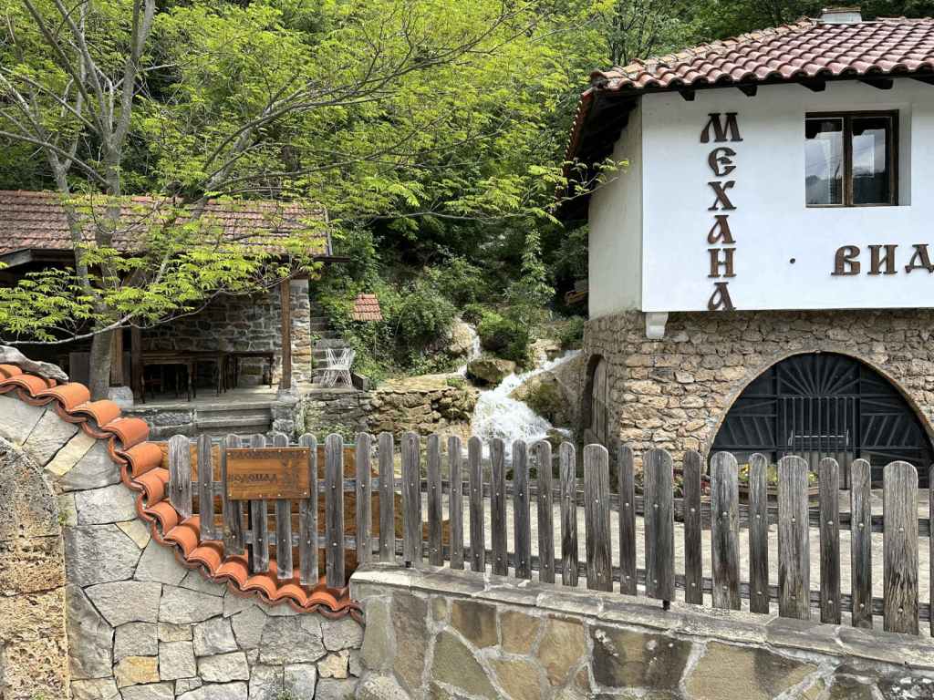
Once you are back at the car, turn around and return the way you have come. Glozhene Waterfall, called Vara because of the limestone, is 13.5 kilometres away. You retrace your route, but having left the centre of Teteven behind, you continue on the 358, ignoring the turning to Golyam Izvor, and 2.4 kilometres after officially leaving Teteven, you will come to a lay-by on the right, next to a mehana or restaurant called Vidrite (‘The Otters’). Park here. In front of the restaurant, next to the road, there is a little sign that says ‘Glozhene Waterfall’. Yes, but the little fall you see in front of you is not Glozhene Waterfall proper, and I dread to think how many people have arrived, taken a photograph and driven off without actually seeing the waterfall itself. To reach the waterfall, you must continue along the road on foot for 120 metres. Next to a STOP sign, there is a partially tarmacked track that doubles back on your right. Follow this track, and in 150 metres you will reach the course of the river. The waterfall is above you, on your left. To reach it, you must now follow a barely visible path on the lefthand side of the river. Just plunge into the trees, you will find it, and this path will take you in 90 metres to the base of the waterfall, one of the most spectacular waterfalls in Bulgaria. I include a map below, showing the lay-by, the restaurant Vidrite (which was closed) and the route from the road 358 to the waterfall. It’s not that difficult, but it does seem to create a lot of confusion!
As you are returning on the track, you will catch a glimpse of Glozhene Monastery on the mountain opposite, our next destination. There is a path from Glozhene Village to the monastery, but most people approach by car from Malak Izvor (the smaller version of Golyam Izvor). To do this, continue on the 358 into Glozhene and after 2.3 kilometres turn left over the River Vit (signposted for the monastery, Yablanitsa, 9 km, and Sofia, 92 km). Continue for 8 kilometres until you reach a turning on your left (signposted for the monastery and Malak Izvor, 2 km). Drive through the village and, after 2.5 kilometres, there is a turning on the left for the monastery.
The distance from here to the monastery is 5.5 kilometres. The road gets steadily worse, and it is difficult for two vehicles to pass each other going in opposite directions. On the way up, we got stuck behind a bus (!) and, on the way down, we got stuck in a hailstorm. But never mind. As you approach the monastery, there is a car park on the left (for which we had to pay 3 leva). There is then a second car park a little further on, and the road stops.
Glozhene Monastery is said to have been founded by a prince from Kiev called George Glozh (who gave his name to the village below) in the thirteenth century. Originally, the monastery, which is dedicated to St George, was down in the village, but the icon of St George kept disappearing and reappearing on top of the hill (a wonderful site with stunning views), so in the end the monks got the message and moved the monastery uphill. You are unlikely to come across a more dramatically located monastery, which helped keep it protected during Ottoman rule. There even used to be a secret tunnel connecting the monastery with the village below, but it was destroyed during an earthquake. You can enter the church and light a candle. There is also a restaurant serving food.
You may find that the day’s excursion has been long enough, but if you still have energy, there is a cave called Morovitsa, one of the longest in Bulgaria, the path to which begins at the gate of the monastery. It is a six-kilometre round trip, which took us 2¼ hours. The path heads right from the monastery and soon becomes a muddy track. In little under one kilometre, this track brought us out into the open, next to a picnic hut. Be careful. You need to join a track that is higher up, on your right. After one kilometre, a path leaves this track on the left, clearly signposted for the cave. The path crosses a stream and then descends rather steeply to the cave. Be careful, because it is slippery. I wouldn’t say this part of the visit is essential – it really depends on your priorities.
To return to Sofia, drive back through Malak Izvor. On reaching the road from Glozhene, go left (signposted for Yablanitsa, 1 km). You will pass under the motorway. Drive into Yablanitsa until you reach a T-junction. Turn left here (signposted for Sofia, 80 km). At the next T-junction, again turn left (signposted for Sofia, 76 km). You will leave Yablanitsa and almost immediately reach the slip road for the motorway. Drive safely!
I had already visited the waterfalls in Teteven and wasn’t planning to include them because we went too early, in winter, before the snow melt. It makes such a difference going in May. Together with Vara Waterfall in Glozhene, they were magical, majestic and mystical.
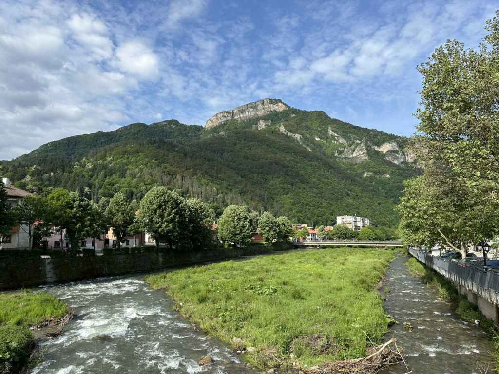
A general view of the River Vit passing through Teteven.
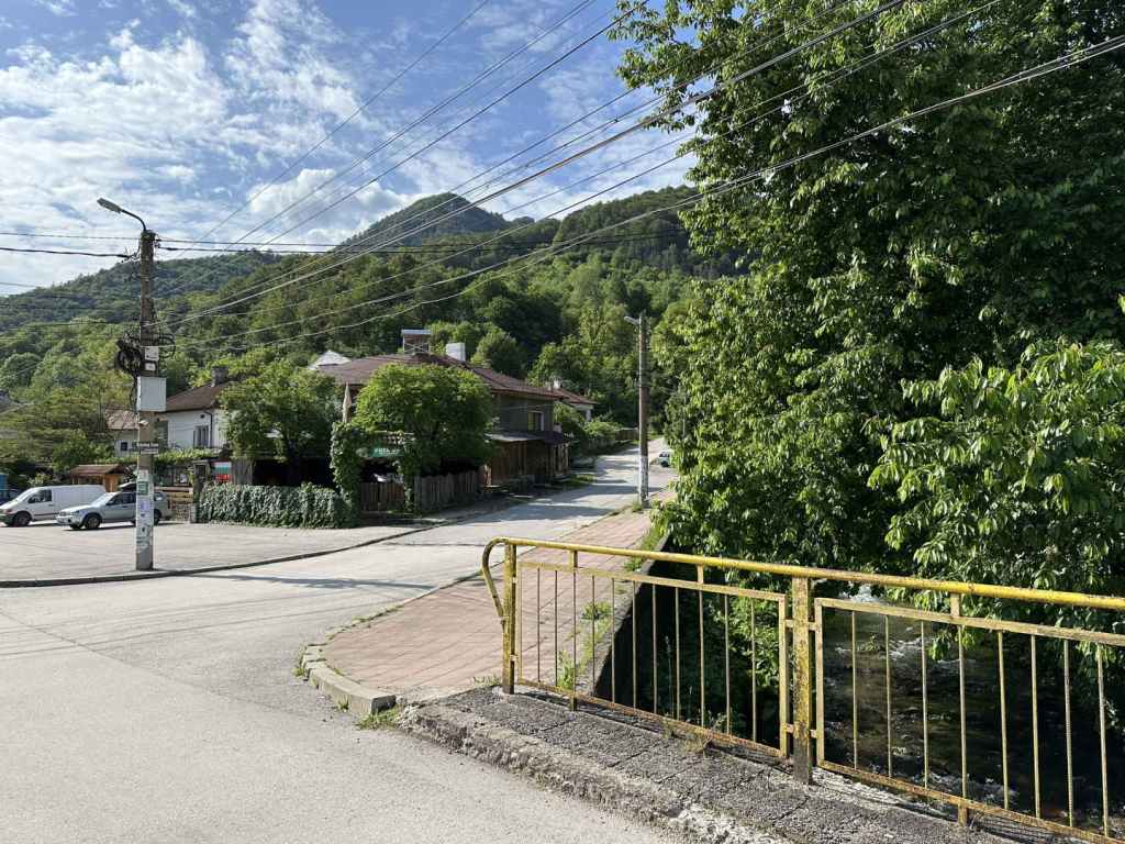
The turning for Skoka Waterfall.
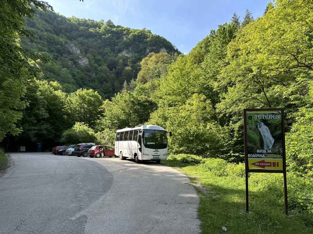
The car park for Skoka Waterfall.
The beginning of the ecopath to Skoka Waterfall.
Teteven’s two waterfalls, Skoka and Praskalo, at the end of the ecopath.
Skoka Waterfall in May.
The spiritual Praskalo Waterfall.
The lay-by before the restaurant Vidrite.
The sign for ‘Glozhene Waterfall’, which is actually much higher up.
The partially tarmacked track that leaves the 358 a short distance away.
Glozhene Waterfall.
The view from the track towards Glozhene Monastery.
The gate to Glozhene Monastery.
The church in Glozhene Monastery.
Morovitsa Cave.
A map showing how to get from the lay-by next to Vidrite to Glozhene Waterfall above.
Yamna is a beautiful village located after the town of Etropole, 95 kilometres north-east of Sofia. The waterfall is called ‘Vranya Voda’, meaning ‘Crow Water’ – legend has it some monks were looking to found a monastery in the vicinity of Etropole and looked at this spot, when a crow alighted. The crow took off, however, and flew to the nearby site of the present-day monastery, but the event – and the name – stuck. It is not a particularly tall waterfall, but it more than makes up for any lack of height by its beauty and the beauty of the surrounding landscape. The waterfall is covered in green and yellow moss, and this makes it quite distinctive.
To reach Yamna, you must take the A2 motorway from Sofia in the direction of Varna. After Botevgrad, leave the motorway where it is signposted for Pravets and Etropole and follow the signs for Etropole, ignoring the signs for Pravets centre. You will pass Pravets Golf Club on your right. Keep going straight. After 3.3 kilometres, turn right for Etropole (still 16 km away). In another 3 kilometres on this road, you will see a sign for Pravets Monastery on your right. Keep going. After another 7 kilometres, again turn right for Etropole (now 3 km) and in 900 metres you will enter the town.
Having entered Etropole, continue on this road for 2 kilometres, where there is a sharp turning on the left, signposted for Etropole Monastery, Yamna and Teteven. Turn left here. The road takes you back on yourself. In 3 kilometres, you reach the village of Ribaritsa, which is where Etropole Monastery is situated. This was an important monastery during Ottoman times, an important scriptorium – many manuscripts were copied here. For now, keep going to Yamna, which is another 5 kilometres. 500 metres after you enter the village of Yamna, the road turns sharply left, and a dirt track diverges from the road on the right. This is the walk to the waterfall. There is a convenient verge just before the dirt track where you can park.
Yamna Waterfall is only half an hour’s walk. In ten minutes (470 metres), a path diverges from the track on the right. This path goes to Etropole Monastery and is said to take 1 hour and 50 minutes. Immediately after this path, there is a second path on the right, with yellow markers. This path will take you to the bottom of the waterfall. If you continue on the track and ignore the two paths, you will come to a field.
Take the second path. The path skirts the forest, which is above you on your right. In five minutes, it crosses a little stream, with views of Yamna on the left. In another ten minutes (1.12 km from the start of the walk), you come to a stream with a limestone bed. This is the stream that flows from the waterfall. The waterfall is up on your right. There is no set path that takes you there – you must walk on one or other bank of the stream, and in 5-10 minutes you will reach the base of the waterfall.
It is only a small area where you can stand, but it is really a privilege to be in front of a wonder of nature, the drops of water sparkling in a clear sky, the moss so soft and intricate. We really enjoyed it. We had lunch further down by the stream. The journey back to where you parked the car will take not much more than twenty minutes.
On the way back, it is imperative that you pay a visit to Etropole Monastery from Ribaritsa village. The diversion is 2.5 kilometres and well worth the effort. Not only does Etropole Monastery have an important history and provide an oasis of peace in the middle of nature, there is a second waterfall behind the monastery called Varovitets! Behind the nineteenth-century church, there is a small door in the wall of the monastery, through which you can gain access to the waterfall, which is only ten minutes away, by following the yellow signs (or the course of the river). It makes for an excellent day trip from Sofia. Not far away is Glozhene Monastery, which also has a waterfall nearby.
500 metres after you enter Yamna, the road veers left and a dirt track diverges on the right. Park here.
The track, which you follow for ten minutes (470 metres).
Take the second path on the right. This goes to the bottom of the waterfall. The track leads to a field.
A view of Yamna on the left.
The path as it arrives at the stream formed by the waterfall.
The waterfall is up on the right, a short climb away.
Yamna Waterfall.
The sparkling water.
The waterfall with the landscape behind.
The moss, a feature of this waterfall!
The katholikon (main church) of Etropole Monastery, built in 1858.