Glozhene-Teteven

This makes for a cracking day, because you get to visit three waterfalls, two in the charming town of Teteven and one in Glozhene. It is then possible to visit the remarkable Glozhene Monastery and even to walk to Morovitsa Cave. For this reason, we got up early and left Sofia at 7.30 in the morning. We were back at 6.30 in the evening. But a word of caution: both Teteven and Glozhene waterfalls are a little famous for not always working at full capacity. We made sure to visit them in May, the ‘waterfall month’, once the snow had started melting and after a few days of rain. This made for a real spectacle.

As for Yamna, which is not far from Teteven as the crow flies, you want to take the A2 motorway from Sofia in the direction of Varna. You go past the exit for Pravets/Etropole and continue to the exit for Dzhurovo and Etropole. Shortly after leaving the motorway, you turn right to Dzhurovo and continue on this road for two kilometres until you reach a T-junction. Turn left here, which is signposted for Golyam Izvor (4 km). After another two kilometres, take a turning on the right (signposted for Golyam Izvor, still 4 km, and Teteven, 15 km). Drive through the pretty village of Golyam Izvor, staying on this road. After leaving the village, you will pass a dirt track on your left, which goes to Glozhene Monastery, our final destination. Keep straight, and in another five kilometres you will enter Teteven.

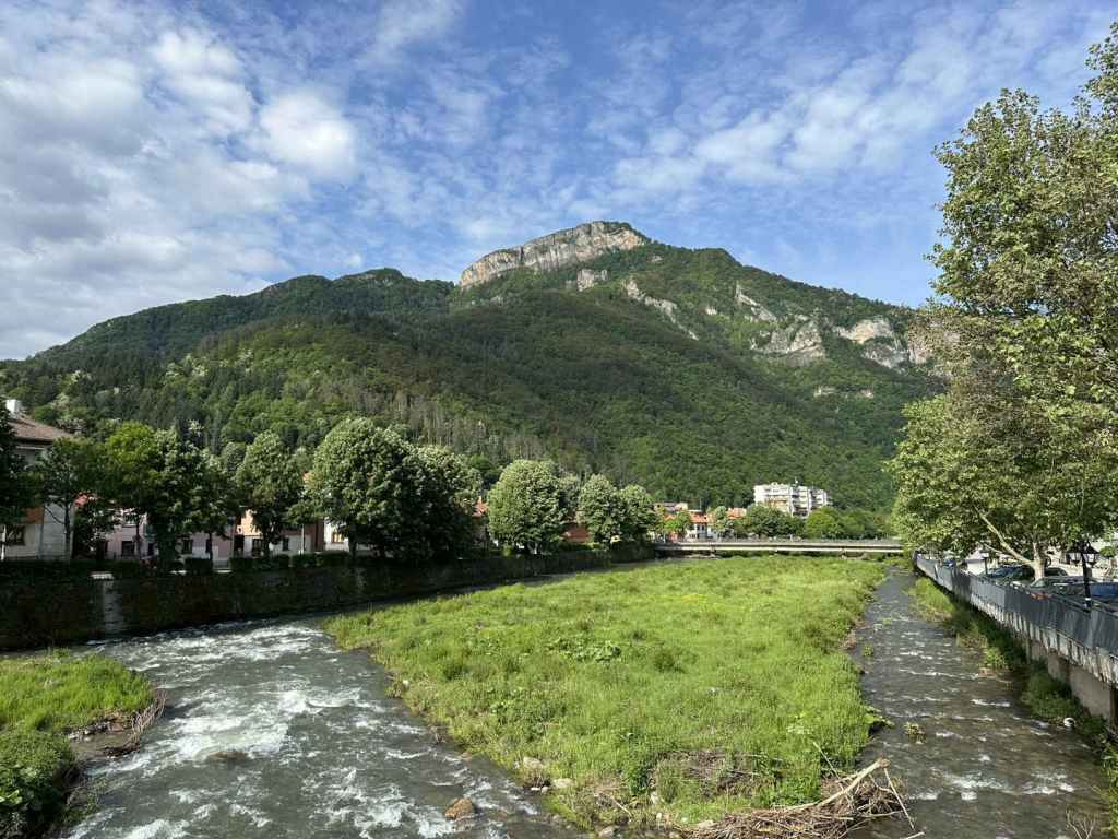
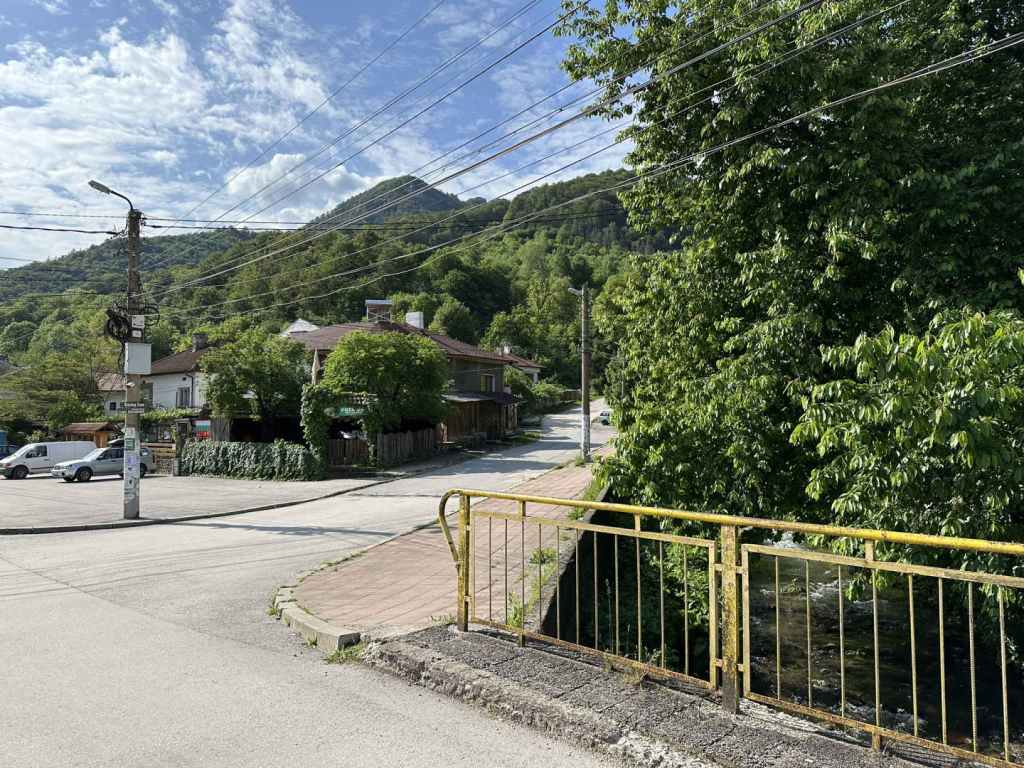
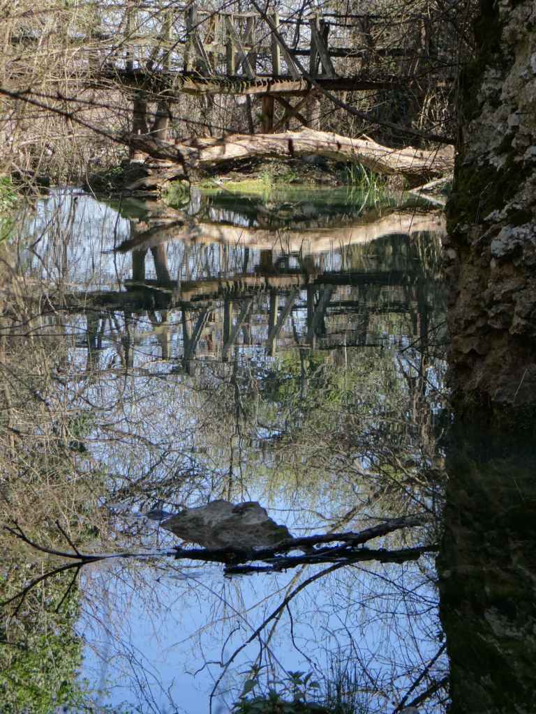
300 metres after you enter Teteven, the road veers left over a bridge, and immediately there is a T-junction. Turn right here (left will take you to Glozhene, where we will be going later). You now have the River Vit, which flows through Teteven, on your right. Drive into the centre of Teteven. In six kilometres, there is a bridge over the Vit on your right which is signposted for the waterfall, Skoka Waterfall, but do not take this turning. Keep going with the river on your right. You will pass a second bridge over the river, and then a third. Take this third one (500 metres after the first). You will cross the river and pass the town’s market on your left. Keep going straight for 300 metres. There is a little bridge, and immediately a turning on the right signposted for Skoka Waterfall. Turn right here.

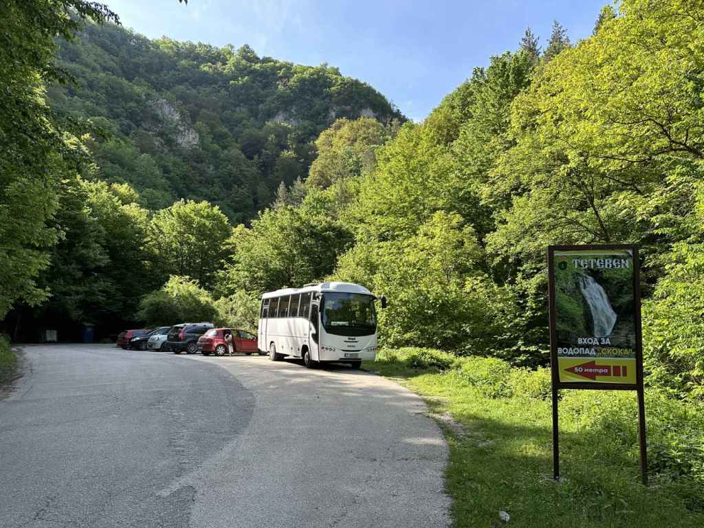
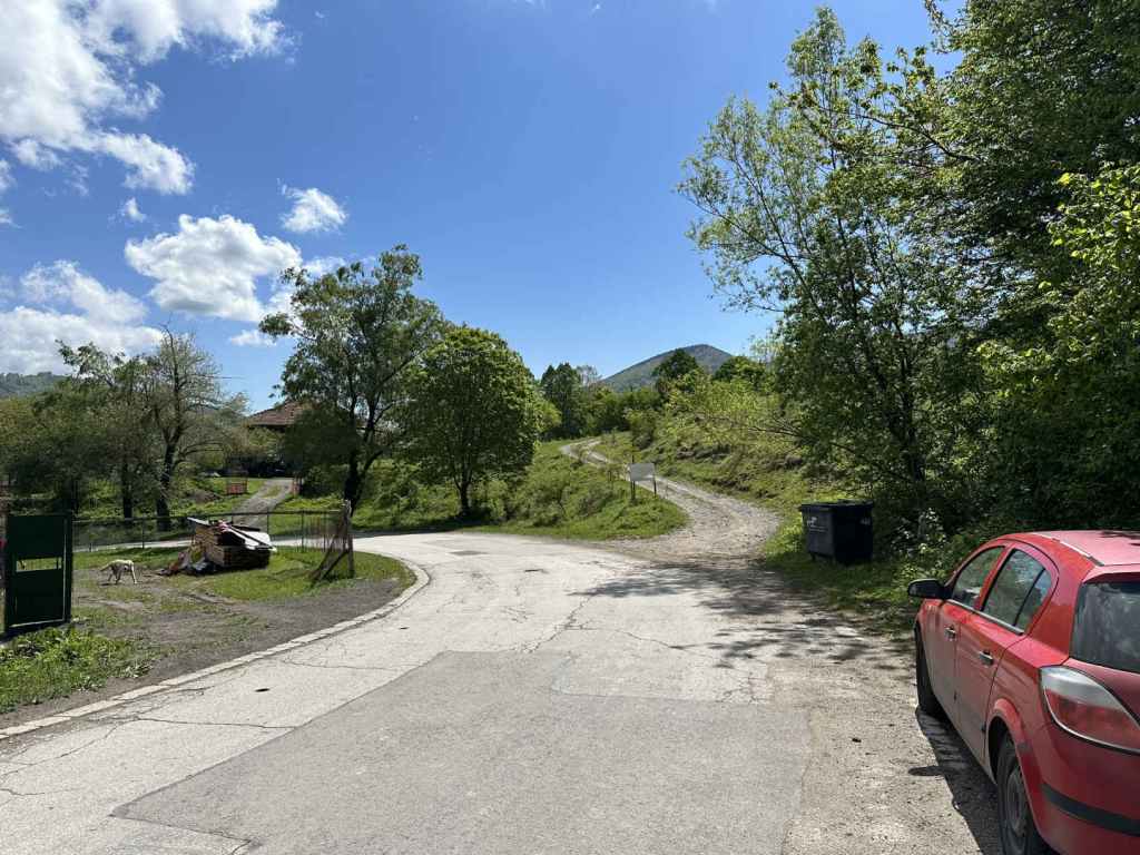
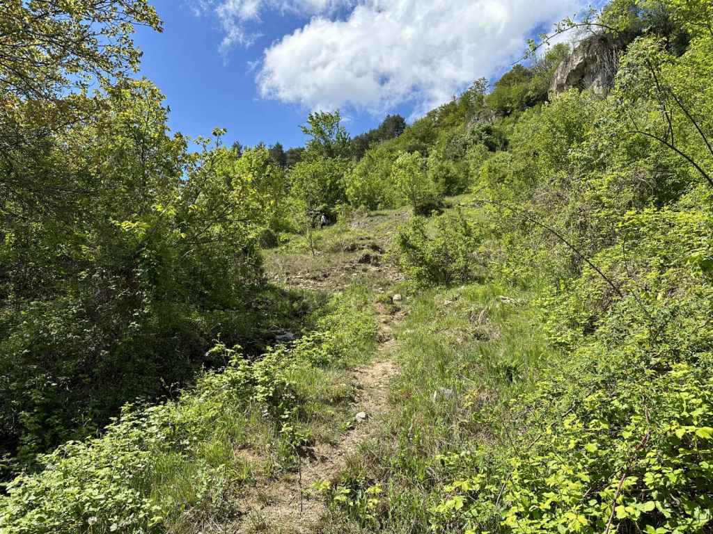
Keep going on this road (avoid the temptation to go straight back over the river you have just crossed), and after 2.8 kilometres you will reach a little car park on your right. Park here. The ecopath to the two waterfalls begins here.

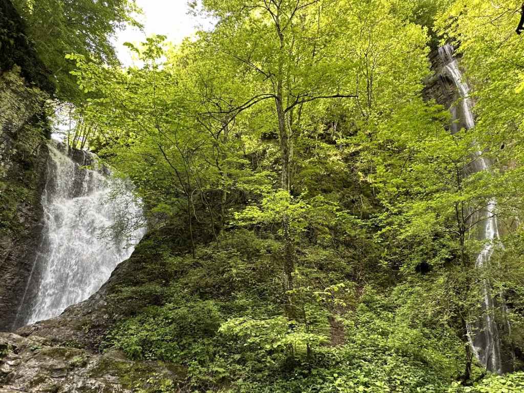
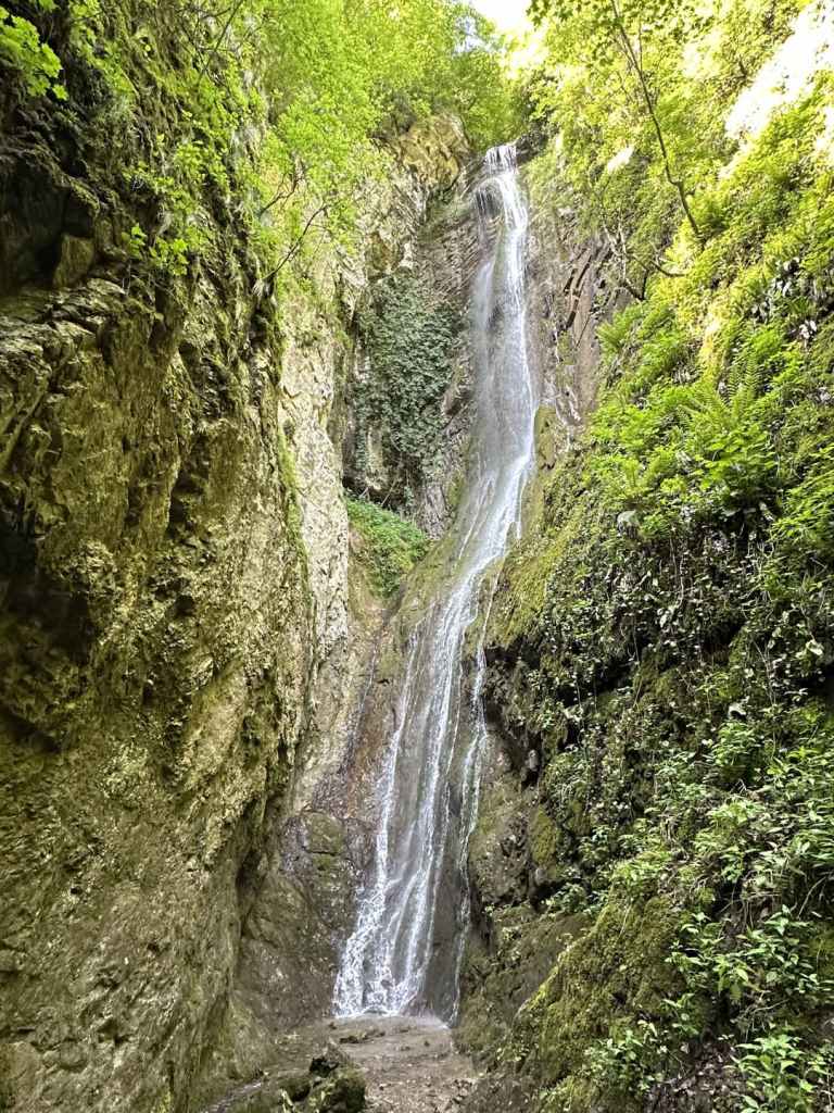
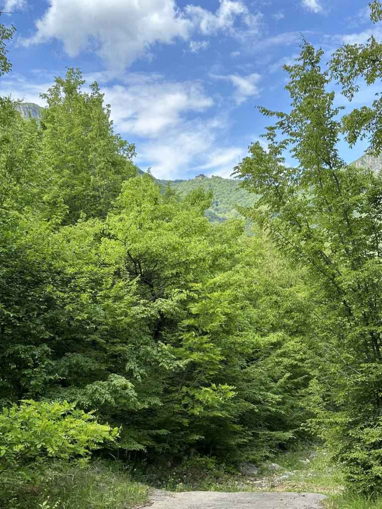
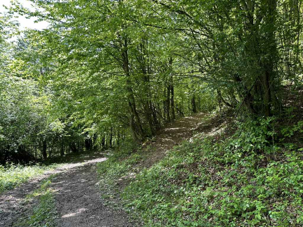
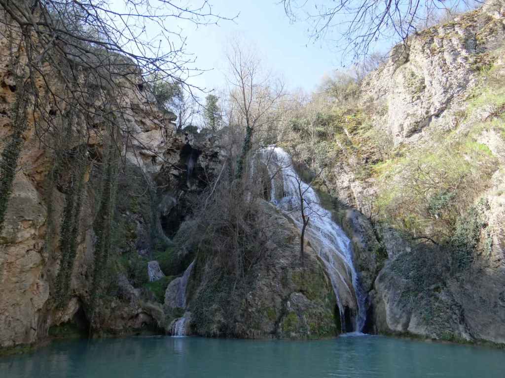
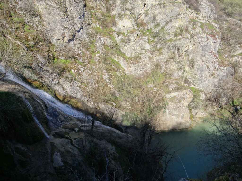
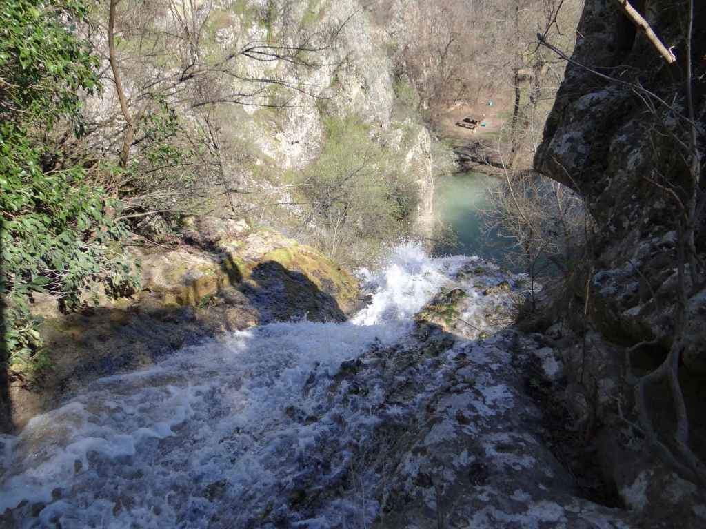
You are in for a treat. The distance to the waterfalls is short – 650 metres – and takes only a quarter of an hour, but the path is very pretty, you pass a smaller waterfall, which is still fairly impressive, and at the end of the path there is a hut with the two waterfalls behind it. Skoka is on your left and attracts most of the attention, but don’t miss the much taller Praskalo on your right. If you have chosen to go in spring after the snow melt and some rain, you will not be disappointed. It is very unusual to find two such pretty waterfalls at such a short distance from each other. I kept going from one to the other. I liked Praskalo more, it was less noisy and very spiritual. We spent about 1¼ hour walking to and from the waterfalls.

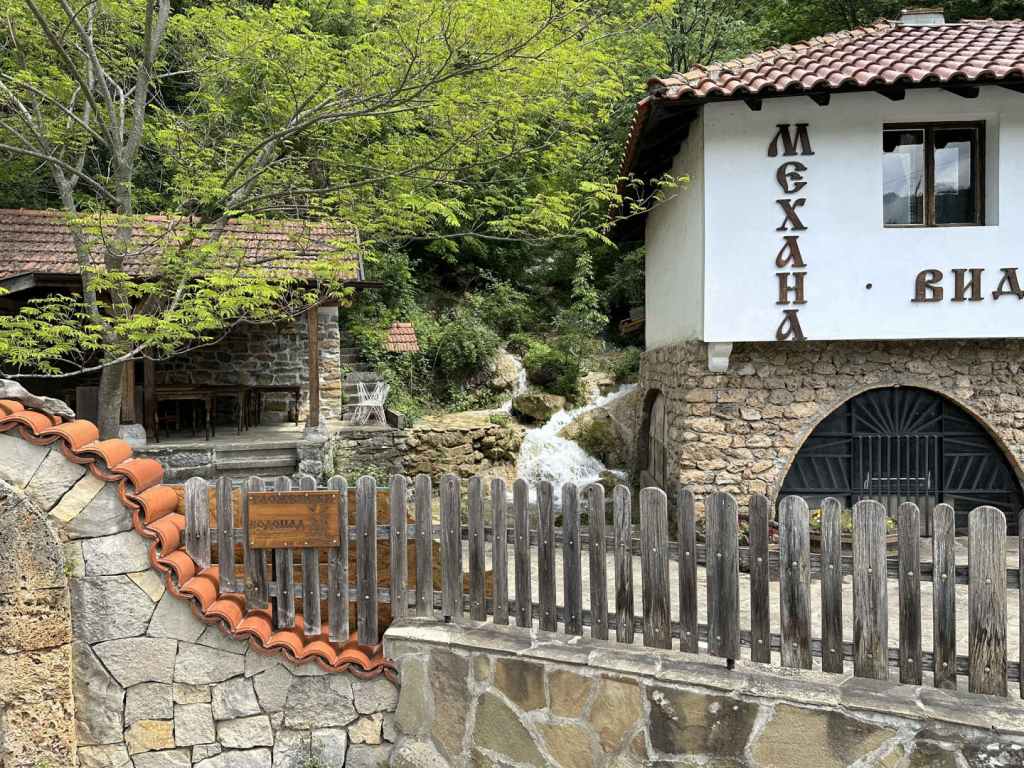
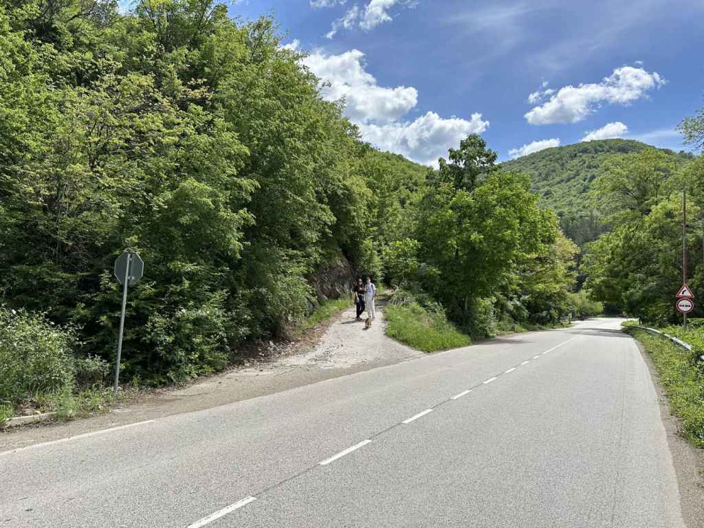
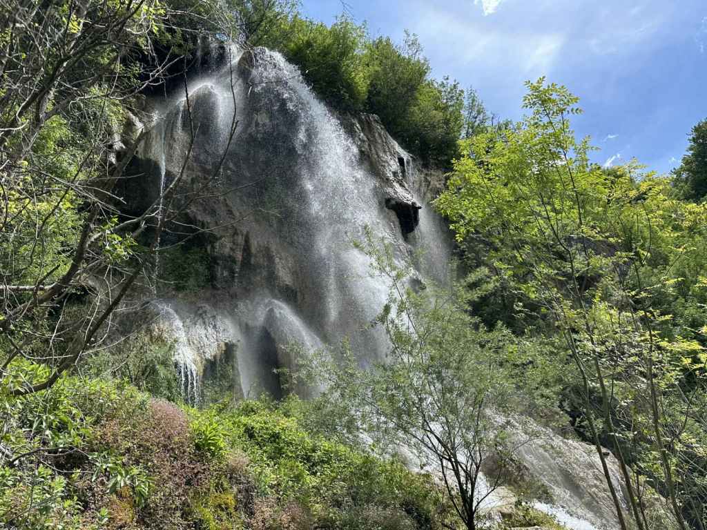
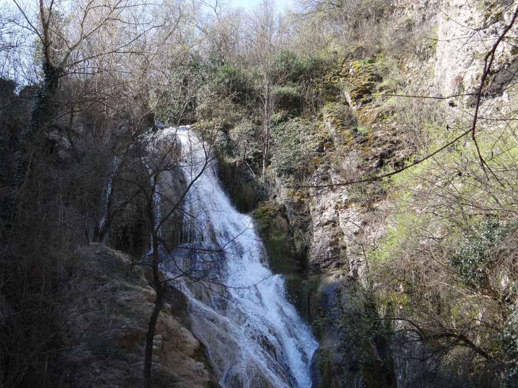
Once you are back at the car, turn around and return the way you have come. Glozhene Waterfall, called Vara because of the limestone, is 13.5 kilometres away. You retrace your route, but having left the centre of Teteven behind, you continue on the 358, ignoring the turning to Golyam Izvor, and 2.4 kilometres after officially leaving Teteven, you will come to a lay-by on the right, next to a mehana or restaurant called Vidrite (‘The Otters’). Park here. In front of the restaurant, next to the road, there is a little sign that says ‘Glozhene Waterfall’. Yes, but the little fall you see in front of you is not Glozhene Waterfall proper, and I dread to think how many people have arrived, taken a photograph and driven off without actually seeing the waterfall itself. To reach the waterfall, you must continue along the road on foot for 120 metres. Next to a STOP sign, there is a partially tarmacked track that doubles back on your right. Follow this track, and in 150 metres you will reach the course of the river. The waterfall is above you, on your left. To reach it, you must now follow a barely visible path on the lefthand side of the river. Just plunge into the trees, you will find it, and this path will take you in 90 metres to the base of the waterfall, one of the most spectacular waterfalls in Bulgaria. I include a map below, showing the lay-by, the restaurant Vidrite (which was closed) and the route from the road 358 to the waterfall. It’s not that difficult, but it does seem to create a lot of confusion!

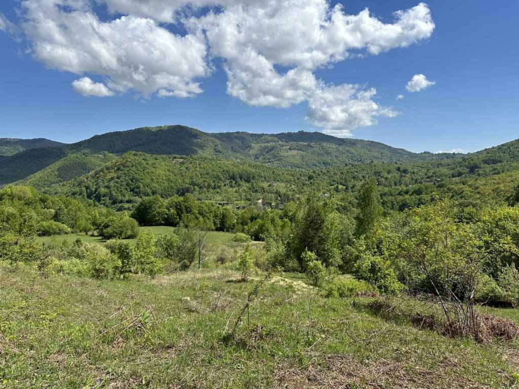
As you are returning on the track, you will catch a glimpse of Glozhene Monastery on the mountain opposite, our next destination. There is a path from Glozhene Village to the monastery, but most people approach by car from Malak Izvor (the smaller version of Golyam Izvor). To do this, continue on the 358 into Glozhene and after 2.3 kilometres turn left over the River Vit (signposted for the monastery, Yablanitsa, 9 km, and Sofia, 92 km). Continue for 8 kilometres until you reach a turning on your left (signposted for the monastery and Malak Izvor, 2 km). Drive through the village and, after 2.5 kilometres, there is a turning on the left for the monastery.

The distance from here to the monastery is 5.5 kilometres. The road gets steadily worse, and it is difficult for two vehicles to pass each other going in opposite directions. On the way up, we got stuck behind a bus (!) and, on the way down, we got stuck in a hailstorm. But never mind. As you approach the monastery, there is a car park on the left (for which we had to pay 3 leva). There is then a second car park a little further on, and the road stops.

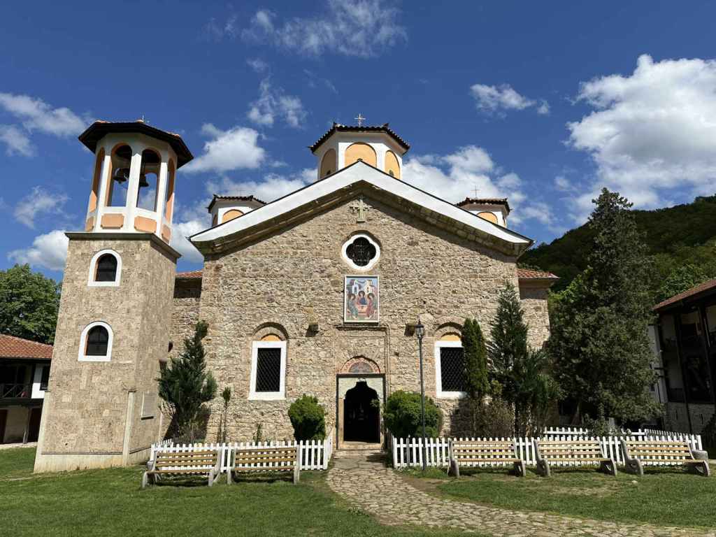
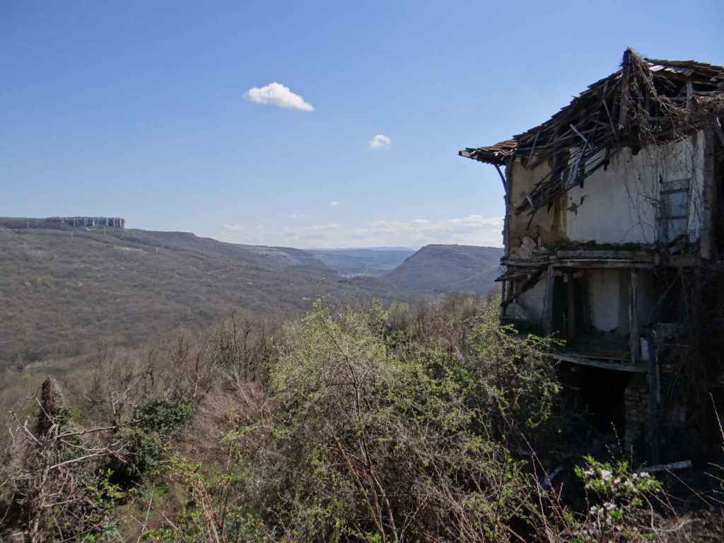
Glozhene Monastery is said to have been founded by a prince from Kiev called George Glozh (who gave his name to the village below) in the thirteenth century. Originally, the monastery, which is dedicated to St George, was down in the village, but the icon of St George kept disappearing and reappearing on top of the hill (a wonderful site with stunning views), so in the end the monks got the message and moved the monastery uphill. You are unlikely to come across a more dramatically located monastery, which helped keep it protected during Ottoman rule. There even used to be a secret tunnel connecting the monastery with the village below, but it was destroyed during an earthquake. You can enter the church and light a candle. There is also a restaurant serving food.

You may find that the day’s excursion has been long enough, but if you still have energy, there is a cave called Morovitsa, one of the longest in Bulgaria, the path to which begins at the gate of the monastery. It is a six-kilometre round trip, which took us 2¼ hours. The path heads right from the monastery and soon becomes a muddy track. In little under one kilometre, this track brought us out into the open, next to a picnic hut. Be careful. You need to join a track that is higher up, on your right. After one kilometre, a path leaves this track on the left, clearly signposted for the cave. The path crosses a stream and then descends rather steeply to the cave. Be careful, because it is slippery. I wouldn’t say this part of the visit is essential – it really depends on your priorities.

To return to Sofia, drive back through Malak Izvor. On reaching the road from Glozhene, go left (signposted for Yablanitsa, 1 km). You will pass under the motorway. Drive into Yablanitsa until you reach a T-junction. Turn left here (signposted for Sofia, 80 km). At the next T-junction, again turn left (signposted for Sofia, 76 km). You will leave Yablanitsa and almost immediately reach the slip road for the motorway. Drive safely!

I had already visited the waterfalls in Teteven and wasn’t planning to include them because we went too early, in winter, before the snow melt. It makes such a difference going in May. Together with Vara Waterfall in Glozhene, they were magical, majestic and mystical.

A general view of the River Vit passing through Teteven.
The turning for Skoka Waterfall.
The car park for Skoka Waterfall.
The beginning of the ecopath to Skoka Waterfall.
Teteven’s two waterfalls, Skoka and Praskalo, at the end of the ecopath.
Skoka Waterfall in May.
The spiritual Praskalo Waterfall.
The lay-by before the restaurant Vidrite.
The sign for ‘Glozhene Waterfall’, which is actually much higher up.
The partially tarmacked track that leaves the 358 a short distance away.
Glozhene Waterfall.
The view from the track towards Glozhene Monastery.
The gate to Glozhene Monastery.
The church in Glozhene Monastery.
Morovitsa Cave.
A map showing how to get from the lay-by next to Vidrite to Glozhene Waterfall above.

Yamna

Yamna is a beautiful village located after the town of Etropole, 95 kilometres north-east of Sofia. The waterfall is called ‘Vranya Voda’, meaning ‘Crow Water’ – legend has it some monks were looking to found a monastery in the vicinity of Etropole and looked at this spot, when a crow alighted. The crow took off, however, and flew to the nearby site of the present-day monastery, but the event – and the name – stuck. It is not a particularly tall waterfall, but it more than makes up for any lack of height by its beauty and the beauty of the surrounding landscape. The waterfall is covered in green and yellow moss, and this makes it quite distinctive.

To reach Yamna, you must take the A2 motorway from Sofia in the direction of Varna. After Botevgrad, leave the motorway where it is signposted for Pravets and Etropole and follow the signs for Etropole, ignoring the signs for Pravets centre. You will pass Pravets Golf Club on your right. Keep going straight. After 3.3 kilometres, turn right for Etropole (still 16 km away). In another 3 kilometres on this road, you will see a sign for Pravets Monastery on your right. Keep going. After another 7 kilometres, again turn right for Etropole (now 3 km) and in 900 metres you will enter the town.

Having entered Etropole, continue on this road for 2 kilometres, where there is a sharp turning on the left, signposted for Etropole Monastery, Yamna and Teteven. Turn left here. The road takes you back on yourself. In 3 kilometres, you reach the village of Ribaritsa, which is where Etropole Monastery is situated. This was an important monastery during Ottoman times, an important scriptorium – many manuscripts were copied here. For now, keep going to Yamna, which is another 5 kilometres. 500 metres after you enter the village of Yamna, the road turns sharply left, and a dirt track diverges from the road on the right. This is the walk to the waterfall. There is a convenient verge just before the dirt track where you can park.

Yamna Waterfall is only half an hour’s walk. In ten minutes (470 metres), a path diverges from the track on the right. This path goes to Etropole Monastery and is said to take 1 hour and 50 minutes. Immediately after this path, there is a second path on the right, with yellow markers. This path will take you to the bottom of the waterfall. If you continue on the track and ignore the two paths, you will come to a field.

Take the second path. The path skirts the forest, which is above you on your right. In five minutes, it crosses a little stream, with views of Yamna on the left. In another ten minutes (1.12 km from the start of the walk), you come to a stream with a limestone bed. This is the stream that flows from the waterfall. The waterfall is up on your right. There is no set path that takes you there – you must walk on one or other bank of the stream, and in 5-10 minutes you will reach the base of the waterfall.

It is only a small area where you can stand, but it is really a privilege to be in front of a wonder of nature, the drops of water sparkling in a clear sky, the moss so soft and intricate. We really enjoyed it. We had lunch further down by the stream. The journey back to where you parked the car will take not much more than twenty minutes.

On the way back, it is imperative that you pay a visit to Etropole Monastery from Ribaritsa village. The diversion is 2.5 kilometres and well worth the effort. Not only does Etropole Monastery have an important history and provide an oasis of peace in the middle of nature, there is a second waterfall behind the monastery called Varovitets! Behind the nineteenth-century church, there is a small door in the wall of the monastery, through which you can gain access to the waterfall, which is only ten minutes away, by following the yellow signs (or the course of the river). It makes for an excellent day trip from Sofia. Not far away is Glozhene Monastery, which also has a waterfall nearby.

500 metres after you enter Yamna, the road veers left and a dirt track diverges on the right. Park here.
The track, which you follow for ten minutes (470 metres).
Take the second path on the right. This goes to the bottom of the waterfall. The track leads to a field.
A view of Yamna on the left.
The path as it arrives at the stream formed by the waterfall.
The waterfall is up on the right, a short climb away.
Yamna Waterfall.
The sparkling water.
The waterfall with the landscape behind.
The moss, a feature of this waterfall!
The katholikon (main church) of Etropole Monastery, built in 1858.
Varovitets Waterfall behind Etropole Monastery.

Hotnitsa

There are three waterfalls north-west of Veliko Tarnovo – near the villages of Hotnitsa, Emen and Vishovgrad. Hotnitsa (‘Kaya Bunar’) is the closest. The journey takes about forty minutes, and on the way back you have the chance to visit one of the most beautiful monasteries in Bulgaria, Preobrazhenski (‘Transfiguration’) Monastery.

The waterfall is where you park the car and is undoubtedly one of the most magical and mystical waterfalls we have visited. To get there from Veliko Tarnovo, follow the brown signs for Preobrazhenski Monastery and for the ancient Roman town Nicopolis ad Istrum. These signs will take you north of Veliko Tarnovo, from where you join the E85 and head in the direction of Samovodene. This main arterial road that joins the towns of Haskovo in the south and Ruse in the north passes along the gorge formed by the river Yantra. After a short while, you will pass the turning for Preobrazhenski Monastery on your left. Keep going straight. In Samovodene, the road divides – the right fork is signposted for Ruse, the left for Resen. You take the left fork and, about a kilometre after leaving Samovodene, take the turning left signposted for the villages of Hotnitsa (5 km) and Pavlikeni.

When you arrive in the centre of Hotnitsa, the waterfall is clearly signposted on your left. The distance from the centre of Hotnitsa to the waterfall is 3 km, and it is clearly signposted all the way. The road ends at the waterfall, where you can park the car. This astonishing waterfall is on your left. The colour of the water is turquoise blue because of the karst spring and limestone rocks.

There is an ecopath (1.5 km) that takes you up the left-hand side of the waterfall, a little up the gorge above the main waterfall and back along the top of the gorge on the right. This ecopath is not for the faint-hearted! I did it carrying our dog, but there are places where you have to climb or descend steep wooden ladders and clamber over the rocks. There are several wooden bridges that take you from side to side of the river Bohot. You can literally stand at the top of the main waterfall. There are smaller waterfalls further upstream. Once you have reached the top of the gorge on the right, the path descends slowly back to the café at the bottom.

On your return to Veliko Tarnovo, don’t miss the chance to visit Preobrazhenski Monastery, which overlooks the Yantra gorge and offers views back to Veliko Tarnovo. The church was built by noted Bulgarian National Revival architect Kolyu Ficheto and painted by another nineteenth-century Bulgarian artist, Zahari Zograf (who also painted Rila and Troyan Monasteries). It has some of the most beautiful frescoes in Bulgaria, including the famous fresco ‘The Circle of Life’ on the outside of the building. Behind the church is a very large rock that missed the church by inches and has been left there to remind us of God’s providence! On the opposite side of the gorge can be seen another important monastery, the Patriarchal Monastery of the Holy Trinity.

The road from the village of Hotnitsa ends at the waterfall.
An overview of Hotnitsa Waterfall.
The upper part of the waterfall.
A view from the side.
A view from the ecopath above – note the turquoise blue water!
The ecopath (no, it’s not a dungeon!).
A view back to the pool below the waterfall.
Standing at the top of the waterfall – be careful!
A smaller waterfall further upstream.
One of the wooden bridges crossing the river Bohot.
One of the steep wooden ladders.
The sun captured in the river.
A view from the top of the gorge back to the car park.
The fresco ‘The Circle of Life’ at Transfiguration Monastery.
View from Transfiguration Monastery to Veliko Tarnovo – note the plateau on the left, above the gorge, where the village of Arbanasi with its famous churches is situated.