Vratsa is a town north of Sofia, midway between Sofia and the river Danube. It is famous for its caves (in particular, Ledenika), waterfalls and rock formations. To the south-west of Vratsa is the Vrachanski Balkan Nature Park, established in 1989. This is where Vratsa Waterfall is situated, together with another waterfall, Borov Kamak, which can be accessed from the village of Zgorigrad. It is also where the Bulgarian revolutionary and poet Hristo Botev was killed in 1876, fighting against the Ottomans in an uprising that would be brutally crushed, but would sow the seeds for the liberation of Bulgaria from Ottoman rule two years later. Vratsa is also famous for the Rogozen Treasure, the largest haul of Thracian treasure ever found in Bulgaria, dating to the fourth century BC, part of which can be seen in the Regional Historical Museum.
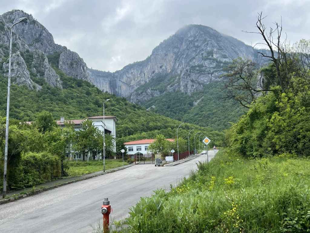
Vratsa is connected to Sofia by railway (for train times, see the Bulgarian State Railways website: https://www.bdz.bg/en). To reach Vratsa from Sofia by car, take the A2 motorway, which connects Sofia with Varna on the Black Sea coast, north-east as far as Botevgrad and then head north-west on the E79 road to Vratsa via Mezdra. The journey takes about two hours. On entering Vratsa, keep going straight and in three kilometres, immediately after passing City Hospital on your left, there is a street, also on your left, called Belasitsa. You need to take this turning. This street continues for 800 metres and then abruptly ends next to an old people’s home, Zora. This is where the path to the waterfall begins (there are several places to park your car).
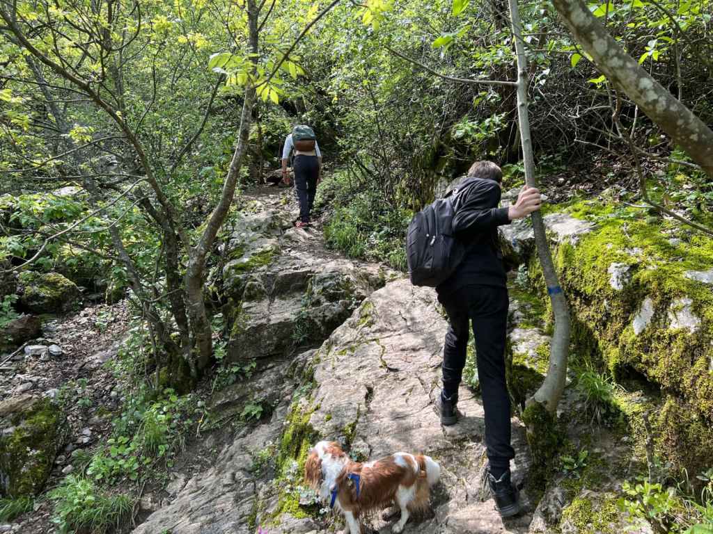
The walk from here to the bottom of the waterfall takes about an hour, but it is steep and slippery. It is not an easy path. Follow the path and, after a few minutes, there is a large gateway on your left with the words ‘Welcome to Vrachanski Karst’ written on it in Bulgarian. This is the name of the reserve, which forms part of the Vrachanski Balkan Nature Park. Do not be tempted to follow the track that climbs the hill directly in front of you, but go left, over the riverbed and under this gate. The riverbed will now be on your right. After five minutes, you will come to a shelter on your right, an ideal place to rest. The path starts to climb, and in another five or ten minutes you come to some benches and a fountain on your left. The path then crosses the riverbed, which was completely dry when we visited. You need now to follow the blue markers (they are sometimes red), ignoring a level path on the right and heading straight uphill. Bear in mind the elevation gain from the start of the walk to the waterfall is about 300 metres. If you stay on this path and observe the blue markers, you will reach the bottom of the waterfall in half an hour.
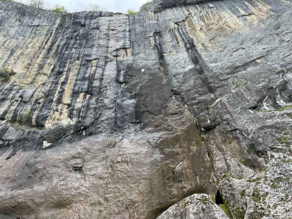
At 141 metres, Vratsa Waterfall, also known as ‘Vrachanska Skaklya’, is one of the highest in Bulgaria, but the flow of water is very little. There are some boulders at the bottom, and an enormous rock face. But where Vratsa Waterfall really stands out is with the views! I heartily recommend that you continue to the top of the waterfall, an elevation gain of another 200 metres, which takes about 45 minutes. As you face the waterfall, the path with the blue markers continues on your left (that is, it continues eastwards). Follow the path and, before reaching the top, you will pass a cave on your right, which you can investigate. Once you reach the top, the path heads right through some trees and then comes to a clearing. If you continue in the same direction, skirting the cliff face on your right, in five minutes you will come to the stream that feeds the waterfall. The views – of the waterfall and rock face as you climb; of Vratsa and Dabnika Reservoir in the distance – are spectacular and well worth the extra effort. The descent from the top of the waterfall to the start of the path took us about an hour.
All in all, you need to allow at least four hours for the hike itself. The climb to a large rock face, followed by a further climb to the top of the waterfall, is reminiscent of the visit to Bovska Skaklya north of Svoge, on the other side of the Vratsa Balkan, only this waterfall is higher.