Dyavolsko Praskalo

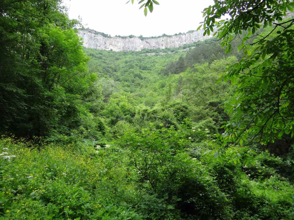
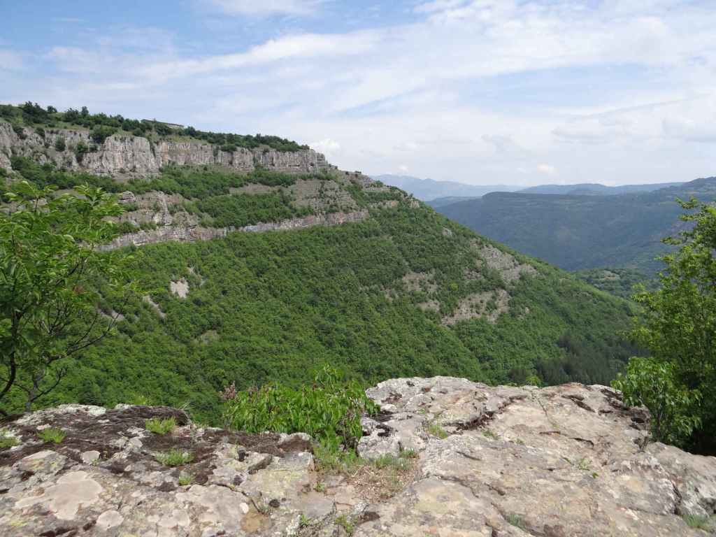
As for the previous waterfall, Vidimsko Praskalo, Dyavolsko Praskalo is accessed from the town of Apriltsi, directly north of the highest point of the Balkan Mountain, Botev Peak (2376 m). This walk will not take you to the bottom of the waterfall itself, but to a cave called Vodnite Dupki (‘Waterholes’) and to Pleven Hut, the departure point for those wishing to scale Botev Peak. It does, however, offer views of the waterfall from a distance, like the ecopath to Vidimsko Praskalo, leading through some of the most beautiful scenery in this area, with its UNESCO-protected beech forests, which makes it well worth doing. But it has an elevation gain of 636 metres over a distance of ten kilometres, which involves some steep climbs. It should only be attempted in good weather conditions.

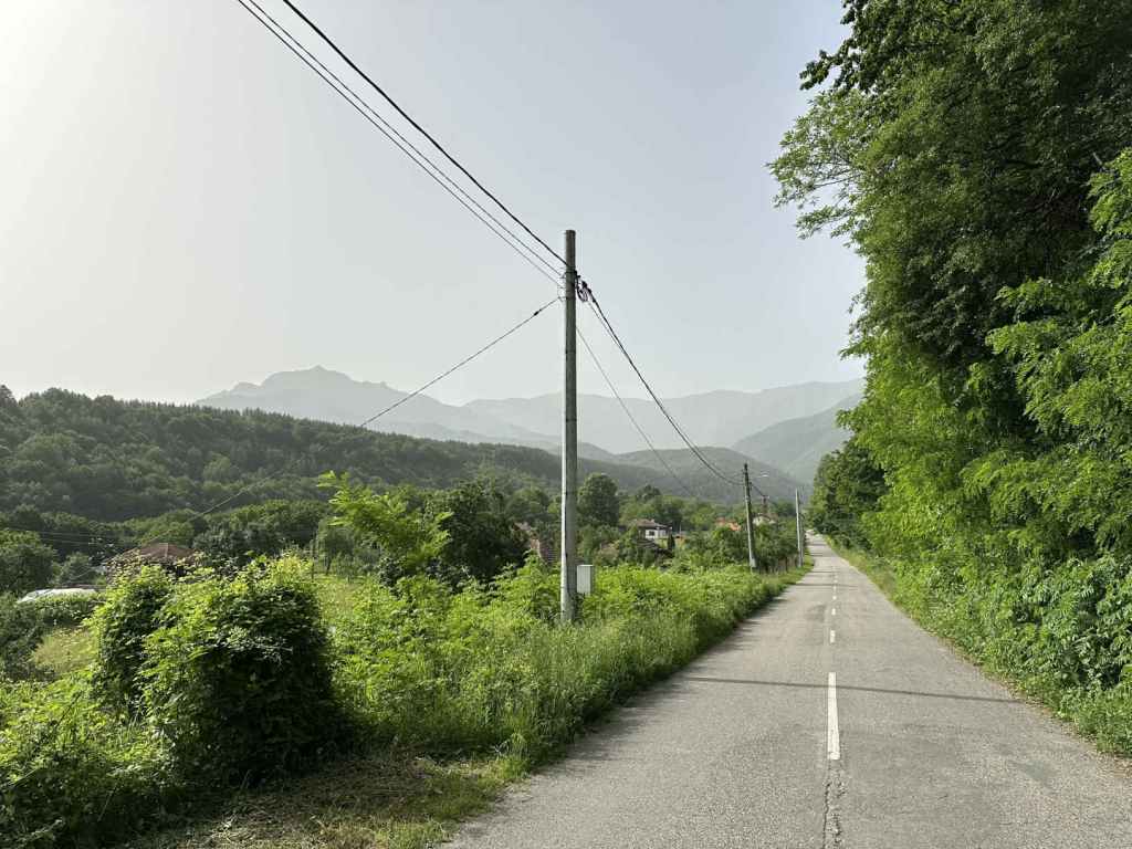
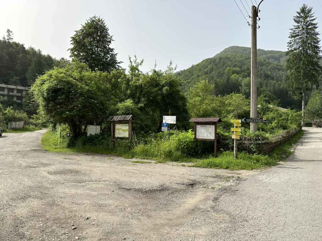
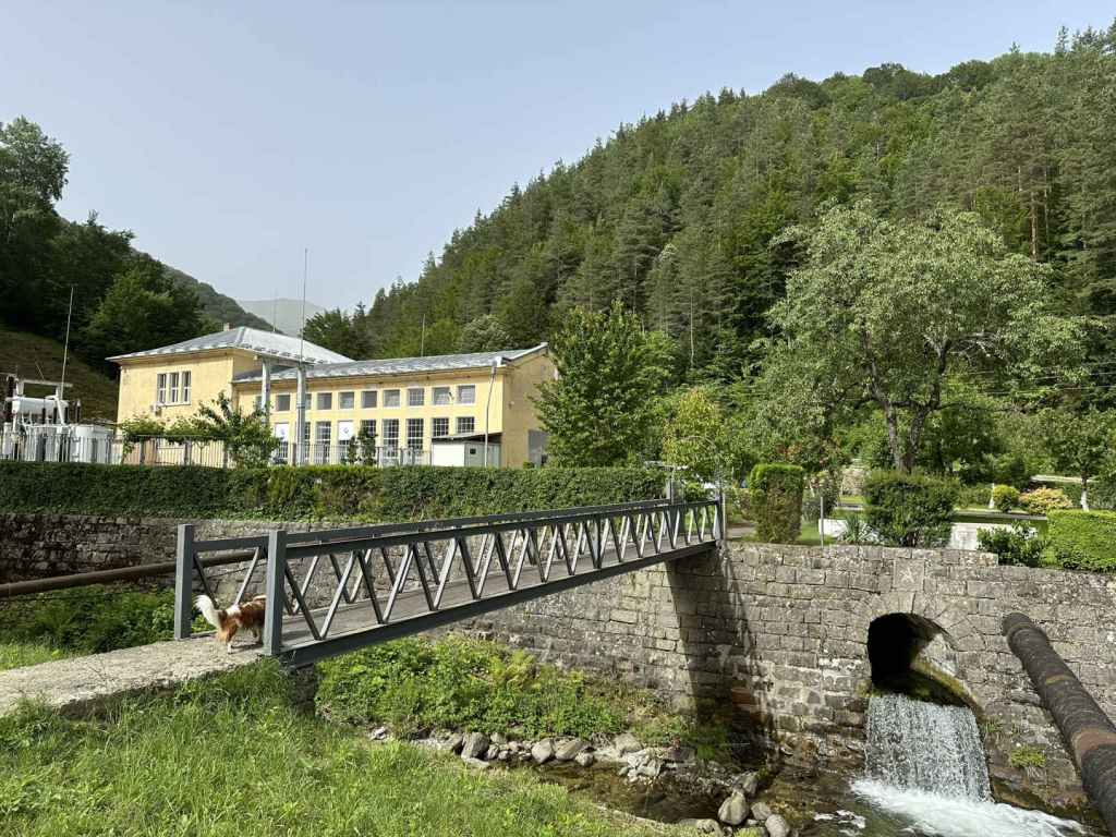
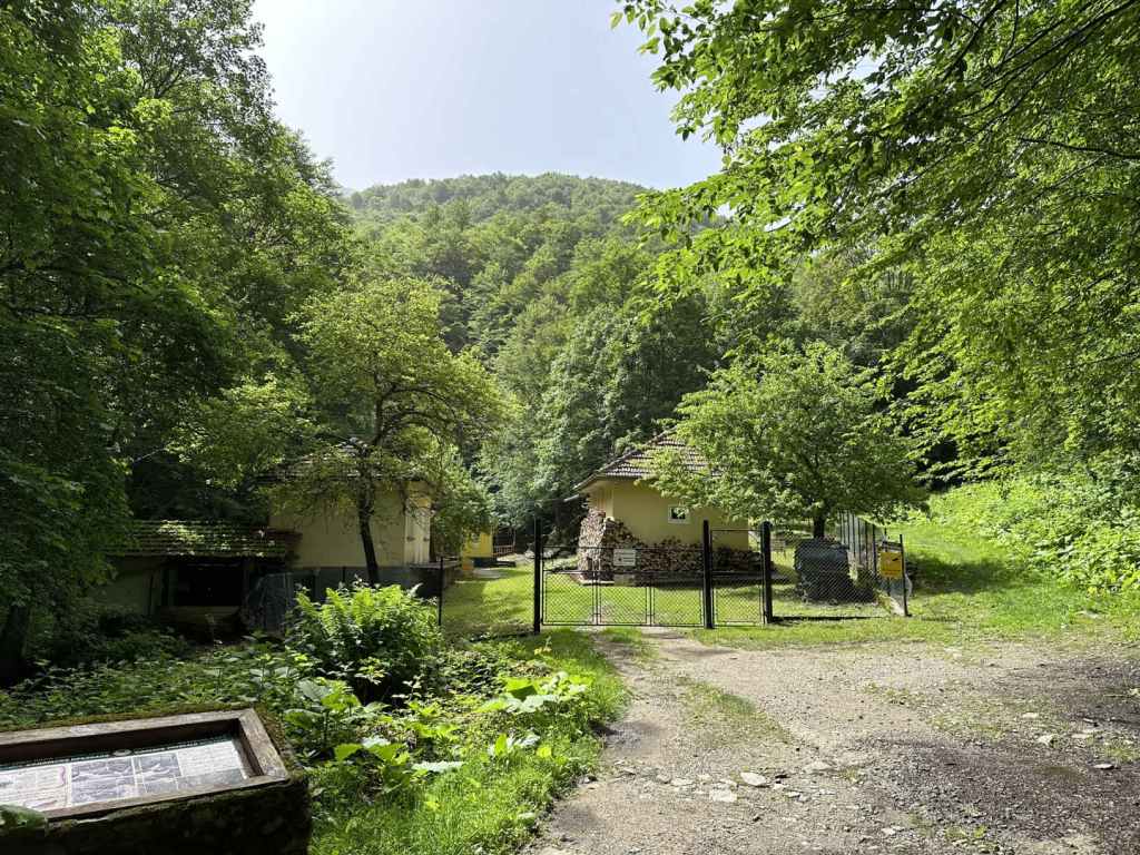
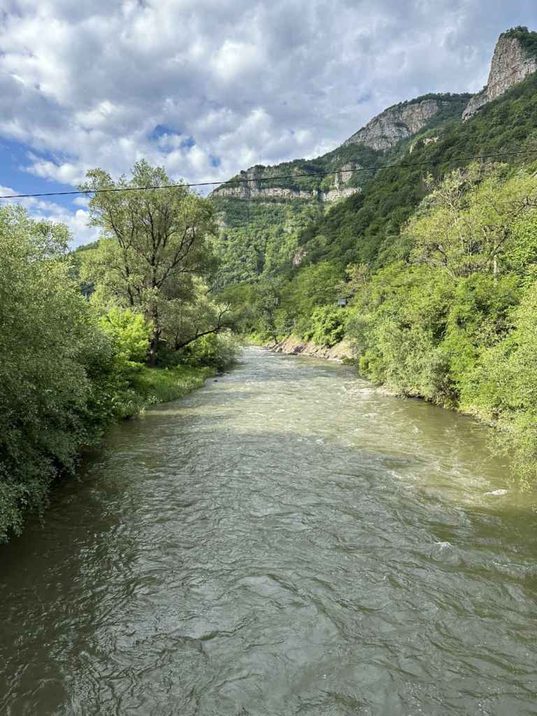
Passing through Apriltsi on the III-607 road, in between the districts of Zla Reka and Novo Selo, take the turning marked ‘kv. Vidima 5’. This turning is next to a bridge over the River Vidima, a river whose source is the waterfall and which features very much in this walk. The road you are on takes you through the centre of Vidima and in 8.5 kilometres arrives at a hydroelectric power station. A turning on the left, directly before the power station, is the start of the ecopath to Vidimsko Praskalo. Continue past the power station on your left. The road becomes quite narrow. In 4.1 kilometres, you reach a car park on your left, with the start of the walk on your right, marked ‘Pleven Hut’. The road continues for a bit, crosses the River Vidima and ends at a second car park, where there is an aerial lift used for transporting goods to the hut.

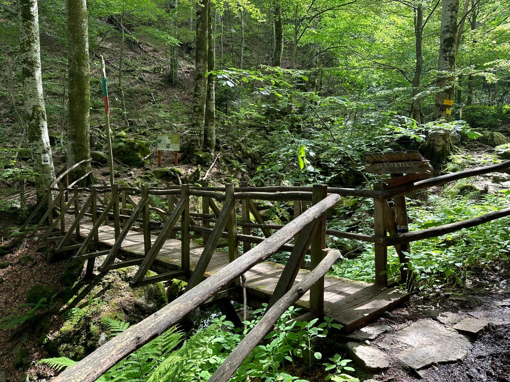
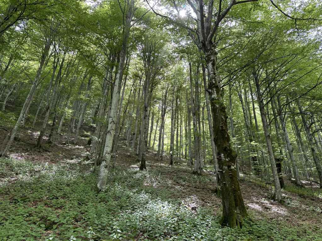
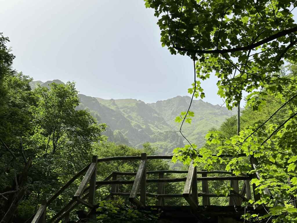
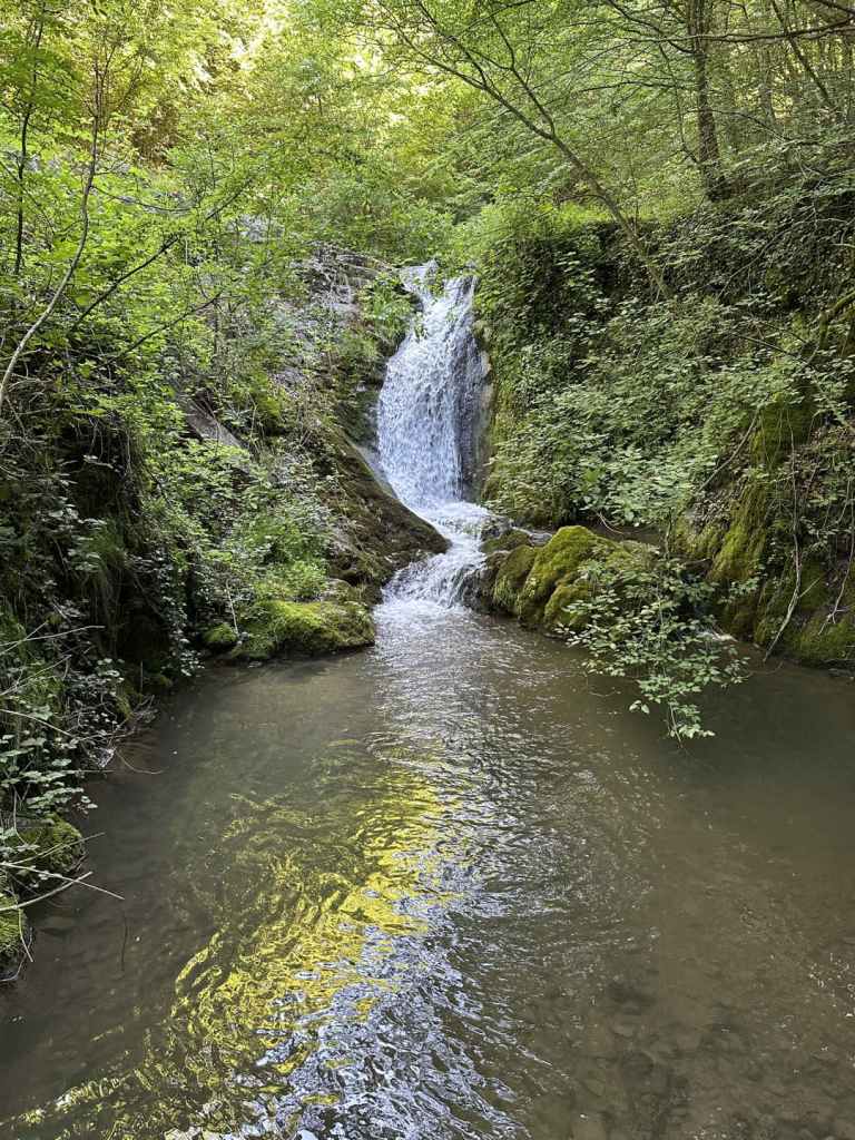
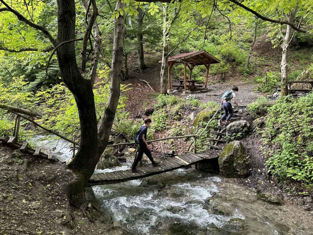
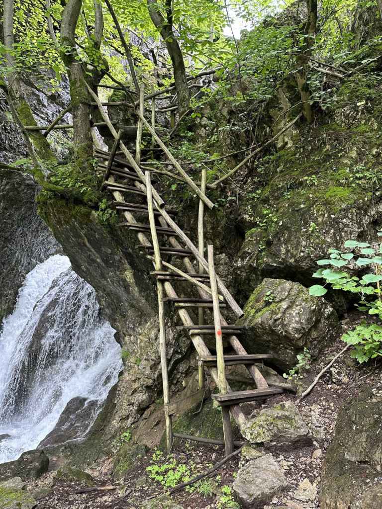
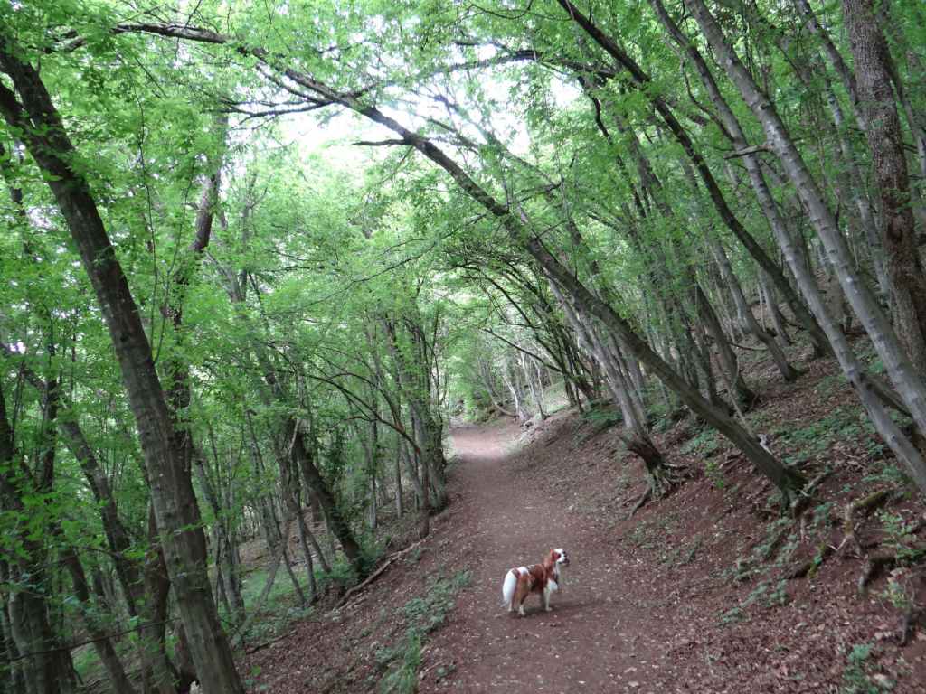
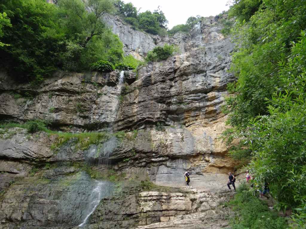
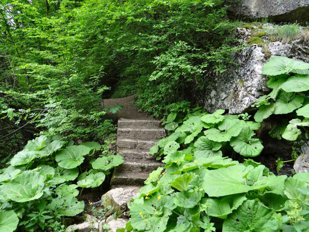
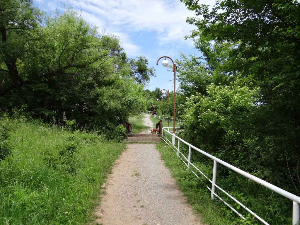
Having parked the car, you are now ready to start the walk. Take the path that is marked for ‘Pleven Hut’. The River Vidima is on your left. In 440 metres, a path diverges on the right. This is the summer route to Pleven Hut and is the route you will come back on. Continue for another 110 metres, and there is a wooden bridge over the Vidima. A winter route to Pleven Hut continues straight, but we want the route to Vodnite Dupki, or Waterholes, cave, which involves crossing the bridge and then walking uphill through beech forest. The climb becomes quite stiff. At one point, the path doubles back on itself, heading north. It then continues south and, as it does so, you catch glimpses of the waterfall, Dyavolsko Praskalo, through the trees.

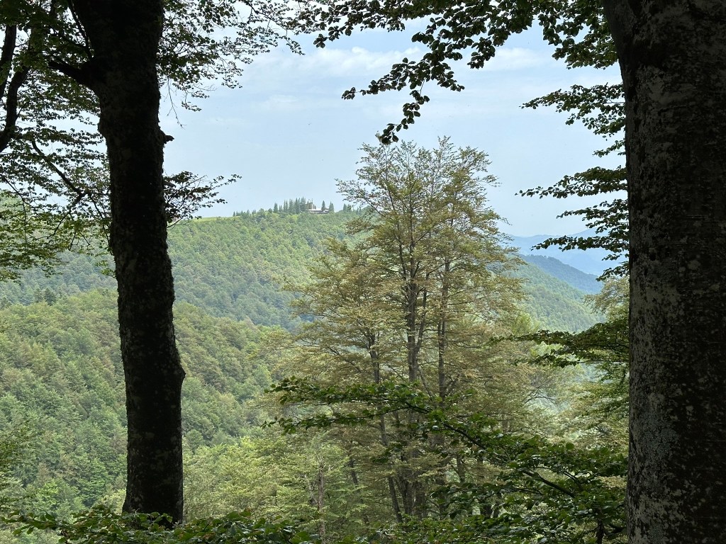
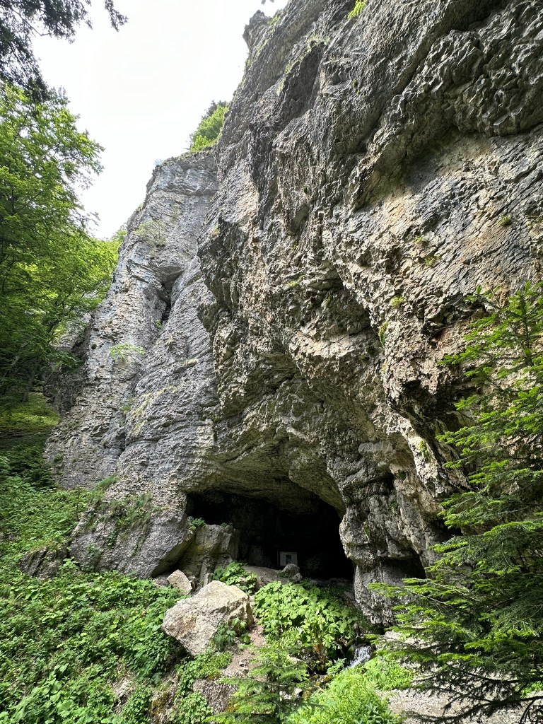
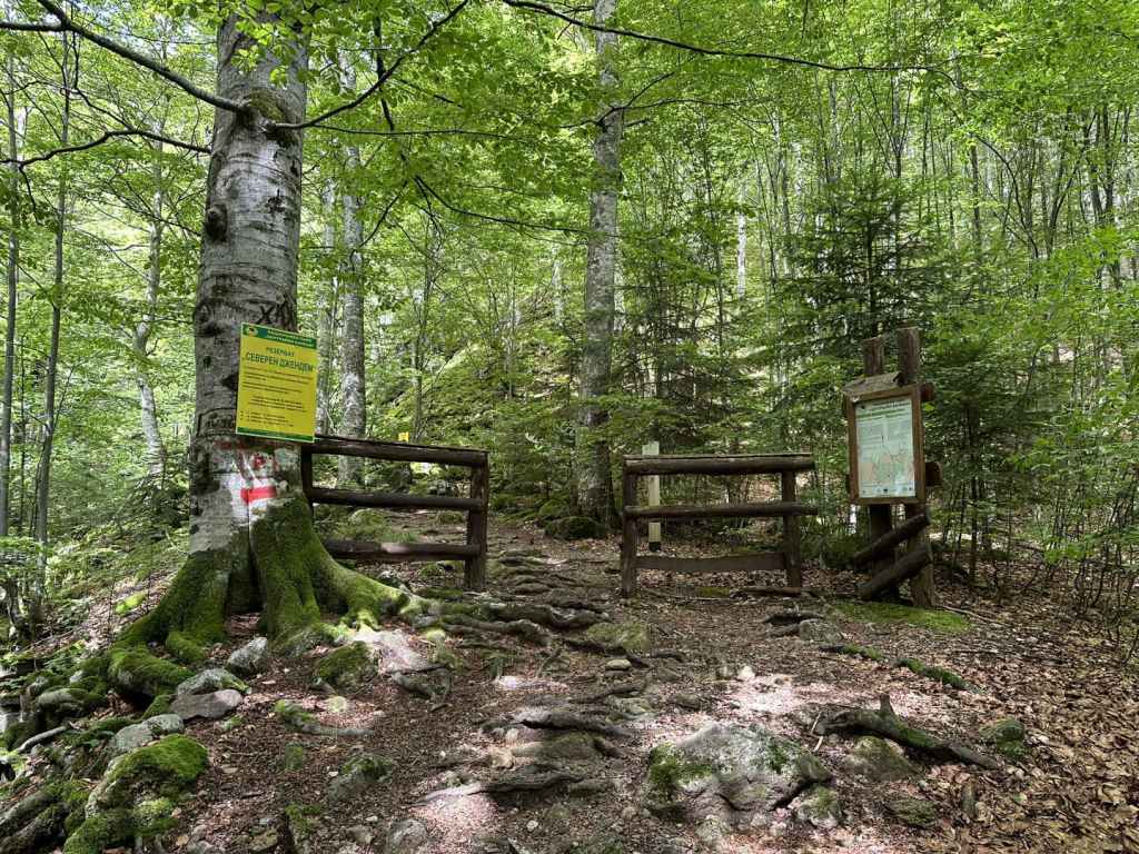
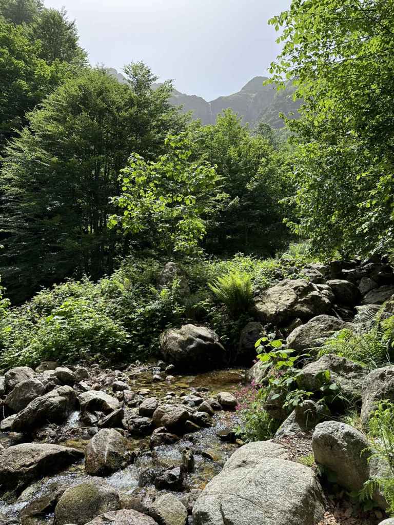
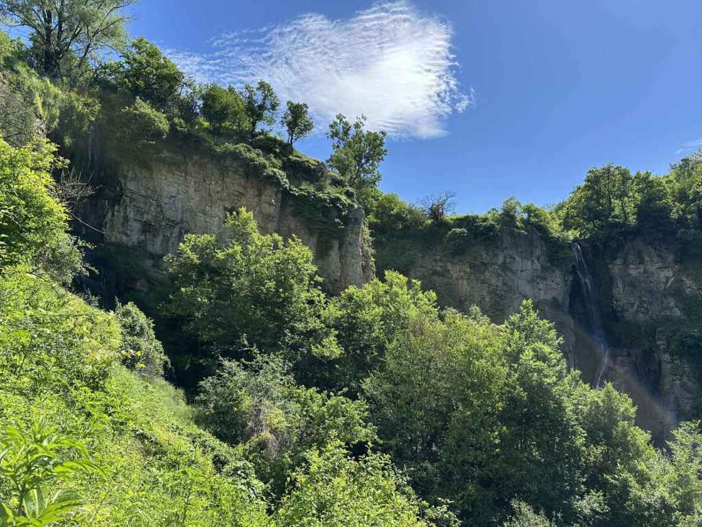
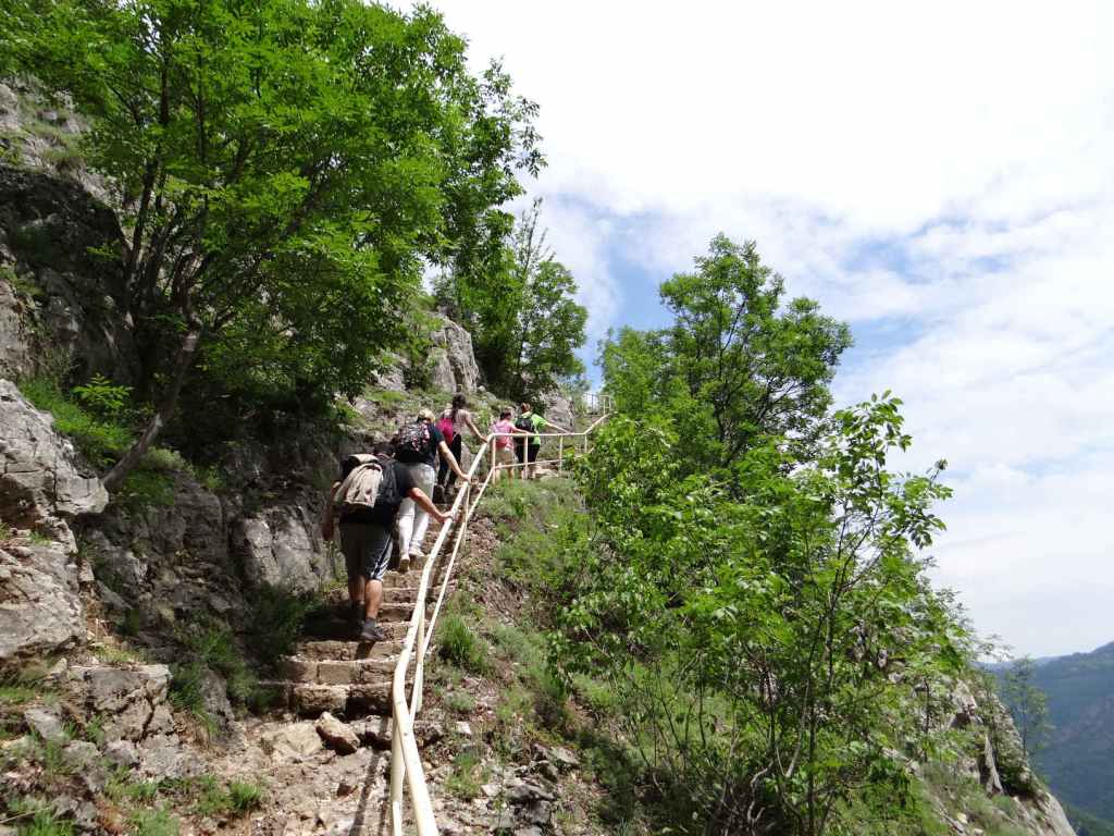
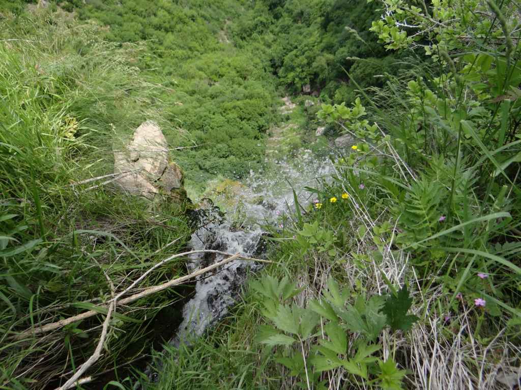
1.7 kilometres after the bridge, you come to a T-junction. The path that goes straight ahead is marked for Pleven Hut and Botev Peak. You want to go left here, to Vodnite Dupki. The path descends in order to cross a stream (soon to become the River Vidima). It climbs again on the other side and, in 300 metres, you can see Pleven Hut across the valley. The path enters the Severen Dzhendem Reserve and descends steeply, going past a moraine field on the right. 500 metres after the sign for the Severen Dzhendem Reserve, it arrives at Vodnite Dupki. As in Krushuna, a stream flows from the cave, accompanied here by cold blasts of air.

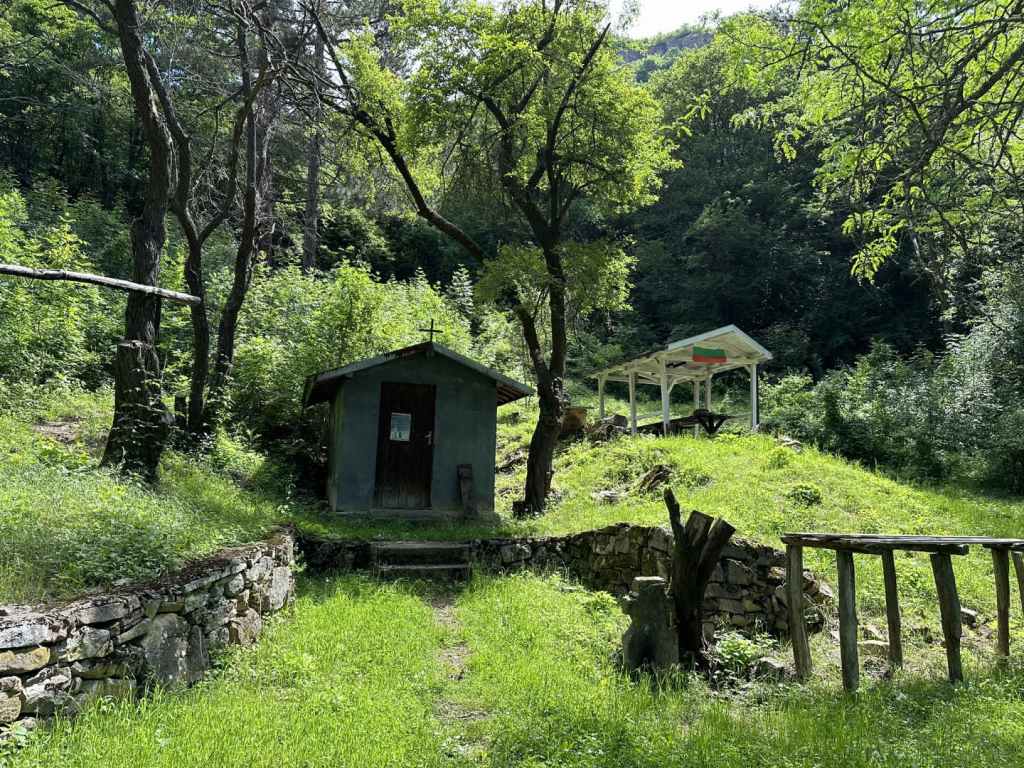
The waterfall is a short distance south of the cave. However, because this is a reserve, you are only permitted to go as far as the cave. The path after the cave is noticeably worse, even non-existent, skirting the rocks before entering the valley where the waterfall is situated and the River Vidima has its beginnings. It is best to turn back here. When you reach the T-junction where you turned left earlier for the cave, now follow directions for Pleven Hut. Unmarked paths diverge left and right, but you should look for the yellow signs to the hut. The path again descends before crossing a stream, another tributary of the Vidima. It then climbs on the other side, continuing through beech forest. 1.3 kilometres after the T-junction, you will come to a series of memorial plaques on your left, celebrating the lives of mountaineers who have walked on this mountain. You are now very close to the hut. The path, which until now has been under the cover of the forest, emerges into an open grassy area. There is a shelter for farm animals ahead of you. The grassy slope climbs steeply on your left, in the direction of Botev Peak, and is probably good for skiing in winter. The hut is to your right, behind three other buildings. You’re supposed to go straight and then turn right, with the buildings on your right. You will then reach the entrance to the hut. When I got there, they were listening to very loud, martial Russian music.

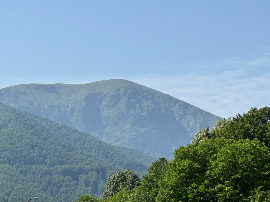
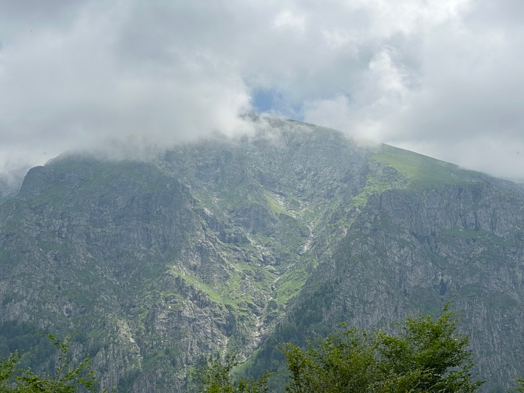
What is amazing about the hut is the view from the balcony outside the restaurant. It faces Botev Peak. You can glimpse the wetness of the waterfall to the right of the peak. Vidimsko Praskalo is hidden to the left. This view is unforgettable. I drank copious amounts of tea and exclaimed from time to time. The man running the hut had spent time in Bromley. No wonder he preferred to move back here!

When you have taken your fill, take the path that descends directly from the hut, with green markers and a wooden railing. It is signposted for the locality Mazaneto, which is where you parked the car. The path descends for 1.4 kilometres before rejoining the path you were on earlier, just below the bridge. Turn left here, and in a short while you will be back at the beginning.

The return trip from Pleven Hut to Botev Peak takes about 8-9 hours. It passes the top of Dyavolsko Praskalo, again offering views of the waterfall, but for this you would need to sleep on the mountain.

Botev Peak from the road through Vidima.
The start of the walk, marked ‘Pleven Hut’.
A robin next to the path.
The bridge over the River Vidima. Follow the sign for Vodnite Dupki.
The T-junction – Vodnite Dupki is left, Pleven Hut straight ahead.
Pleven Hut through the trees.
Vodnite Dupki, or Waterholes Cave.
The view from the cave.
The valley with the waterfall.
Pleven Hut.
Botev Peak from Pleven Hut.
Tea with a view.
The path back to Mazaneto, where you parked the car.
The River Vidima as it passes through Debnevo.

Vidimsko Praskalo

This is a walk into the heart of the Balkan. It takes you to within sight of one of the tallest waterfalls in Bulgaria (most of which are in this region, on the north and south sides of the Balkan Mountain), Vidimsko Praskalo. Praskalo is the Bulgarian word for ‘spray’, ‘sprinkler’, it’s just another word for ‘waterfall’. Vidimsko refers to the nearby village of Vidima. There used to be four villages in this area: Novo Selo in the centre, Zla Reka to the west, Ostrets to the east, and Vidima to the south. In 1976, they decided to club together and form a town, Apriltsi, which was named after the April Uprising of a hundred years earlier, in which the village of Novo Selo lost 142 of its citizens to Ottoman units, who massacred the locals, causing uproar in the West. Bulgaria would become free of Ottoman rule two years later.

A bird could fly from one praskalo to another in a matter of minutes ­– clustered around Botev Peak there are several, Raysko Praskalo being the highest. But we are mere mortals and must use our feet. There is an ecopath that takes you, five kilometres along a track, and the final kilometre along a path, to a viewing area, from where you can view the waterfall in the distance. Believe me, it is magical, even at a distance. The waterfall is located within a part of the Central Balkan National Park known as Severen Dzhendem, and you’re not just allowed to walk freely. This is one of the routes you are allowed to do.

Make your way to Apriltsi. The town is traversed by the III-607 road. Between Zla Reka and Novo Selo (where the centre is), there is a turning marked ‘kv. Vidima 5’. Take this turning, which heads due south, offering impressive views of the Balkan. Continue on this road for 8.5 kilometres, passing through the centre of Vidima and out the other side. Just before reaching a hydroelectric power station, there is a small turning on the left with lots of signs pointing to the waterfall and the ecopath. It’s impossible to miss. Park your car here.

Now you are on foot. The road immediately crosses the River Vidima and turns right, past the power station on your right. The power station is located between the Rivers Vidima and Praskalska (‘of the waterfall’). You are now next to the River Praskalska and are going to follow it all the way to your destination.

The track you are on, wide enough for a car, crosses the river a couple of times, it even crosses a couple of tributaries and goes past some buildings linked to the water supply, but you are never going to leave it until, after five kilometres, you reach the entrance to the Severen Dzhendem Reserve. Most of the time, the river will be on your right. Sometimes the track will toy with you and make as if to climb away from the river, but it soon returns. Just stay on it, ignoring the turnings to Mecho Chakalo and Turski Rat (obviously one of the people involved in 1876) on your left. In 3.7 kilometres, you will come to a fountain on the left, with a picnic hut on the right. Another kilometre, and you will reach the buildings linked to the water supply, where it is forbidden to go too close to the river (there is another fountain here, and a viewing platform over the river). Stay on the track.

This track that has offered so much finally ends after five kilometres, and you enter the Severen Dzhendem Reserve, where there are beech forests protected by UNESCO. It now becomes a path. You have one more kilometre to go (twenty minutes). You will cross four wooden bridges. Then you will come to a fifth, higher wooden bridge, and suddenly notice the peaks of the mountain up ahead. It’s a startling view. Cross this bridge, and you will come to a small area with wooden benches, where you can sit, rest and admire the waterfall in the distance. It’s incredibly picturesque.

It is not permitted to continue towards the waterfall and, without a guide, it would be difficult to achieve. But it is enough. It’s not always necessary to reach the end, and it’s also good to allow wild animals a little peace and quiet from us. It took me two hours to reach the viewing area from the power station, and 1½ hours to come back. But I have to say I stayed quite a long time, viewing the waterfall (like a destiny) in the distance, and was reluctant to leave.

The River Vidima as it passes through Apriltsi. It goes on to join the Rositsa in Sevlievo, which itself joins the Yantra (the river that goes through Veliko Tarnovo) before becoming part of the Danube.
The road due south that passes through Vidima and leads to the Balkan.
The turning on the left for the ecopath to Vidimsko Praskalo. The road on the right continues to Pleven Hut.
The hydroelectric power station on the right.
The track following the course of the River Praskalska.
The river through the trees.
The track higher up.
The buildings linked to the water supply.
The entrance to the Severen Dzhendem Reserve, where the track ends and becomes a path.
The first of the wooden bridges.
The UNESCO-protected beech forest.
The fifth wooden bridge with views of the ridge.
The small viewing area.
The river with the waterfall behind.
A close-up of the waterfall.

Pod Kamiko

Bovska Skaklya, because of its height and dramatic setting, is perhaps better known, but Pod Kamiko is no less beautiful and worth every bit as much effort. There is a good ecopath that takes you from the stadium in Gara Bov to the waterfall, which is on the outskirts of the village of Bov. The walk to the waterfall takes you along the valley of the River Bov, and there are many smaller waterfalls along the way, some of them quite beautiful. The return takes you along the top of the gorge and back to the stadium from the east. The scenery is spectacular, and the waterfall one of the most beautiful I have seen.

Again, to reach Gara Bov, you must take the II-16 from Sofia in the direction of Novi Iskar, Svoge and Mezdra. This road is very windy as it follows the course of the magnificent River Iskar on its way to the Danube, so even though the distance is not great, it takes its time, and there are several speed cameras. Eight kilometres after the picturesque town of Svoge – with its turning to Iskrets (from where you can reach Dobravitsa Waterfall) – you pass the sign for Bov. 1.1 kilometres after this sign, there is a turning on the right, signposted for Gara Bov (1 km) and Bov (4 km). Take this turning. You will drive along the railway, go left under the railway, pass the railway station again on your left. Continue uphill. As the road veers left, immediately on the right is the stadium. Park the car here. If you have travelled by train, exit the station, join the road as it goes uphill and in 800 metres you will be at the stadium.

The ecopath heads north-east, along the course of the River Bov. It passes along the lefthand side of the football pitch and then immediately goes over a wooden bridge. Follow the green markers. The path is very well marked. It begins to climb, with the river on your left. After 700 metres, there is a turning on the right for a monastery, but continue straight. You will see a small waterfall on the left, and then the path again crosses a bridge. Keep following the course of the river, which is now on your right.

You will pass three more small waterfalls, then come out onto a flat rocky area next to the river. More small waterfalls follow on the right (a particularly beautiful one, 280 metres after the rocky area). A few more hundred metres, and you will again cross the river, using a stepping stone. The path now becomes a track and heads away from the river, but only for a short while before veering left again and bringing you out into the open, with the river down below you on your left. The path descends, crosses another bridge and climbs up the other side. When it reaches the top, turn right. In 200 metres, you will cross a small tributary, which immediately plummets down to the river on your right. The path does a zigzag. 340 metres after the tributary, a path on the left leads to the top of the waterfall. You will come back this way, but for now continue straight. You will cross a second tributary and, in less than a hundred metres, see the waterfall straight ahead. The distance from the stadium to the waterfall is 2.9 km and takes about an hour.

The waterfall is magnificent, especially if you go in spring or after heavy rainfall. There is a second, smaller waterfall to the left of this one, which you can see as you climb to the top of the gorge. So, when you have had your fill, return on the same path and take the path that diverges, now on your right, to the top of the waterfall. It is marked “above the waterfall”. It climbs steeply, offering views of both waterfalls, Pod Kamiko and the smaller one to its left, before taking you around the rocks, with views back to Gara Bov and Bovska Skaklya in the distance, and up to the village of Bov. You will not enter the village, but skirt along the top of the gorge. When I went in May, the path here was very overgrown. You basically want to head back in the direction of Pod Kamiko. The path takes you over the top of the smaller waterfall and joins a track. Go right here, and in a short while it will bring you to the top of Pod Kamiko. There is a wooden bridge on the left. Please do not go too close to the edge.

When you are ready, continue along the track, which passes a house on the left. When I was here, the track was blocked by cows and their calves, so I had to make a detour through one of the fields and rejoin the track a little further on with my dog. In 750 metres, the track passes a fountain on the left and then enters a field on the left, but you want to continue between a picnic area on the right and a stone cross on the left. In another 200 metres, you will come to a blue gate. Stay on this track, again avoiding the temptation to enter fields on your left.

In 370 metres, there is another fountain next to a ruined house. The path now enters a field and then continues on the right. As it descends, you will have views of Tserovo (the village before Bov) on the left. Keep descending through the forest. The path zigzags, left-right-left, and in 800 metres reaches a larger picnic area with a small chapel. This is a good place to rest. From here, the path continues left. In 750 metres, it joins a larger track by the River Treskavetz. Go right here, and in one kilometre you will be back at the stadium. The whole route is 7.6 kilometres and took me 3½ hours with ample breaks.

The River Iskar as it passes by Bov.
Gara Bov, the railway station.
The stadium in Gara Bov.
The most beautiful of the smaller waterfalls on the way.
One of the wooden bridges.
Pod Kamiko Waterfall.
A view of the top, the water glistening in the sunlight.
A view of both waterfalls (the smaller one is just visible on the far left).
The rocks at the top of the gorge.
The track leading to the top of Pod Kamiko.
The view from the top of Pod Kamiko.
Cows blocking the road!
The blue gate.
The chapel and picnic area.

Zgorigrad

This is an astonishing walk, but it is not for the faint-hearted! To get to the bottom of the waterfall, known as ‘Borov Kamak’ (‘Pine Stone’), it is necessary to climb fourteen ladders, some of which are quite steep, and to cross from side to side of the river Varteshnitsa. We were with a small dog and had to carry him up and down the ladders. Also, in reviews online, a lot of people express their disappointment at the waterfall having no water. We went in the second half of June after heavy rains, and I can say that this was not the case! The waterfall was working at full capacity, and a couple of times, where there was no bridge, it was necessary to wade across the river.

That said, this is one of the most beautiful places I have been to in Bulgaria, and the waterfall is memorable. You get what you put in, I suppose. To reach the old mining village of Zgorigrad, you must first travel to Vratsa. Coming from Mezdra on the E79, you enter the town of Vratsa and keep going straight, following the signs for Ledenika Cave. After three kilometres, you pass the turning on the left for Vratsa Waterfall (directly after the hospital). After another kilometre, ignore the turning right that goes to the centre and follow the sign for Ledenika. In 300 metres, take the turning on the left to Ledenika and Zgorigrad. You leave Vratsa and go through the dramatic Vratsa Pass. After 2.2 kilometres, there is a sign for Ledenika at a distance of thirteen kilometres on the right, but you continue straight and enter Zgorigrad village. Keep going straight, pass through the centre (with the river Varteshnitsa on your right) and, as the road begins to loop, 2.2 kilometres after the centre of Zgorigrad, you come to the start of the ecopath that leads to the waterfall. Park your car on the grassy verge. The river is now on your left.

The walk to the waterfall takes about two hours. If you factor in another hour to visit the top of the waterfall, you will need to allow five hours to go and come back. The ecopath climbs the grassy verge and quickly enters forest. On your left is an old tailings pond, used to store waste material from the extraction of metal ore. This tailings pond caused a terrible flood (almost half a million cubic metres) in 1966, with significant loss of life in the nearby village. There is a short film about the disaster by Robart Nikolchev on YouTube. In about twenty minutes, you cross the first of several bridges taking you from side to side of the river. After the third bridge, we were tempted to go straight, but you must go right, uphill, following the course of the river. If you find yourself moving away from the river at any point, then you have gone wrong. Keep an eye on the red markers.

After the fourth bridge, the ladders start in earnest. There are eight ladders in the space of half an hour. After the fifth bridge, we again went slightly wrong and started moving away from the river. Follow the red markers and stay close to the river. Another three ladders, and then comes the fun part. You are required to cross to the lefthand side of the river, but there is no bridge, presumably because there isn’t normally so much water and it’s possible to hop from rock to rock. In our case, the river was roaring down, and this wasn’t possible! We tried taking off our shoes and socks, but the water was so cold we didn’t get very far! In the end, we just waded across. I carried our dog.

Another fifteen minutes, and you come to the bottom of the waterfall, which is 63 metres high. It’s a wonderful location. If you want to visit the top of the waterfall, you need again to cross the river without the help of a bridge. We again got soaked! But it was worth it. There is a picnic table under the eaves of the rocks on the righthand side of the river. You can stop here for lunch and admire the waterfall. We certainly did.

If you decide to continue the top, you must follow the path in front of you, which soon goes left. You must climb another four ladders to reach the top, but the view is amazing and the sensation of watching the river tumble over the edge is exhilarating. There is a place to stand, with a railing, but please be careful. The river before it cascades over the edge is much calmer. You can continue upstream. Having crossed a bridge, in about twenty minutes you will reach a mountain shelter and an open meadow. This is as far as we got.

Beware that descending the ladders is perhaps more difficult than going up (especially when you are responsible for a small creature!). We had heard that the walk to Vratsa Waterfall is quite steep, but found this walk to be more difficult, albeit more beautiful. ‘Borov Kamak’ easily ranks in my top five, along with waterfalls like Hristo Danovo and Polska Skakavitsa.

The ecopath starts 2.2 kilometres after the centre of Zgorigrad village.
It passes through forest, with the river Varteshnitsa on your left.
The first of several bridges.
Crossing back to the other side.
The ladders begin in earnest.
There is a wooden walkway with views towards Zgorigrad.
The ladders get steeper!
The river Varteshnitsa as it descends through the forest.
The first crossing without a bridge!
‘Borov Kamak’ Waterfall.
The picnic table on the righthand side of the waterfall.
The waterfall seen from the right.
The top of the waterfall.
The view from the top of the waterfall towards Zgorigrad.
The meadow further upstream.

Bovska Skaklya

At 85 metres, Bovska Skaklya (‘Bov Waterfall’) is one of the highest in Bulgaria. Like Polska Skakavitsa, it can easily be reached by train from Sofia. The journey takes an hour, and there are regular services during the day (see the excellent Bulgarian State Railways website for train times, https://www.bdz.bg/en).

Bovska Skaklya is located at the halfway point between the villages of Bov (down below) and Zasele (up above). An ecopath has been built between these two villages to incorporate the waterfall and is named after the famous Bulgarian poet Ivan Vazov, who apparently used to enjoy walks in this area. There is some suggestion that you should descend from the village of Zasele, make your way down to the waterfall and the village of Bov and then climb back up again. Since it seems to me to make more sense to get the climbing in early in the day, I suggest starting in Bov. Also, Bov is the stop on the railway line from Sofia and is on the main road from Svoge to Mezdra, the II-16.

If you insist on starting in Zasele, located above the waterfall, then you will need a car. As you leave the village of Tserovo, five kilometres after Svoge, there is a turning left signposted for Zasele (7 km). Follow this winding road uphill until you come to the centre of Zasele, where there is a tarmac square. The ecopath starts from here.

Otherwise, continue to Bov, three kilometres after Tserovo. Ignore the turning right, signposted Gara Bov (‘Bov Station’), and continue on the main road for another 400 metres, taking a turning left signposted for Skaklya. This narrow road continues for 1.4 km to the start of the ecopath, but be careful. 200 metres before the end of the road, the road divides – keep left, going uphill, until you come to a small area next to a house, with the river on your right, where you can park the car. For those travelling by train, alight at Gara Bov and walk 400 metres down to the main road (leave the station, turn right, go under the railway and follow the road as it veers right and crosses the River Iskar). Once you reach the main road, turn right, continue for 400 metres until you reach the turning for Skaklya and then follow the previous directions.

From where you park the car, you have a forty-minute steady climb through the forest to the bottom of the waterfall. The forest is magical, and there are some wonderful views back the way you have come. Once you reach the waterfall, another forty-minute climb, slightly stiffer this time, will take you to the top. As you get higher, there are steps and a railing to hold onto. You really get an impression of the height of the waterfall because you are climbing it! At the top is an open area of grass with several picnic tables. Continue to the village of Zasele, perched on top of the rock, and you will come across one or two restaurants and guest houses if you wish to stay the night (though I understand you have to book ahead).

The best time for visiting waterfalls is immediately after the snow melts – second half of April, first half of May. This is when the flow of water is at its strongest. We went at the beginning of June, so already the flow had declined somewhat. In autumn, it becomes a trickle. We first visited the waterfall ten years ago, in November. There wasn’t much water left, but the autumnal colours of the trees more than made up for the lack of watery fireworks!

Bovska Skaklya is not far as the crow flies from another waterfall, Dobravitsa (except that for Dobravitsa, you have to leave the main road in Svoge and follow the signs for Iskrets and Breze). From Gara Bov, another ecopath takes you to the waterfall Pod Kamiko. This ecopath starts from the stadium in Gara Bov and is circular, so you don’t have to come back the way you went (see the map on the road outside the station).

Gara Bov.
The turning for Skaklya. There is also a sign saying ‘Touristic Road “Vazov’s Path”, 1.4 km’.
200 metres before the ecopath begins, the road divides – keep left here.
There is a small area to park the car where the road peters out and the ecopath begins.
A view from the ecopath of the rocks up above.
The path as it passes through the forest.
The waterfall in the distance.
Arriving at the waterfall.
Bovska Skaklya, seen from below.
From here, the path continues to the top of the waterfall and the village of Zasele.
This path has steps and a railing.
The view near the top.
The top of the waterfall – the stream passes under the bridge and tumbles down 85 metres.
The water as it becomes airborne.
The view back to Bov.
Bovska Skaklya.