Sopot

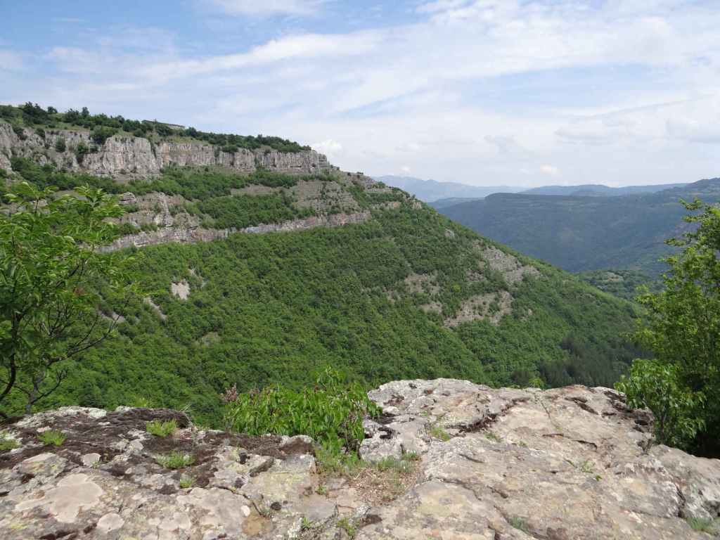
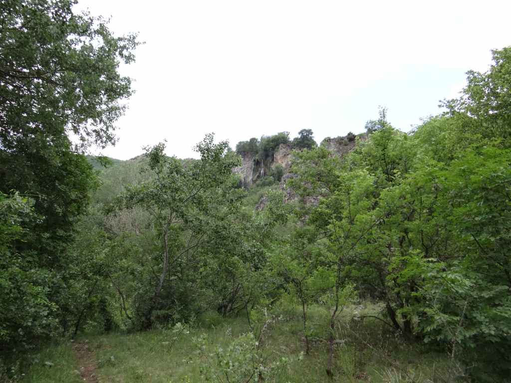
The E871 is one of my favourite roads in Bulgaria. It’s even a little difficult to find. There are three roads heading east from Sofia. They all go to the sea. The E83/772 goes to Varna via the medieval capital, Veliko Tarnovo, running north of the Balkan Mountains. The E80/773 goes to Burgas via Bulgaria’s second city, Plovdiv. The E871 doesn’t seem to go anywhere, though it does in fact drop down at the last moment and join the E773 on its way into Burgas – but only at the very last moment. Apart from that, it travels on the warmer side of the Balkan Mountains, the south side, and offers wonderful views of this beast that is the Balkan, scratching its belly (the mountain, I mean) in the early autumn sun.

I say it’s difficult to find because you leave Sofia in the east and if you’re not careful, you end up going to Varna. You have to hang a right, passing through the suburb of Dolni Bogrov, which always at weekends has lines of cars in the slow lane, parked for a market that takes place there and seems very well attended. Once past Dolni Bogrov, you again have to take a right (otherwise you’ll end up going to Varna), and then the journey begins. The road stretches in front of you, like a tree’s shadow, long and straight. You must up and over three hills (the second containing a bust of Bulgaria’s nineteenth-century freedom fighter, Vasil Levski, at its base). You then pass the turning for Chavdar, the first of the waterfalls along this road, which I described in an earlier post. You drive at under 50 km/h through the towns of Zlatitsa and Pirdop, twins joined at the hip. And then the fun starts. Numerous bridges, all with little bumps (I thought I counted five or seven on every bridge), from which people organize bungee jumps when it’s not too windy. Today was extremely windy, so there was nobody in sight (plus it’s the Bulgarian elections).

Just before Karnare, you pass the turning for the second of the waterfalls located near this wonderful road – Hristo Danovo, a stunning straight line like a windpipe. But be careful in Karnare – this is where Bulgaria’s freedom fighter Vasil Levski was betrayed to the Turks by a local priest, Pop Krustio! It’s also where a road dares to cross the Balkan Mountain from south to north, as if it’s suddenly decided to switch sides, passing through Troyan, the third most important Bulgarian monastery after Rila and Bachkovo.

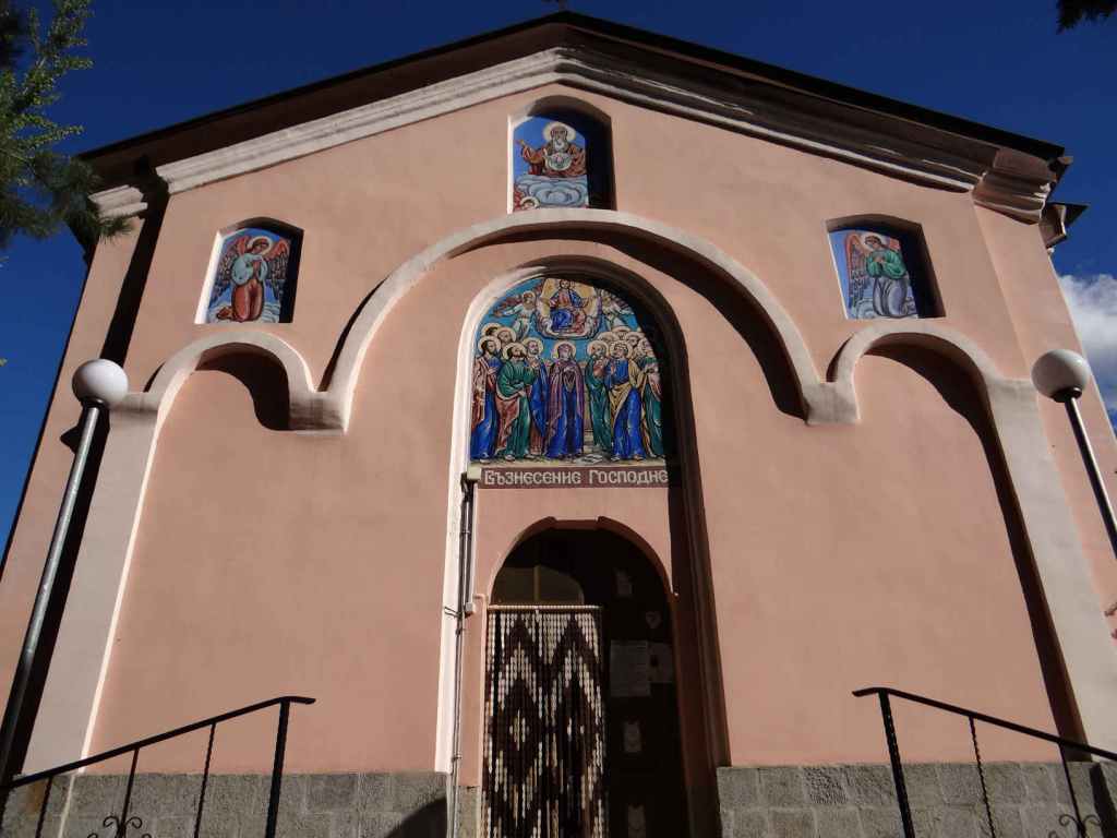
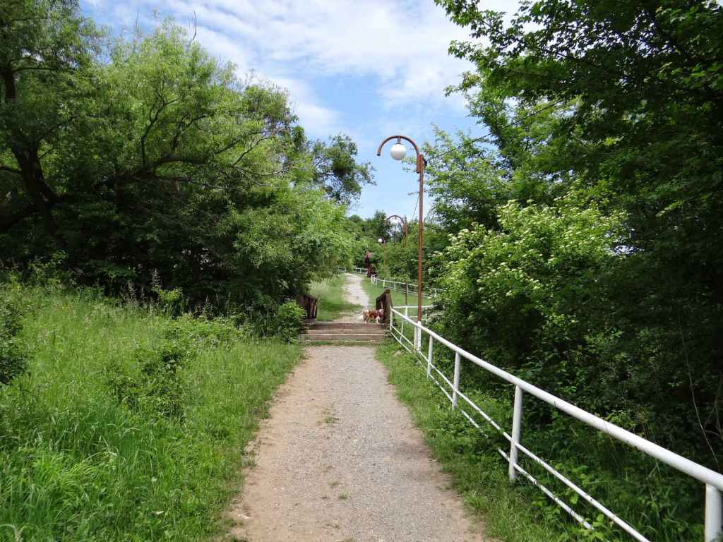
One is not diverted, however, but continues along on the E871 (wonderful road that it is!) and after Anevo, just before entering Sopot proper, you will see a turning on the left for Anevo Fortress (2 km), followed immediately by another turning on the left for Sopot Lift (I think it was written ‘Lift Sopot’, 1 km). This is the turning you need. But you are not going to the lift. You actually need to head to one of Sopot’s two monasteries, the one dedicated to the Ascension of Jesus, which is situated at a distance of 1.2 km from the E871.

So when you see a sign for Sopot Lift (or Lift Sopot) saying ‘200 m’, don’t go there. Continue right and just around the corner the monastery will come into view. There is an open area where you can park the car.

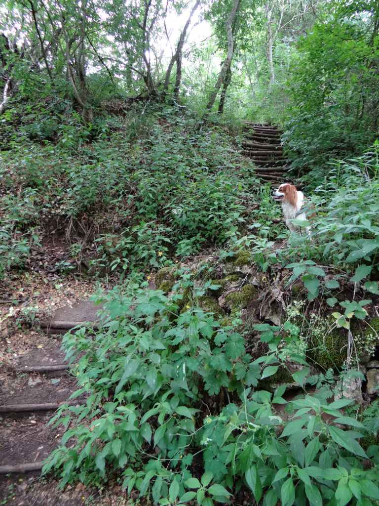
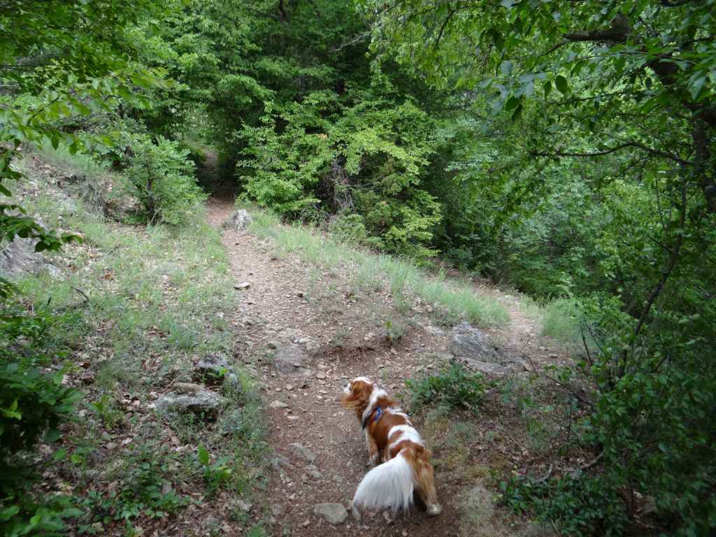
With the monastery in front of you, look to the left. A narrow path hugs the wall of the monastery enclosure before, in theory, heading up the valley to the waterfall. You need to take this path. But this is where things get difficult. Let me explain.

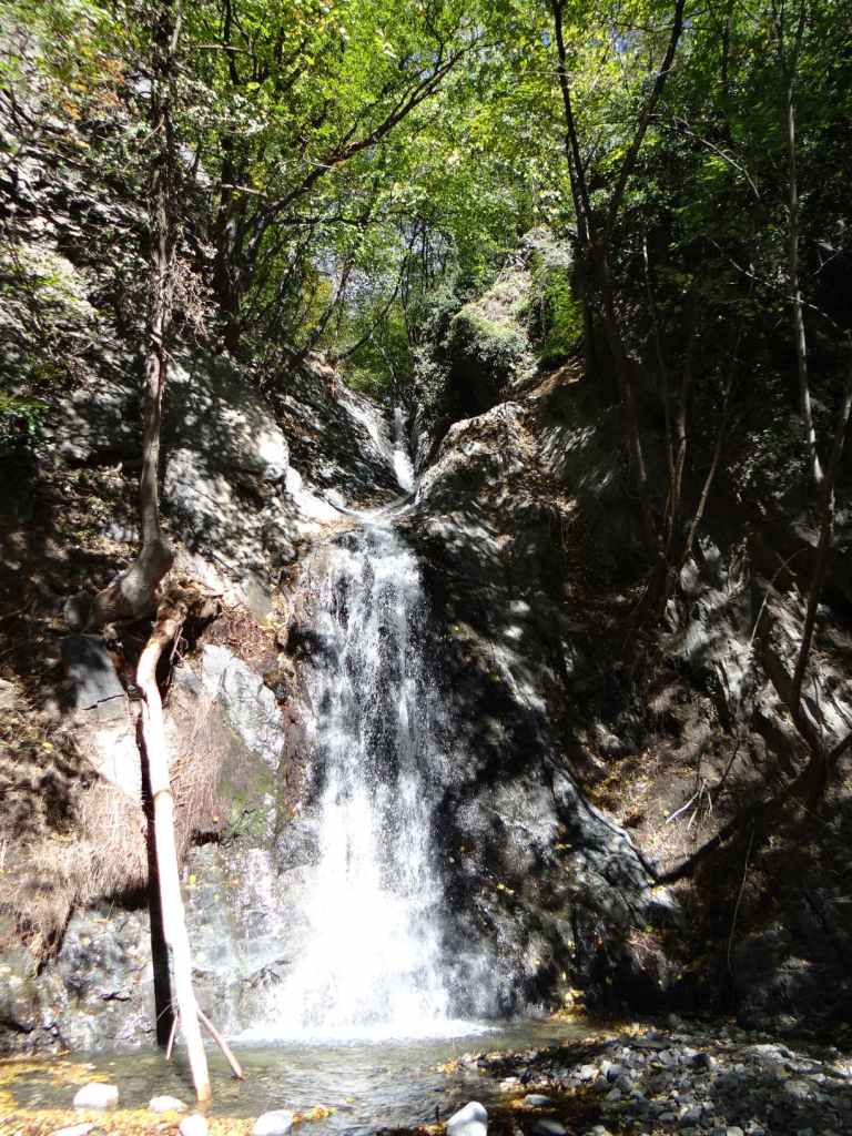
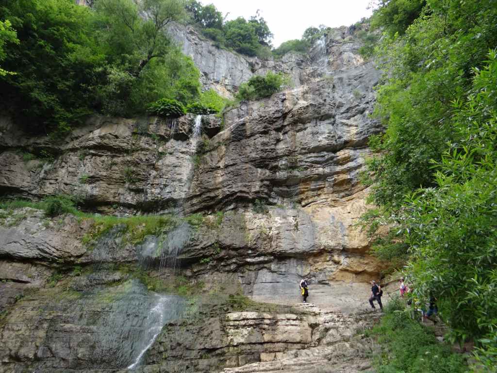
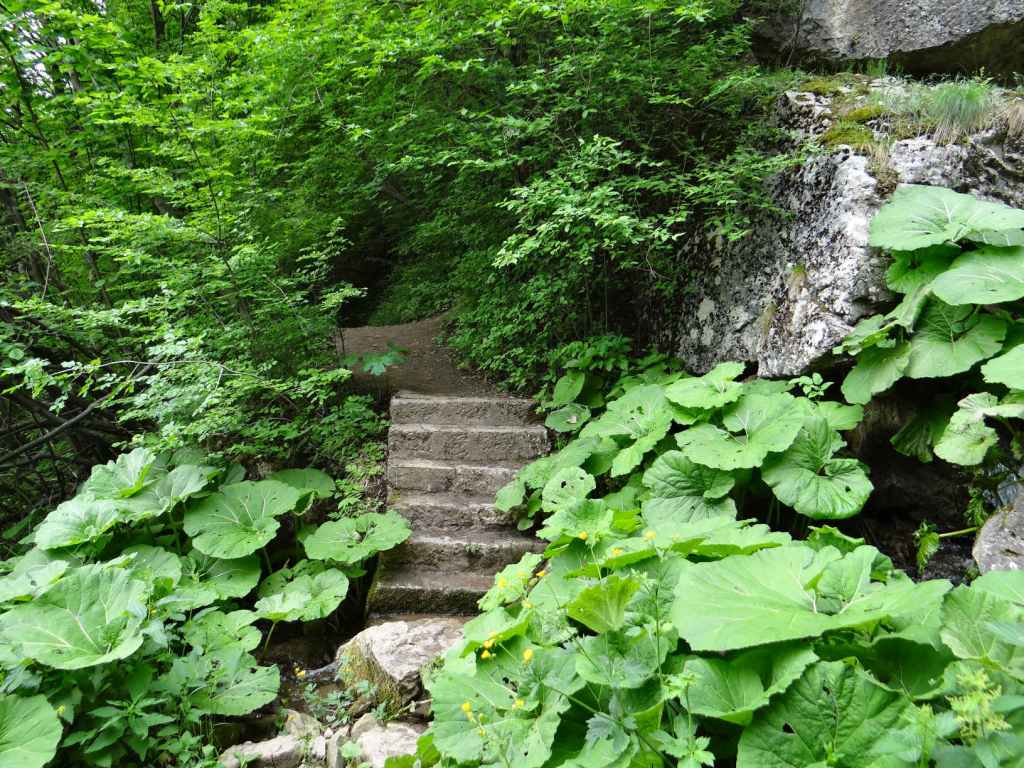
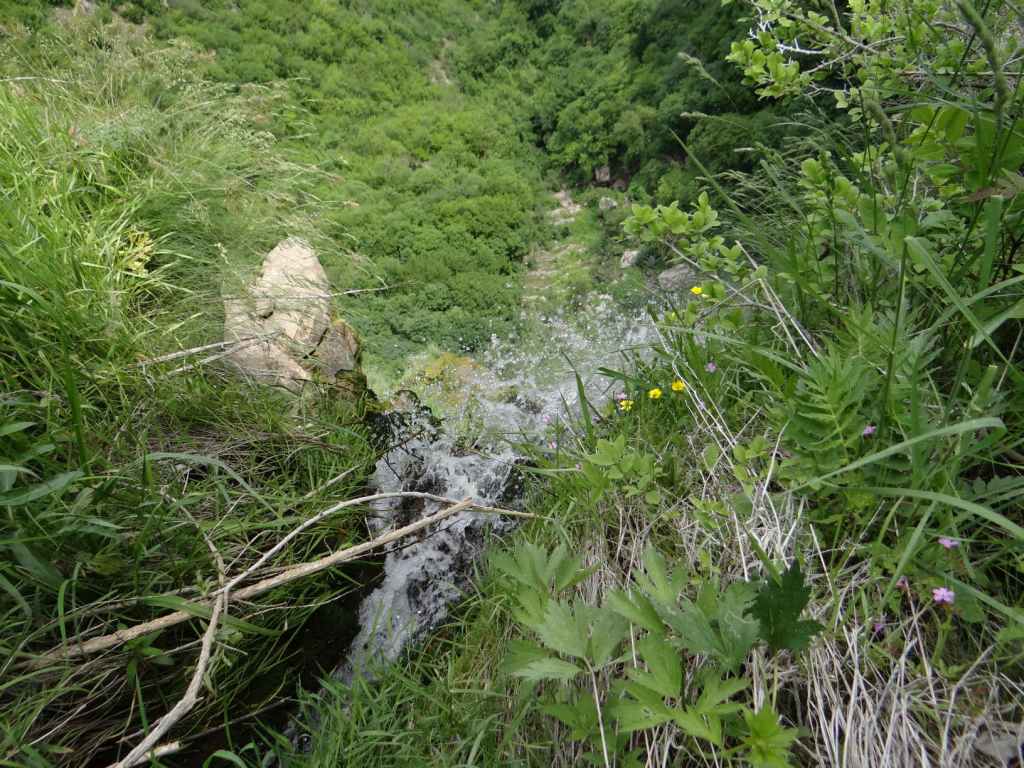
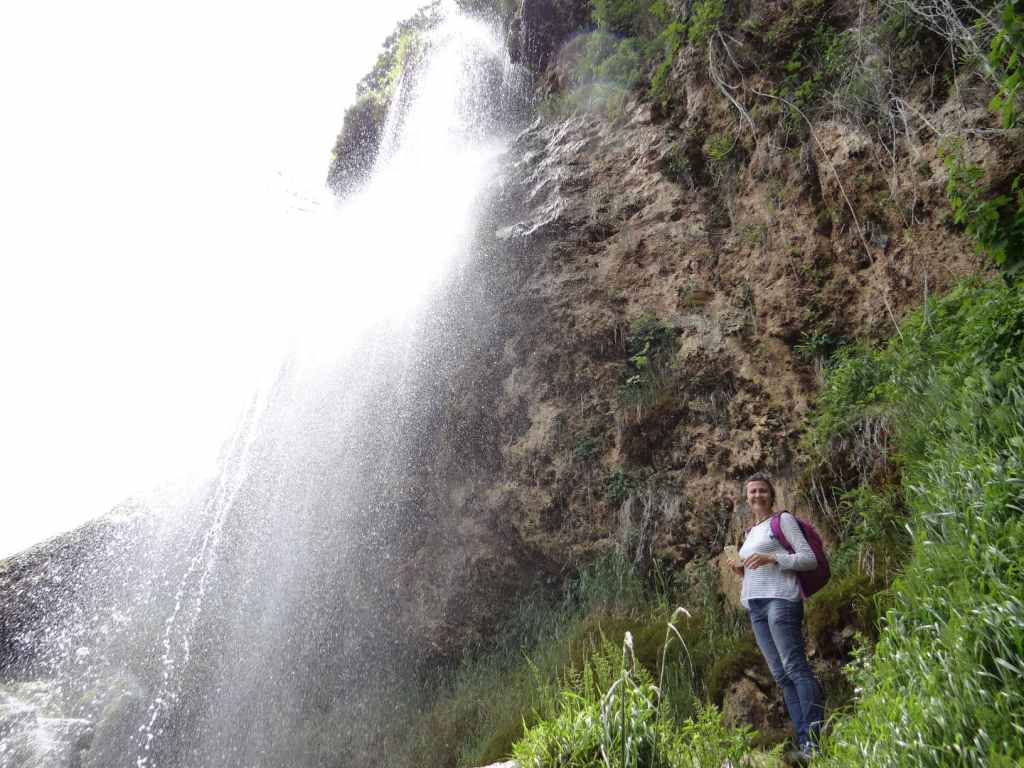
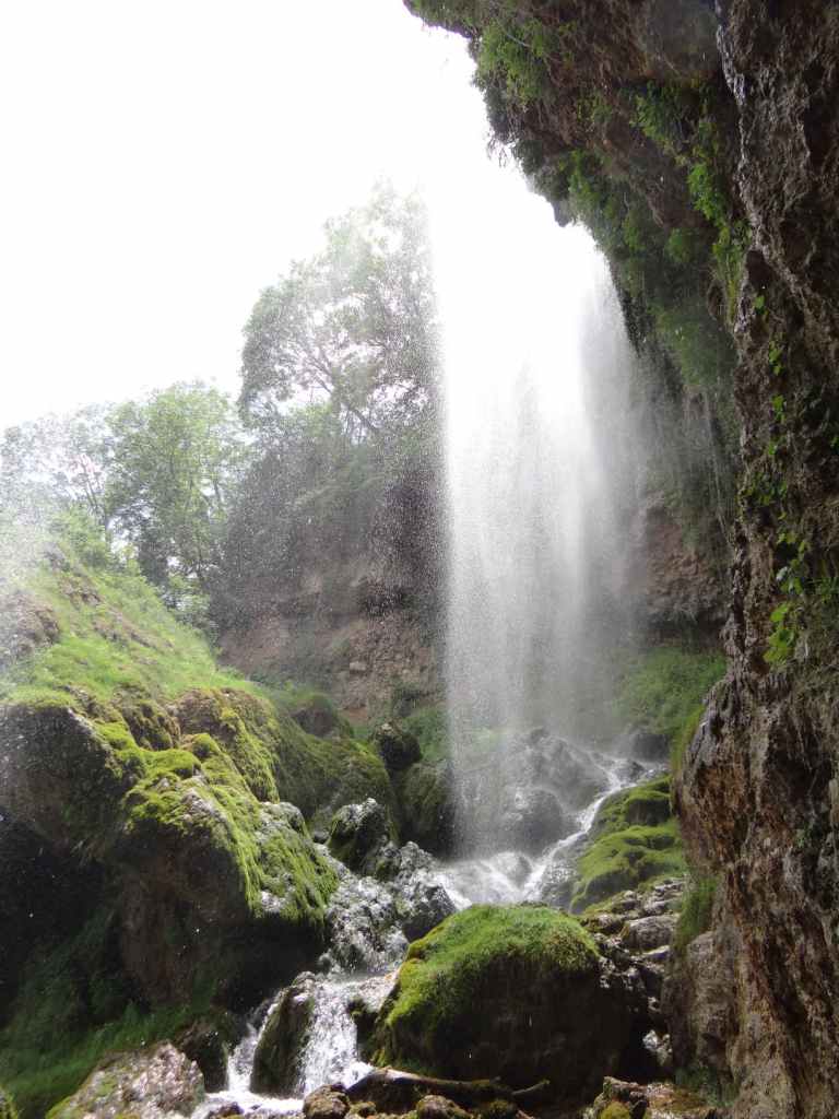
In the past, a nice path ran all the way to the waterfall, passing a small chapel before reaching the waterfall after only 30 minutes. To our amazement, today no path was visible. It ended abruptly at the bridge just behind the monastery and had been replaced by an abyss, a drop down to the riverbed. There is no path anymore. A flash flood – or something like it – appears to have swept away not only the path that used to meander nicely among the trees, but also the very riverbank. There is no riverbank. I am not joking. You are forced to drop down to the riverbed and then to walk along the riverbed. So this outing is not for the fainthearted. But before you become discouraged, let me tell you an hour after we arrived at the waterfall, a gaggle of children all aged under ten arrived as well – I can’t believe how many there were, they started lobbing heavy stones into the pool at the foot of the waterfall – so it can’t have been all that difficult.

But let me repeat: there is no path. There isn’t even any earth. You are on the riverbed, jumping over rocks, threading your way through fallen trees. It took us an hour and a half (a little less coming back – my wife asked me why it’s always easier coming back, I thought it was perhaps because you already know the way). And here’s the lesson from our outing today.

As we walked beside the monastery wall, a glum-faced gentleman in his elder years droned that there was no point going on, the path ended after the bridge. He and his companions had evidently turned around.

Once we were on the riverbed, but still at the beginning, a younger couple (he looked particularly sporty, she was more elegant) also warned us against continuing. Ten minutes, and they had had to turn around.

If we had listened, we would have got back in the car and missed the most amazing beauty. So don’t listen when people try to dissuade you, when they try to make you lose faith. Listen only to your inner voice. It’s like Christ says in John chapter 8, the last day of the Festival of Booths: just believe.

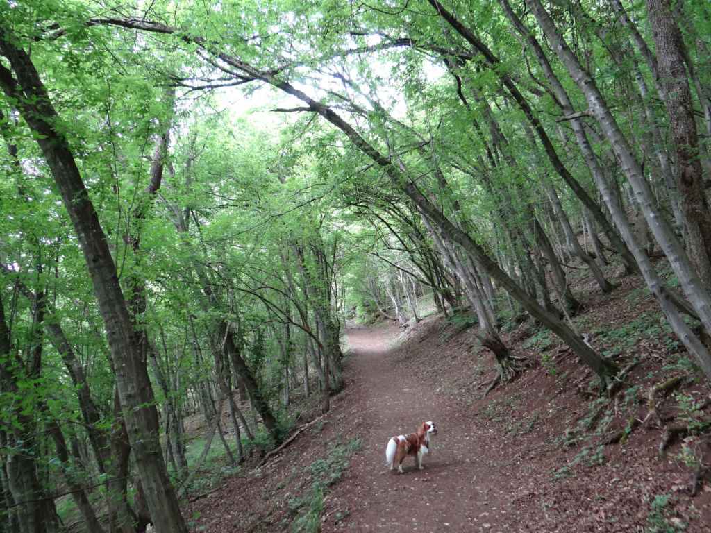
It’s lucky our dog was there to help us choose the best route. I felt like Arthur Morgan in the computer game Red Dead Redemption 2, turning on eagle eye, which enables him to see the trail left by a cart or an animal. You find your way through, you continue up the riverbed (it’s actually very beautiful being this close to the river!), you ignore the gainsayers (don’t go, it’s not worth it!), and at the end you witness incredible beauty.

Because Sopot Waterfall is a heart. It is a spring of water gushing up to eternal life (John 4:14 – have you read John’s Gospel? It is a fantastic book of short stories, of intimate encounters). Hristo Danovo is purity. Polska Skakavitsa, southwest of Sofia, is baptism – you cannot help but get immersed. Sopot is love, and so it ranks among my top waterfalls (even if there is no path, even if you have to walk through the air to get there). The water makes the shape of a heart. It is like a knot. A heart is a knot, two interlocked fingers.

And don’t let anybody tell you any different.

The path (it doesn’t last long) follows the wall of the Monastery of the Ascension.
It then abruptly ends. Here you can see how the riverbank has been obliterated – all that is left is the riverbed.
Miraculously, the path does reappear at one moment.
The magic of water.
Here you get a good idea of the terrain that you must cross to get to the waterfall.
The ruined chapel.
A pile of leaves – underwater!
In the absence of a path, people have taken to stacking stones when they reach the waterfall.
Sopot Waterfall.
A close-up of the heart.
The waterfall also resembles an hourglass.
The Monastery of the Ascension, which you can visit on your return.

Bov

At 85 metres, Bov Waterfall (‘Bovska Skaklya’) is one of the highest in Bulgaria. Like Polska Skakavitsa, it can easily be reached by train from Sofia. The journey takes an hour, and there are regular services during the day (see the excellent Bulgarian State Railways website for train times, https://www.bdz.bg/en).

Bov Waterfall is located at the halfway point between the villages of Bov (down below) and Zasele (up above). An ecopath has been built between these two villages to incorporate the waterfall and is named after the famous Bulgarian poet Ivan Vazov, who apparently used to enjoy walks in this area. There is some suggestion that you should descend from the village of Zasele, make your way down to the waterfall and the village of Bov and then climb back up again. Since it seems to me to make more sense to get the climbing in early in the day, I suggest starting in Bov. Also, Bov is the stop on the railway line from Sofia and is on the main road from Svoge to Mezdra, the II-16.

If you insist on starting in Zasele, located above the waterfall, then you will need a car. As you leave the village of Tserovo, five kilometres after Svoge, there is a turning left signposted for Zasele (7 km). Follow this winding road uphill until you come to the centre of Zasele, where there is a tarmac square. The ecopath starts from here.

Otherwise, continue to Bov, three kilometres after Tserovo. Ignore the turning right, signposted Gara Bov (Bov Station), and continue on the main road for another 400 metres, taking a turning left signposted for Skaklya. This narrow road continues for 1.4 km to the start of the ecopath, but be careful. 200 metres before the end of the road, the road divides – keep left, going uphill, until you come to a small area next to a house, with the river on your right, where you can park the car. For those travelling by train, alight at Bov Station and walk 400 metres down to the main road (leave the station, turn right, go under the railway and follow the road as it veers right and crosses the River Iskar). Once you reach the main road, turn right, continue for 400 metres until you reach the turning for Skaklya and then follow the previous directions.

From where you park the car, you have a forty-minute steady climb through the forest to the bottom of the waterfall. The forest is magical, and there are some wonderful views back the way you have come. Once you reach the waterfall, another forty-minute climb, slightly stiffer this time, will take you to the top. As you get higher, there are steps and a railing to hold onto. You really get an impression of the height of the waterfall because you are climbing it! At the top is an open area of grass with several picnic tables. Continue to the village of Zasele, perched on top of the rock, and you will come across one or two restaurants and guest houses if you wish to stay the night (though I understand you have to book ahead).

The best time for visiting waterfalls is immediately after the snow melts – second half of April, first half of May. This is when the flow of water is at its strongest. We went at the beginning of June, so already the flow had declined somewhat. In autumn, it becomes a trickle. We first visited the waterfall ten years ago, in November. There wasn’t much water left, but the autumnal colours of the trees more than made up for the lack of watery fireworks! It was the first waterfall we went to, and the only one we have been to three times!

Bov Waterfall is not far as the crow flies from another waterfall, Dobravitsa (except that for Dobravitsa, you have to leave the main road in Svoge and follow the signs for Iskrets and Breze). From Gara Bov, another ecopath takes you to the waterfall Pod Kamiko. This ecopath starts from the football pitch in Gara Bov and is circular, so you don’t have to come back the way you went (see the map on the road outside Bov Station).

Bov Station.
The turning for Skaklya. There is also a sign indicating the ‘Touristic Road “Vazov’s Path”, 1.4 km’.
200 metres before the ecopath begins, the road divides – keep left here.
There is a small area to park the car where the road peters out and the ecopath begins.
A view from the ecopath of the rocks up above.
The path as it passes through the forest.
The waterfall in the distance.
Arriving at the waterfall.
Bov Waterfall, seen from below.
From here, the path continues to the top of the waterfall and the village of Zasele.
This path has steps and a railing.
The view near the top.
The top of the waterfall – the stream passes under the bridge and tumbles down 85 metres.
The water as it becomes airborne.
The view back to Bov.
Bov Waterfall.

Polska Skakavitsa

Undoubtedly one of the most beautiful waterfalls in Bulgaria. The journey to the waterfall reminded me a little of the 1970 film The Railway Children since it involves travelling by train and then walking along the railway line for a short distance. You can travel by car to the villages of Ruzhdavitsa and Polska Skakavitsa, after which the waterfall is named, but I understand the road is not good and then you have a long hike to get to the waterfall. By far the better option is to travel by train! The stop for the waterfall is called ‘Skakavica’ and it is on the line from Sofia to Kyustendil. The journey from Sofia to Skakavica is two and a quarter hours, and there are trains about every two hours. The trains are very pleasant and they run on time! I direct you to the wonderful Bulgarian State Railways website: https://www.bdz.bg/en. Here you will find up-to-date information on train times and other destinations in Bulgaria.

Not all trains are direct, sometimes it’s necessary to change in Radomir, but don’t worry, the connecting train waits for the train you are on to arrive. We drove to Radomir and took the train from there. A return ticket Radomir-Skakavica-Radomir cost a little over 2 euros! The stop before Skakavica is Zemen, where there is a famous Monastery of St John the Theologian. The train then travels along a gorge created by the Struma, a stunning river that rises on the southern slopes of Mt Vitosha (the mountain that overlooks Sofia) and then travels to Greece, entering the Aegean Sea at the ancient site of Amphipolis. There are interesting rock formations. After fifteen minutes, you reach Skakavica station. Alight here, wait for the train to leave and then continue along the railway line in the same direction the train has just gone in (that is, south). It’s quite safe. This is a single-track railway, so there is no immediate danger of a train coming the other way. After fifteen minutes of walking along the railway, you will come to a short tunnel. Go through the tunnel and, before you reach the iron bridge crossing the river Struma and entering a second tunnel, on your right you will see a low concrete wall. The path to the waterfall starts here, at the end of the concrete wall.

Follow the path, which runs alongside the river Struma on your left – admire the river! – and in about fifteen minutes you will reach a signpost indicating a picnic area to the left (‘МЯСТО ЗА БИВАК’) and the waterfall to the right (‘КЪМ ВОДОПАДА’). Go right here. The path climbs a little, and you reach a wooden bridge over a stream on your left. This is the way to the waterfall. The wooden bridge is somewhat destroyed, but you can cross the stream just above the bridge. You must now climb some steps, which will take you to a small terrace, where you get a view of the gorge and the Struma on its implacable way to Greece. Continue uphill. The first turning on the left takes you to the bottom of the waterfall. If you continue uphill, you will come to an area just below the top of the waterfall. In both places, you are likely to get wet! But who cares, right? The experience is invigorating.

At the top of the waterfall is a small chapel dedicated to St Demetrius. This can be seen from below. Near the wooden bridge is a map of the area and a description of the local wildlife, with a couple of picnic tables in the shade. While we rested here, a bird kept us company with an astonishing succession of melodies and trills. This is Bulgarian nature at its best. It took us only forty minutes to get from the station to the top of the waterfall, and the walk is very pleasant. The waterfall in its entirety is seventy metres high. It is formed by the Shiroki Dol river, which then joins the Struma below on its journey to Greece. At a distance of about six kilometres from the waterfall is an old chapel dedicated to the Assumption of the Virgin Mary, near the village of Ruzhdavitsa, which we didn’t go to. All in all, a fantastic day out.

A note of warning: when you head back to Skakavica station, allowing about an hour to get there, so you have plenty of time, the path along the Struma back to the railway line divides at one point, and it is very tempting to take the left branch that heads uphill (and, for all I know, goes to the railway station), but if you want to go back the way you came, you must take the right branch. In a couple of minutes, you’ll be back at the railway. Provided you’ve left enough time, there is no danger of coinciding with the train, but obviously caution is required.

The path alongside the railway, after you leave Skakavica station.
The tunnel.
The low concrete wall. The path to the waterfall starts here.
The waterfall in the distance.
Fifteen minutes after you leave the railway, the path divides. Head right to the waterfall (‘КЪМ ВОДОПАДА’).
The steps leading up to the waterfall.
The small terrace overlooking the gorge formed by the Struma River.
The top of the waterfall.
The view from the top of the waterfall, with the Struma River in the distance.
The bottom of the waterfall.
Polska Skakavitsa Waterfall.
Heading back to the railway, the path divides. Keep right in order to reach the railway!
The path as it descends to the railway.