Vidimsko Praskalo

This is a walk into the heart of the Balkan. It takes you to within sight of one of the tallest waterfalls in Bulgaria (most of which are in this region, on the north and south sides of the Balkan Mountain), Vidimsko Praskalo. Praskalo is the Bulgarian word for ‘spray’, ‘sprinkler’, it’s just another word for ‘waterfall’. Vidimsko refers to the nearby village of Vidima. There used to be four villages in this area: Novo Selo in the centre, Zla Reka to the west, Ostrets to the east, and Vidima to the south. In 1976, they decided to club together and form a town, Apriltsi, which was named after the April Uprising of a hundred years earlier, in which the village of Novo Selo lost 142 of its citizens to Ottoman units, who massacred the locals, causing uproar in the West. Bulgaria would become free of Ottoman rule two years later.

A bird could fly from one praskalo to another in a matter of minutes ­– clustered around Botev Peak there are several, Raysko Praskalo being the highest. But we are mere mortals and must use our feet. There is an ecopath that takes you, five kilometres along a track, and the final kilometre along a path, to a viewing area, from where you can view the waterfall in the distance. Believe me, it is magical, even at a distance. The waterfall is located within a part of the Central Balkan National Park known as Severen Dzhendem, and you’re not just allowed to walk freely. This is one of the routes you are allowed to do.

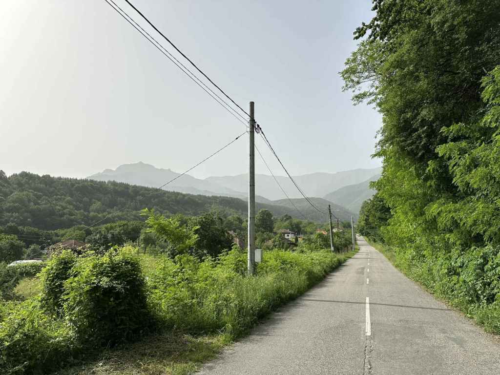
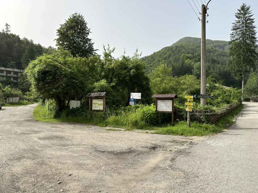
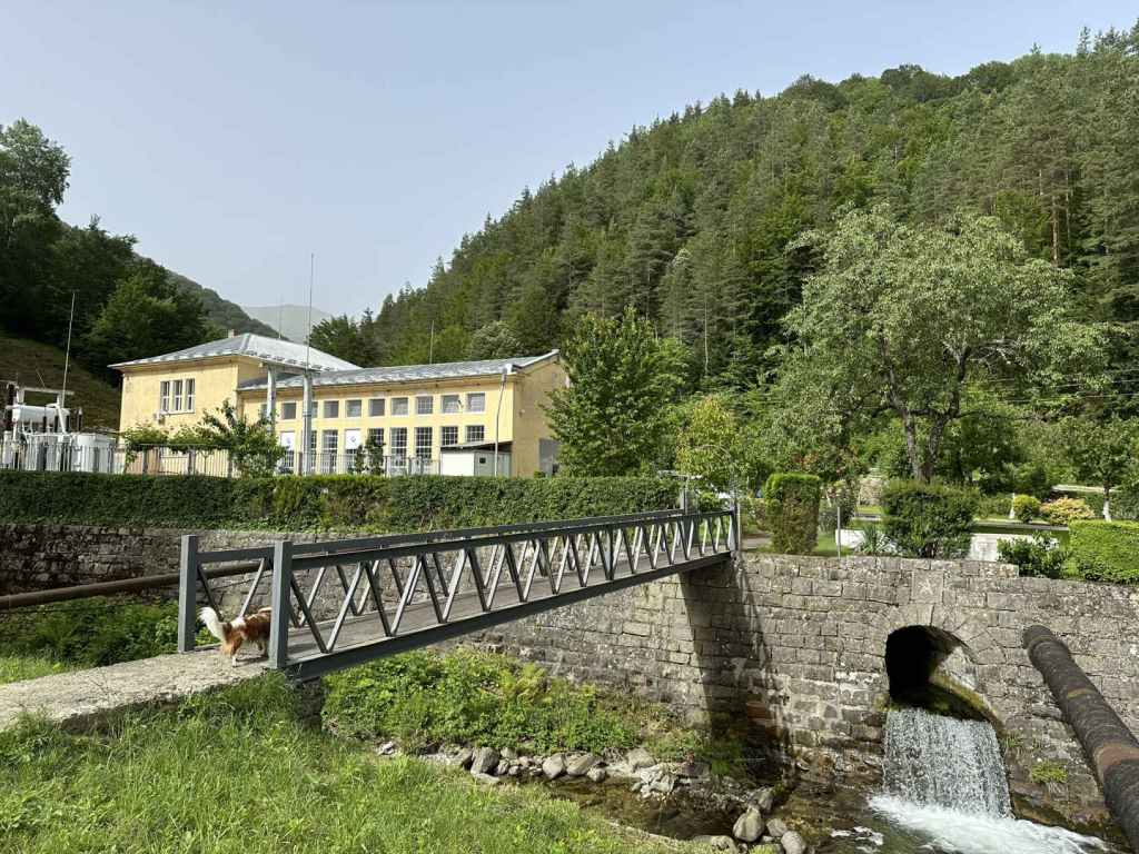
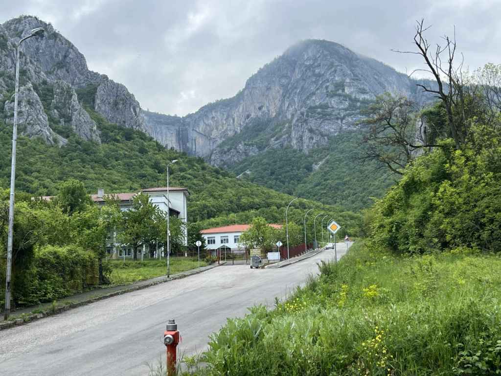
Make your way to Apriltsi. The town is traversed by the III-607 road. Between Zla Reka and Novo Selo (where the centre is), there is a turning marked ‘kv. Vidima 5’. Take this turning, which heads due south, offering impressive views of the Balkan. Continue on this road for 8.5 kilometres, passing through the centre of Vidima and out the other side. Just before reaching a hydroelectric power station, there is a small turning on the left with lots of signs pointing to the waterfall and the ecopath. It’s impossible to miss. Park your car here.

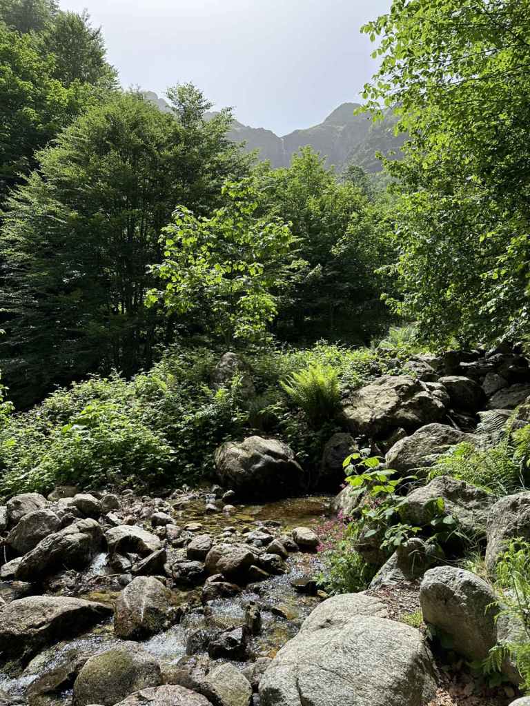
Now you are on foot. The road immediately crosses the River Vidima and turns right, past the power station on your right. The power station is located between the Rivers Vidima and Praskalska (‘of the waterfall’). You are now next to the River Praskalska and are going to follow it all the way to your destination.

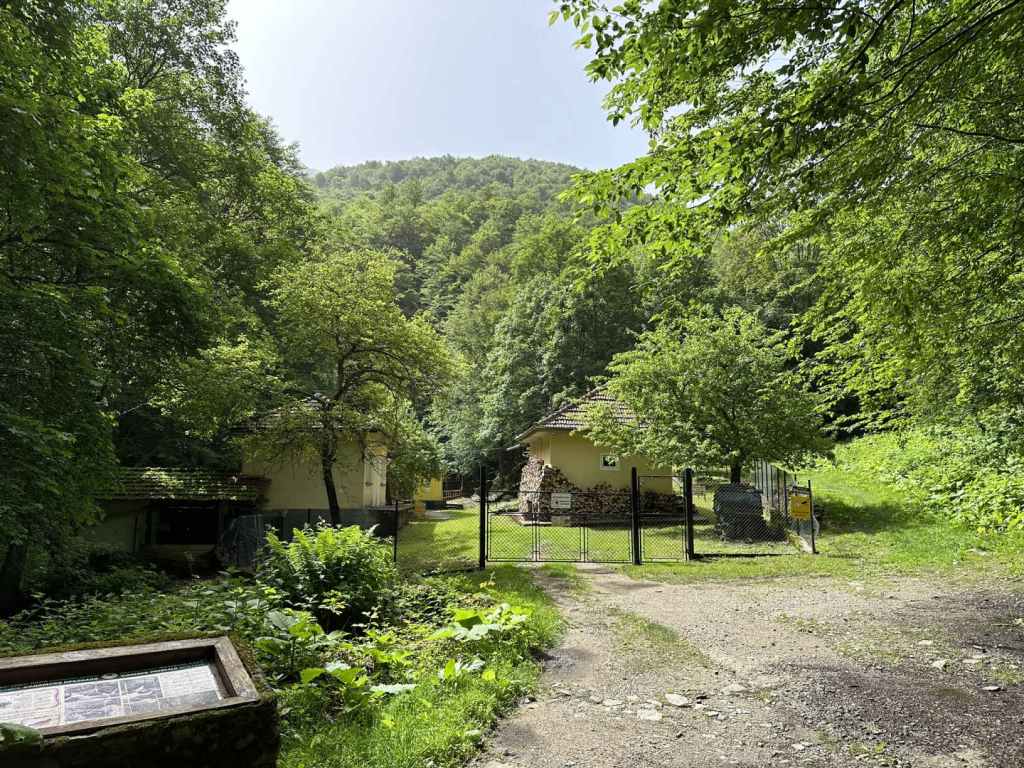
The track you are on, wide enough for a car, crosses the river a couple of times, it even crosses a couple of tributaries and goes past some buildings linked to the water supply, but you are never going to leave it until, after five kilometres, you reach the entrance to the Severen Dzhendem Reserve. Most of the time, the river will be on your right. Sometimes the track will toy with you and make as if to climb away from the river, but it soon returns. Just stay on it, ignoring the turnings to Mecho Chakalo and Turski Rat (obviously one of the people involved in 1876) on your left. In 3.7 kilometres, you will come to a fountain on the left, with a picnic hut on the right. Another kilometre, and you will reach the buildings linked to the water supply, where it is forbidden to go too close to the river (there is another fountain here, and a viewing platform over the river). Stay on the track.

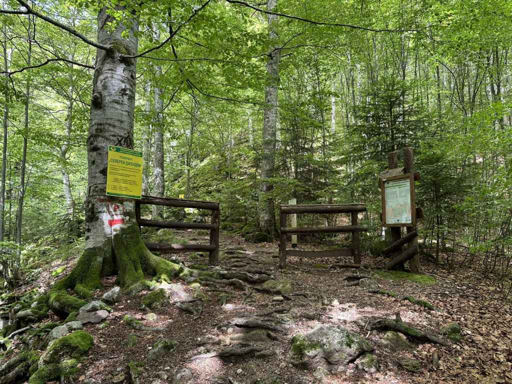
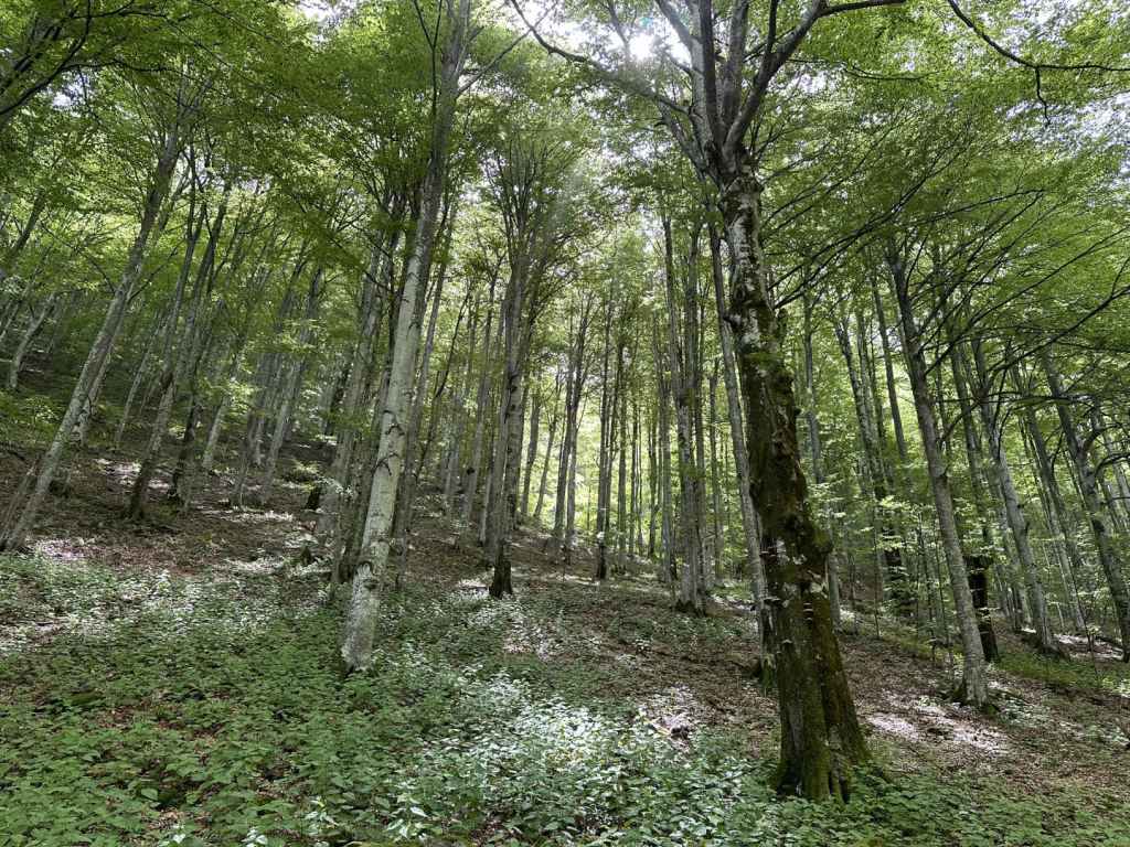
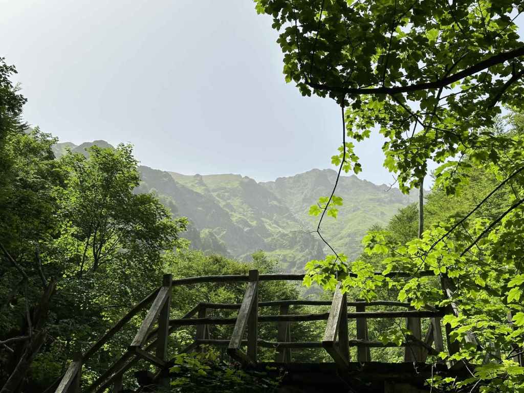
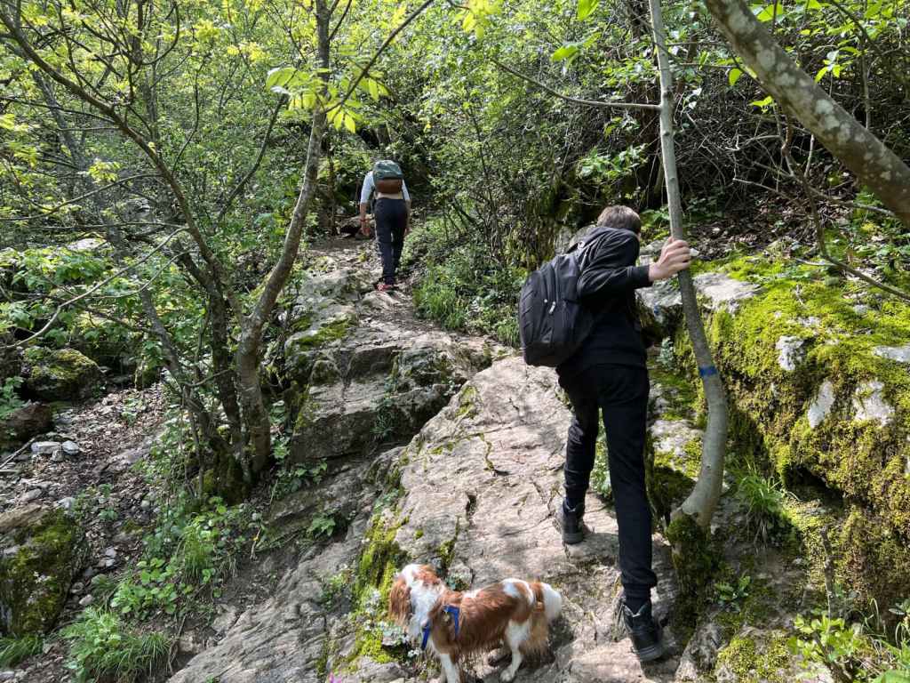
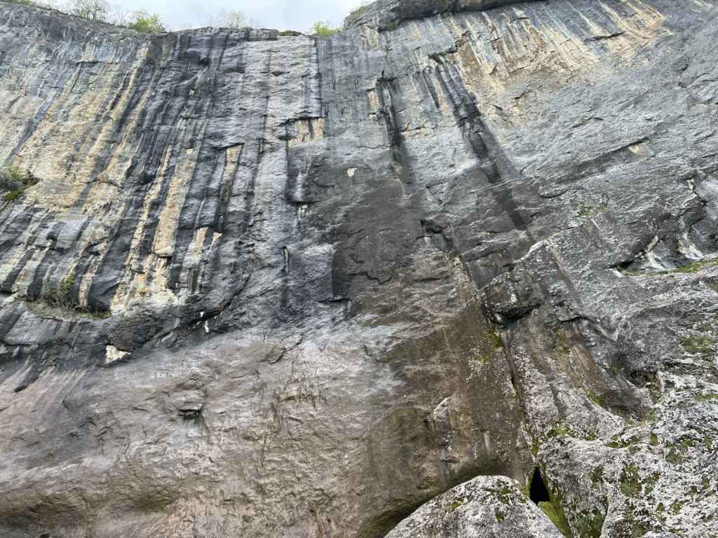
This track that has offered so much finally ends after five kilometres, and you enter the Severen Dzhendem Reserve, where there are beech forests protected by UNESCO. It now becomes a path. You have one more kilometre to go (twenty minutes). You will cross four wooden bridges. Then you will come to a fifth, higher wooden bridge, and suddenly notice the peaks of the mountain up ahead. It’s a startling view. Cross this bridge, and you will come to a small area with wooden benches, where you can sit, rest and admire the waterfall in the distance. It’s incredibly picturesque.

It is not permitted to continue towards the waterfall and, without a guide, it would be difficult to achieve. But it is enough. It’s not always necessary to reach the end, and it’s also good to allow wild animals a little peace and quiet from us. It took me two hours to reach the viewing area from the power station, and 1½ hours to come back. But I have to say I stayed quite a long time, viewing the waterfall (like a destiny) in the distance, and was reluctant to leave.

The River Vidima as it passes through Apriltsi. It goes on to join the Rositsa in Sevlievo, which itself joins the Yantra (the river that goes through Veliko Tarnovo) before becoming part of the Danube.
The road due south that passes through Vidima and leads to the Balkan.
The turning on the left for the ecopath to Vidimsko Praskalo. The road on the right continues to Pleven Hut.
The hydroelectric power station on the right.
The track following the course of the River Praskalska.
The river through the trees.
The track higher up.
The buildings linked to the water supply.
The entrance to the Severen Dzhendem Reserve, where the track ends and becomes a path.
The first of the wooden bridges.
The UNESCO-protected beech forest.
The fifth wooden bridge with views of the ridge.
The small viewing area.
The river with the waterfall behind.
A close-up of the waterfall.

Vratsa

Vratsa is a town north of Sofia, midway between Sofia and the river Danube. It is famous for its caves (in particular, Ledenika), waterfalls and rock formations. To the south-west of Vratsa is the Vrachanski Balkan Nature Park, established in 1989. This is where Vratsa Waterfall is situated, together with another waterfall, Borov Kamak, which can be accessed from the village of Zgorigrad. It is also where the Bulgarian revolutionary and poet Hristo Botev was killed in 1876, fighting against the Ottomans in an uprising that would be brutally crushed, but would sow the seeds for the liberation of Bulgaria from Ottoman rule two years later. Vratsa is also famous for the Rogozen Treasure, the largest haul of Thracian treasure ever found in Bulgaria, dating to the fourth century BC, part of which can be seen in the Regional Historical Museum.

Vratsa is connected to Sofia by railway (for train times, see the Bulgarian State Railways website: https://www.bdz.bg/en). To reach Vratsa from Sofia by car, take the A2 motorway, which connects Sofia with Varna on the Black Sea coast, north-east as far as Botevgrad and then head north-west on the E79 road to Vratsa via Mezdra. The journey takes about two hours. On entering Vratsa, keep going straight and in three kilometres, immediately after passing City Hospital on your left, there is a street, also on your left, called Belasitsa. You need to take this turning. This street continues for 800 metres and then abruptly ends next to an old people’s home, Zora. This is where the path to the waterfall begins (there are several places to park your car).

The walk from here to the bottom of the waterfall takes about an hour, but it is steep and slippery. It is not an easy path. Follow the path and, after a few minutes, there is a large gateway on your left with the words ‘Welcome to Vrachanski Karst’ written on it in Bulgarian. This is the name of the reserve, which forms part of the Vrachanski Balkan Nature Park. Do not be tempted to follow the track that climbs the hill directly in front of you, but go left, over the riverbed and under this gate. The riverbed will now be on your right. After five minutes, you will come to a shelter on your right, an ideal place to rest. The path starts to climb, and in another five or ten minutes you come to some benches and a fountain on your left. The path then crosses the riverbed, which was completely dry when we visited. You need now to follow the blue markers (they are sometimes red), ignoring a level path on the right and heading straight uphill. Bear in mind the elevation gain from the start of the walk to the waterfall is about 300 metres. If you stay on this path and observe the blue markers, you will reach the bottom of the waterfall in half an hour.

At 141 metres, Vratsa Waterfall, also known as ‘Vrachanska Skaklya’, is one of the highest in Bulgaria, but the flow of water is very little. There are some boulders at the bottom, and an enormous rock face. But where Vratsa Waterfall really stands out is with the views! I heartily recommend that you continue to the top of the waterfall, an elevation gain of another 200 metres, which takes about 45 minutes. As you face the waterfall, the path with the blue markers continues on your left (that is, it continues eastwards). Follow the path and, before reaching the top, you will pass a cave on your right, which you can investigate. Once you reach the top, the path heads right through some trees and then comes to a clearing. If you continue in the same direction, skirting the cliff face on your right, in five minutes you will come to the stream that feeds the waterfall. The views – of the waterfall and rock face as you climb; of Vratsa and Dabnika Reservoir in the distance – are spectacular and well worth the extra effort. The descent from the top of the waterfall to the start of the path took us about an hour.

All in all, you need to allow at least four hours for the hike itself. The climb to a large rock face, followed by a further climb to the top of the waterfall, is reminiscent of the visit to Bovska Skaklya north of Svoge, on the other side of the Vratsa Balkan, only this waterfall is higher.

The turning after the hospital, Belasitsa Street, ends next to an old people’s home. The path begins here. The waterfall is the dark patch on the rocks behind.
After a few minutes, turn left and pass through the gateway, which says ‘Welcome to Vrachanski Karst’.
A rock on the right.
A picnic shelter in ideal surroundings.
The path starts to climb.
After crossing the riverbed, the path becomes steep.
Vratsa Waterfall from below.
As we continue to the top, the views of the waterfall and Vratsa are wonderful!
A view of Vratsa from inside the cave.
At the top, the path heads through some trees.
And you come to a clearing.
In another five minutes, you reach the stream that forms the waterfall.
A view of Vratsa and Dabnika Reservoir from the top of the waterfall.