Emen

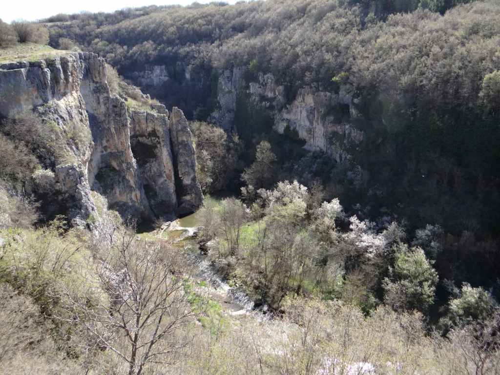
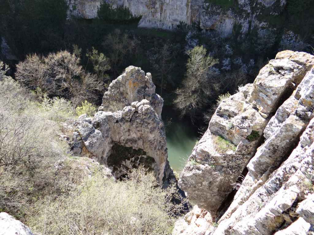
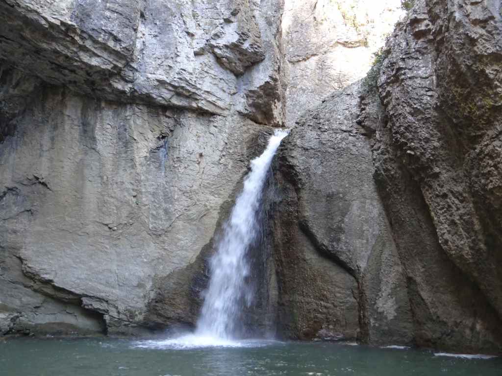
Emen is the second of three waterfalls that lie north-west of the medieval capital Veliko Tarnovo – Hotnitsa, Emen and Vishovgrad. What sets Emen apart is the canyon with the river Negovanka at its bottom. Just before the Negovanka forms a large reservoir, there is a ten-metre waterfall called ‘Momin Skok’, meaning ‘Maiden Jump’ – as with Ovchartsi Waterfall in Rila, this refers to the legend of young girls jumping to their death in order not to be forcibly converted to Islam during the Ottoman occupation of Bulgaria (14th-19th centuries).

To get there from Veliko Tarnovo, take the main road to Sofia (E772) and after 20 km turn right for the village of Balvan. Follow the road to the centre of this village and then turn right for Emen (8 km). Be careful because there is a sign for Emen in Balvan that has been turned back to front and seems to indicate that you should go straight ahead when the road veers left. This is not the case. The road veers left and after a short while you reach the centre of the village.

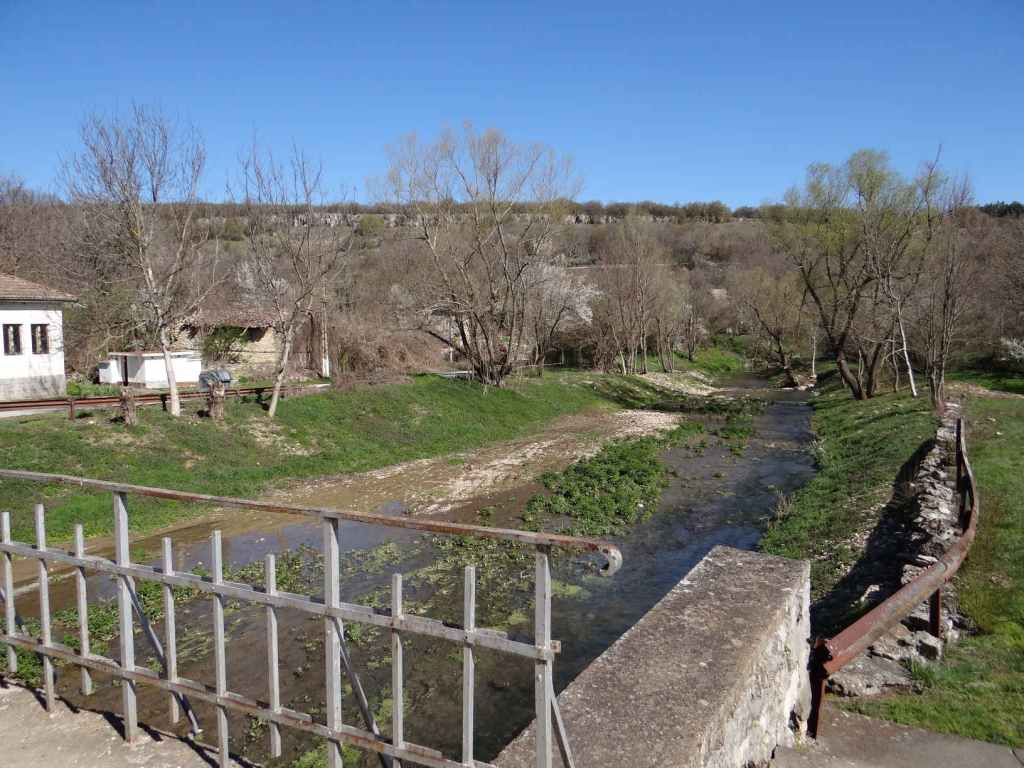
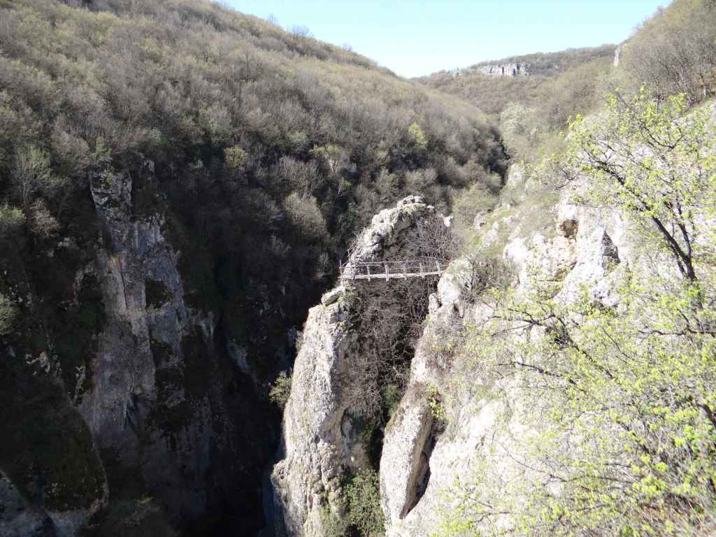
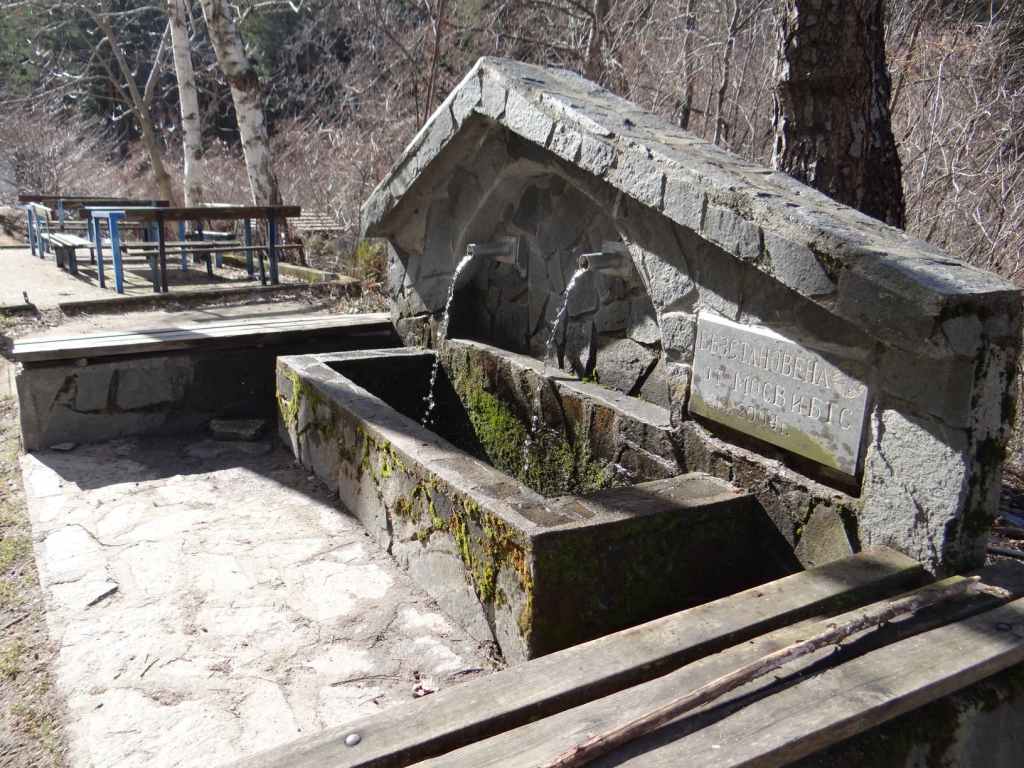
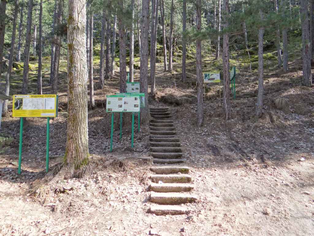
Here you turn right and after 8 km arrive in Emen. The road takes you over a bridge on the river Negovanka and immediately you arrive at a small square opposite the town hall where you can park the car. There is also drinking water. A smaller road leads to the right, following the left bank of the river. The road becomes a dirt track and then a path. After fifteen minutes, you reach a wooden suspension bridge over the river, but you stay on the left bank. The path climbs up to another dirt track, which then leads on your right to the beginning of the ecopath, where there is a cave. The cave is 3 km long and is home to various species of bat. In communist times, it was used as an arms depot for a military base located directly above it.

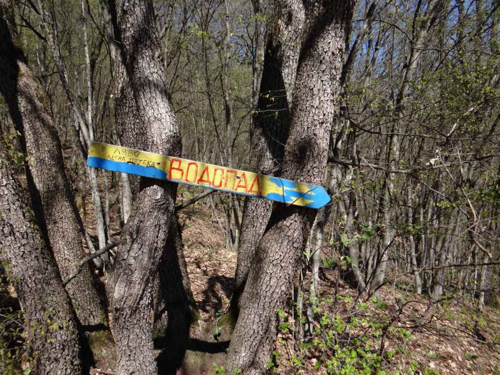
The ecopath is said to have been the first in Bulgaria and was created in 1992, shortly after the fall of communism. I think the initial idea was to follow the course of the river at the bottom of the gorge, but the wooden bridges crisscrossing the river have long since succumbed to the elements, which is a shame, and now the ‘ecopath’ actually runs along the top of the canyon on the left. From the beginning of the ecopath, where the cave is, to the waterfall is about forty minutes. The path takes you up to the top of the canyon and then winds along the edge, in amongst trees. After about thirty minutes, the path divides, but it doesn’t matter which branch you take – one continues among the trees, the other skirts the precipice. The path then descends to the left (this is clearly marked by blue arrows) to rejoin the river at the bottom. Turn right, and you will arrive at the waterfall in five minutes. You can hear the waterfall from the top of the gorge.

It is possible to drive to the start of the ecopath. Continue past the main square in Emen and after about 200 m you will reach a crossroads. Turn right, and just as you are leaving Emen, a dirt track forks off to the right, leading to the ecopath. Continue along this road, without taking the dirt track on your right, and in a short while you will reach the waterfall of Vishovgrad, ‘Zarapovo’. Both waterfalls can easily be visited on the same day since they are only a short distance apart.

The Negovanka River as it passes through Emen.
The wooden suspension bridge in Emen.
The path on the left bank of the river joins the dirt track leading to the start of the ecopath.
The start of the ecopath – steps leading up to the cave, the 17th longest in Bulgaria at just over 3 km.
The start of the ecopath, after the cave.
Having immediately climbed to the top of the canyon, view of the canyon itself.
Cragged rocks.
View up the canyon.
The path divides – either branch will lead to the waterfall.
The remnants of the ecopath clinging on for dear life!
A blue sign indicates the beginning of the descent from the top of the gorge to the waterfall below.
Emen Waterfall.
Close-up of the waterfall.
Panoramic view of the waterfall.
If you decide to drive to the start of the ecopath, you need to take the dirt track on the right. Continue along the asphalt road, and you will soon reach Vishovgrad Waterfall.

Ovchartsi

Undoubtedly one of the most beautiful waterfalls in Bulgaria, Ovchartsi Waterfall is named after a Bulgarian maiden, Goritsa, who lived in the local village and was betrothed to a shepherd called Yovitsa. This was during the time of Turkish slavery, Ottoman rule in Bulgaria during the fourteenth-nineteenth centuries. The Turkish overlord or bey was struck by Goritsa’s beauty (it must have been a slightly terrifying time to be beautiful) and ordered his servants to fetch her for him. Goritsa took to the hills, in search of Yovitsa, who was watching his flocks, but the servants reached her before she could get to him, so she threw herself off the cliff. Ever since then, the waterfall (39 metres) and the river have borne her name.

The waterfall is above the village of Ovchartsi on the northern slopes of Rila Mountain. To get there from Sofia is about an hour and a quarter by car. You take the motorway to Greece (Kulata) and leave the motorway at the signs for Dupnitsa. You actually leave the motorway seven kilometres before Dupnitsa and follow the old road into Dupnitsa, past a succession of second-hand car dealers. On entering Dupnitsa, you take a right just before the OMV petrol station, signposted Sapareva Banya. You then follow this road, ignore a left turn that is signposted Plovdiv and Samokov and continue to the next set of lights, where you turn left for Sapareva Banya and Panichishte. If you take the road for Plovdiv and Samokov, you will have a very picturesque ride alongside the northern slopes of Rila, but you will not be able to reach the villages that nestle on these slopes. This is why you continue to the next set of lights and turn left here. This road takes you through the villages of Samoranovo and Resilovo to Ovchartsi.

In Ovchartsi, head to the central square, where there is a town hall and a children’s playground. Turn right on the near side of the square and go straight up the steep road in front of you, which bears right at the top, leading to a fountain and a place to park. From here, continue on foot. There is an ecopath to the waterfall, and it only takes about fifteen minutes to get there. Admire the view. When we went in February, there was a lot of ice, which made the path very slippery and people were having difficulty going up and down (with the inevitable laughter).

You can also make your way down to the river below the waterfall, but to do this you have to leave the path and climb down a slightly steep slope. Heading upstream, you will come to the lower part of the waterfall, with a wonderful view of the rocks above and trees silhouetted against the light.

Between Resilovo and Ovchartsi is the Resilovo Convent of the Holy Protection. It is a short drive from the road. The nature is beautiful, and the church has stunning frescoes. You can light a candle for your loved ones and enjoy the view back to Sofia!

The road into Dupnitsa, flanked by second-hand car dealers. Rila Mountain is right in front of you.
The fountain where you can park the car.
The steps at the start of the ecopath, with information boards in Bulgarian and English.
A peak in the distance.
A second, longer flight of steps.
With a wooden bridge at the top, leading to the waterfall.
Ovchartsi Waterfall.
The upper waterfall.
A sign with the story of Goritsa (Goritza).
The lower waterfall, seen from above. From here, the rock resembles the head of a young woman.
Beautiful February cloud formations.
The ice rink!
The river below the waterfall.
The lower waterfall. The rock now resembles the head of an old woman.
Directly above the rock, note the figure in white against a black background that seems to be jumping, thus confirming the legend.
The whole waterfall, seen from below.
Ovchartsi Town Hall (which has pictures of the waterfall).
Resilovo Convent of the Holy Protection.