Kapinovo-Ruhovtsi

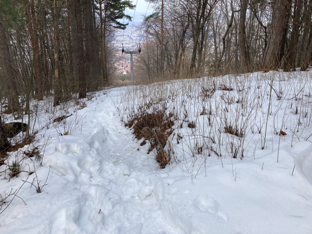
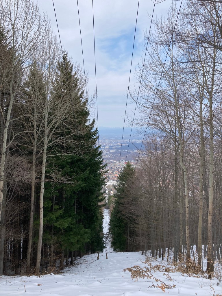
There are two waterfalls south-east of Veliko Tarnovo, near the villages of Kapinovo and Ruhovtsi. They can be visited together.

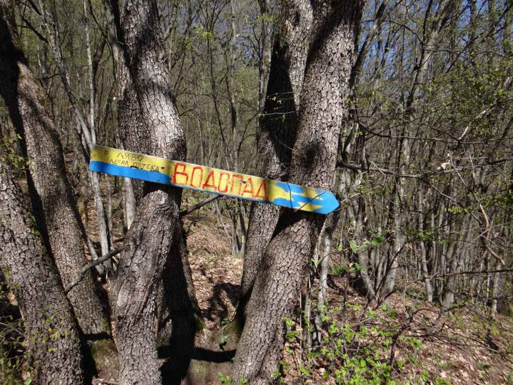
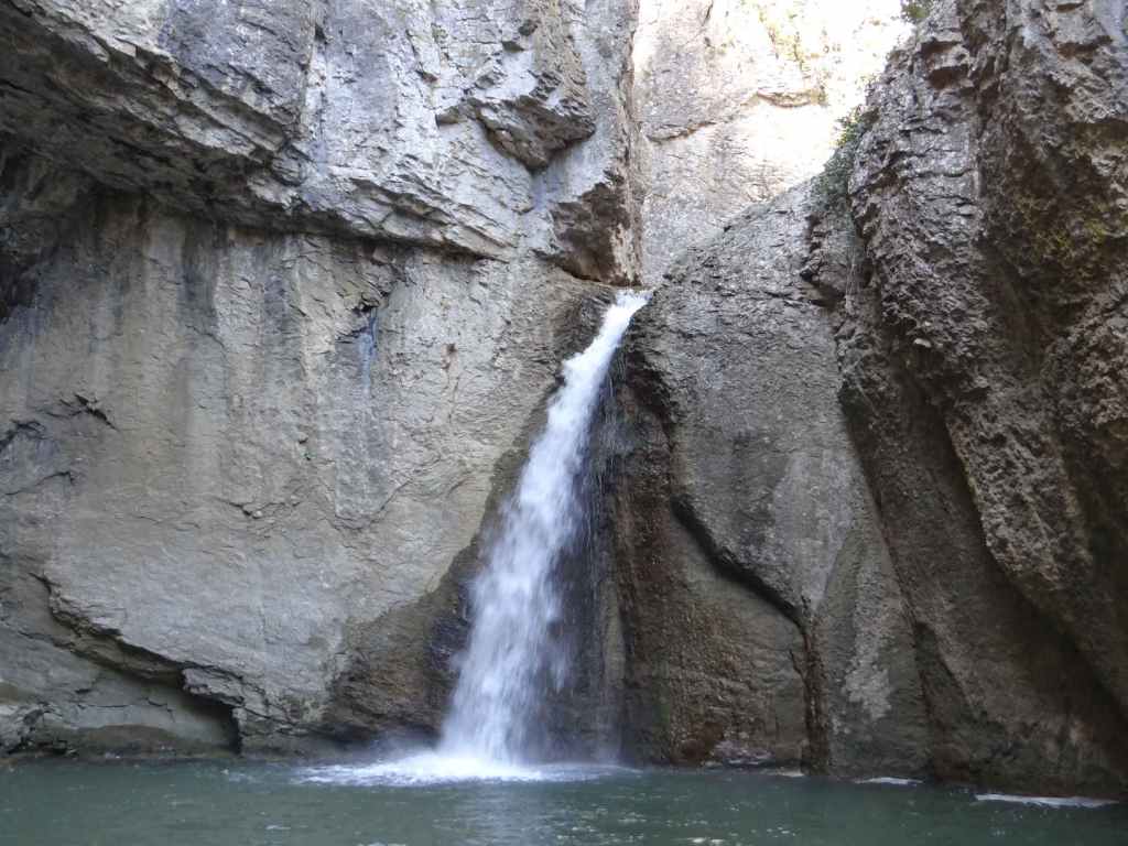
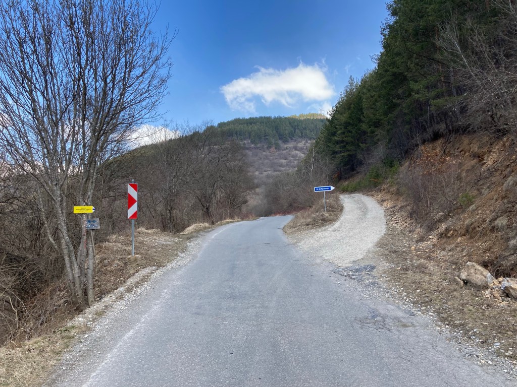
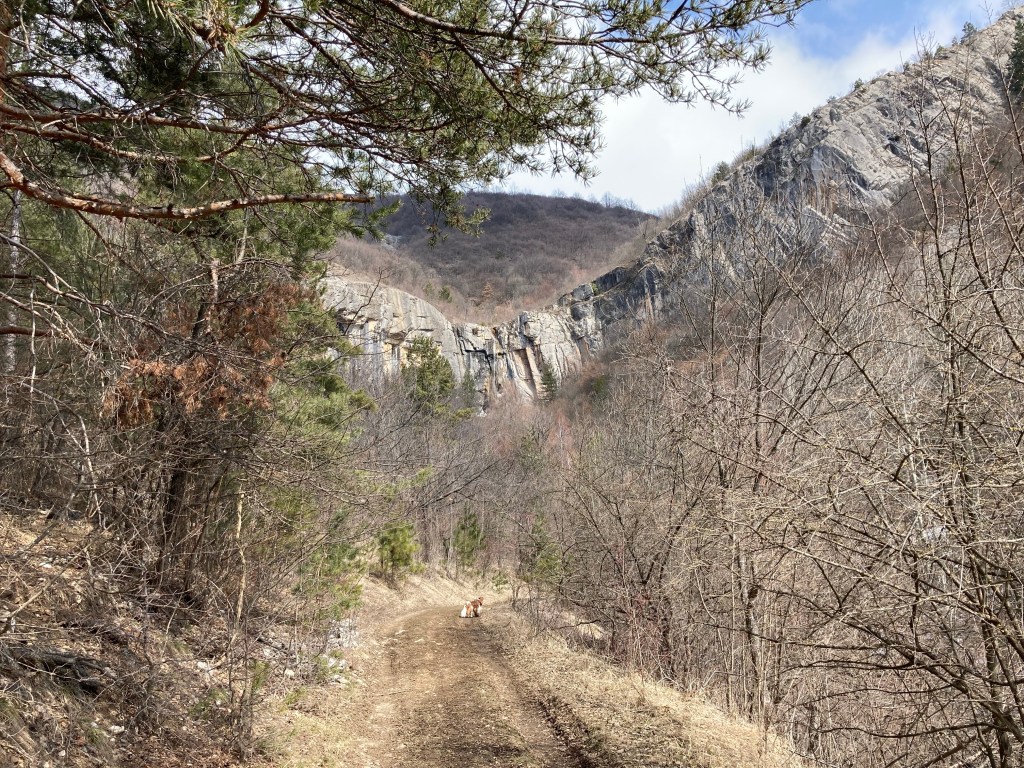
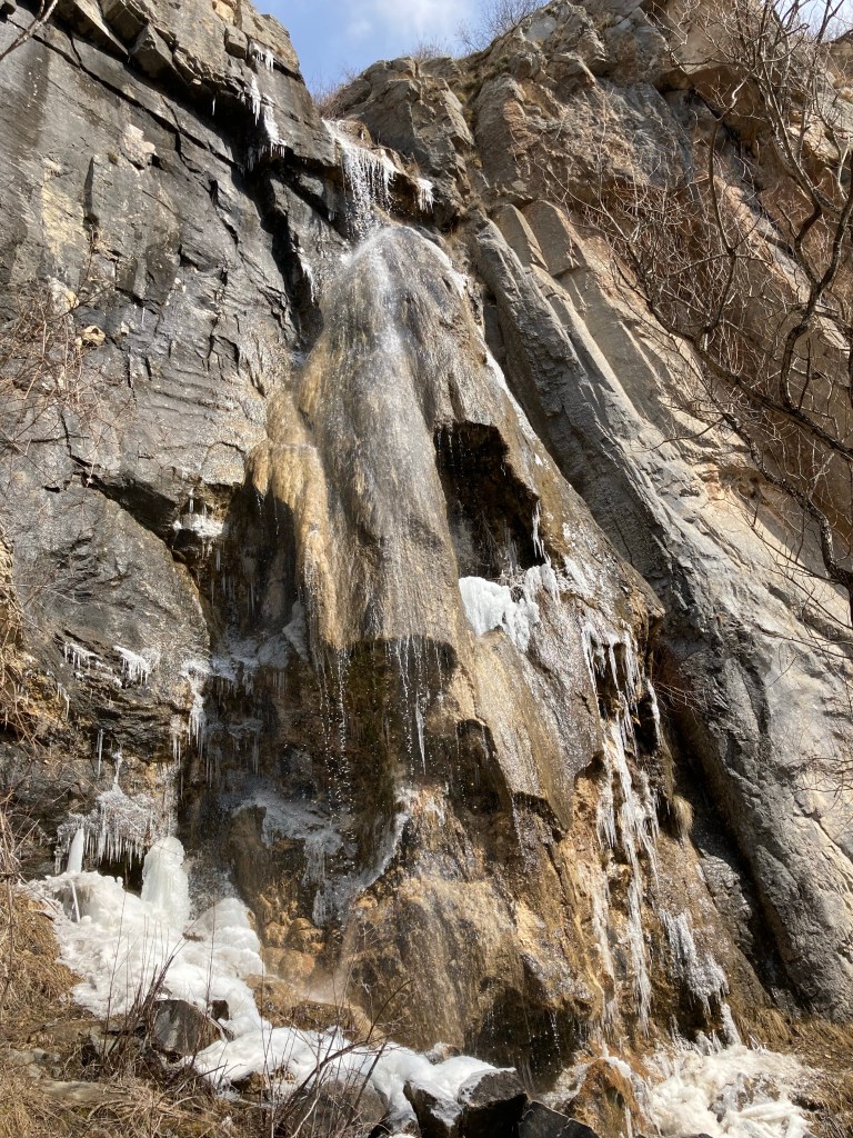
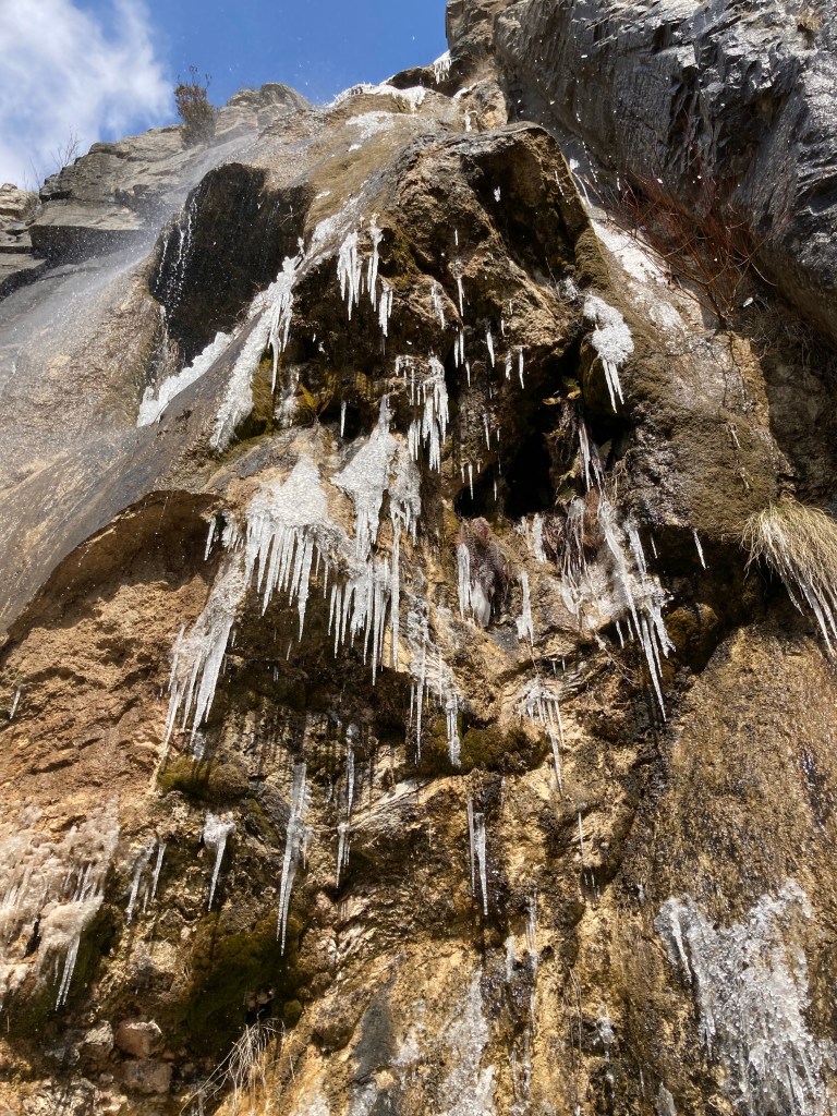
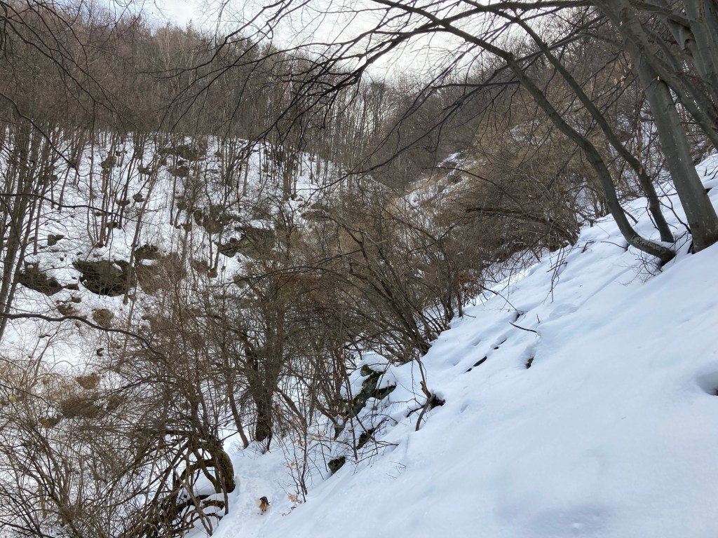
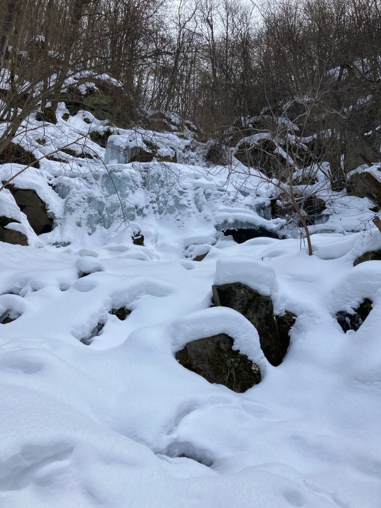
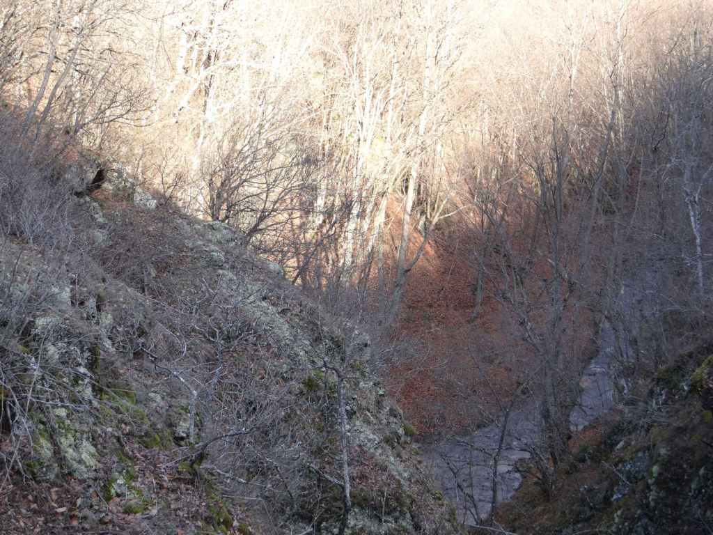
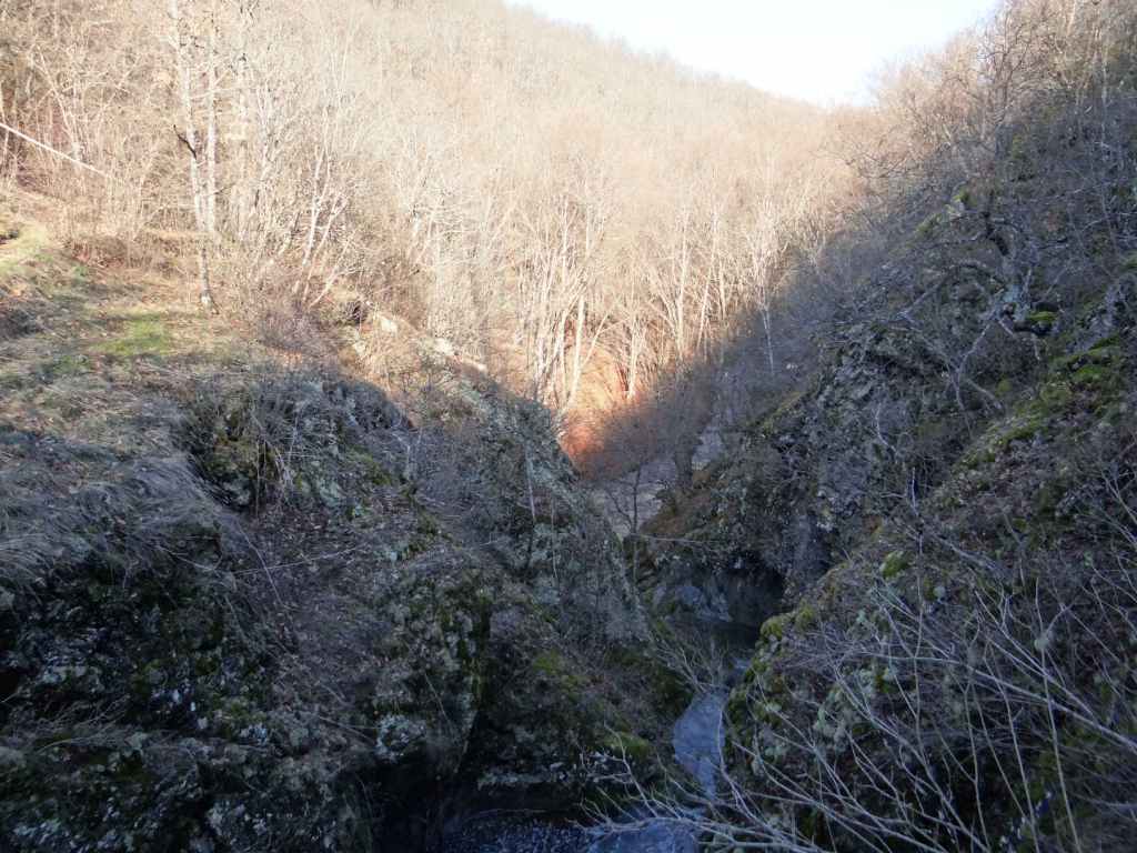
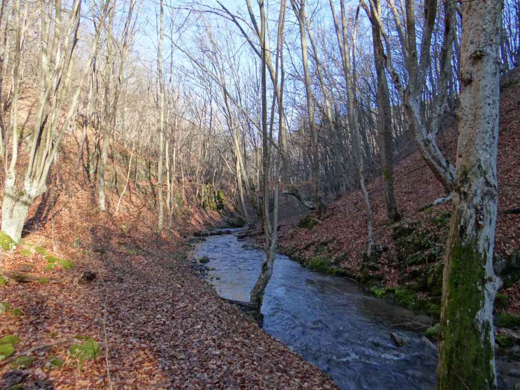
Ruhovtsi is a village 5 km east of the town of Elena. The waterfall is named ‘Hristovski’ after a nearby settlement. Drive from Veliko Tarnovo along the E772 in the direction of Varna. After 10 km, turn right for Elena (33 km). Drive past Elena and continue for another 4 km until you reach the turning on the right for Ruhovtsi (1 km). When you reach the main square of the village, turn right and continue for 1.8 km. Just after crossing a river, you will see a sign for the waterfall on your right and an open space to park your car on the left. Follow the dirt track that leaves the road on your right for about 15 minutes. The dirt track veers left through the forest and then leads directly to the waterfall. This waterfall is attractive because of the width of its cascade.

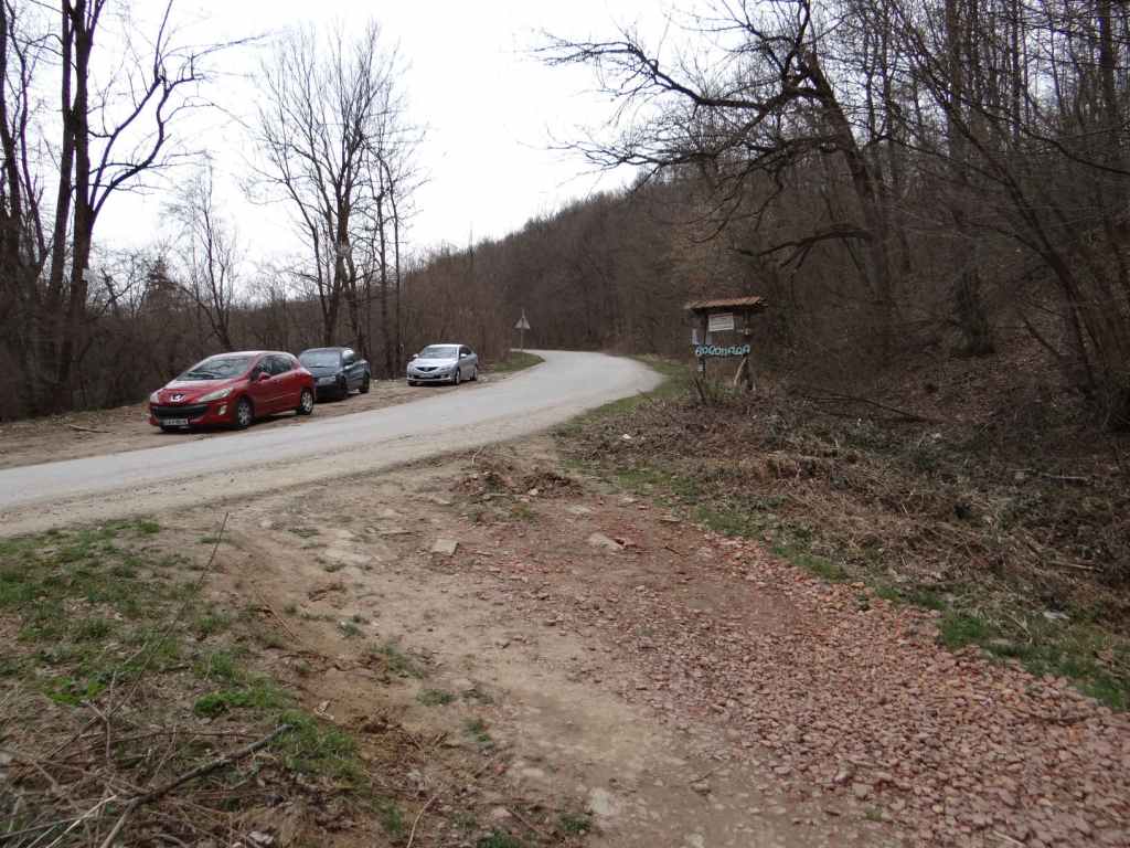
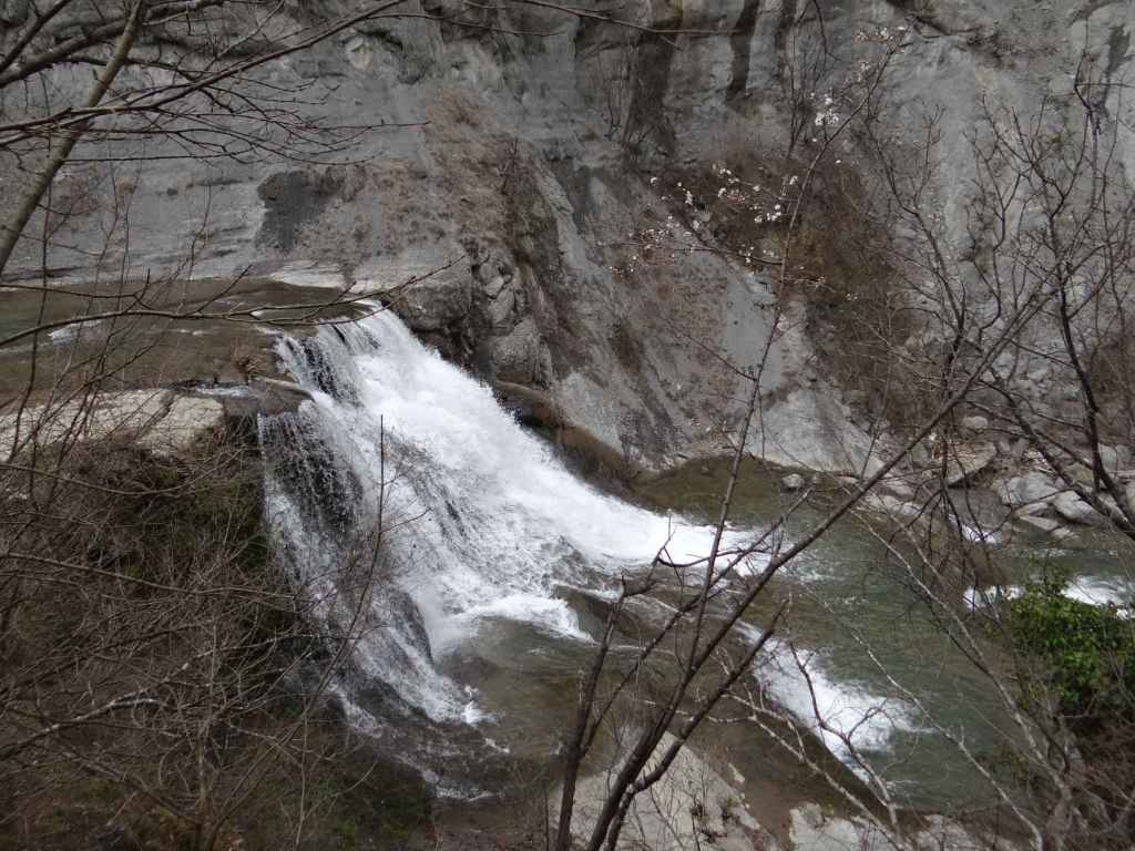
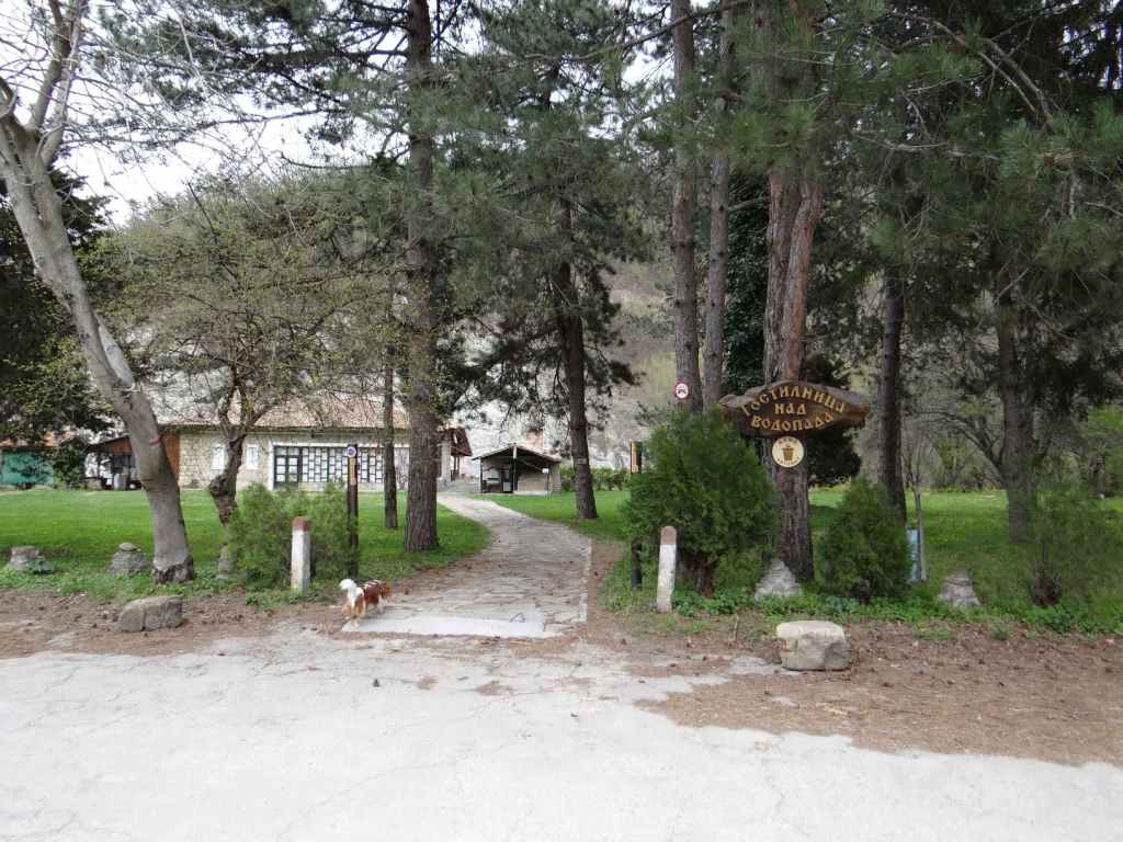
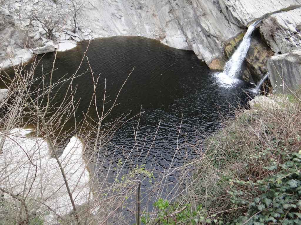
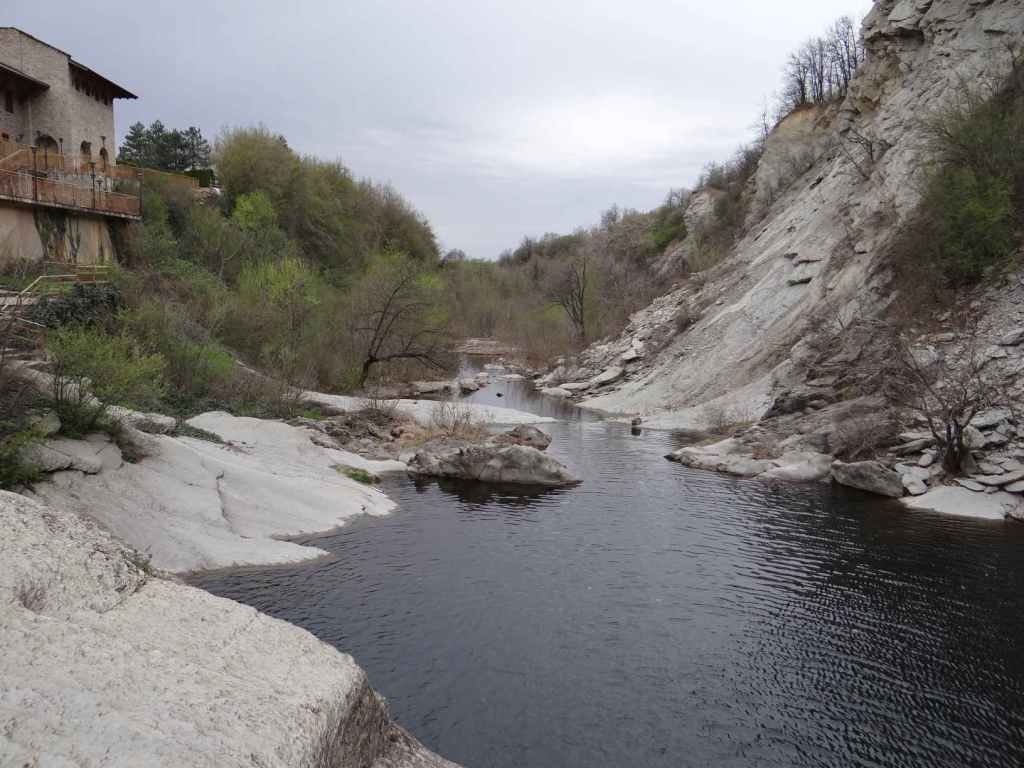
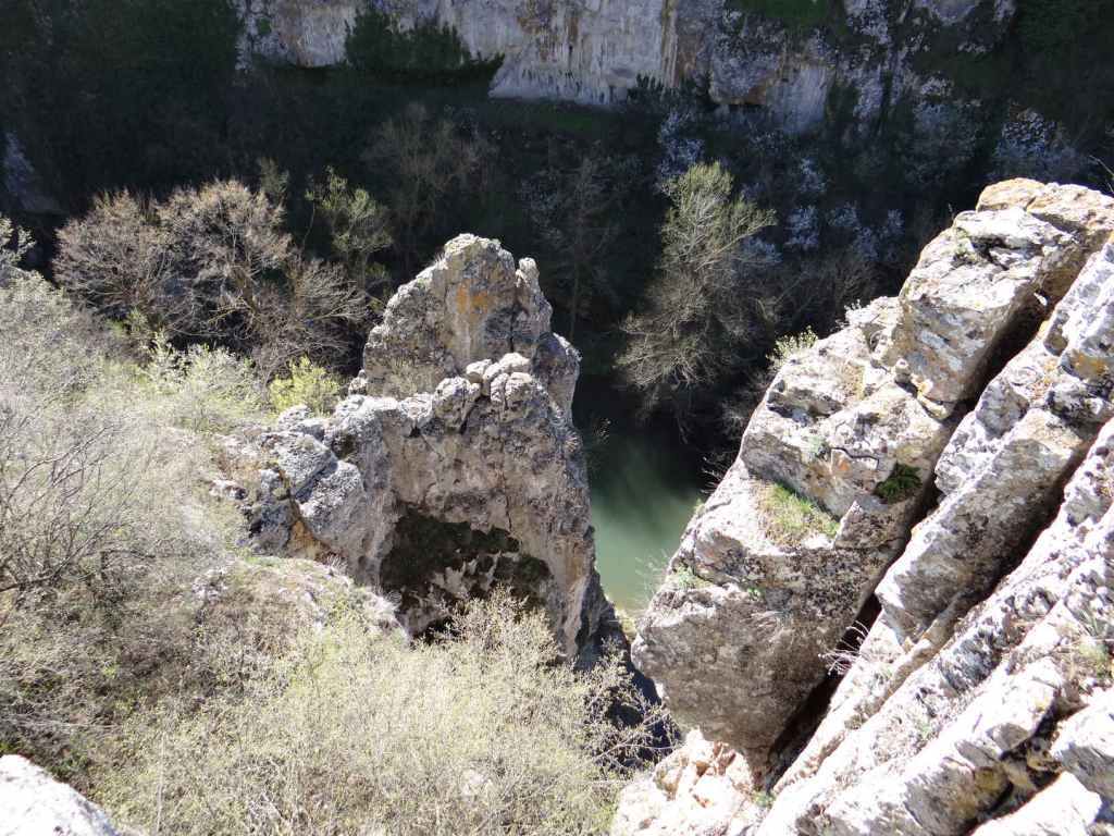
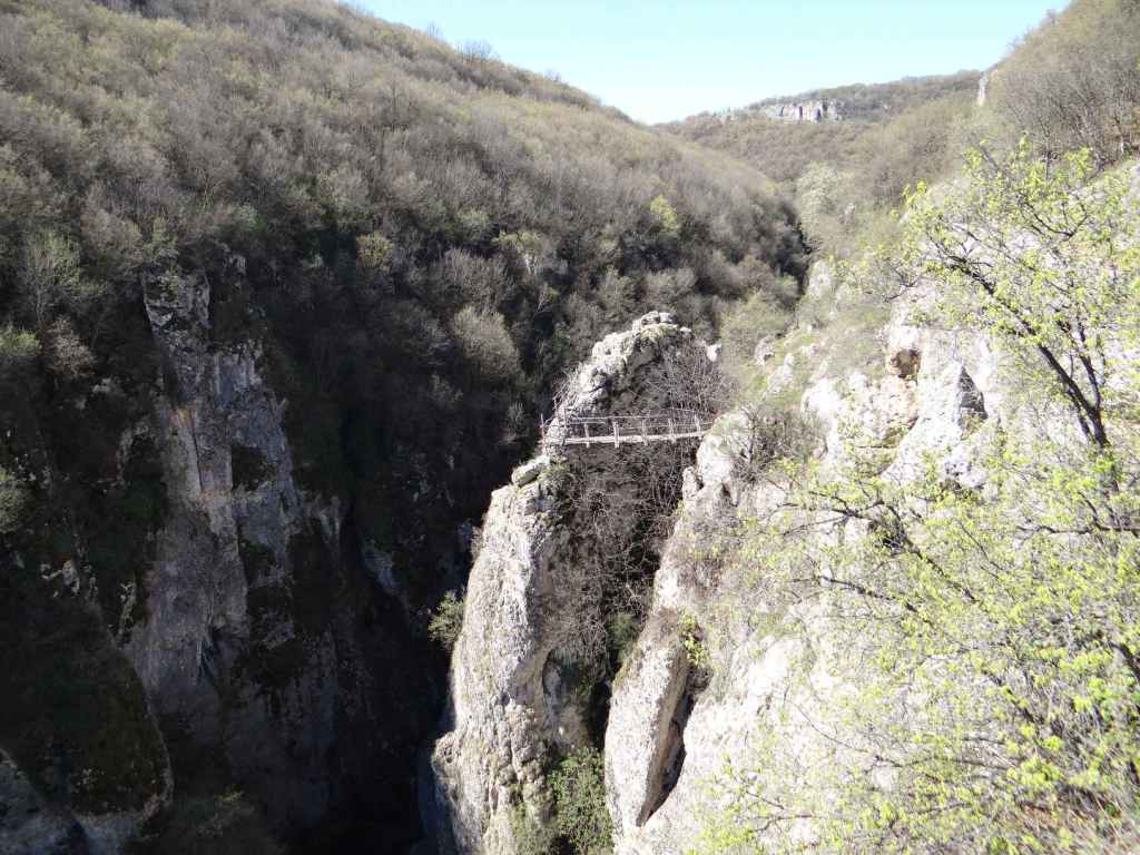
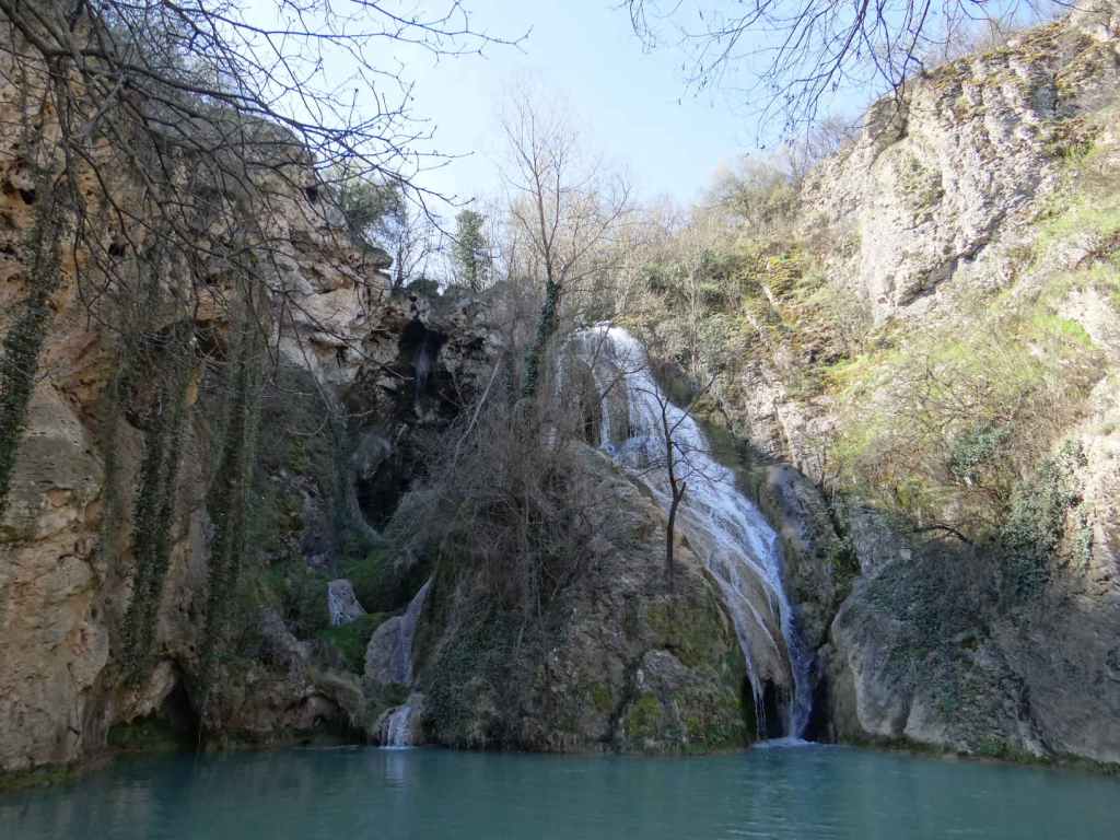
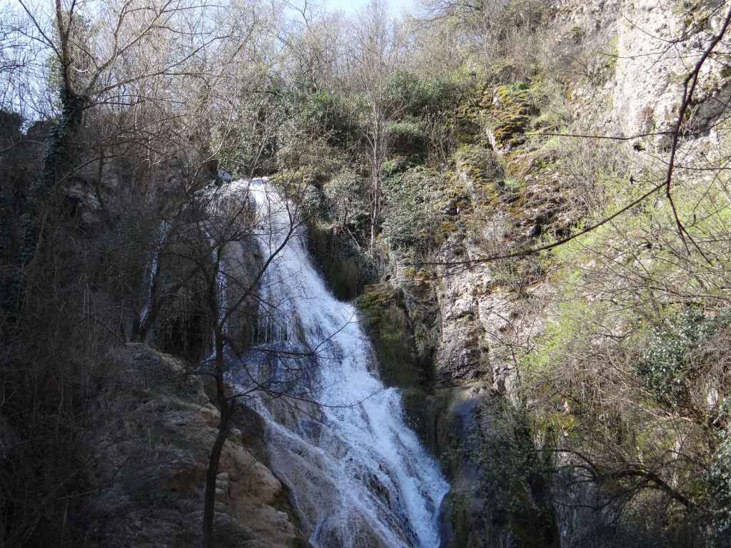
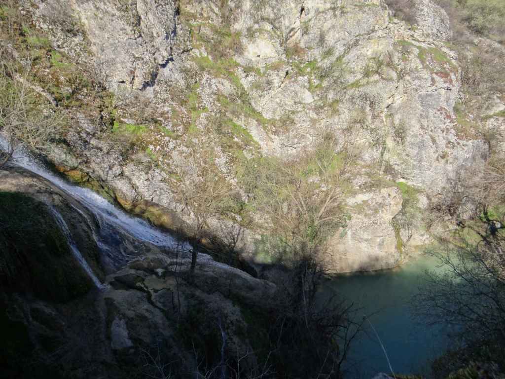
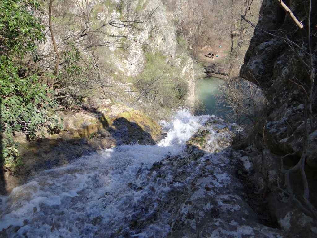
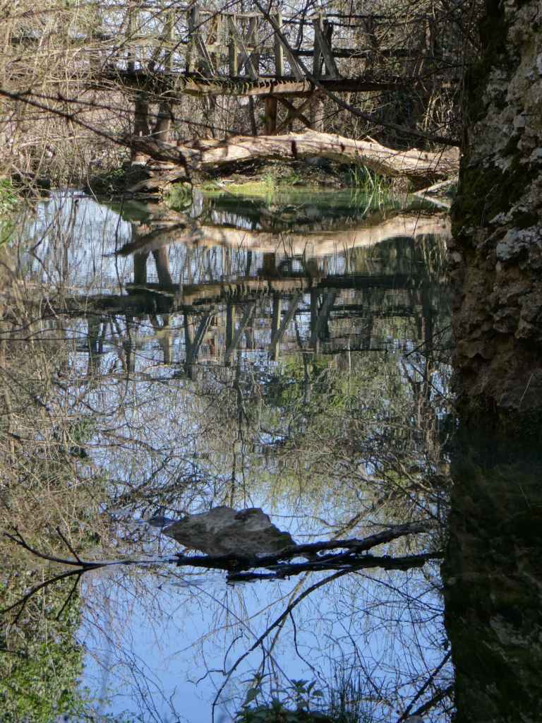
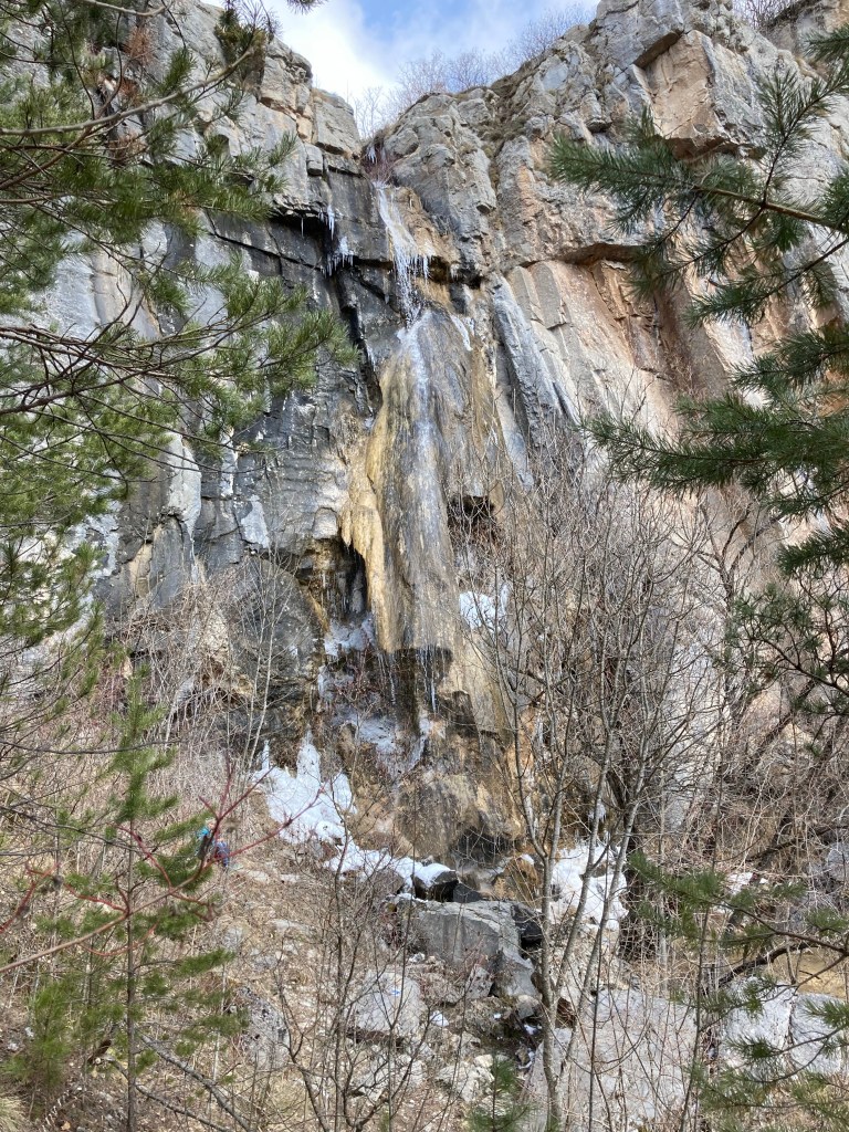
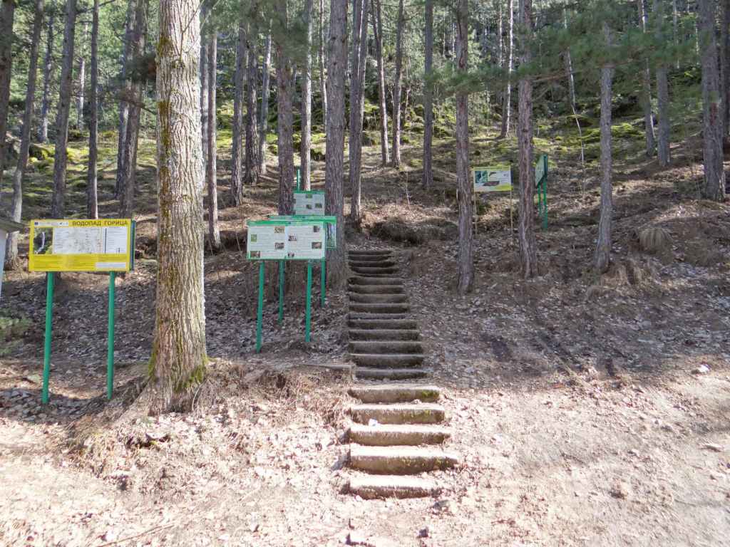
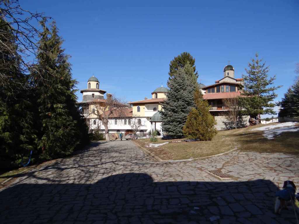
To visit Kapinovo Waterfall, you need to go not to the village of Kapinovo, but to Kapinovo Monastery. The waterfall is in the grounds of the monastery. Drive back past Elena in the direction of the E772. 15 km after Elena, you will reach the village of Mindya. Turn left for Kapinovo. Drive straight through Kapinovo (ignore the sign for Kapinovo Monastery on your left, just before the main square, the road is not fit for normal vehicles), continue through the villages of Tserova Koria and Pchelishte, and then turn left at the sign for Velchevo (7 km). Drive straight through Velchevo and continue for another 6 km to Kapinovo Monastery. The grounds of the monastery have been turned into a campsite. On entering the monastery grounds, you will be able to park the car at a small roundabout. The waterfall is over on your left, by the rocks. There is a guesthouse overlooking the waterfall. The path to the waterfall descends to the right of the guesthouse.

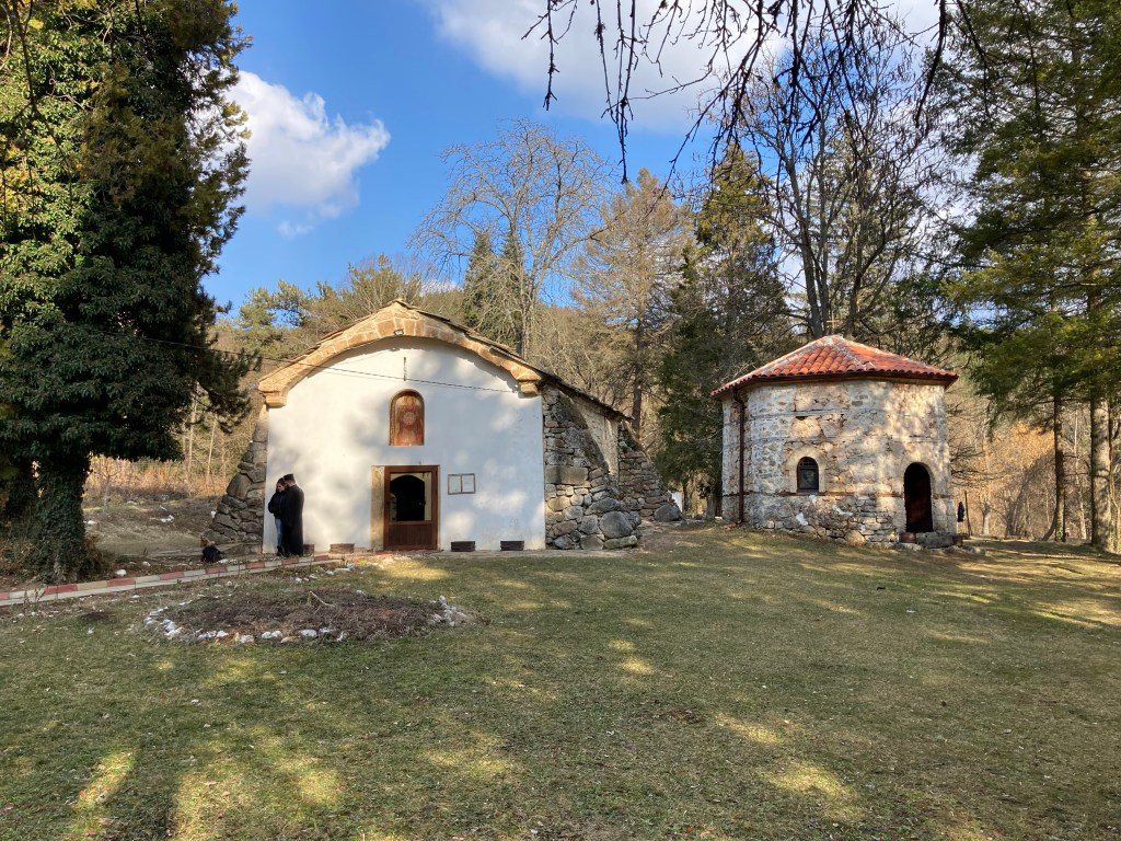
Don’t forget to visit the church of Kapinovo Monastery, which is dedicated to St Nicholas and has an impressive fresco of ‘The Last Judgement’ on its façade. The church is a short distance from the waterfall and can be reached by following a subsidiary road.

Of course, it is possible to visit Kapinovo Waterfall without going to Elena and Ruhovtsi. In which case, all you need to do is to take the E85 south of Veliko Tarnovo in the direction of Debelets, Dryanovo and Gabrovo. After only 1 km, there will be a turning on your left for Prisovo, Kapinovo and Mindya. Take this turning. Drive through Prisovo and then turn right at the sign for Velchevo (7 km). Drive through Velchevo and continue to Kapinovo Monastery.

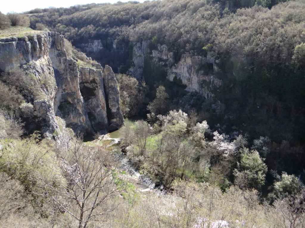
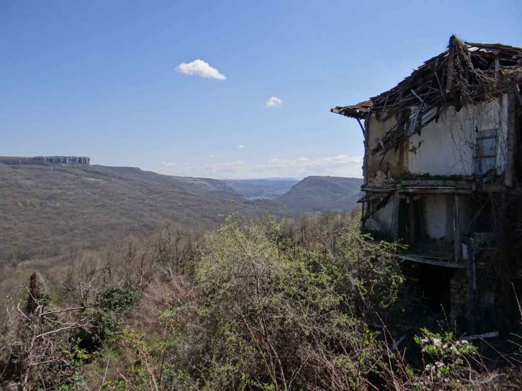
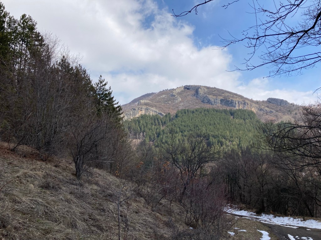
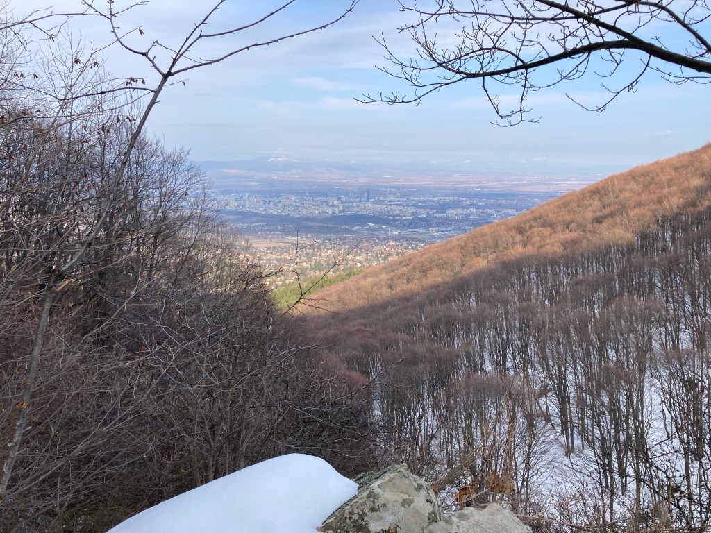
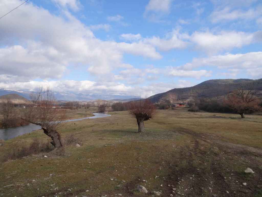
These waterfalls are not as impressive as the waterfalls north-west of Veliko Tarnovo – Hotnitsa, Emen and Vishovgrad – but they are still beautiful and worth a visit. There are numerous other monasteries in or near the surrounding villages of Kilifarevo, Prisovo, Plakovo (this monastery is just before Kapinovo Monastery), Merdanya, Maryan… Just remember while some monasteries are located in the village, most are some distance away – at the end of the road…

Mural in Elena.
The dirt track leaving the road for Ruhovtsi Waterfall.
The dirt track as it passes through the forest.
April blossom!
Ruhovtsi (‘Hristovski’) Waterfall.
Close-up of Ruhovtsi Waterfall.
The waterfall from the side.
The path to Kapinovo Waterfall in the monastery grounds (campsite). The path leads right of a guesthouse.
Kapinovo Waterfall from above.
Kapinovo Waterfall.
Close-up – the rock resembles a dog lapping water!
The peaceful view downstream.
The fresco ‘The Last Judgement’ in Kapinovo Monastery.

Emen

Emen is the second of three waterfalls that lie north-west of the medieval capital Veliko Tarnovo – Hotnitsa, Emen and Vishovgrad. What sets Emen apart is the canyon with the river Negovanka at its bottom. Just before the Negovanka forms a large reservoir, there is a ten-metre waterfall called ‘Momin Skok’, meaning ‘Maiden Jump’ – as with Ovchartsi Waterfall in Rila, this refers to the legend of young girls jumping to their death in order not to be forcibly converted to Islam during the Ottoman occupation of Bulgaria (14th-19th centuries).

To get there from Veliko Tarnovo, take the main road to Sofia (E772) and after 20 km turn right for the village of Balvan. Follow the road to the centre of this village and then turn right for Emen (8 km). Be careful because there is a sign for Emen in Balvan that has been turned back to front and seems to indicate that you should go straight ahead when the road veers left. This is not the case. The road veers left and after a short while you reach the centre of the village.

Here you turn right and after 8 km arrive in Emen. The road takes you over a bridge on the river Negovanka and immediately you arrive at a small square opposite the town hall where you can park the car. There is also drinking water. A smaller road leads to the right, following the left bank of the river. The road becomes a dirt track and then a path. After fifteen minutes, you reach a wooden suspension bridge over the river, but you stay on the left bank. The path climbs up to another dirt track, which then leads on your right to the beginning of the ecopath, where there is a cave. The cave is 3 km long and is home to various species of bat. In communist times, it was used as an arms depot for a military base located directly above it.

The ecopath is said to have been the first in Bulgaria and was created in 1992, shortly after the fall of communism. I think the initial idea was to follow the course of the river at the bottom of the gorge, but the wooden bridges crisscrossing the river have long since succumbed to the elements, which is a shame, and now the ‘ecopath’ actually runs along the top of the canyon on the left. From the beginning of the ecopath, where the cave is, to the waterfall is about forty minutes. The path takes you up to the top of the canyon and then winds along the edge, in amongst trees. After about thirty minutes, the path divides, but it doesn’t matter which branch you take – one continues among the trees, the other skirts the precipice. The path then descends to the left (this is clearly marked by blue arrows) to rejoin the river at the bottom. Turn right, and you will arrive at the waterfall in five minutes. You can hear the waterfall from the top of the gorge.

It is possible to drive to the start of the ecopath. Continue past the main square in Emen and after about 200 m you will reach a crossroads. Turn right, and just as you are leaving Emen, a dirt track forks off to the right, leading to the ecopath. Continue along this road, without taking the dirt track on your right, and in a short while you will reach the waterfall of Vishovgrad, ‘Zarapovo’. Both waterfalls can easily be visited on the same day since they are only a short distance apart.

The Negovanka River as it passes through Emen.
The wooden suspension bridge in Emen.
The path on the left bank of the river joins the dirt track leading to the start of the ecopath.
The start of the ecopath – steps leading up to the cave, the 17th longest in Bulgaria at just over 3 km.
The start of the ecopath, after the cave.
Having immediately climbed to the top of the canyon, view of the canyon itself.
Cragged rocks.
View up the canyon.
The path divides – either branch will lead to the waterfall.
The remnants of the ecopath clinging on for dear life!
A blue sign indicates the beginning of the descent from the top of the gorge to the waterfall below.
Emen Waterfall.
Close-up of the waterfall.
Panoramic view of the waterfall.
If you decide to drive to the start of the ecopath, you need to take the dirt track on the right. Continue along the asphalt road, and you will soon reach Vishovgrad Waterfall.

Hotnitsa

There are three waterfalls north-west of Veliko Tarnovo – near the villages of Hotnitsa, Emen and Vishovgrad. Hotnitsa (‘Kaya Bunar’) is the closest. The journey takes about forty minutes, and on the way back you have the chance to visit one of the most beautiful monasteries in Bulgaria, Preobrazhenski (‘Transfiguration’) Monastery.

The waterfall is where you park the car and is undoubtedly one of the most magical and mystical waterfalls we have visited. To get there from Veliko Tarnovo, follow the brown signs for Preobrazhenski Monastery and for the ancient Roman town Nicopolis ad Istrum. These signs will take you north of Veliko Tarnovo, from where you join the E85 and head in the direction of Samovodene. This main arterial road that joins the towns of Haskovo in the south and Ruse in the north passes along the gorge formed by the river Yantra. After a short while, you will pass the turning for Preobrazhenski Monastery on your left. Keep going straight. In Samovodene, the road divides – the right fork is signposted for Ruse, the left for Resen. You take the left fork and, about a kilometre after leaving Samovodene, take the turning left signposted for the villages of Hotnitsa (5 km) and Pavlikeni.

When you arrive in the centre of Hotnitsa, the waterfall is clearly signposted on your left. The distance from the centre of Hotnitsa to the waterfall is 3 km, and it is clearly signposted all the way. The road ends at the waterfall, where you can park the car. This astonishing waterfall is on your left. The colour of the water is turquoise blue because of the karst spring and limestone rocks.

There is an ecopath (1.5 km) that takes you up the left-hand side of the waterfall, a little up the gorge above the main waterfall and back along the top of the gorge on the right. This ecopath is not for the faint-hearted! I did it carrying our dog, but there are places where you have to climb or descend steep wooden ladders and clamber over the rocks. There are several wooden bridges that take you from side to side of the river Bohot. You can literally stand at the top of the main waterfall. There are smaller waterfalls further upstream. Once you have reached the top of the gorge on the right, the path descends slowly back to the café at the bottom.

On your return to Veliko Tarnovo, don’t miss the chance to visit Preobrazhenski Monastery, which overlooks the Yantra gorge and offers views back to Veliko Tarnovo. The church was built by noted Bulgarian National Revival architect Kolyu Ficheto and painted by another nineteenth-century Bulgarian artist, Zahari Zograf (who also painted Rila and Troyan Monasteries). It has some of the most beautiful frescoes in Bulgaria, including the famous fresco ‘The Circle of Life’ on the outside of the building. Behind the church is a very large rock that missed the church by inches and has been left there to remind us of God’s providence! On the opposite side of the gorge can be seen another important monastery, the Patriarchal Monastery of the Holy Trinity.

The road from the village of Hotnitsa ends at the waterfall.
An overview of Hotnitsa Waterfall.
The upper part of the waterfall.
A view from the side.
A view from the ecopath above – note the turquoise blue water!
The ecopath (no, it’s not a dungeon!).
A view back to the pool below the waterfall.
Standing at the top of the waterfall – be careful!
A smaller waterfall further upstream.
One of the wooden bridges crossing the river Bohot.
One of the steep wooden ladders.
The sun captured in the river.
A view from the top of the gorge back to the car park.
The fresco ‘The Circle of Life’ at Transfiguration Monastery.
View from Transfiguration Monastery to Veliko Tarnovo – note the plateau on the left, above the gorge, where the village of Arbanasi with its famous churches is situated.

Dobravitsa

The longest river to run entirely in Bulgaria is the River Iskar, which rises in Rila Mountain and flows into the Danube between Bulgaria and Romania. Geologically, it is the oldest river in the Balkan Peninsula. Plenty of reason to admire it, then.

North of Sofia, it forms the Iskar Gorge, a fact that is taken advantage of by the railway, which runs alongside the river. The first major town heading north from Sofia is Svoge, famous for its chocolate factory, and from here Dobravitsa Waterfall is only twelve kilometres away!

So expect a windy road that follows the course of the river, with some spectacular views. To get there from Sofia, you need to go round on the ring road to Novi Iskar and then follow the signs for Svoge and Mezdra. Svoge is 38 kilometres north of Sofia, so the distance to the waterfall is 50 kilometres, but because of the twists and turns the journey takes about an hour and a half.

When you enter Svoge, do not follow the signs for the centre, which is left of the main road. Keep going and turn left when you reach the sign for Iskrets. You will pass the chocolate factory on your left and now you are following the course of another river, the Iskretska. Drive through Iskrets, but before you exit the town, take a right turn for Breze (5 km). This takes you up into the hills.

Pass an abandoned factory, and shortly after you ‘enter’ Breze (though the village itself is further on) you will see a dirt track leaving the road on your right. This is signposted for the waterfall and for the village of Dobravitsa. You can either park the car here, next to the main road, or risk driving your car up to the village. The distance from the main road to the waterfall is 3.9 km and takes about an hour and twenty minutes. If you drive to the village, the distance to the waterfall is 1.7 km and takes about forty minutes.

Immediately as you enter the village of Dobravitsa, the track veers to the right (the village is ahead of you). Follow this track for 800 m. When the track forks, turn left. The waterfall is another 900 m. There are some wonderful views over the hills, and you can see back to Iskrets.

As you approach the waterfall, you will see a remarkable rock formation on top of the hill in front of you, forming the Greek letter omega (Ω). Follow the rock with your eyes as it descends to the left. The waterfall is at the end. As the track veers back on itself, you leave the track and continue on a path to the waterfall, which is directly in front of you.

On your return through Iskrets, do consider stopping at Iskrets Monastery, which is in the grounds of the Tsar Ferdinand I Hospital, a specialized lung hospital. There is another beautiful waterfall just north of Svoge, near the village of Bov. The autumn colours here are amazing! But this might be better left for another day!

The Iskar Gorge with the railway running alongside it (in the background is Vitosha, the mountain south of Sofia).
The River Iskar as it passes through Svoge.
The dirt track leaving the road in Breze (the yellow sign is for the waterfall, the blue sign is for the village of Dobravitsa).
The dirt track leading to the village of Dobravitsa.
At the entrance to the village, the track veers right (again, the waterfall is signposted).
An island in the sky.
Here, the track forks – turn left (again, the waterfall is signposted).
The Omega formation on the hill in front of you.
Ice in a rut!
The waterfall in front of you.
Arriving at the waterfall.
The waterfall close up.
When we were there, ice kept cracking off the rock and landing in the water near us!
An overview of Dobravitsa Waterfall.
Iskrets Monastery.

Ovchartsi

Undoubtedly one of the most beautiful waterfalls in Bulgaria, Ovchartsi Waterfall is named after a Bulgarian maiden, Goritsa, who lived in the local village and was betrothed to a shepherd called Yovitsa. This was during the time of Turkish slavery, Ottoman rule in Bulgaria during the fourteenth-nineteenth centuries. The Turkish overlord or bey was struck by Goritsa’s beauty (it must have been a slightly terrifying time to be beautiful) and ordered his servants to fetch her for him. Goritsa took to the hills, in search of Yovitsa, who was watching his flocks, but the servants reached her before she could get to him, so she threw herself off the cliff. Ever since then, the waterfall (39 metres) and the river have borne her name.

The waterfall is above the village of Ovchartsi on the northern slopes of Rila Mountain. To get there from Sofia is about an hour and a quarter by car. You take the motorway to Greece (Kulata) and leave the motorway at the signs for Dupnitsa. You actually leave the motorway seven kilometres before Dupnitsa and follow the old road into Dupnitsa, past a succession of second-hand car dealers. On entering Dupnitsa, you take a right just before the OMV petrol station, signposted Sapareva Banya. You then follow this road, ignore a left turn that is signposted Plovdiv and Samokov and continue to the next set of lights, where you turn left for Sapareva Banya and Panichishte. If you take the road for Plovdiv and Samokov, you will have a very picturesque ride alongside the northern slopes of Rila, but you will not be able to reach the villages that nestle on these slopes. This is why you continue to the next set of lights and turn left here. This road takes you through the villages of Samoranovo and Resilovo to Ovchartsi.

In Ovchartsi, head to the central square, where there is a town hall and a children’s playground. Turn right on the near side of the square and go straight up the steep road in front of you, which bears right at the top, leading to a fountain and a place to park. From here, continue on foot. There is an ecopath to the waterfall, and it only takes about fifteen minutes to get there. Admire the view. When we went in February, there was a lot of ice, which made the path very slippery and people were having difficulty going up and down (with the inevitable laughter).

You can also make your way down to the river below the waterfall, but to do this you have to leave the path and climb down a slightly steep slope. Heading upstream, you will come to the lower part of the waterfall, with a wonderful view of the rocks above and trees silhouetted against the light.

Between Resilovo and Ovchartsi is the Resilovo Convent of the Holy Protection. It is a short drive from the road. The nature is beautiful, and the church has stunning frescoes. You can light a candle for your loved ones and enjoy the view back to Sofia!

The road into Dupnitsa, flanked by second-hand car dealers. Rila Mountain is right in front of you.
The fountain where you can park the car.
The steps at the start of the ecopath, with information boards in Bulgarian and English.
A peak in the distance.
A second, longer flight of steps.
With a wooden bridge at the top, leading to the waterfall.
Ovchartsi Waterfall.
The upper waterfall.
A sign with the story of Goritsa (Goritza).
The lower waterfall, seen from above. From here, the rock resembles the head of a young woman.
Beautiful February cloud formations.
The ice rink!
The river below the waterfall.
The lower waterfall. The rock now resembles the head of an old woman.
Directly above the rock, note the figure in white against a black background that seems to be jumping, thus confirming the legend.
The whole waterfall, seen from below.
Ovchartsi Town Hall (which has pictures of the waterfall).
Resilovo Convent of the Holy Protection.

Aleko

There are two waterfalls on the outskirts of Sofia, on the lower slopes of the mountain that overlooks Sofia from the south, Vitosha. They are Aleko and Boyana. Aleko is the name of the last stop on the cabin lift that climbs the mountain from the Simeonovo district of Sofia and finishes a few hundred metres shy of the summit, Cherni Vrah (‘Black Peak’). Aleko Waterfall, however, is much lower down the mountain, between the districts of Dragalevtsi and Simeonovo.

To reach Aleko Waterfall, the best way is to head to Dragalevtsi Monastery, one of the oldest monasteries in Sofia, which has an old church with valuable frescoes. Above the monastery is a car park. From the far corner of the car park a path leads directly up the mountain, with the monastery residential building on the left, but you don’t have to go any higher up the mountain. Instead you take a path that forks immediately left (with the monastery behind you and on your left) and then you stay more or less at the same height and wind your way around the mountain. Within a few minutes, the path forks again. Do not be tempted to start to climb the mountain; take the left fork and continue until you reach two wooden bridges crossing the Dragalevska River. This is a charming spot, with the river threading through the forest, and there is a wooden walkway between the bridges to help you keep your feet dry!

Continue at the same height. The path winds through a wonderful beech and pine forest. After a short time, you reach the disused Dragalevtsi-Goli Vrah chairlift, my first experience of taking a lift on Vitosha Mountain. It was like sitting on a park bench suspended in mid-air and for me, a novice at the time, it was a terrifying experience. I gradually became used to it, but sadly the lift has been discontinued. This is a shame since it offered a very useful way for walkers and mountain bikers to head up the mountain.

At a later stage, you will come across a fountain with a bench and a small icon of the Mother of God. All the time, paths continue up the mountain or drop down, but there is no need to change your height. After about an hour, there is a rocky outcrop with one of the most beautiful views of Sofia down below. Be careful not to go too close to the edge! This is an ideal place to stop and take some refreshments. You are now two minutes away from the waterfall. Continue along the path, and you will come to the waterfall, which when I visited in February was partially frozen and made for a wonderful sight.

The waterfall is formed by the river Skakavitsa, and I understand there is a second, smaller waterfall further down. You now have a choice to retrace your footsteps (if you have left the car in the car park) or to continue to Simeonovo and the Simeonovo Lakes, a set of small, artificial pools, which takes another half an hour. Buses go to and from the districts of Dragalevtsi and Simeonovo, so whether you retrace your footsteps or continue to Simeonovo, you should be able to take a bus from there back to the centre of Sofia.

A tree has been protected by a fence. On the left is the wire fence surrounding Dragalevtsi Monastery.
The monastery buildings through the trees.
The path forks almost immediately. Keep left.
A wooden bridge over the Dragalevska River.
Snow and beeches!
The disused Dragalevtsi chairlift, with Sofia in the background.
More cables cut through the forest, offering another view of Sofia.
Beneath the snow is one of many moraines – rocks left by glaciers – on Vitosha Mountain.
Small trees pushing against the odds.
Rock formations.
The rocky outcrop just before the waterfall.
From here you are within touching distance of the waterfall.
The waterfall, which in February was partially frozen.
A more general view of the waterfall.
The rocky outcrop offers one of the best views of Sofia.

Chavdar

Chavdar is a pretty village about seventy kilometres due east of Sofia, a little south of the main road, the E871, that connects Sofia with Burgas on the Black Sea coast. This road runs alongside the Balkan mountain to the north, so from Chavdar and the walk to the nearby waterfall of Kazanite you get wonderful views of the Balkan itself. To the east, you also get a glimpse of the industrial town of Pirdop.

You drive straight through the village and continue for another three kilometres along the asphalt road until you reach the river Topolnitsa, a beautiful river that looks like elephant hide. Here the asphalt road becomes a dirt track. We went in January and decided to park the car on the verge just before the bridge. You then walk about 700 metres along the dirt track in front of you before cutting through the forest on your right (there is a signpost), again along a rutted track that climbs the side of the hill, offering wonderful views of the Balkan and Pirdop behind you.

You reach the top of the hill, and the track begins to descend. Shortly afterwards, there is a steep path going directly down to the waterfall. Again, this is signposted. The path leads to a metal bridge over the waterfall and to a picnic table on the other side, next to the stream (a tributary of the Topolnitsa). From here, you can see the top of the waterfall, but the only way to get a general view of the waterfall like the one in the photos is to backtrack a little and then edge your way along the side of the stream until you can see the waterfall in front of you. The ledge you walk along is narrow, so this is not for the fainthearted! You can also walk off the path down to the stream below the waterfall and again look upstream to the waterfall, though from here you will only see the lower part of the waterfall.

The waterfall is called ‘Kazanite’, meaning ‘The Cauldrons’ in Bulgarian. The various pools look like cauldrons, the running water is the ingredients being stirred. In the photos below, you can see the walk to the waterfall, which takes about an hour and a half, and the waterfall itself. A perfect day out from Sofia. On the way back, you can stop in the village of Chavdar and have a drink in the centre.

The river Topolnitsa, where we left the car.
A view alongside the Topolnitsa.
The rutted track running through the forest.
A view west (the side of the hill is being mined for something).
Beautiful white winter blossom.
Looking back – the Balkan mountain to the north of Chavdar and the E871.
The road ahead!
The bare forest – down below is the stream that creates the waterfall. We are nearly there!
The short path leading down to the bridge over the waterfall.
A general view of Chavdar Waterfall (I am standing on a ledge!).
A close-up of the waterfall. Note a waterfall comprises two things: the water and the rock around it.
A fiery heart in the forest. You can see the stream below the waterfall and an open area to the left.
Ditto. You can see the path on the left, which has a wooden handrail.
The open area next to the stream below the waterfall. You have to leave the path to get here.
Looking back up to the lower part of Chavdar Waterfall, with a January sunset.