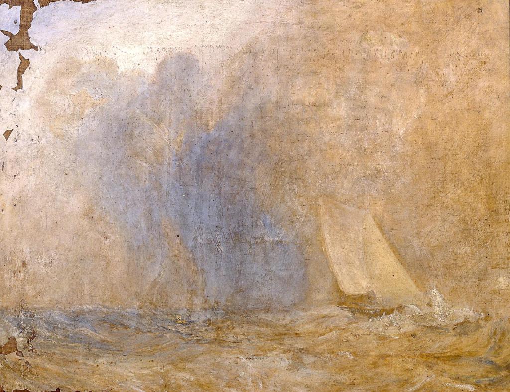
Turner’s painting Seascape with a Yacht (?), c. 1825-30, is somewhat cursorily dismissed on the Tate Gallery website. It doesn’t get a display caption, like most of the paintings. There is a catalogue entry, but it is short and rather scathing – “thinly and freely painted […] lack of drama and small size” – and ends: “There are some losses down the left-hand edge and particularly at the top corner. The picture has not yet been restored.” No wonder it wasn’t put on display.
There even seems to be uncertainty about the title (that question mark in brackets) and about the date (circa a period of five years). Everything points to a painting unworthy of our attention. And yet it is the gift of the poet to see something extraordinary in the ordinary, and in her book Turner and the Uncreated Light the Bulgarian poet Tsvetanka Elenkova does just this. Let us look at the painting:
Not much, right? A splodge which is falling to pieces. There appears to be a yacht (is it a yacht?) on the right, and some waves. But the poet has noticed the predominantly ochre colour of the painting. The sea looks less like a sea than a desert. The yacht she understands to represent the people of Israel crossing the desert. And that tall white wave at the bow of the yacht she takes to be the prophet Moses.
Then she draws our attention to the large blue area in the left half of the picture, standing, as it were, on the waves. She understands this to be Archangel Gabriel. We can see the fold of his tunic where it crosses on his chest, in a lighter colour. Out of the tunic appear his neck and head. He is looking towards the yacht, watching over the people of Israel as they make their way to the promised land. Behind him (again in a lighter colour) we can see the outline of his wings.
It may help at this point to reproduce a fresco of Archangel Gabriel found in the medieval Church of Sts Peter and Paul in the old Bulgarian capital Veliko Tarnovo (in central Bulgaria) because there is an obvious similarity between the two images:
Fresco of Archangel Gabriel in the Church of Sts Peter and Paul, Veliko Tarnovo, Bulgaria
Again, the tunic is folded over on his chest. The angel’s skin is darker than the cloth of the garment. And we can see the outline of his wings. He is writing on a scroll (“Wash yourselves and be clean learn to do good”) – perhaps that is the meaning of the dark blue patch to the right of the angel in Turner’s painting.
And in the painting she also sees a horse’s head in the ochre sky above the yacht and slightly to the right. It is possible to make out the horse’s eyes and nostrils. Admittedly we can always disbelieve. Then the magic of the painting begins to recede, and we are left with a tattered painting. But the poet’s vision is so much richer. Here we have a depiction of the Exodus – this is why the painting has not been restored, we haven’t got there yet. We are on the way, a prophet leading us, a guardian angel over our shoulder. As with the other paintings, not for a moment do I think Turner consciously painted these things. It’s just he received the same inspiration as the painter of the fresco in a church in central Bulgaria several hundred years earlier. It is the same Spirit working through him.
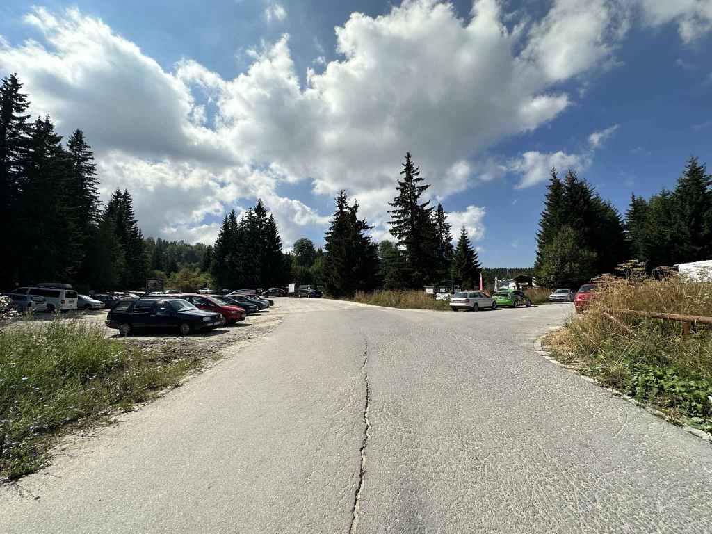
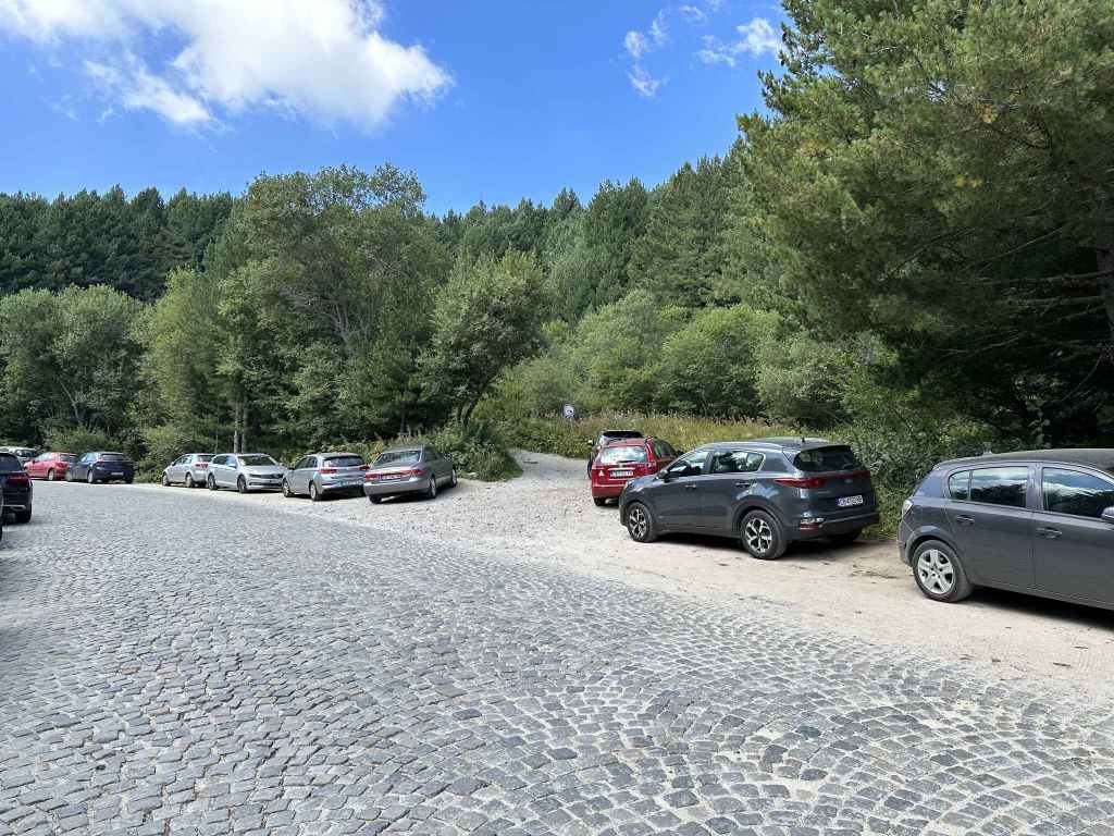
Transport: by car, or by bus no. 69 just past Zheleznitsa (this still leaves a significant distance)
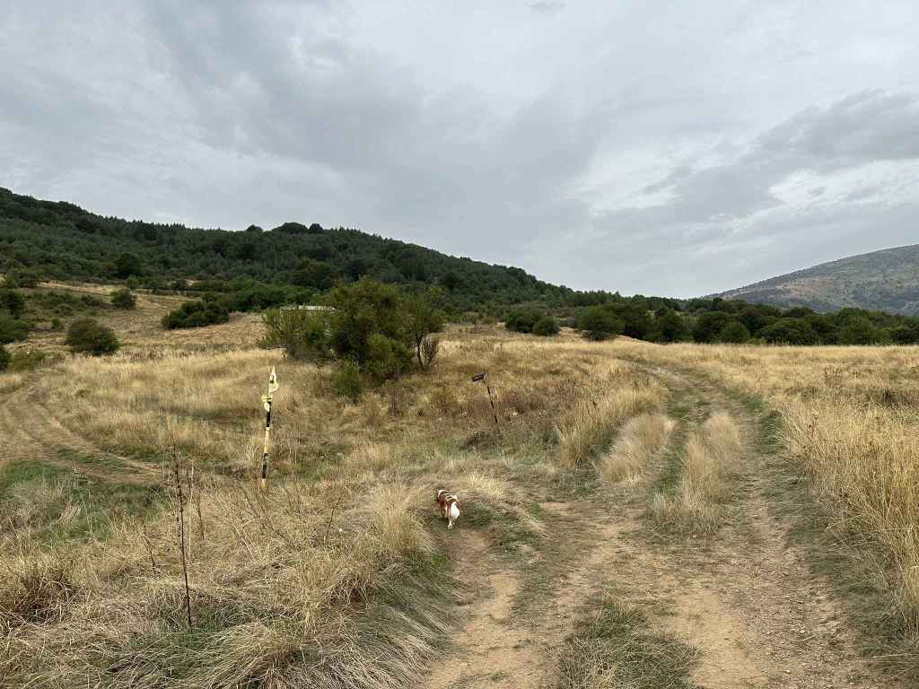
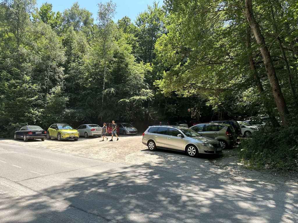
The turning right to Yarlovo in Kovachevtsi.
The main square in Yarlovo.
The street heading north-west in the direction of Cherni Vrah via Golemiya Rid.
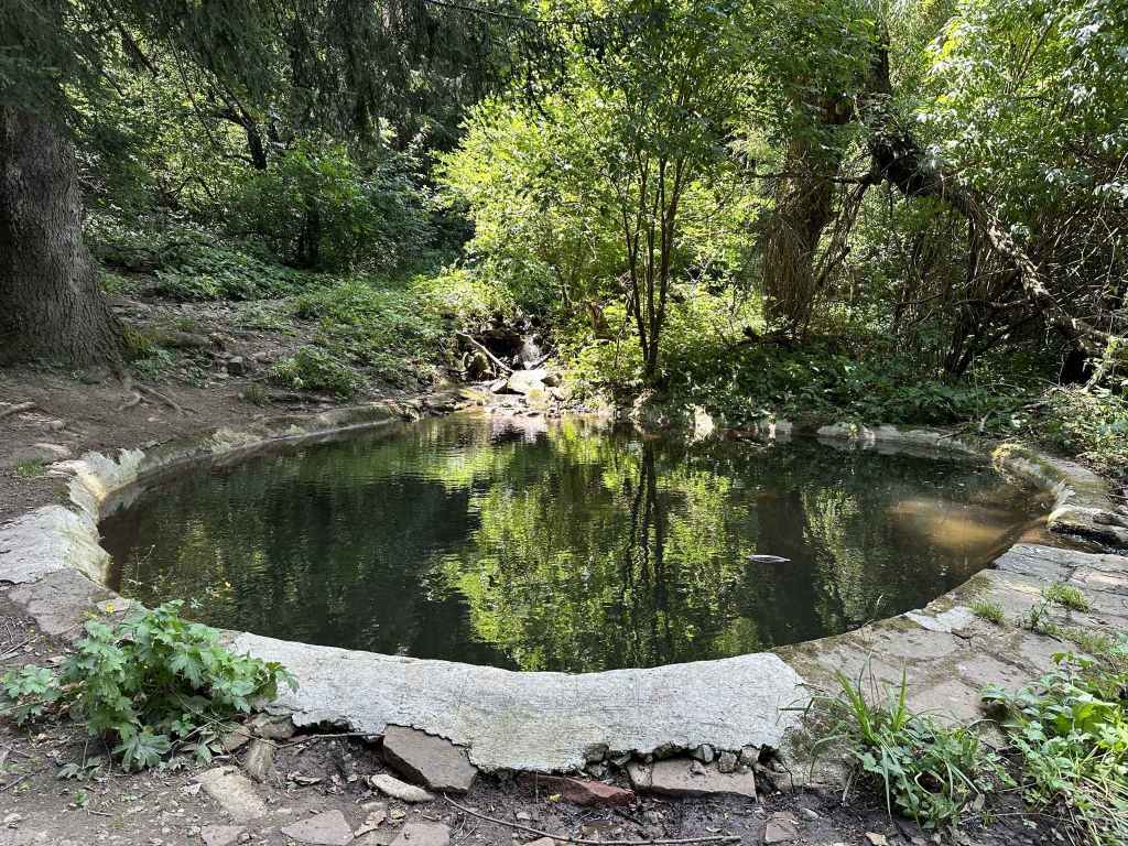
The track as it crosses the river Palakaria.
The track now continues on the west bank of the Palakaria.
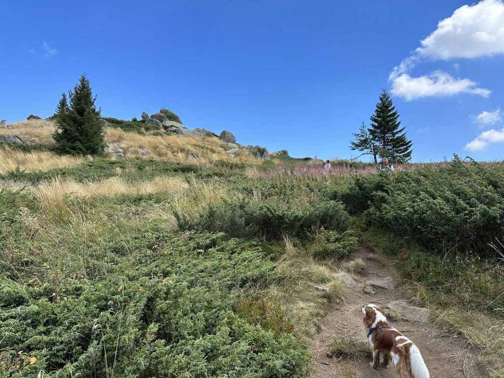
After fifteen minutes, the path divides. Go left here.
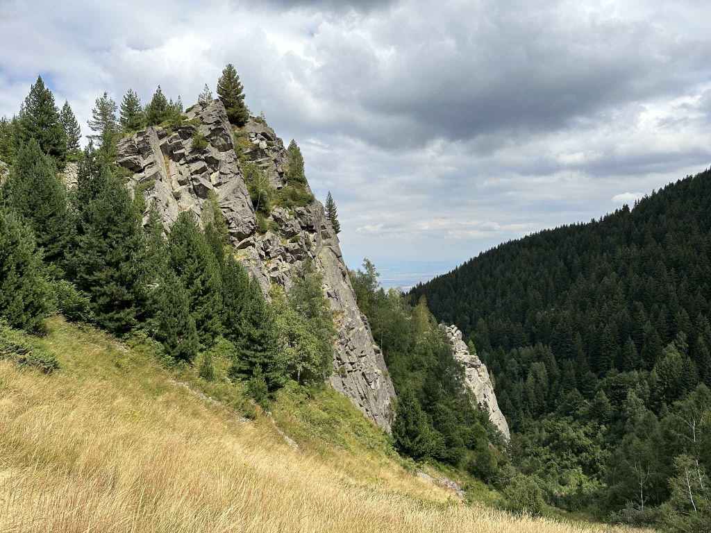
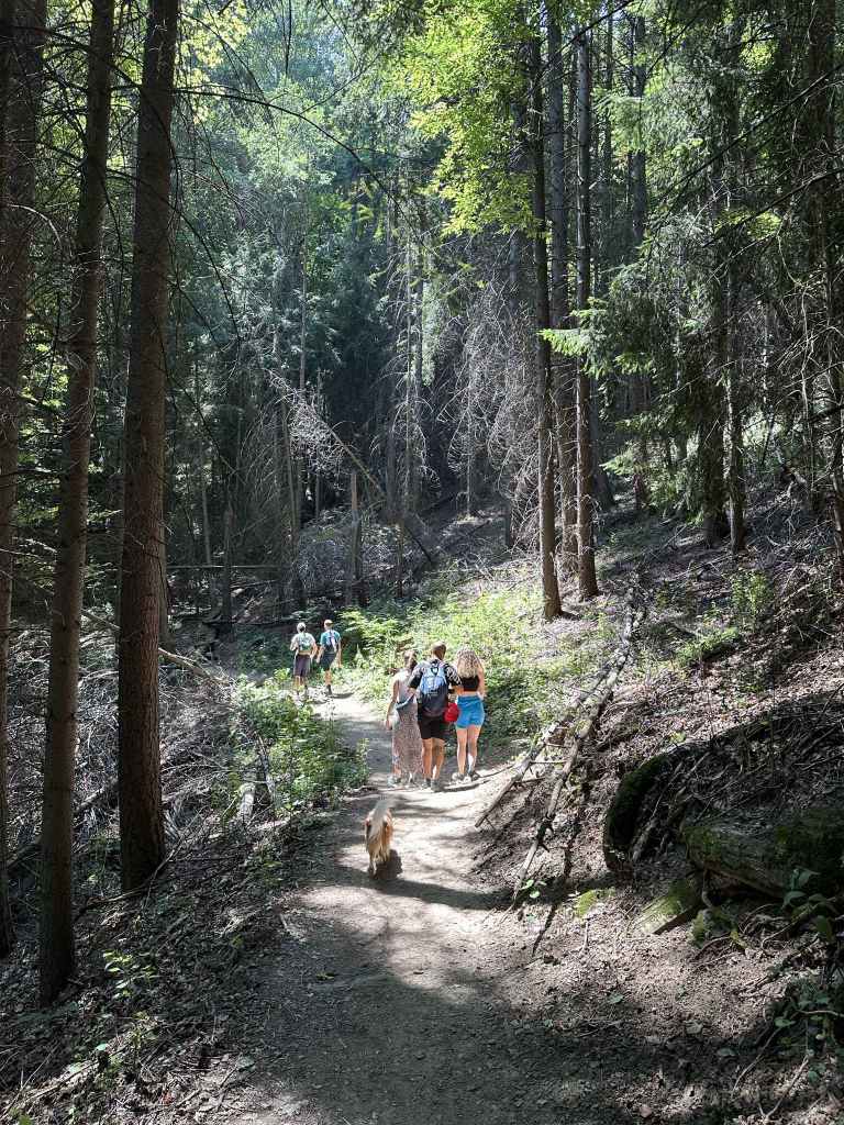
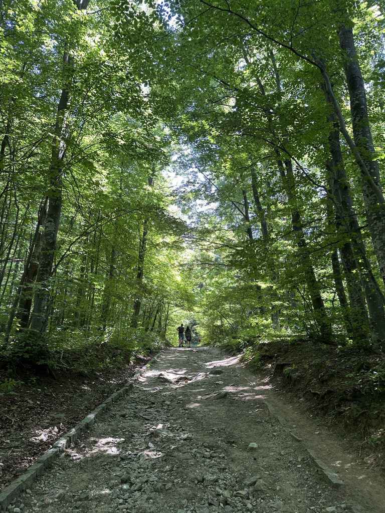
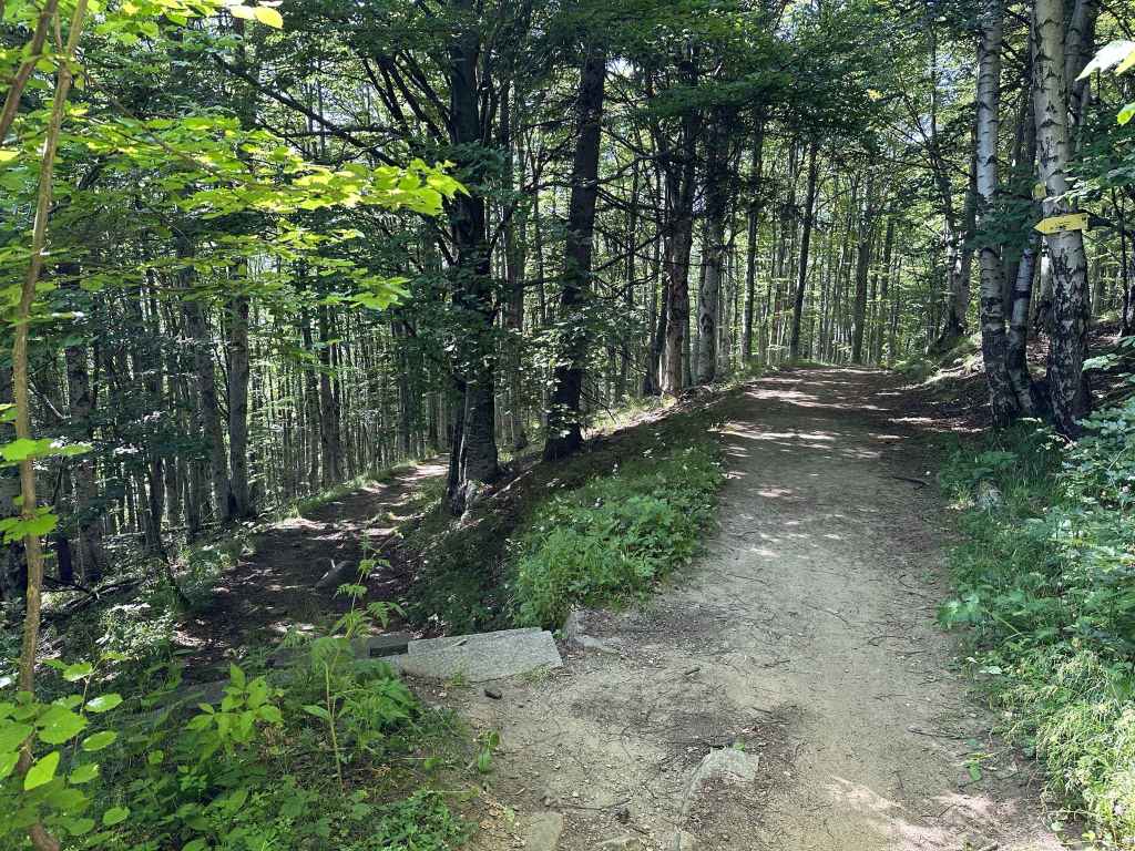
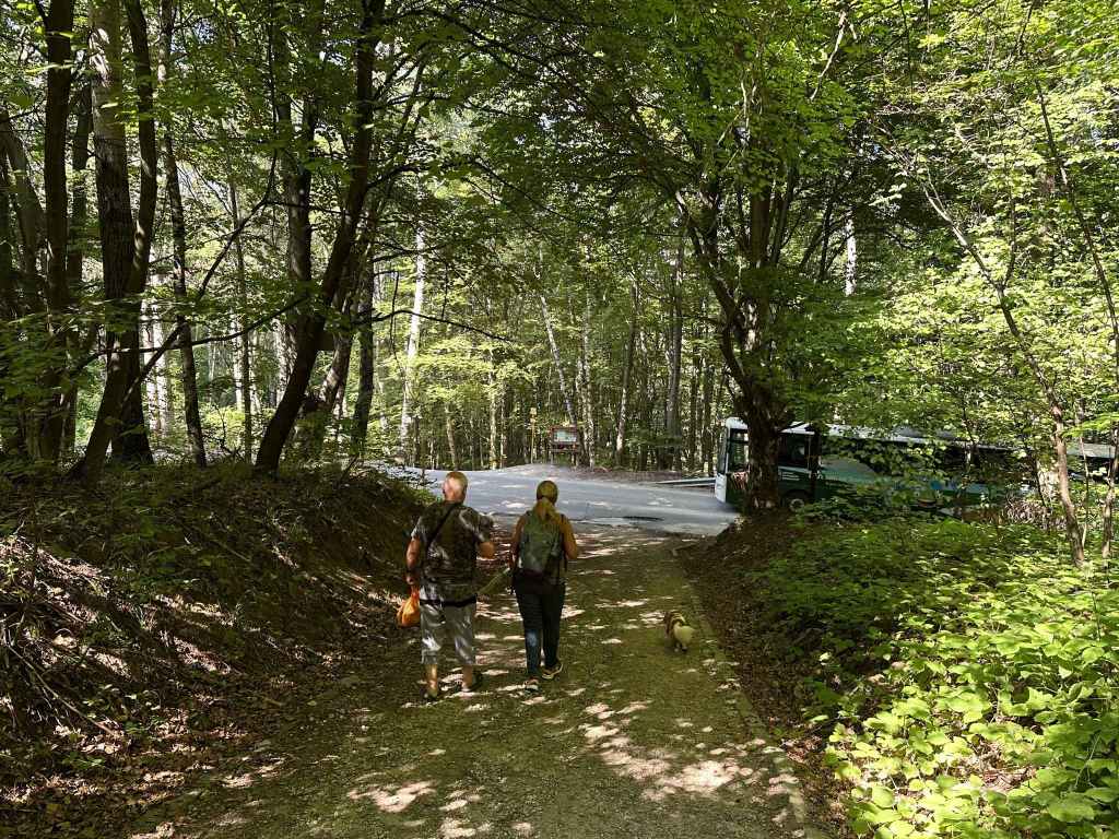
The path through the forest.
At post 158, go right in the direction of Cherni Vrah.
After twenty minutes, the path divides. Go left here.
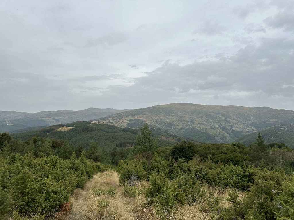
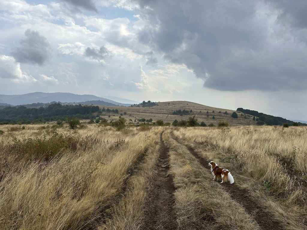
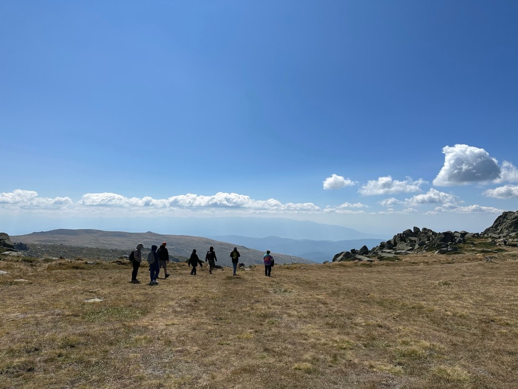
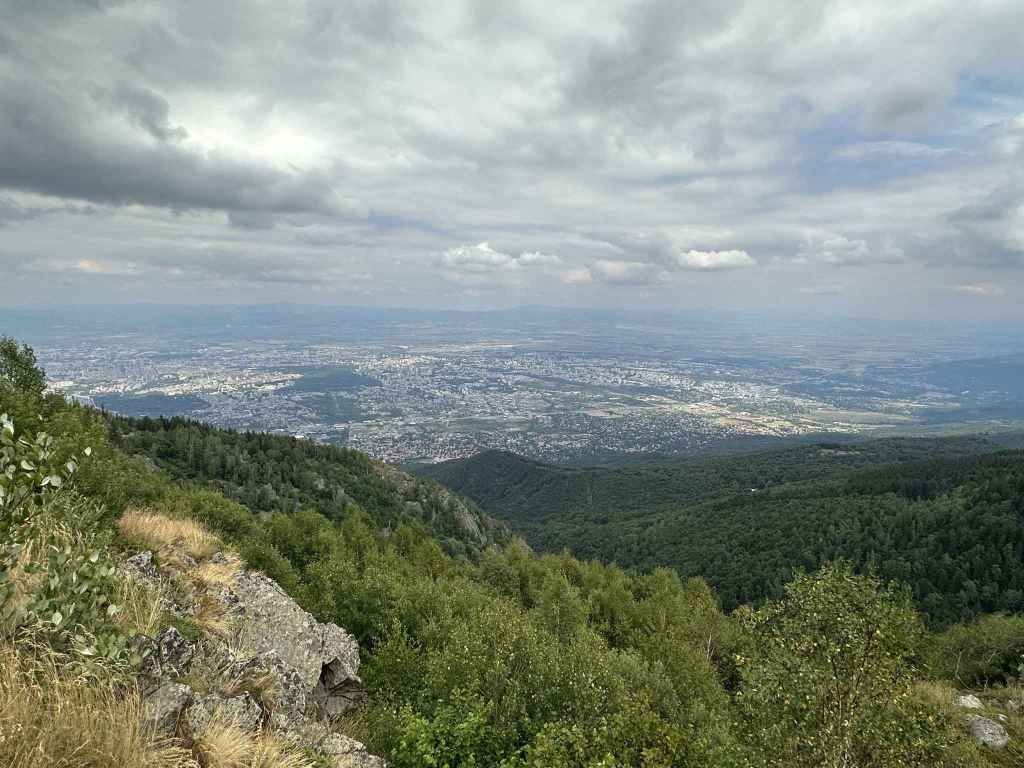
View north from Golemiya Rid of Cherni Vrah and Yarlovski Kupen.
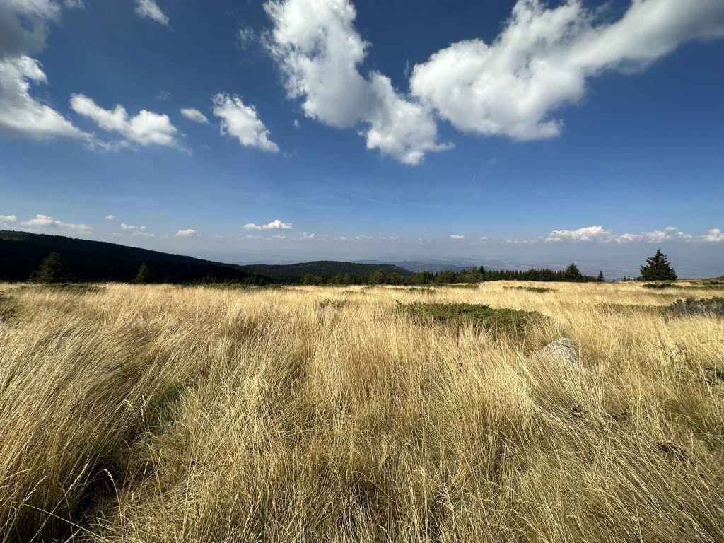
View south of Yarlovo and Rila in the distance.
Half an hour after the peak, you will come to a crossroads. Go straight in the direction of Klisura.
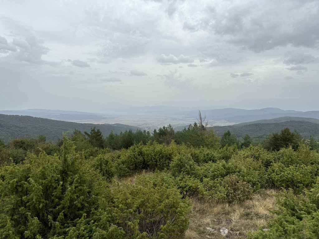
The view back towards Cherni Vrah and Yarlovski Kupen.
At the T-junction, go left to return to Yarlovo.
The tarmacked road back to Yarlovo.
The village as it appears.
Where we were welcomed by some donkeys.
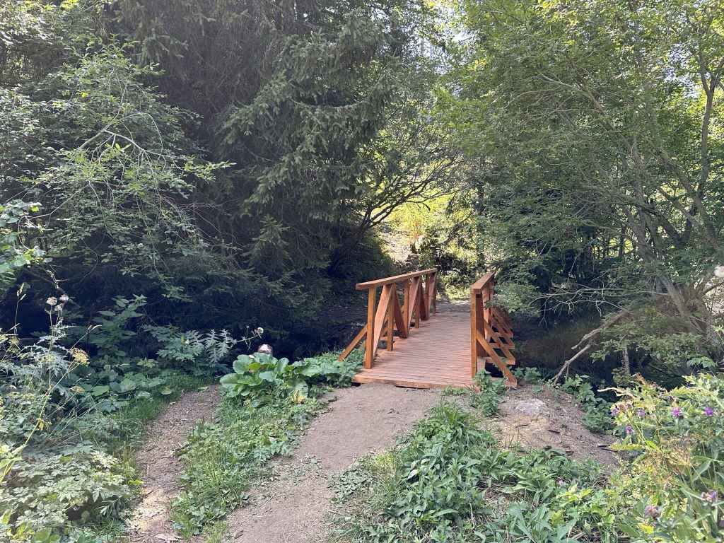
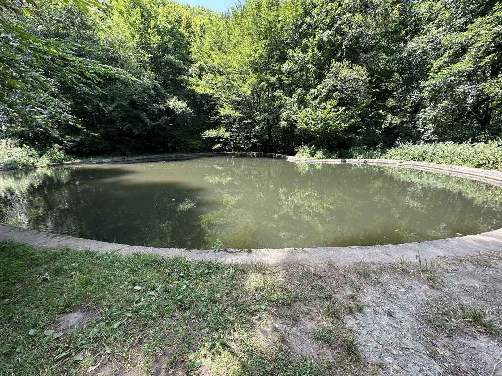
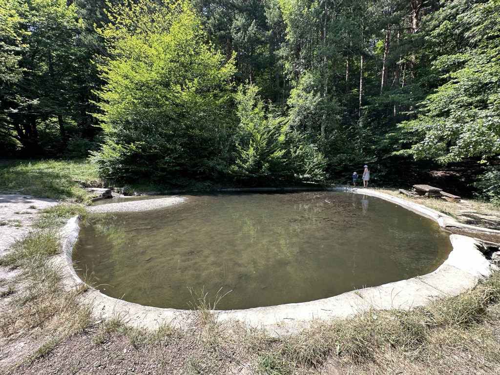
The bridge over the river Palakaria.
The river Palakaria in Yarlovo.
Yarlovo is the other most distant village you can reach on the south side of Vitosha, together with Chuypetlovo, the difference being that you come at them from different directions. To reach Chuypetlovo, you go west around the mountain. To reach Yarlovo, you go east, via Bistritsa and Zheleznitsa. The two villages are actually in adjoining valleys – Chuypetlovo in the Struma valley, Yarlovo in the Palakaria valley – so visiting both villages is like putting your arms around the mountain from both sides, a fitting way to bring this book to a conclusion.
Yarlovo is again about fifty kilometres from central Sofia, an hour’s drive. You pass through Bistritsa, Zheleznitsa, the villa zone known as Yarema, until you reach Kovachevtsi. From Bistritsa to Kovachevtsi is 22 kilometres. Shortly after entering Kovachevtsi, there is a turning on the right for Yarlovo, 5 km. The furthest you can get with public transport is bus no. 69, which takes you just past Zheleznitsa, but that still leaves a significant distance to Yarlovo (about 17 km).
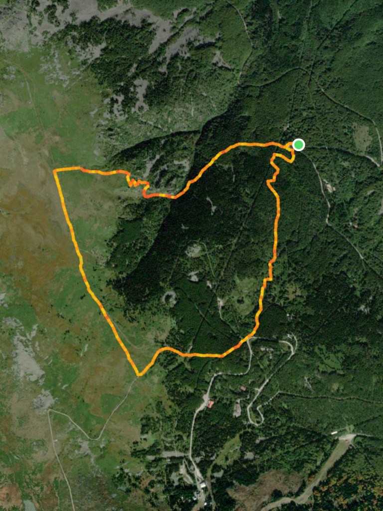
On entering Yarlovo, the road veers to the right, goes past a playground on the right and then heads left into the main square, where there is a Church of St Nedelya, the town hall, a post office and various amenities. Park here. This walk will take you along the course of the Palakaria, up onto the ridge between Yarlovo and Chuypetlovo to the peak Golemiya Rid (with wonderful views north to Cherni Vrah and south to Rila) and back around to Yarlovo. So you leave the main square in the north-west corner and return via the south-west corner.
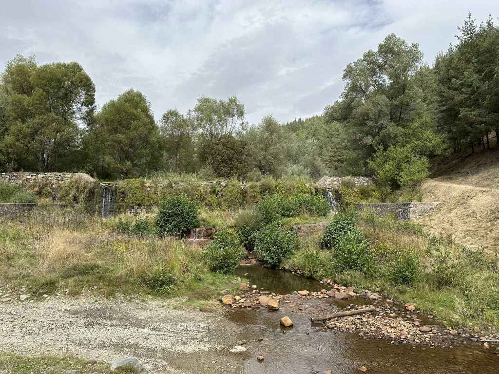
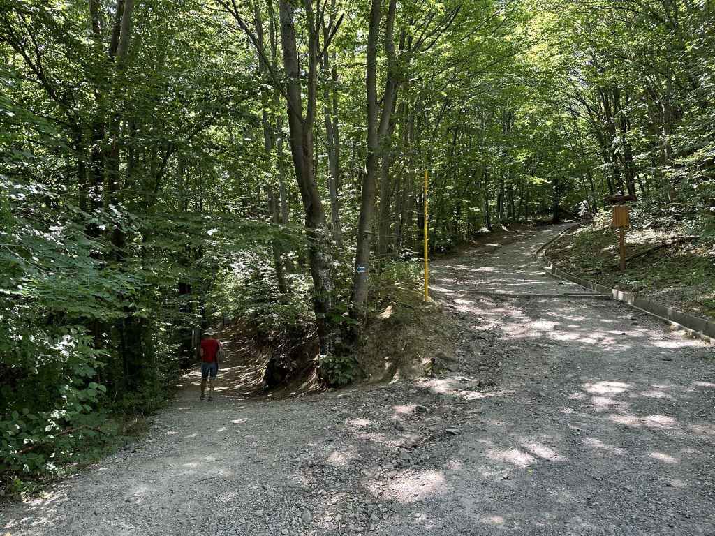
Take the street that leaves the square in the north-west corner (to the west of the church). It is signposted for Smilyo shelter, Chuypetlovo village and Cherni Vrah via Golemiya Rid. The river Palakaria is flowing on your left. You will pass two bridges going over the river on your left, but just keep going on this street. In half an hour, after the tarmac ends and the road turns into a dirt track, it crosses the river, where there is a pretty waterfall. On the other side of the river, the track begins to climb and turns right (left will take you back into Yarlovo). In fifteen minutes, you will cross a small tributary of the Palakaria, and immediately the path divides. Right will take you along the course of the river. You want to go left, up the mountain. Now stay on this path (with the black and yellow posts), ignore the turning on the left that appears immediately. The path divides and then comes back together (it doesn’t matter which branch you take) and in little more than ten minutes it emerges into the open.
Another ten minutes, and you will reach post number 158. A path on the left will take you to Smilyo, Chuypetlovo and Bosnek. Go right here, in the direction of Cherni Vrah. You will pass a farm outbuilding on the left and then a small house. Follow this path for twenty minutes. It then divides. The right branch will continue taking you in the direction of Cherni Vrah, the summit, but we are going to go left here, in the direction of Golemiya Rid peak. 200 metres after this left turning, there is a path through the grass on the left. In ten minutes (500 metres), this path will take you to the peak, which is a good place to stop for rest and refreshment. Halfway there, a path diverges on the left – ignore it, and in no time at all you will be at the peak. North of here is Cherni Vrah. To the right of Cherni Vrah is Yarlovski Kupen, the main peak at the head of the Palakaria valley. North-west is the village of Chuypetlovo, which featured in our previous walk. And south-east is Yarlovo and the mysterious peaks of Rila, the highest point in the Balkans, in the distance.
Once you have had time to enjoy the views, return to the path you were on and continue left. In about twenty minutes, you will reach a clear crossroads with a picnic area on the right. The left branch will take you to post number 158 and the farm outbuilding, from where you can return directly to Yarlovo. The right branch takes you down to the road just before Chuypetlovo. Keep straight, in the direction of Klisura village. After a hundred metres, ignore the turnings on the right and stay on the path you are on. In half an hour, it divides (the right branch goes to a “cheshma” or fountain). Keep left here, and in five minutes you will come to a T-junction. The right branch goes to Klisura. You want to head left, back to Yarlovo three kilometres away. The road is now tarmacked.
When you reach the first houses in Yarlovo, there is a dirt track on the right, which soon becomes tarmacked as it enters the village, running alongside the river Palakaria on your left. After ten minutes (800 metres), cross the bridge on your left and in five minutes you will enter the main square from the south-west.
Please note: it is easily possible to shorten this walk in two ways. The first is to take the left turning at post 158 and to walk in the direction of Chuypetlovo, not Cherni Vrah. This will omit the peak Golemiya Rid. When you get to the crossroads, take the left turning for Klisura village and continue as per the description. Alternatively, having climbed the peak, when you reach the crossroads, instead of continuing in the direction of Klisura village, turn left here for Yarlovo. You will return to post 158, where you can turn right and descend into the village the way you climbed up. Both options will reduce the walk by several kilometres.
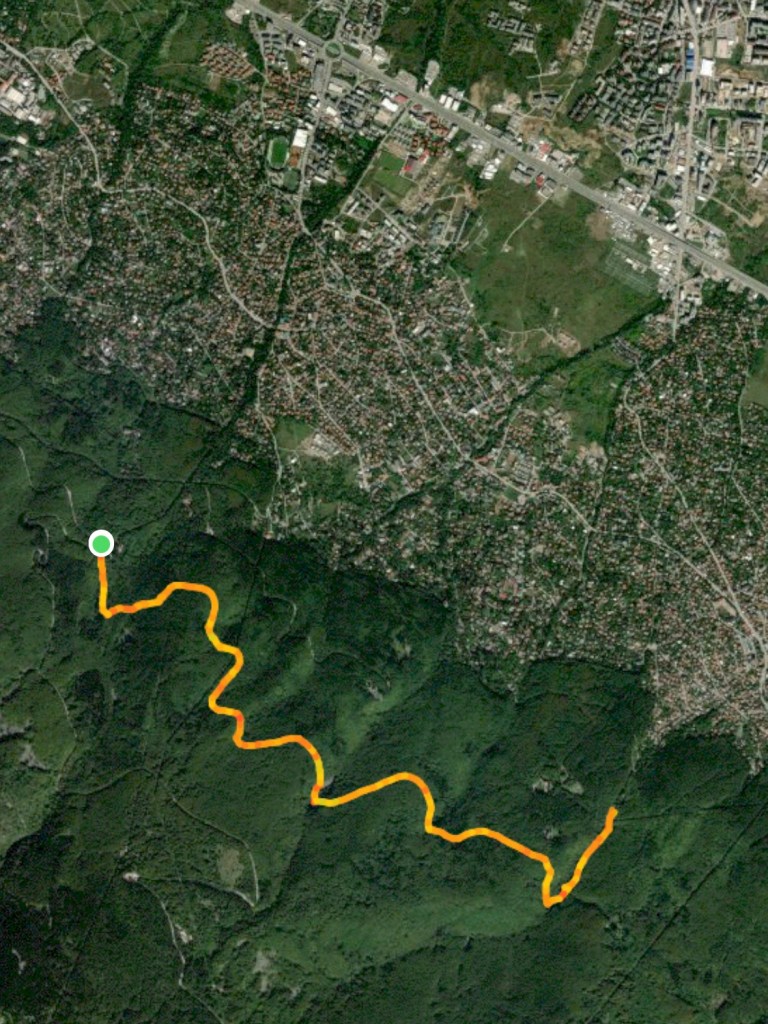
A map of the walk in relation to the whole mountain, with the outskirts of Sofia visible in the top right-hand corner:
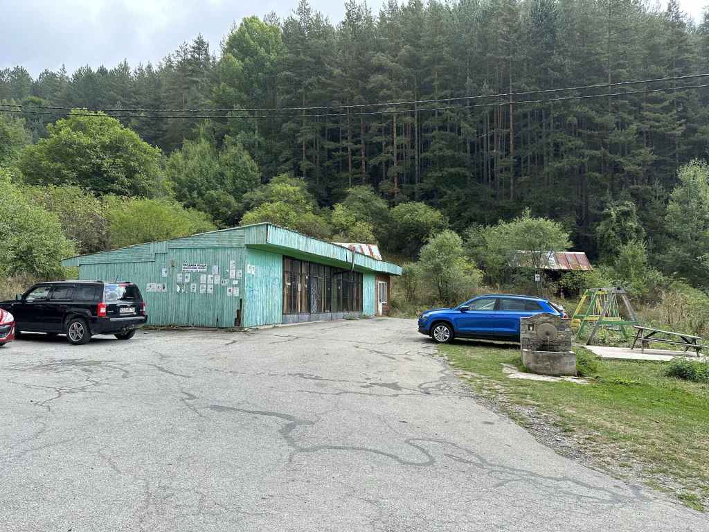
300 metres after the sign for Chuypetlovo, the road ends at a green building and a fountain.
Take the shared trail heading north out of the village, with the river on your left.
The trail leaving the village.
Moraines to the left of the path.
The bridge over the river Struma.
The river Struma heading south.
The path climbing through beech and birch forest.
And emerging onto an open area of tall grass.
Be careful! The path divides, with the right branch going to Kladnitsa. You want the left branch.
A tree in the grass.
The path heads south towards a hill, behind which is Bosnek.
A wild deer.
Before the hill, go left (at post 11 or 12, it doesn’t matter).
The view back towards the summit.
The path descends back into the village.
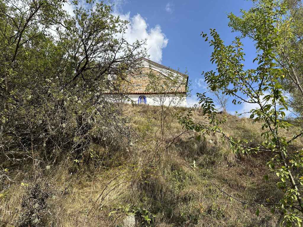
And passes the Church of St Petka.
In a couple of minutes, a turning on the left takes you back to the square where you started.
Chuypetlovo is the first village on the course of the river Struma as it heads south from its source at the peak, Cherni Vrah, to flow into the Aegean in northern Greece. This alone makes it very special. It also offers wonderful views of the summit, but from the other side – the south side of the mountain. Conversely, this means that this little village can be seen from the summit if you head to the rocks a little south of Cherni Vrah hut.
The only way to get to Chuypetlovo, really, is by car. It takes about an hour from Sofia, and the distance is about fifty kilometres. You take the road from Sofia to Pernik. When you reach the large roundabout before Pernik, go left on the A3 motorway in the direction of Greece (Kulata). You travel south on the motorway for twelve kilometres, going past Studena. You then turn off the motorway at the sign for Bosnek (the village before Chuypetlovo), go under the motorway, turn left and follow this road for another thirteen kilometres. As you go through Bosnek, there is a dink in the road – it veers left and then right – but as long as you stay on this road, you won’t get lost. 300 metres after the sign for Chuypetlovo, the road ends at a green building and a fountain. Park the car here.
You are now going to walk up the east side of the river Struma and return to the village along the west side, so you want to take the shared trail to the left of the green building, a sort of continuation of the road you were on, but now a dirt track signposted for Chuypetlovo 1 and Kladnitsa. Follow this trail out of the village, with the river on your left (even if you can’t see it, the river should be on your left). In ten minutes, you will leave the village through trees, and in another ten minutes you will come out into the open, with moraines scattered to the left of the path. Keep heading north basically, and in another twenty minutes you will reach a bridge over the Struma. This is a perfect place to have a picnic and to enjoy the river’s company since you’re not going to see much more of it until you come back into the village.
Having taken your rest, cross the bridge. The path continues on your left and then heads north as it climbs. After twenty minutes of walking through forest, you come out onto an open area of tall grass with fantastic views towards the summit on your right and a succession of lower hills on your left. After ten minutes, a path joins from the right and then leaves on the left. You can ignore it. After another five minutes, the path you are on divides (there is a sign “Chuypetlovo Village Horse ride” pointing back the way you came). You must be careful here because if you go right (north-west), you will end up in the village of Kladnitsa. Go left (south-west).
After ten minutes, a path goes over the hill on your right. Ignore it. At the black and yellow post 4, a path joins from the right. Just before post 6, a path diverges on the right. Ignore these turnings. Five minutes after post 6, a path diverges on the left. Keep going right, that is due south, and in ten minutes a hill will appear in front of you. The path you are on goes over this hill, in the direction of Bosnek. You must take the path on your left to return to Chuypetlovo, that is at post 11 or 12 (it doesn’t matter which, 11 is a shortcut, 12 is a right angle), towards the trees to the left of the hill. You should now be heading south-east.
This path offers wonderful views of the summit and the radar station on top (which looks like a golf ball). After twenty minutes, it begins to descend and soon enters forest. Another ten minutes, and you are back in the village. You pass the Church of St Petka on a rise to the left of the path and then cross the Struma once again. Immediately after this crossing, there is a sign for Yarlovo and Bosnek going straight. Turn left here, and in no time at all you will be back at the square where you started.
This walk offers a valuable opportunity to see the Struma in its infancy. It also gives you a different perspective on the mountain (in particular, Cherni Vrah, the summit). These two factors, for me, make it one of the nicest walks on the mountain. We even saw a wild deer, and that has only happened to me on the mountain twice in twenty years (the other time was at Kominite)!
Transport: by car, by gondola lift, or by bus no. 66 to the last stop
Approaching Aleko on the road from Dragalevtsi, with Malak Rezen peak clearly visible.
The top of the gondola lift that goes to Aleko from the district of Simeonovo.
Aleko hut.
The fountain on the south side of Aleko hut, where the path to Cherni Vrah begins.
The path as it zigzags up the mountain.
The path higher up.
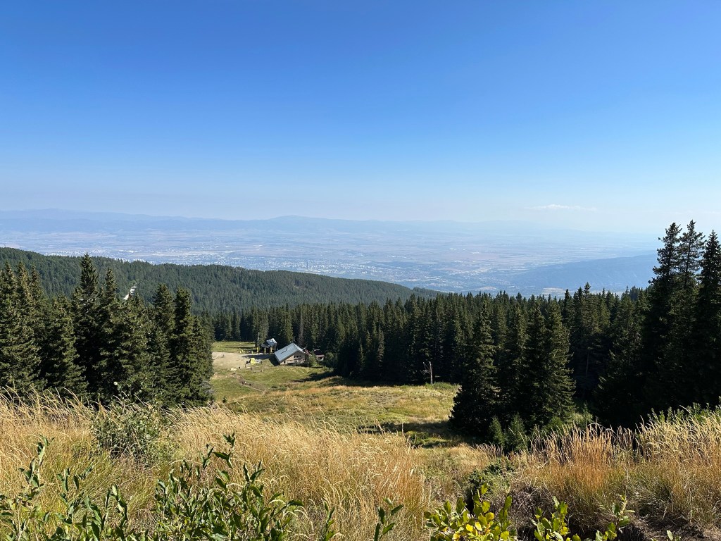
A view back to Aleko, with Sofia in the distance.
The path where it joins the slip road from Goli Vrah (an easier, but longer route).
After 450 metres, a path leaves this slip road (at post 39) and heads directly to the summit.
The peat reserve on the right, with a large moraine field spilling into it.
The hut at the summit.
With the large bell.
A view further south, with Rila mountain in the distance.
The path heading back to the slip road, with Sofia in the distance.
The slip road to Goli Vrah.
Aleko is named after the Bulgarian writer Aleko Konstantinov, creator of the fictional character Bay Ganyo, who encouraged tourism in Bulgaria. It is one of the most popular destinations on Vitosha – because it takes you within striking distance (3.2 km) of the summit, because it boasts several ski slopes, because it is at the top of the gondola lift from Simeonovo, and because it is about as high as you can get on the mountain with a normal vehicle. It is the first place I visited as a tourist, before I started walking on the mountain as a hiker.
There are three ways to reach Aleko. By car, you take the road that climbs the mountain from Dragalevtsi and continue to where the road ends, a distance of just over 15 kilometres. By public transport, you take bus no. 66 and continue to the last stop, opposite a hotel called Moreni, and then walk the final 700 metres before coming to the end of the road, after passing a large moraine field on your right. Or there is a gondola lift that climbs the mountain from Simeonovo, though this lift normally only works at weekends.
Once at Aleko, you have a choice of walking to the summit, or you can take a chair lift (run by the same company that runs the Simeonovo gondola lift). This chair lift used to depart directly opposite Aleko hut and climb the peak in front of you, Malak Rezen, but it is no longer operative, so you must now take the path that heads east in the direction of Bistritsa village and, on reaching the ski slope Vitoshko Lale (where there is a chair lift), take a path on your right that climbs to the middle station. This lift also only works at weekends, but it is relatively inexpensive. It is just under a kilometre from Aleko hut to the lift.
To walk to the summit, look for the fountain on the south side of Aleko hut. To the left of this fountain, there is a path that climbs the mountain. This is the path you want. It skirts the disused chair lift on your left, with Malak Rezen peak also on your left. You have a choice of choosing a more direct route, or zigzagging slightly (following the red markers), which makes the ascent easier. From Aleko hut to where the path joins the slip road from Goli Vrah is an elevation gain of 260 metres and takes approximately forty minutes. The views back to Sofia, of Malak Rezen peak to the south, Ushite and the peat reserve to the north (see the walk Ushite), are wonderful and well worth the effort.
When you get to the top, you join the slip road coming from Goli Vrah. Many people choose to access the summit by means of this slip road, which is a dirt track and leaves the main road from Dragalevtsi 900 metres before the road ends at Aleko (200 metres before the last bus stop), taking a more circuitous route. When you join the slip road, turn left. Follow the road for 450 metres until you reach a black and yellow post with the number 39 on it. Here, the road continues to the radar station on your left, while a path leads directly to the summit in front of you. It takes half an hour on this path to reach the summit, where there is a hut with a bunch of antennae on top of it. You can see the radar station (a white golf ball) on your left and the valuable peat reserve on your right.
When you reach the hut at the summit, there is a large bell inside an iron structure. It was the tradition, when I first came here, to ring the bell, but even if that is no longer possible, you can still touch the bell with your wedding ring (if you have one) and it will issue a small sound in recognition of your achievement. After all, it’s not every day you make it to the summit of a mountain. The weather can be windy up here, so it’s good to pack something warm. The hut serves food. Beyond the hut is a large grassy area and stunning views of the other side. You can see Rila mountain in the distance on a clear day. You may want to linger here for a while, enjoying the views. It’s also worth walking south-east for half an hour, in the direction of Skoparnika peak. There are unusual rock formations which look suspiciously like Picasso paintings.
When you’ve had enough, follow the black and yellow posts back down towards the slip road, rejoin the slip road for 450 metres, and then you can either descend directly towards Aleko the way you came up (at post 60), or you can continue on the slip road, a longer but easier route which will take you alongside the peat reserve all the way back to the main road, where you will have to turn right in order to complete the last few hundred metres. The route via Goli Vrah is about twice as long as the more direct route to Aleko.
This is a hard walk – it’s not so easy to climb a summit – but the views at the top in all directions are stunning. This is also where the magnificent Struma River has its source (this river flows into the Aegean in northern Greece, next to the ancient settlement of Amphipolis; if you drive to Greece on the motorway from Sofia, you follow the course of this mythical river). Please note: Struma River begins on Vitosha (not on Rila or Pirin, as might be expected). It is not the only river to do this.
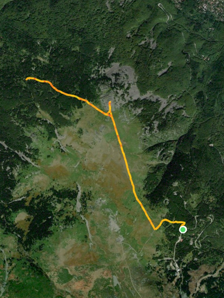
The following map shows where we parked the car (the green circle). We then walked south to Aleko hut, took a detour to see the chair lift on Vitoshko Lake, returned to the hut, zigzagged up the mountain to Cherni Vrah; on our return, we decided to take the slip road back to Goli Vrah, where we rejoined the main road, turned right and walked back to the car. Please bear in mind that Aleko can be busy at weekends.
Transport: by car, or by bus no. 63 to Zlatni Mostove
The T-junction at Ofeliite. The walk begins by going right here.
After 380 metres, a path leaves the road on the left.
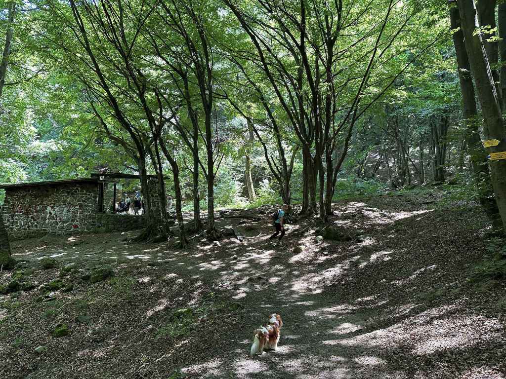
In twenty-five minutes, you will come to the hut Edelweiss on your right.
Continue uphill until you come to the hut Zvezditsa.
Go through the garden here and take the wooden walkway on your left into the forest.
You will pass a small moraine field.
And cross numerous streams.
Once in the open, some rocks appear on the left.
These offer wonderful views north-west.
And back towards the summit.
The abandoned huts at Konyarnika.
The path from Konyarnika to Kumata becomes a sort of road.
The hut Kumata.
Vladaya River where it meets the path to Vladaya via Ofeliite.
The Vetrovala ski slope.
This is a lovely walk that forms an almost perfect circuit and takes you within striking distance of the summit (see the last walk in this section, Kumata). The starting point is Ofeliite, three kilometres after Zlatni Mostove, on the road that goes up the mountain from Boyana. The bus, no. 63, only goes as far as Zlatni Mostove, so if travelling by public transport you need to factor in this extra distance.
When you reach Zlatni Mostove, where the bus turns around, ignore the turning on the left and continue on the main road, which is partly cobbled, partly tarmacked. After three kilometres, you will reach Ofeliite, a kind of T-junction, with the road continuing on the left to Planinarska Pesen and with a turning on the right to Zvezditsa. There is a small car park on the left, a mountain hut opposite, and a children’s ski slope on the right. The walk takes us along the turning on the right and brings us back along the road on the left.
Take the turning on the right (signposted for Trendafila, Zvezditsa, Edelweiss and Advokati). Continue along this road for 380 metres until you reach a path on the left which leads directly up the mountain. Take this path. After ten minutes, it comes close to the road again, which is meandering along next to it. Keep going. In another fifteen minutes, you will come to the hut Edelweiss on your right. This is a popular place to have lunch, and there is also an excellent drinking fountain on the far side of the hut, which is worth a short detour. From here, a path goes left to the hut Kumata. You can shorten this walk by taking this path and rejoining the route at Kumata. It is very picturesque, but it doesn’t take you to within sight of the summit at Konyarnika.
So we will continue uphill, ignoring the paths left to Kumata and right to Edelweiss, and in ten minutes we will come to another hut, Zvezditsa, which is where the road from Ofeliite ends. This is another popular destination for lunch. There is a garden out the back with activities for children. Go straight through this garden and take the wooden walkway that appears immediately on the left, signposted for Konyarnika and Cherni Vrah.
This walkway takes you into a forest. Follow the path through the forest for about twenty minutes. You will cross numerous streams coming down the mountain and pass a moraine field on the right. On leaving the forest, there are rocks on your left, and then a wonderful view towards the summit, Cherni Vrah, opens up on your right. I suggest leaving the path at this point, once you are out in the open, and climbing one of the rocks on the left. People stop here to have a picnic and to enjoy the amazing views north-west from here. You cannot see Sofia (that is hidden by the mountain), but you can just make out the TV tower at Kopitoto.
Rejoin the path you were on, and in five minutes you will come to the main path between Kumata and Cherni Vrah. This is Konyarnika. There are several picnic tables, a disused chair lift, some abandoned huts on the left and Sredets Peak directly in front of you. I have had surprisingly warms days in November, sitting here, enjoying the view. Where the path you were on joins this new path, there is a black and yellow post with the number 180 on it. Go right here, and the path will take you to the summit (see the walk Kumata), but we are going to go left. To get to Kumata, follow this path, ignore the black and yellow posts that cut across the grass on your right and keep going. The path gradually becomes a sort of road. The posts rejoin the road further on. At post 194, leave the road and veer left. After post 196, you will come to a bridge over Vladaya River, a truly magnificent river that features in the walk Tihiya Kat, but here is much smaller. In fact, it has only just formed in the peat reserve between you and Cherni Vrah.
Cross the river and rejoin the road at post 204. Turn left. Continue along the road for 50 metres, then take the path on the right (post 206). This path will take you straight to the hut Kumata (post 218). Go past the hut on your left, cross the road in front of you and take the path directly opposite, signposted for Zlatni Mostove. (The shorter route from Edelweiss arrives here from the left, at the far end of the car park.) In less than ten minutes, you will come to the road between Ofeliite and Planinarska Pesen. Go straight across and take the path diagonally opposite. This path heads down to Zlatni Mostove. In three minutes you will pass a fountain on your right, where there is a sort of crossroads. The path ahead and the path on the right feature in the walk Zlatni Mostove, but we are going to take the path on the left, signposted for Vladaya via Ofeliite. This lovely path takes you over a stream, then over Vladaya River, which is already gaining in confidence, past the Vetrovala ski slope on your right, which has wonderful views off into the distance. In twenty minutes, you will again come to the road between Ofeliite and Planinarska Pesen. Go straight across, walk down the path opposite and rejoin the road no more than a minute later. Now turn left and follow the road back to Ofeliite.
Transport: by car, or by bus no. 66 to the last stop
The slip road to the top of the Dragalevtsi chair lift, Goli Vrah, 200 metres before the last stop on the 66 bus route.
The top of the chair lift.
The path right, marked by black and yellow posts, across the peat reserve.
The peat reserve, with Ushite and Chernata Skala in the distance.
The peat reserve.
The brightly coloured flowers.
The Ushite shelter.
Kamen Del peak.
The view of Sofia from Kamen Del peak.
As the path descends towards Bor, the TV tower at Kopitoto is visible.
In a short while, the path enters forest.
It passes a hut and a fountain.
Bor mountain hut (inactive).
Immediately after Bor mountain hut, there is a small bridge over Boyana River, a nice place to rest.
On the return, the views from the Ushite shelter towards the summit, Cherni Vrah, are spectacular.
Part of this walk is the same as for Kominite, along the plateau next to the top of the Dragalevtsi chair lift, Goli Vrah. It takes you all the way across the peat reserve and down to Bor mountain hut, which features in the walks Planinets and Zlatni Mostove. It offers the chance to climb a peak, Kamen Del, the peak which is most visible from the centre of Sofia, next to Ushite, and affords wonderful views of the city itself.
If you are travelling by public transport, you take bus no. 66 to the end of the line and then walk back 200 metres to the slip road to Goli Vrah. By car, you take the road up the mountain from Dragalevtsi village. From the cobbled square at the centre of Dragalevtsi, you take the road in the far corner and drive for 14.2 kilometres, past the turning for the “Vodenitsata” restaurant, past the car park behind Dragalevtsi Monastery, under the Dragalevtsi chair lift, past the middle station on the Dragalevtsi chair lift (Bay Krastyo), past the turning for the ski slope Vitoshko Lale, until you get to the slip road that takes you to the top of the chair lift, Goli Vrah. If you find yourself in Aleko, where the road ends, you have gone too far and need to drive back a short distance. The slip road is on the right, 200 metres before the final bus stop.
Many people use this slip road to access the summit, Cherni Vrah, instead of going to the summit from Aleko, which is nearer, because the slip road climbs more gradually whereas the climb from Aleko is very steep (there is a chair lift). The slip road takes you in five minutes past the top of the Dragalevtsi chair lift, Goli Vrah, and in another five minutes you come to the peat reserve on your right and a path marked with black and yellow posts. Turn right here (it is signposted for the Ushite shelter, “zaslon Ushite”) and follow the black and yellow posts for the next forty-five minutes. You will notice a slight springiness in your step because of the peat, it buoys you up. The views behind you to the summit, Cherni Vrah, right to Sofia, and straight ahead to Ushite (“The Ears”) with Chernata Skala (“Black Rock”) to the left of it are all wonderful. So is the sense that you are crossing a valuable piece of land, the peat reserve, full of grasses and brightly coloured flowers.
The path from the slip road starts at post number 30. In ten minutes (post 50), there is a path on the right going back to Goli Vrah. Keep going straight. In another ten minutes (post 64), there is a path on the right. Ignore it. In another ten minutes (post 89), there is a path going right to the Kominite Climbing Area. This features in the walk to Kominite. Keep going. In another ten minutes (post 108), you reach the Ushite shelter on your left, with Ushite behind it. Immediately after you have left the shelter behind, another peak, Kamen Del, becomes visible to your right, overlooking Sofia, a Bulgarian flag flying on top. This is a popular destination at weekends during summer.
The path you are on, with the black and yellow posts, will take you all the way to Bor mountain hut, but it is worth making a diversion to climb Kamen Del peak. So five minutes after the Ushite shelter (post 116), take the path on the right in the direction of the peak, which you will reach after ten minutes. Enjoy the fabulous views over Sofia! Lots of people stay here to admire the landscape, the valley with Sofia and the airport, Pancharevo (with the lake) and Bistritsa to the right, the Balkan mountain in the distance. If at this point you feel you have walked far enough, it is perfectly possible to turn around here and retrace your steps. Otherwise, come down from the peak, return to the path with the black and yellow posts (you can rejoin this path at post 121 instead of returning to post 116 by taking a path on the right as you come down from the peak).
Once you are back on the path with the black and yellow posts, it will begin to descend and soon it will enter forest. Forty minutes after Kamen Del peak, you pass a hut and a fountain on the left. Immediately after this hut and fountain, the path forks. Keep left, join the tarmac road and in five minutes you will be at Bor mountain hut, which is not active. If you keep going straight, after the mountain hut, you will immediately come to a small bridge over Boyana River, which is a lovely place to sit and rest. In the not so distant future, this small river will become Boyana Waterfall, but that’s still in the future.
Then simply return the way you came, taking the same path (signposted for Platoto and Aleko Hut). On the way back, when you emerge from the forest after half an hour, the path divides. It doesn’t matter which fork you take since they have the same destination, but I usually follow the fork with the black and yellow post next to it. That way, I know I’m going in the right direction. In another ten minutes (post 120), the climb ceases and, as you reach the Ushite shelter on your return, the views over the plateau towards Cherni Vrah are truly stunning. At post 50, there is the option of taking a slightly shorter route to Goli Vrah, but I’m a stickler for tradition and prefer to stay on the path with the posts. At post 30, you rejoin the slip road. Turn left, and in ten minutes you will be back at the main road where you started. Like all walks that go and return by the same route, this walk can easily be shortened by turning back earlier. What I like about continuing to Bor mountain hut is that it links this walk with two earlier walks, Planinets and Zlatni Mostove, and I get a better understanding of the mountain (just as the walks from Kopitoto and Bay Krastyo also meet in the middle, but lower down the mountain).
Transport: by car, or by bus no. 66 to the stop for Bay Krastyo
The penultimate stop of the 66 bus route with the hut in the bend of the road.
The path to Kominite. This is the path you will come back on.
The path (E4) to Aleko and Cherni Vrah. Take this path to the top of the chair lift (Goli Vrah).
Climb the log steps.
The path through the forest, having left the chair lift behind.
The small fountain.
The top of the chair lift, Goli Vrah.
The beginning of the path across the peat reserve in the direction of Ushite (visible in front of you).
The peat reserve with Ushite behind.
A description of the peat reserve.
After turning right to go to Kominite, look back to see the summit.
The picnic area next to the path from the peat reserve to Kominite.
There are wonderful views of Sofia.
Kominite, a well-known rock climbing area.
Dragalevtsi River, with Sofia in the background.
This is one of the higher routes on Vitosha, taking you to the peat reserve between Goli Vrah, the top of the Dragalevtsi chair lift, and Ushite, meaning “The Ears”, which is the part of the mountain most easily seen from Sofia. It is good to do it in reasonably fair weather. I have marked it “moderate-hard” because of the steep descent past the rock climbing area known as Kominite (“The Chimneys”), but the distance is comparable with other walks.
The starting point is the same as for the walk from Bay Krastyo to Kikish. You take the road that goes up the mountain from Dragalevtsi or bus no. 66. From the cobbled square of Dragalevtsi, you take the road in the far corner and carry on driving up the mountain for 9 km, ignoring the turning on the left for “Vodenitsata” restaurant. Stop at the slip road for Bay Krastyo, the middle station on the currently defunct Dragalevtsi chair lift, or get off at the penultimate stop of the 66 bus route.
Instead of walking down the slip road towards the station, however, you need to continue up the main road. After 80 metres, you will see a path signposted for Kominite. This is the path you will come back on. Continue around the corner for another 80 metres, and you will come to a second path on your right, the E4, signposted for Aleko and Cherni Vrah. This is the path you want, which begins on the other side of a hut inside the bend of the road with large heaps of what looks like cement.
This path will take you to the top of the chair lift, Goli Vrah. It is a little confusing to begin with because on the left there is a bike trail. Some steps have been built with logs. It’s a good idea to follow these steps, and at the top turn right to continue up the mountain. In ten minutes, you will pass under the chair lift, but then the path will double back on itself, forming a zigzag and taking you back under the chair lift. It does this a second time. On returning under the chair lift for a second time, continue straight. Then, confusingly, the path again zigzags twice, not as far as the chair lift this time (the chair lift should end up on your right), before finally deciding to climb the mountain and leave the chair lift behind. If you are in any doubt, simply follow the red and black markers.
After fifteen minutes, you will see the bike trail on your left, which crosses the path you are on. Continue straight. The path gradually narrows and becomes wet. Logs have been placed where the ground is wettest and there is running water. In another five minutes, you will come to a fountain on your right. In another twenty minutes, you will pass a generator behind a wire fence on your left and become aware of the main road behind it. The path crosses a slip road, climbs some steps, and then crosses a second slip road (going to Salzitsa hut). Continue straight, ignoring the main road on your left and the slip road on your right. A stiff climb brings you in ten minutes to a third slip road. You want to join this slip road, which goes from the main road behind you all the way to the top of the mountain (the main road does not go to the summit of the mountain, it stops short, at Aleko).
Turn right along this slip road and in five minutes you will pass the top of the Dragalevtsi chair lift, Goli Vrah, on your right. Continue along the slip road, and in another five minutes take the turning right signposted for the shelter (“zaslon”) Ushite. This turning is very clearly marked by black and yellow posts, starting with the number 30. You are now in a very precious part of the mountain, the peat reserve, designated as such in 1935 and covering an area of 783 hectares. You will immediately notice that you have a spring in your step. Walking suddenly becomes easy because of the ground you are stepping on. Follow this path in the direction of Ushite directly in front of you, with Chernata Skala, “Black Rock”, to the left of it.
After ten minutes (post number 50), a path doubles back to Goli Vrah on your right. Keep going straight. Another ten minutes (post number 64), and a path diverges on the right. Keep going straight until after another ten minutes you get to post number 89. Here take the turning on your right, signposted for the Kominite Climbing Area and Kikish. Were you to continue in the direction of Ushite, the path would eventually take you to Bor mountain hut, which features in the walks Planinets and Zlatni Mostove. See the walk Ushite.
As you start along the turning on the right, look back the way you came and you will get a wonderful view of the summit, Cherni Vrah, on the right with the radar station (aka a golf ball) in the middle. Continue along this path. You are now heading in an easterly direction. After five minutes, there is a convenient picnic area on your right, where you can sit and admire the view towards Bistritsa and Pancharevo, with the mountains behind. Sometimes there are hang-gliders. Now the path begins to descend, with excellent views of Sofia to the north-east. After five minutes, a path heads left to Kikish. Keep right. The path becomes quite overgrown. In another fifteen minutes, you will reach Kominite, the rocks in front of you. The path veers right here (to avoid the rocks). The path then divides, but both branches lead in the same direction (the left branch is steeper, the right branch more roundabout). They will both take you past the climbing area on your left. This part of the walk can be tiring, you need to watch your step as the descent is quite steep. In twenty minutes, you will reach Dragalevtsi River. This river features in two other walks, Bay Krastyo and Simeonovo Lakes, but you are now higher upstream. Cross the river and follow the path across a small moraine field and back under the chair lift. In twenty-five minutes, you will be back at the main road where you started.
We have often done this walk in reverse, going from the main road (Bay Krastyo) only as far as Kominite and climbing the rocks there to have lunch. It’s not ideal for small children or pets, since the rocks are steep, but it’s a wonderful place to have a picnic. Shortly after crossing the river, at the bottom of the rock faces where people can be seen climbing, you leave the path you are on, walk along the bottom of the rock faces, and continue for another ten minutes. You pass a small shelter and come to a secluded area with large rocks you can sit on. It’s safe so long as you stay away from the edge.
Transport: by car, or by bus no. 66 to the stop for Dragalevtsi Monastery
The start of the walk at the southern corner of the Dragalevtsi Monastery car park.
After 50 metres, turn left. Do not go up the mountain!
Seven minutes later, the path divides. Keep left.
One of the bridges across Dragalevtsi River.
The disused Dragalevtsi chair lift.
The path is in forest most of the way.
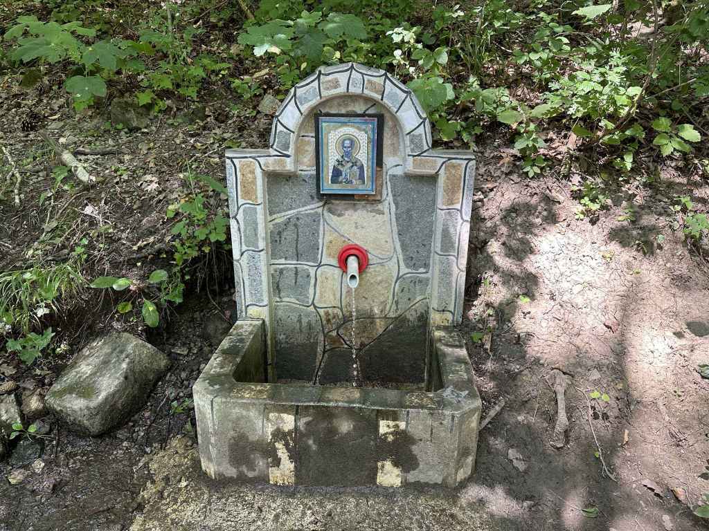
The fountain with an icon of St Nicholas.
Approaching the rocky outcrop.
The rocky outcrop.
The view towards Sofia.
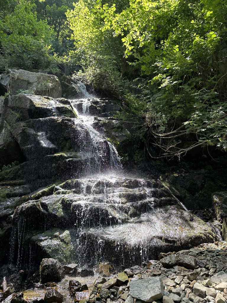
Aleko Waterfall.
In another 2.5 km, you will come to an abandoned shelter. Turn left here for Simeonovo Lakes.
Lake no. 1.
Lake no. 2.
Lake no. 3.
Lake no. 4 (or the other way around, depending on where you started).
Two walks start from the car park which is above and behind Dragalevtsi Monastery – the walk to Boyana Lake, and this walk to Simeonovo Lakes. They both follow the low-altitude circular trail that goes around the mountain at more or less the same elevation – that is, without climbing or descending the mountain a great deal. But while Boyana Lake really is a lake, Simeonovo Lakes are not what I would call lakes. They are man-made ponds (we even spotted fish in one of them), but they are still very attractive and a popular picnic spot above the district of Simeonovo.
To reach the car park above/behind Dragalevtsi Monastery, you must access the mountain via Dragalevtsi. If you are travelling by bus no. 66, you will get out at the stop for Dragalevtsi Monastery. By car, leave the central square, drive up the cobbled road in the far corner, ignore the turning left to the “Vodenitsata” restaurant after 1.5 km and continue straight for another 3 km. Here is the bus stop for Dragalevtsi Monastery, and on your left, partially hidden by the trees, is a car park with the monastery behind it. Park here.
Go the southern corner of the car park and take the path that goes up the mountain, but only for 50 metres. Immediately join the path going left. This is the low-altitude circular trail. The monastery is again on your left, and the road is now behind you. This path will take you all the way to Simeonovo Lakes. It will be crisscrossed by other paths going up and down the mountain, by bike trails, by leafy hollows, by dry riverbeds, but don’t be led astray. If you have started climbing or descending more than usual, then you have gone the wrong way. Just stay on the path for 5¼ kilometres. It will take you across Dragalevtsi River, under a disused chair lift, through beautiful beech forest, past a rocky outcrop with a wonderful view of Sofia, past a waterfall, and then deliver you to a picturesque spot with tables in the shade. What more could you possibly ask for?
But, like life, just when you think things are going smoothly, a problem arises. The path divides after seven minutes. You didn’t want a choice, but you’ve been given one and are going to have to make it. Keep left (the path is signposted for Simeonovo and Bistritsa). Do not start to climb! The path on the right, signposted for Momina Skala and Kamen Del, may look level, but don’t be fooled – before you know it, you’ll be going up the mountain!
So keep left, and you will become aware of Dragalevtsi River, a river that features heavily in the walk Bay Krastyo-Kikish, on your left. In a couple of minutes, the path turns a corner, and you cross the river by means of two bridges and a walkway. Keep going on this path, ignoring any turnings on the left or on the right, and in another ten minutes you come to the disused Dragalevtsi chair lift (see the walk Bay Krastyo-Kikish). Keep going straight, and in another fifteen minutes you come to a most welcome fountain and bench. There is normally an icon of the Virgin Mary above the fountain, but this time it was St Nicholas. No matter. The water is very refreshing.
Keep going, ignore the dry riverbeds and bike trails crisscrossing the path, and in twenty minutes you will reach one of my favourite places on the mountain – a rocky outcrop I have been visiting for twenty years. Look left, and you will have a wonderful view of Sofia. You can sit on the rocks on either side of the path and have a rest.
But a surprise awaits you! In another 100 metres, continuing on the same path, is Aleko Waterfall, created by Skakavitsa River. This is one of two popular waterfalls on the mountain (the other is Boyana). You are now about halfway to Simeonovo Lakes and are perfectly entitled to decide you have come far enough and to turn around. Simeonovo Lakes is another 2.5 km from here (45 minutes), so it’s up to you.
If you wish to continue, you just keep going on the same low-altitude circular trail. You will come to a couple of benches – ignore the turnings left and right! Keep going straight (signposted for Bistritsa and Zheleznitsa), and half an hour after the waterfall you will come to an abandoned stone shelter which people use to light barbecues. Behind the shelter is the stream that forms the lakes. Go upstream (that is, turn right), and you will come to Buda, the destination of another walk. You want to go downstream (that is, turn left at the shelter) and follow the course of the stream. It will take you downhill to a total of four lakes. Wooden bridges crisscross the stream. It doesn’t matter which side you are on, as long as you are following the course of the stream. Having enjoyed the view and decided which lake you like best, simply climb back uphill to the stone shelter, turn right here, and take the low-altitude circular trail all the way back to Dragalevtsi Monastery and the car park.
Don’t underestimate the distance, though. This walk is more than ten kilometres, but can easily be shortened by turning back at the waterfall. Of course, Simeonovo Lakes can be approached more directly from Simeonovo itself (bus no. 67).
The car park on the right of the road just before it makes a 180-degree turn.
The little bridge at the start of the path that climbs the mountain.
The path up the mountain.
The stream that runs next to the path.
The path rejoins the main road and continues opposite.
After 5-10 minutes, there is a crossroads. The path on the left is the one you will come back on.
The path joins the road between Zlatni Mostove and Momina Skala.
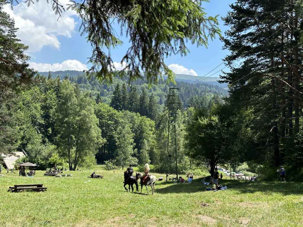
The meadow Beli Bryag with some horse riders.
The road to Momina Skala on the left, the path in the middle, and another path on the right. Take the path in the middle.
Cross the cobbled road and take the path diagonally opposite.
After five minutes, some stone steps on the left lead to Planinets.
After ten minutes, go under a tree trunk before taking the path to Belite Brezi on the left.
The magical forest.
A bridge crosses a stream.
You return to the path you were on and head back down the mountain.
Back to the main road.
Over one or two small bridges.
To the car park.
This is a beautiful walk up and down the mountain which has the advantage of being accessible even when there is heavy snow higher up the mountain. The starting point is not the Dendrarium itself, but a car park before the Dendrarium. Take the road that accesses the mountain via Boyana. This is Bulgaria Boulevard. You go under the ring road, drive through Boyana (with the centre of the village on your left) and continue straight up the mountain. As the houses give way to forest, the road begins to wind. You come to a motel called Tihiya Kat, the starting point for the walk to Vladaya River. 900 metres after this motel is a car park on the right of the road. This is where you need to start. If you are travelling by bus no. 63, you can get off at Tihiya Kat and walk the remaining distance or continue to the next stop (the Bear Museum) and walk back.
Immediately after the car park, the road does a 180-degree turn before continuing up the mountain. Leave the road behind. The car park is on your right. From here a path leads directly up the mountain in the direction of Zlatni Mostove. It begins with a little bridge, and then climbs steadily, but not onerously, for about an hour. The road (and bus) have the same destination, but take a much more roundabout way to get there.
As you climb the mountain, various paths go left in the direction of the Dendrarium, but you want to stay on the same path, which is signposted for Zlatni Mostove and Momina Skala. Soon you will notice a stream on your right. After about fifteen minutes, you cross a secondary road connecting the Dendrarium on your left with a mountain hut, Iglika, on your right, a popular place for picnics in the summer. Continue straight with the stream now on your left. Ten minutes later, the path veers abruptly right, then left, and the road appears in front of you.
Go directly over the road and continue on the path on the other side. In a few minutes, there is a picnic table on your right. Another five minutes, and you come to a sort of crossroads with Vladaya village (and a mountain hut, Belite Brezi) on the right and a path to Kopitoto and Planinets on the left. The path to Kopitoto and Planinets is the path you will come back on. For now, continue straight up the mountain. You pass some more picnic tables and a fountain on the left. In about twenty minutes, a path joins from the left and, immediately after that, you reach the road that connects Zlatni Mostove on your right with Momina Skala on your left. On the other side of the road is a large, open meadow called Beli Bryag. This is a popular picnic area in summer and a good place to stop for refreshment. There are stalls selling corn on the cob, jams and souvenirs. If you head in the direction of Zlatni Mostove, there are some restaurants.
Having paused for refreshment, continue with the meadow on your right. This brings you to a wooden barrier with the road to Momina Skala on your left, a path heading up the hill in front of you, and a path on the right. The path heading up the hill in front of you skirts the road. Take this path. You are now doing part of the walk from Planinets, but in reverse. After three minutes, a path on the left is signposted for Planinets. Take this path, cross the cobbled road and continue on the path diagonally opposite. This path is signposted for Kopitoto. After five minutes, there are some stone steps on the left. Go down these steps and join the path to Planinets. After ten minutes, a tree trunk blocks the path. Go under the tree trunk, and immediately there is a path on the left signposted for Belite Brezi. You have to make a 150-degree turn. Do not continue to Planinets, but take the path to Belite Brezi, a path less trodden which leads you through magical forest (I have taken this path when there was thick snow and got quite lost; I have also encountered people sitting by the side of the path, seemingly lost in meditation). After ten minutes, a path on the right is signposted for the Dendrarium, but do not take it. Keep straight. A bridge crosses a stream, and in another ten minutes you will be back at the crossroads you saw earlier. Turn right here and go straight down the mountain. Cross the main road, then the side road between the Dendrarium and Iglika, and in half an hour you will be back at the car park where you started.