From Kopitoto to Momina Skala on Vitosha, the mountain south of Sofia, a short distance but an encyclopaedia of flowers.
Meadow vetchling (pea), cicely (celery), the ethereal willowherb, the incredibly named perennial honesty (as a race we should adopt this flower), spotted dead-nettle, tansy chrysanthemum, dusky crane’s-bill, heal-all (mint), spreading bellflower, water forget-me-not, bladder campion, great masterwort (onion), sulphur clover, winged broom, Breckland thyme (mint, the butterflies were crazy about this one), bloody crane’s-bill, starwort, great mullein, bush vetch (pea), alpine rose. Incalculable wealth at our feet.
Some of these photos were taken in and around Presopta Place, the crossroads between Kopitoto and Momina Skala, about which I have written a poem called “Presopta Place”.
Transport: by car, or by bus no. 64 and 107 to Boyana Village
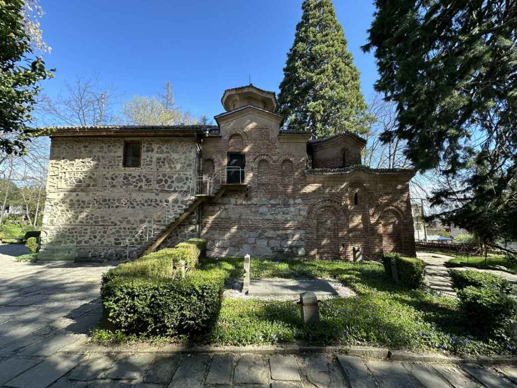
Boyana Church, very near the start of the walk.
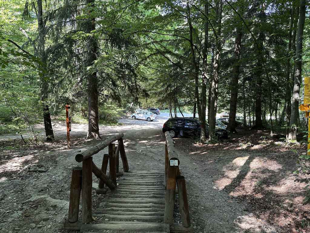
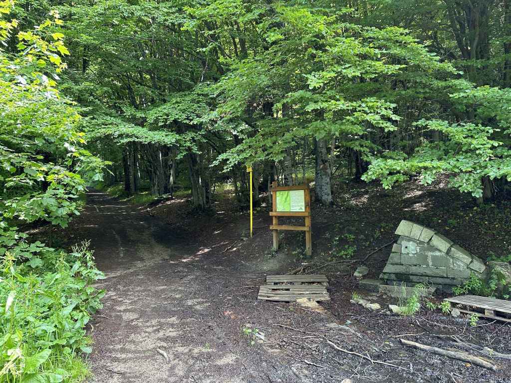
The entrance to Vitosha Nature Park from Boyana Village.
The military installation behind barbed wire.
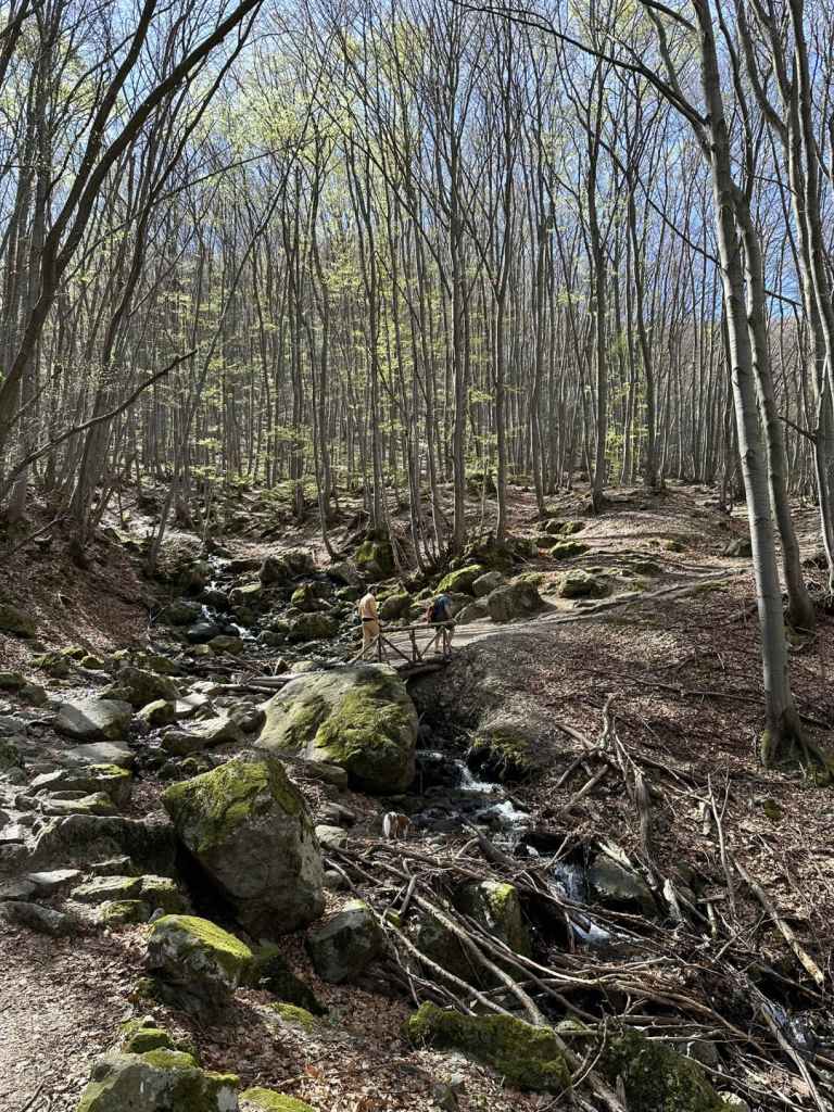
The bridge over a tributary.
Boyana River, like a scarf caught in the trees.
Boyana River, heading north from the waterfall to Sofia.
One of the mini-waterfalls before the waterfall proper.
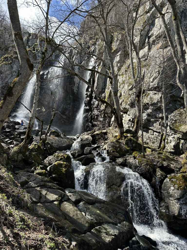
The approach to Boyana Waterfall.
Arriving at Boyana Waterfall.
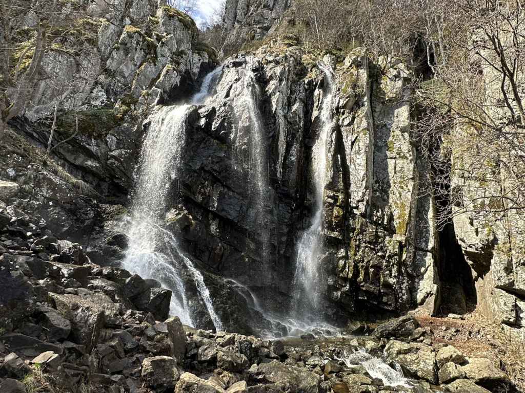
Boyana Waterfall (the Communion of the Apostles).
The path from Boyana Waterfall heading east to Boyana Lake.
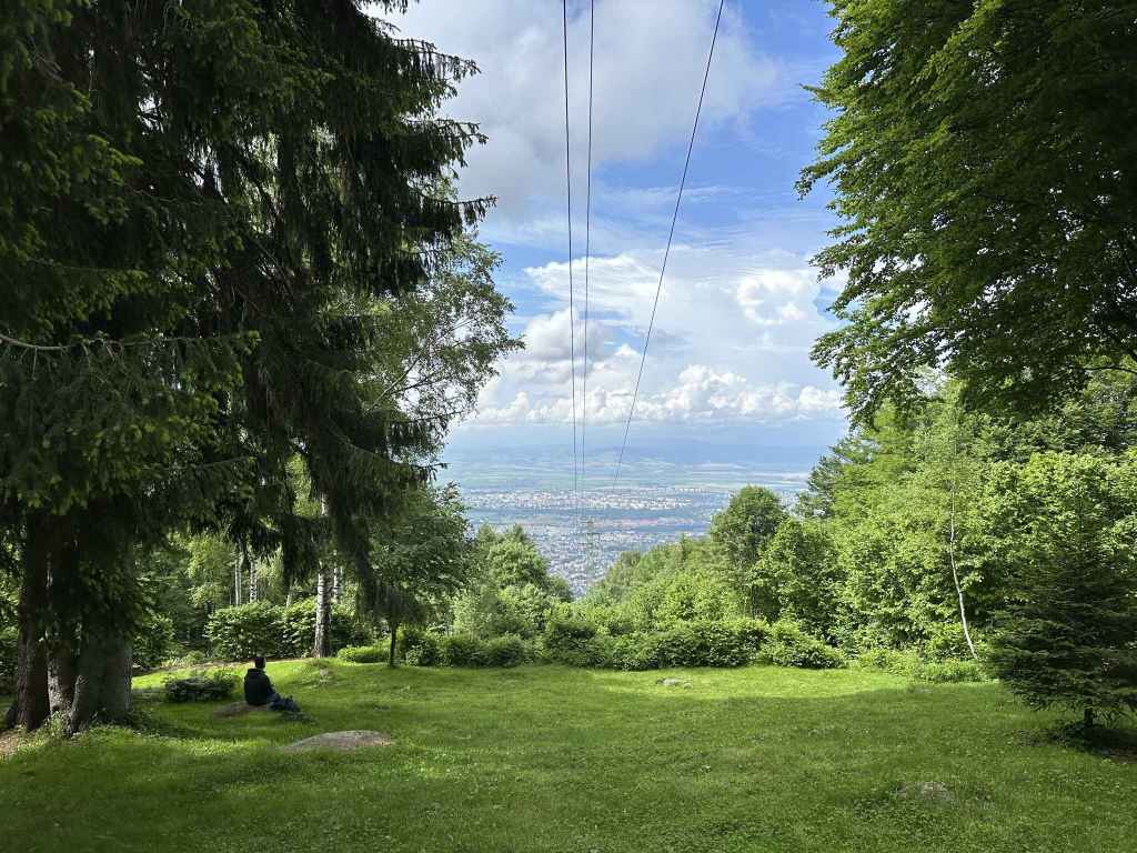
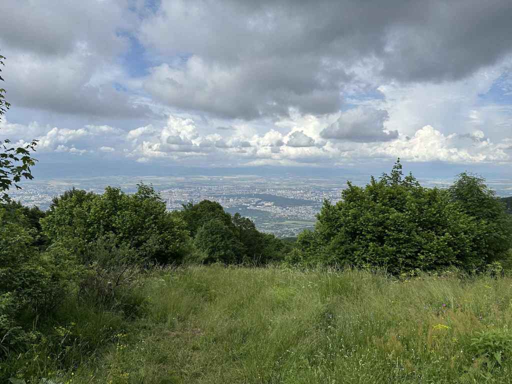
A view of Sofia.
Kopitoto in the west. From the hotel, there is another, easier route to Boyana Waterfall.
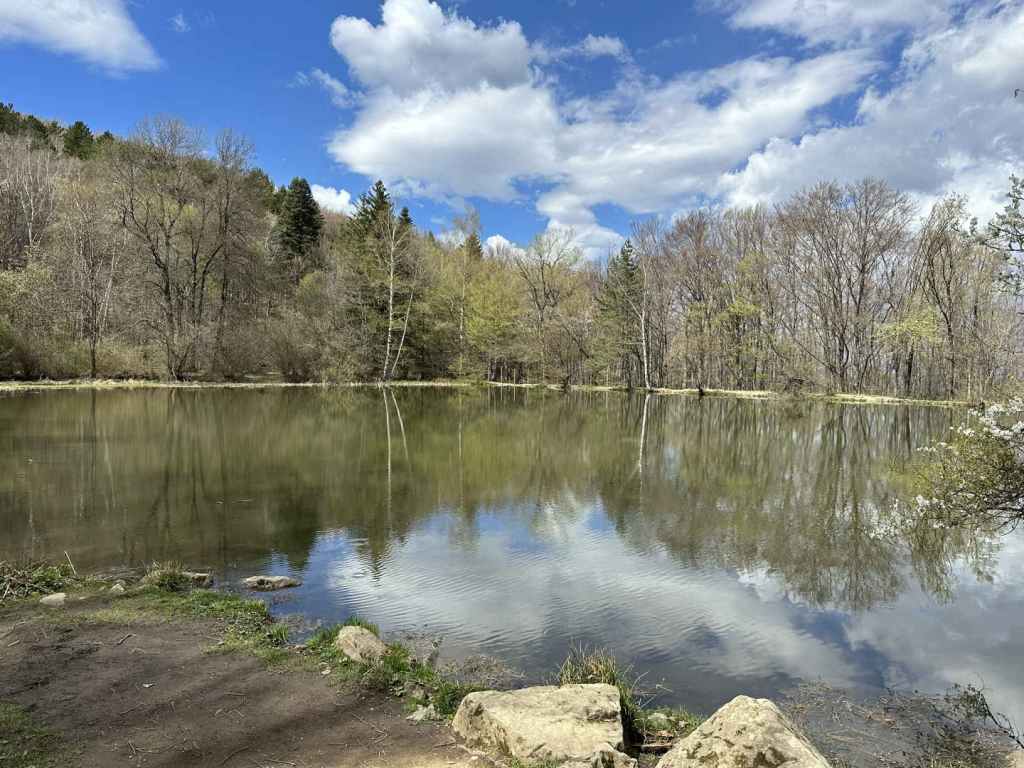
Boyana Lake.
The path heading north from the lake, which brings you back to the starting point.
The start of this walk is very near the famous Boyana Church, one of the principal tourist attractions in Sofia, a World Heritage Site with medieval frescoes dating from 1259. The church is open every day during normal working hours and, although you only get about ten minutes inside (due to conservation measures), it is well worth a visit.
Both the 64 and the 107 buses stop near the church. For the 64 bus, which continues to the next village east, Dragalevtsi, you want to get off at the stop “Boyansko Hanche”, a restaurant on Sborishte Square. The 107 bus will take you all the way to the church, since this is its last stop. By car, you approach Boyana on Bulgaria Boulevard (from where you can see the waterfall on the side of the mountain), go under the ring road and, 200 metres after entering the village, you come to a roundabout. Go left here and, at the traffic lights, turn left. After 400 metres, you will cross Boyana River (which, higher up, forms the waterfall) and, in another 200 metres, Boyana Church will be signposted on the right. Park somewhere near the square.
To reach the church, you go past All Seasons Residence Hotel and continue uphill. The church is about five minutes away and can be visited before or after the walk. To reach the start of the walk, with the entrance to Boyana Church in front of you, go right and continue further uphill. At the top, turn left and, in a couple of minutes, you will reach some stone steps and the entrance to Vitosha Nature Park.
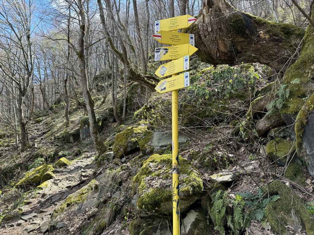
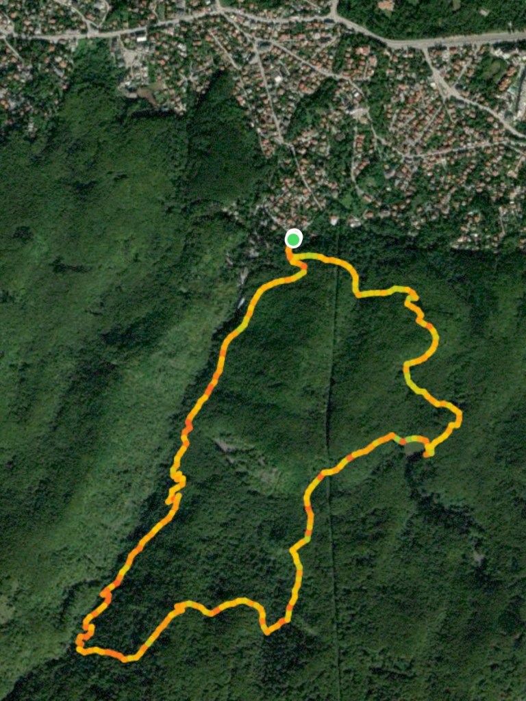
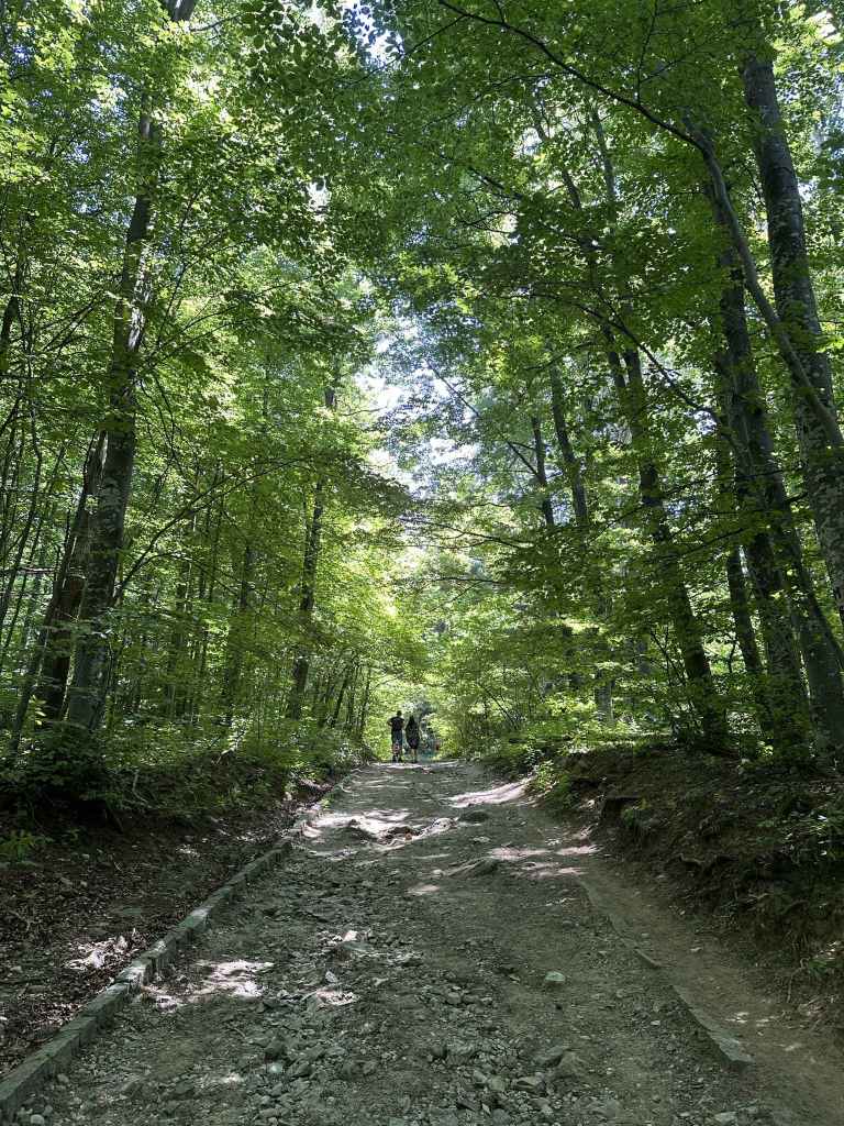
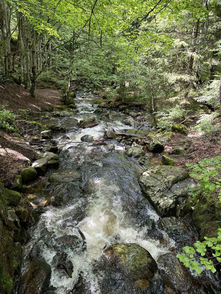
The walk consists of three parts – a stiff climb to the waterfall (1¼ hr, 2.9 km); a gradual descent to the lake (50 mins, 2.3 km); and a return to the starting point (30 mins, 1.7 km). These three parts have red, green and blue markers respectively. As you enter the park (“protected territory since 1934”), you will see a military installation on your right. Follow the red markers. The path takes you uphill and then behind the military installation. You will soon see the river on your right. You will now follow the course of the river all the way to the waterfall. After 1 km, a bridge crosses a tributary from the left. In another 350 metres, a path goes down to the river on the right, but keep left (uphill). The path starts to zigzag and, when you double back on yourself and are facing north, quite often there are pretty views of Sofia through the trees. As you approach the waterfall, the river starts to tumble. There are one or two mini-waterfalls before the waterfall itself. The path here has a metal railing, and at certain points you need to be careful with your footing. There is a rising sense of anticipation as you near the waterfall. It soon appears and is a sight to behold, especially if you go in early spring (during or after the snow melt).
The waterfall reminds me of the Communion of the Apostles in Orthodox churches. It is remarkable how a bubbling stream has now become a burning star pouring forth rays of light. There’s a certain amount of tomfoolery, people taking their shirts off and standing beneath the spray or taking selfies.
After you have taken your fill, you can of course return down the mountain, but I recommend you continue to Boyana Lake. It doesn’t take much longer, and the lake is pretty. Take the path that climbs next to the waterfall, but instead of continuing uphill (south), take the path that immediately forks left (east), which is signposted for Boyana Lake and has green markers. This path meanders around rather than up the mountain. After 350 metres, a path joins from the right. Keep going east. The path begins to descend. In another 300 metres, you will reach a T-junction. Go left here, signposted for Boyana Lake and Dragalevtsi. You will soon cross another tributary of Boyana River. After 1 km, a path joins from the right. Keep going in the same direction (which is now more or less northwards). Several paths diverge to the left. Ignore them. Keep right, and you will soon come to a ruined building, behind which is the lake.
Continue to the north side of the lake, where there are some rocks and people have barbecues. A separate walk approaches the lake from Dragalevtsi Monastery further east. It is normally full of croaking frogs, who like to make their presence felt, but I wouldn’t recommend letting any animals with you drink the water, it’s a little stagnant. Once you’ve had your fill, leave the lake and head north/north-west. A path with blue markers descends the mountain, with the lake behind you/to your left. Follow this path, and in half an hour you will be back where you started!
This walk is an excellent introduction to Vitosha Mountain. It also enables you to visit one of the most famous sites in Bulgaria, Boyana Church. Also in Boyana is the National Historical Museum, which has some impressive exhibits. It is also possible to visit Boyana Waterfall from Kopitoto further up the mountain – in this case, you descend rather than climb to the waterfall, and this is what I did for many years, but I have to say I find the climb from Boyana Village very rewarding. The fact you’re by the river all the way – it’s like she’s taken you by the hand and led you there herself.
The car park on the right of the road just before it makes a 180-degree turn.
The little bridge at the start of the path that climbs the mountain.
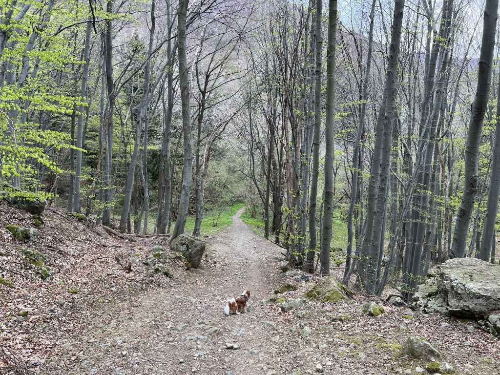
The path up the mountain.
The stream that runs next to the path.
The path rejoins the main road and continues opposite.
After 5-10 minutes, there is a crossroads. The path on the left is the one you will come back on.
The path joins the road between Zlatni Mostove and Momina Skala.
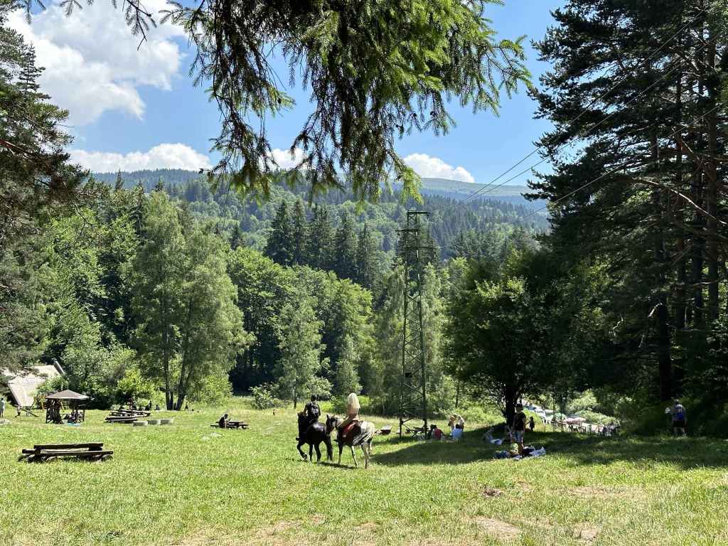
The meadow Beli Bryag with some horse riders.
The road to Momina Skala on the left, the path in the middle, and another path on the right. Take the path in the middle.
Cross the cobbled road and take the path diagonally opposite.
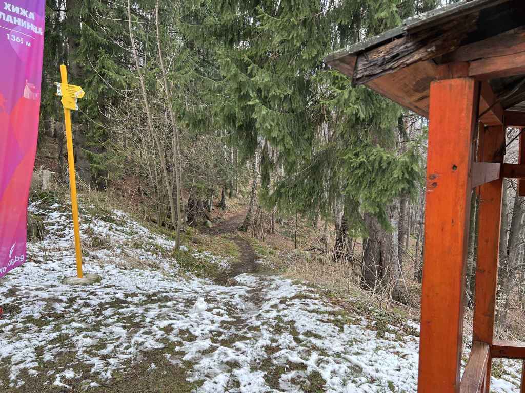
After five minutes, some stone steps on the left lead to Planinets.
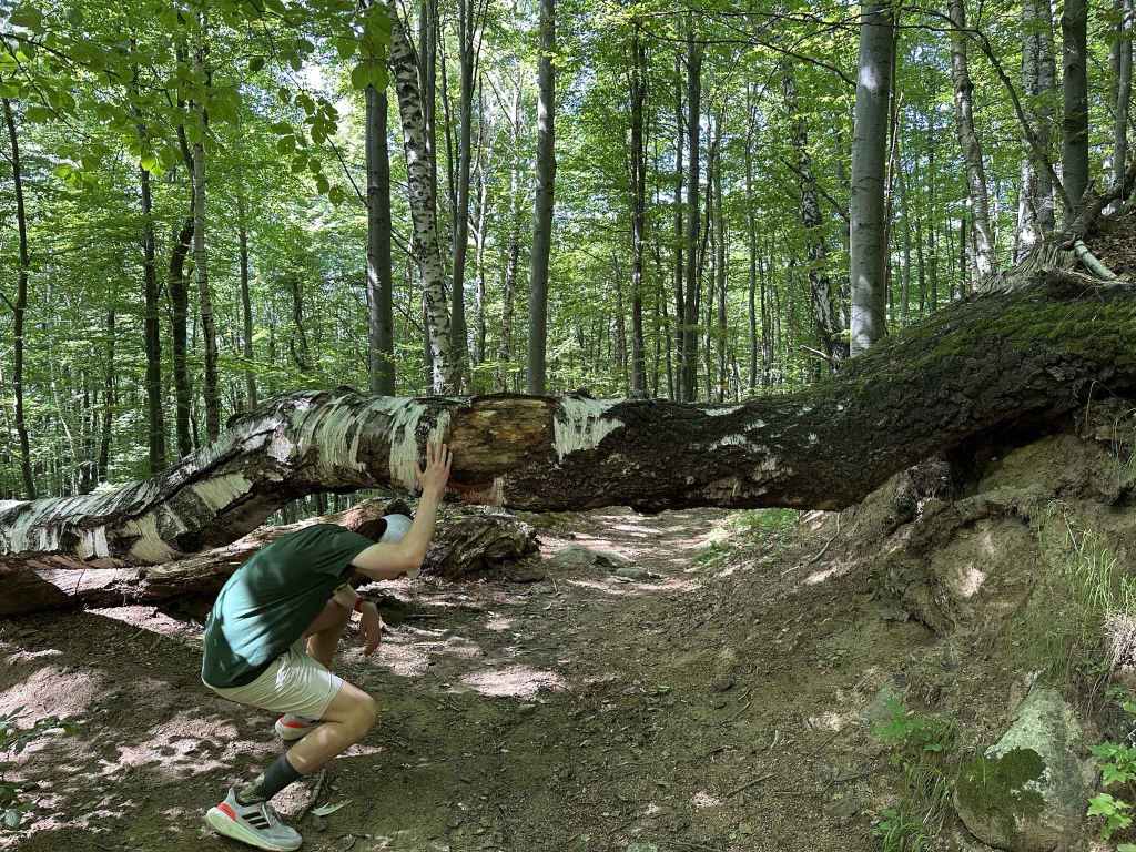
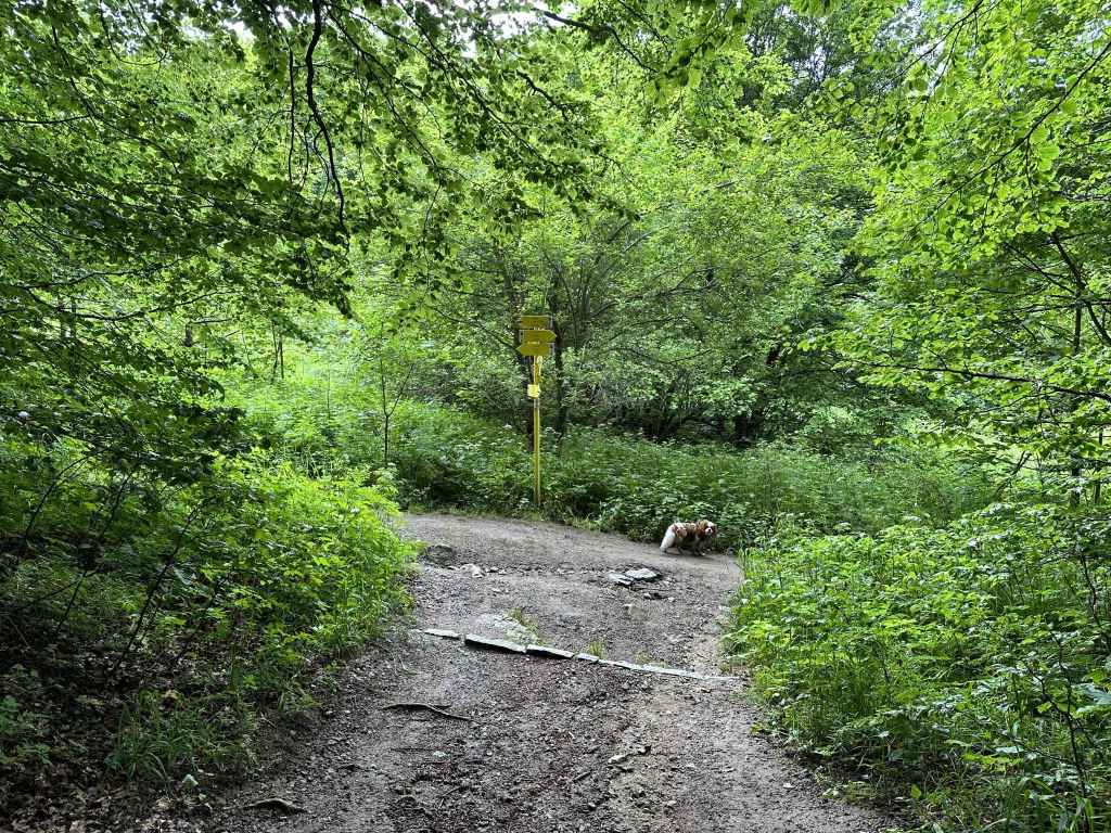
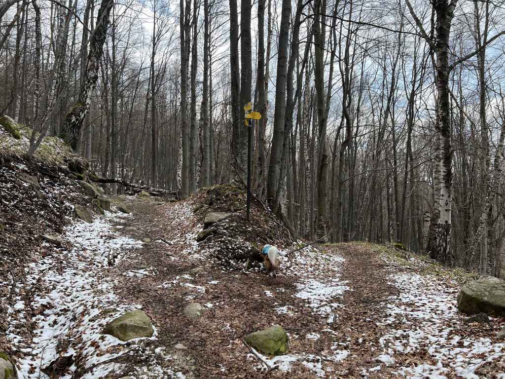
After ten minutes, go under a tree trunk before taking the path to Belite Brezi on the left.
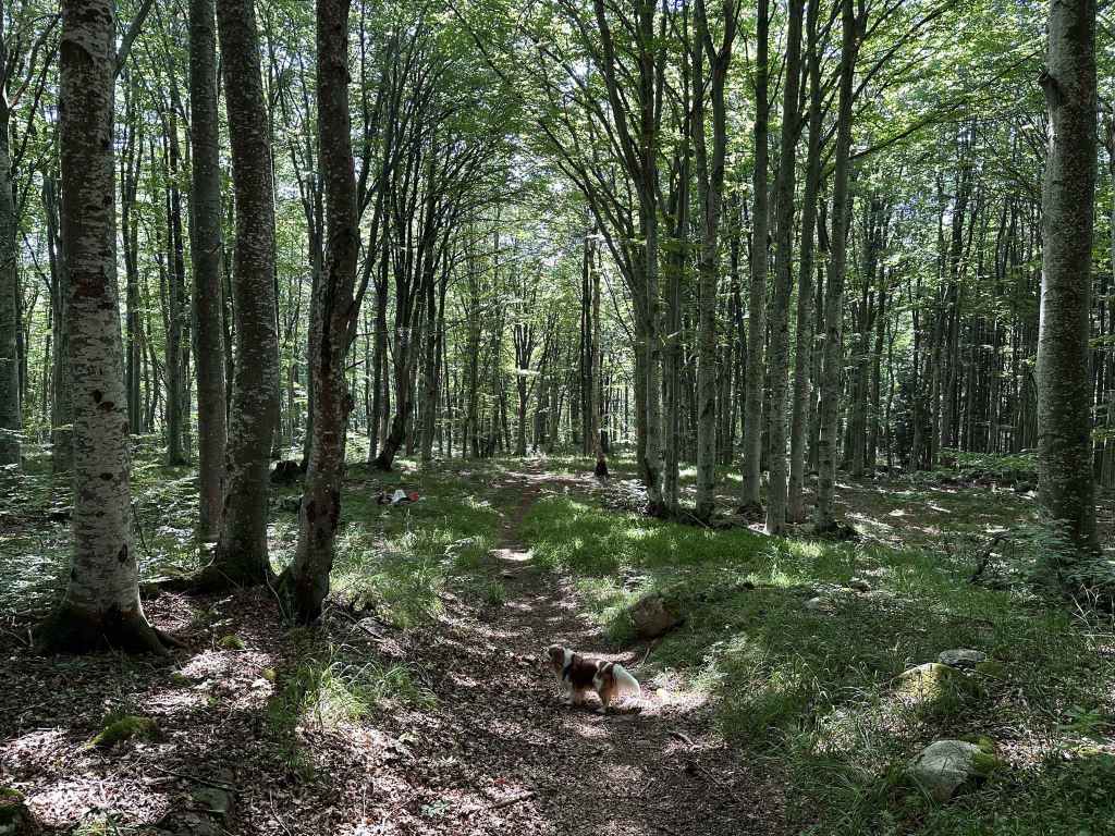
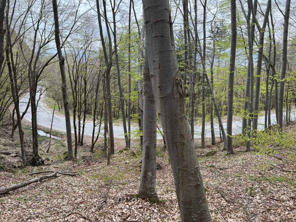
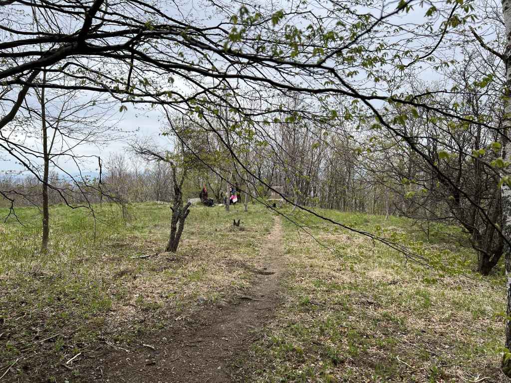
The magical forest.
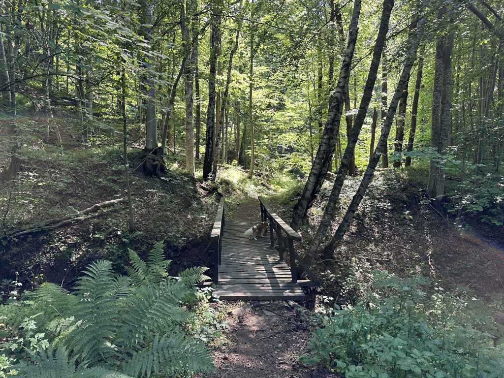
A bridge crosses a stream.
You return to the path you were on and head back down the mountain.
Back to the main road.
Over one or two small bridges.
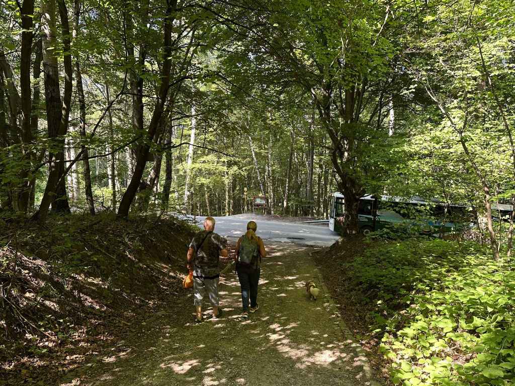
To the car park.
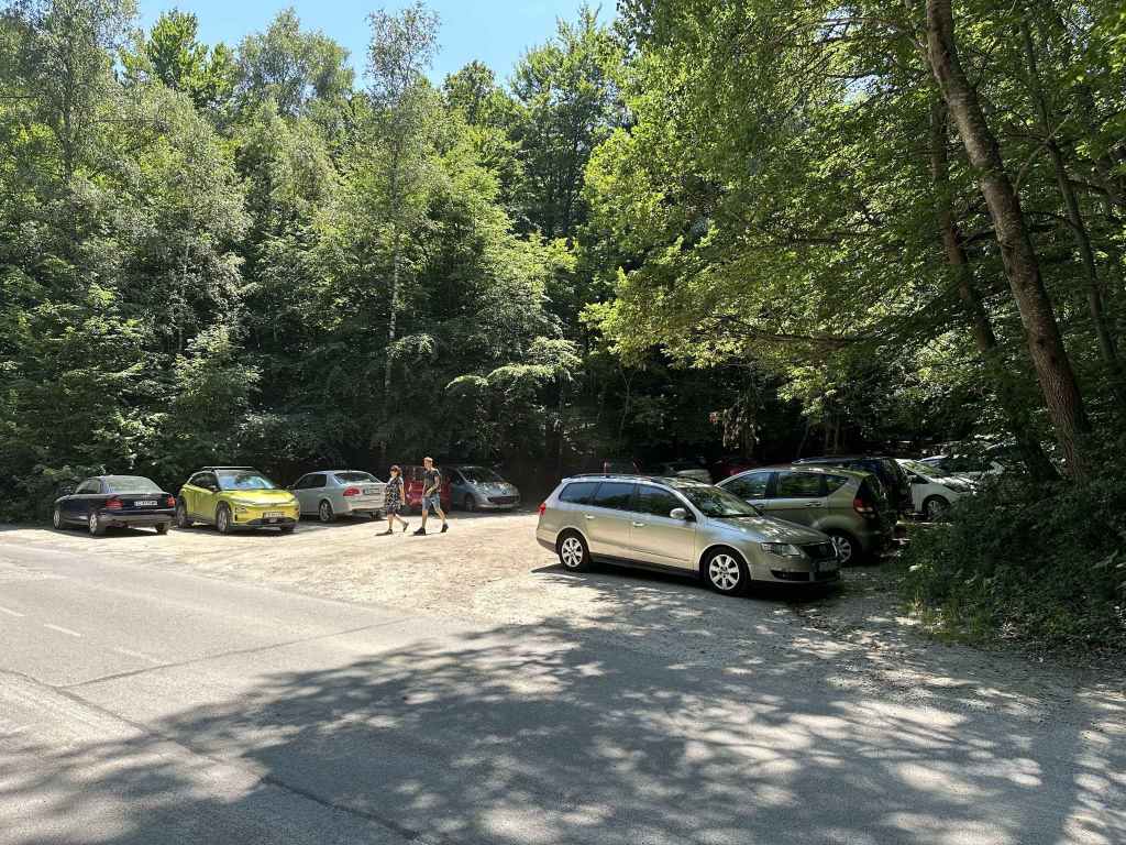
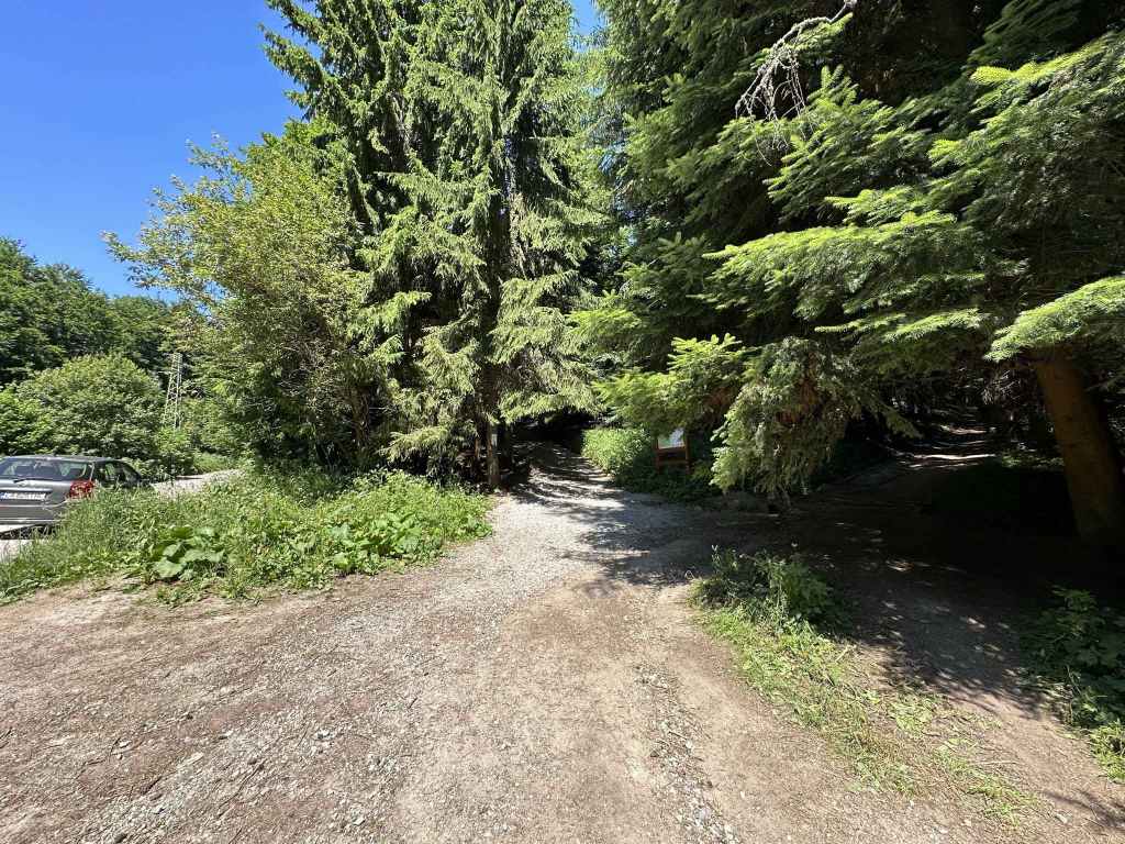
This is a beautiful walk up and down the mountain which has the advantage of being accessible even when there is heavy snow higher up the mountain. The starting point is not the Dendrarium itself, but a car park before the Dendrarium. Take the road that accesses the mountain via Boyana. This is Bulgaria Boulevard. You go under the ring road, drive through Boyana (with the centre of the village on your left) and continue straight up the mountain. As the houses give way to forest, the road begins to wind. You come to a motel called Tihiya Kat, the starting point for the walk to Vladaya River. 900 metres after this motel is a car park on the right of the road. This is where you need to start. If you are travelling by bus no. 63, you can get off at Tihiya Kat and walk the remaining distance or continue to the next stop (the Bear Museum) and walk back.
Immediately after the car park, the road does a 180-degree turn before continuing up the mountain. Leave the road behind. The car park is on your right. From here a path leads directly up the mountain in the direction of Zlatni Mostove. It begins with a little bridge, and then climbs steadily, but not onerously, for about an hour. The road (and bus) have the same destination, but take a much more roundabout way to get there.
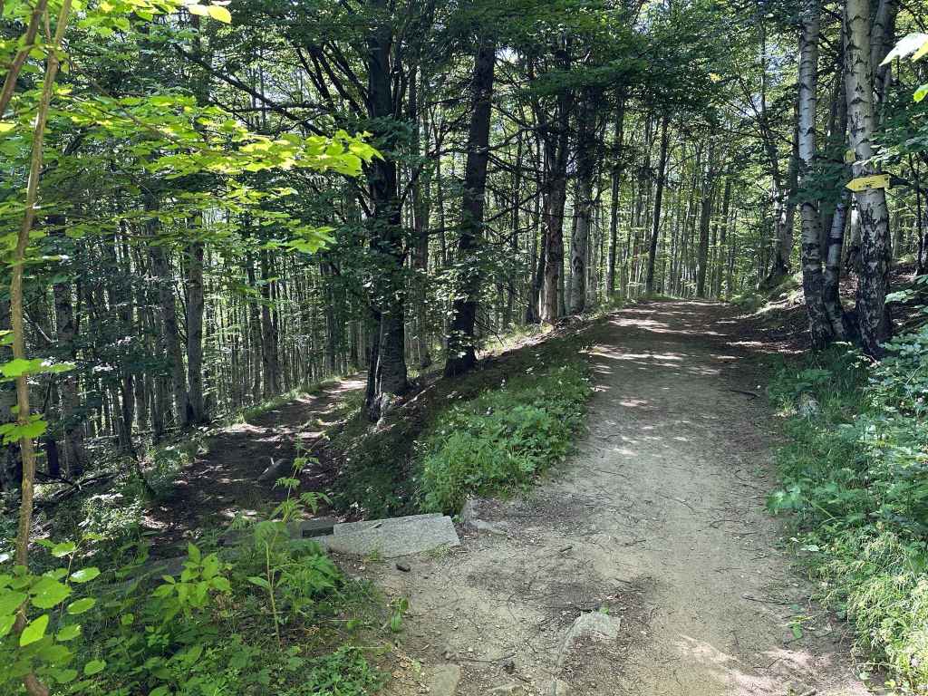
As you climb the mountain, various paths go left in the direction of the Dendrarium, but you want to stay on the same path, which is signposted for Zlatni Mostove and Momina Skala. Soon you will notice a stream on your right. After about fifteen minutes, you cross a secondary road connecting the Dendrarium on your left with a mountain hut, Iglika, on your right, a popular place for picnics in the summer. Continue straight with the stream now on your left. Ten minutes later, the path veers abruptly right, then left, and the road appears in front of you.
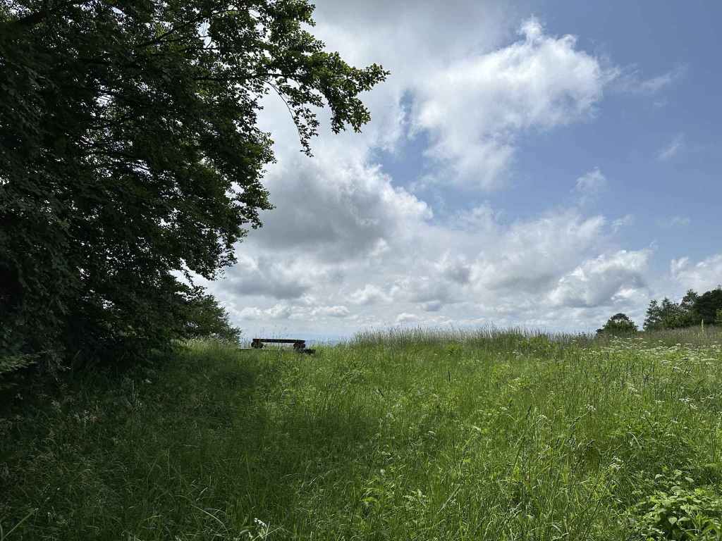
Go directly over the road and continue on the path on the other side. In a few minutes, there is a picnic table on your right. Another five minutes, and you come to a sort of crossroads with Vladaya village (and a mountain hut, Belite Brezi) on the right and a path to Kopitoto and Planinets on the left. The path to Kopitoto and Planinets is the path you will come back on. For now, continue straight up the mountain. You pass some more picnic tables and a fountain on the left. In about twenty minutes, a path joins from the left and, immediately after that, you reach the road that connects Zlatni Mostove on your right with Momina Skala on your left. On the other side of the road is a large, open meadow called Beli Bryag. This is a popular picnic area in summer and a good place to stop for refreshment. There are stalls selling corn on the cob, jams and souvenirs. If you head in the direction of Zlatni Mostove, there are some restaurants.
Having paused for refreshment, continue with the meadow on your right. This brings you to a wooden barrier with the road to Momina Skala on your left, a path heading up the hill in front of you, and a path on the right. The path heading up the hill in front of you skirts the road. Take this path. You are now doing part of the walk from Planinets, but in reverse. After three minutes, a path on the left is signposted for Planinets. Take this path, cross the cobbled road and continue on the path diagonally opposite. This path is signposted for Kopitoto. After five minutes, there are some stone steps on the left. Go down these steps and join the path to Planinets. After ten minutes, a tree trunk blocks the path. Go under the tree trunk, and immediately there is a path on the left signposted for Belite Brezi. You have to make a 150-degree turn. Do not continue to Planinets, but take the path to Belite Brezi, a path less trodden which leads you through magical forest (I have taken this path when there was thick snow and got quite lost; I have also encountered people sitting by the side of the path, seemingly lost in meditation). After ten minutes, a path on the right is signposted for the Dendrarium, but do not take it. Keep straight. A bridge crosses a stream, and in another ten minutes you will be back at the crossroads you saw earlier. Turn right here and go straight down the mountain. Cross the main road, then the side road between the Dendrarium and Iglika, and in half an hour you will be back at the car park where you started.
Transport: by car, or by bus no. 63 to the Dendrarium
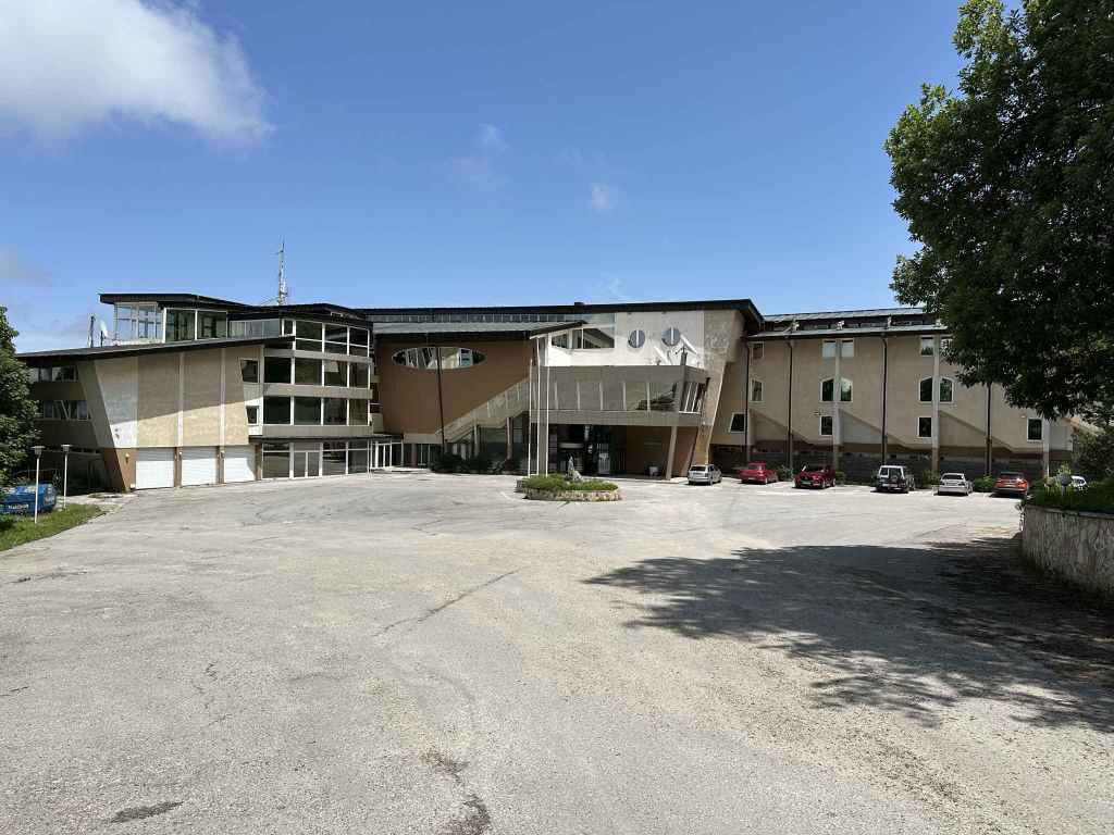
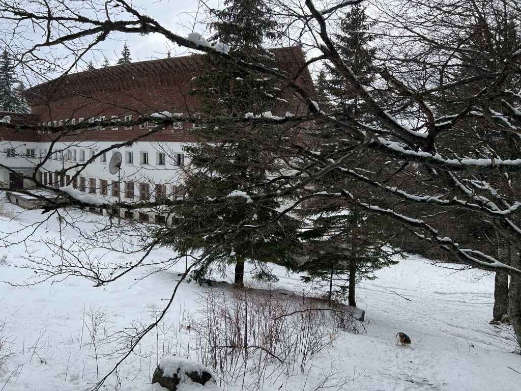
Kopitoto Hotel.
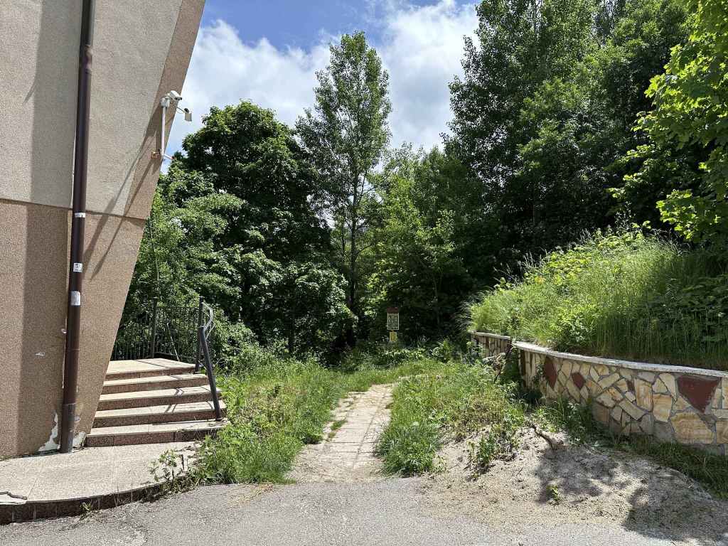
The path starts on the right of the hotel.
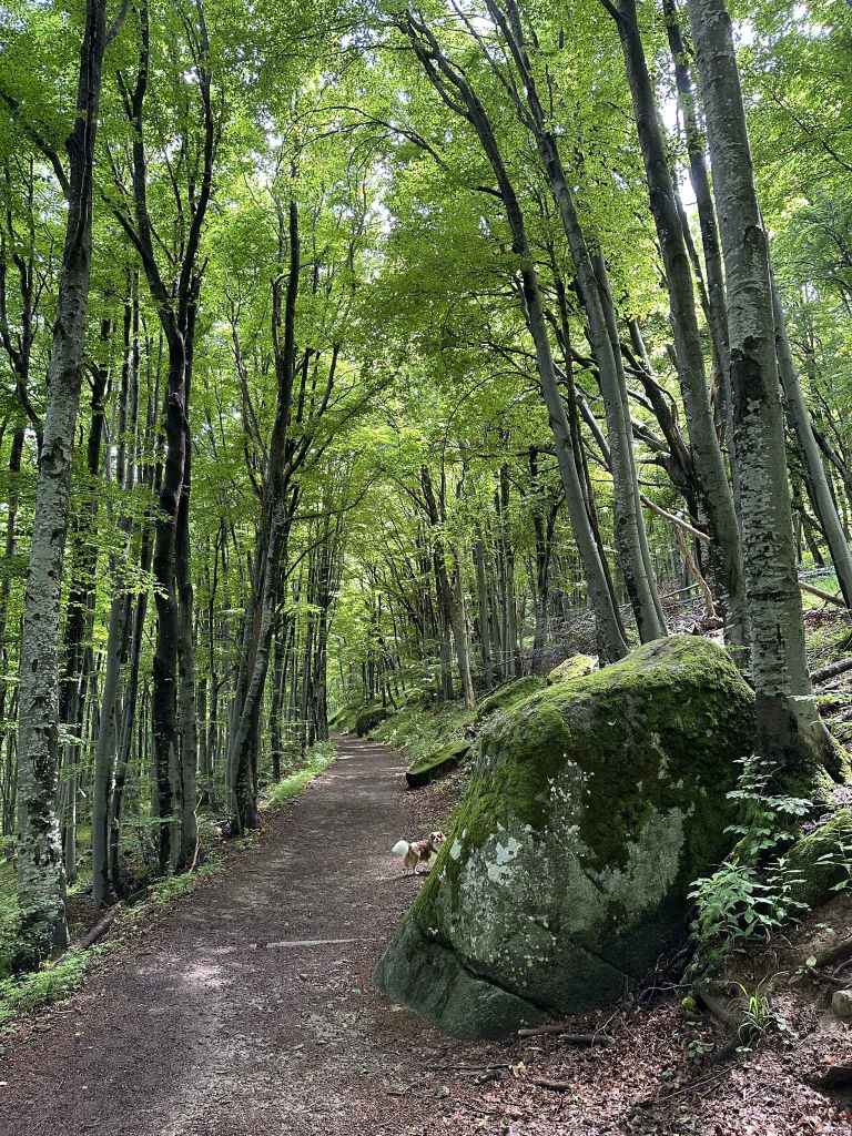
You are directly submerged into forest.
Twenty minutes after the hotel, there is a crossroads. Go left…
… but only after making a small detour!
Momina Skala – the large, open field.
Momina Skala – the hut in the trees.
Boyana River as it leaves the hut behind.
Esperanto hut.
Kamen Del hut.
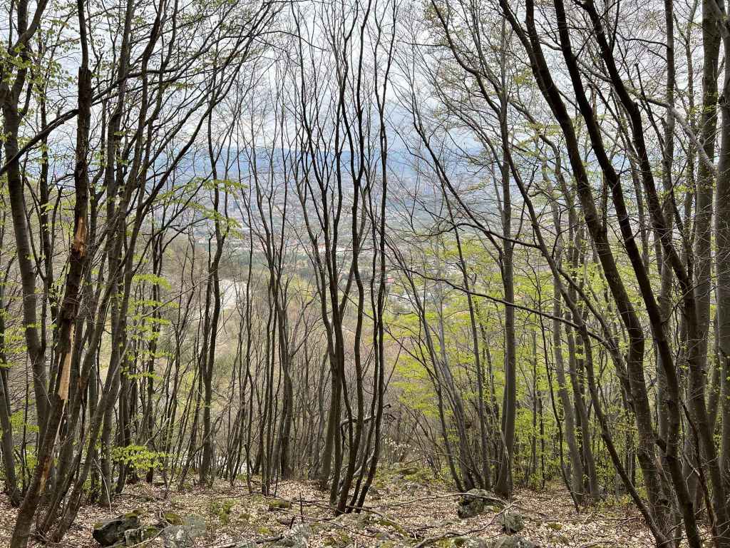
The view of Sofia from Kamen Del.
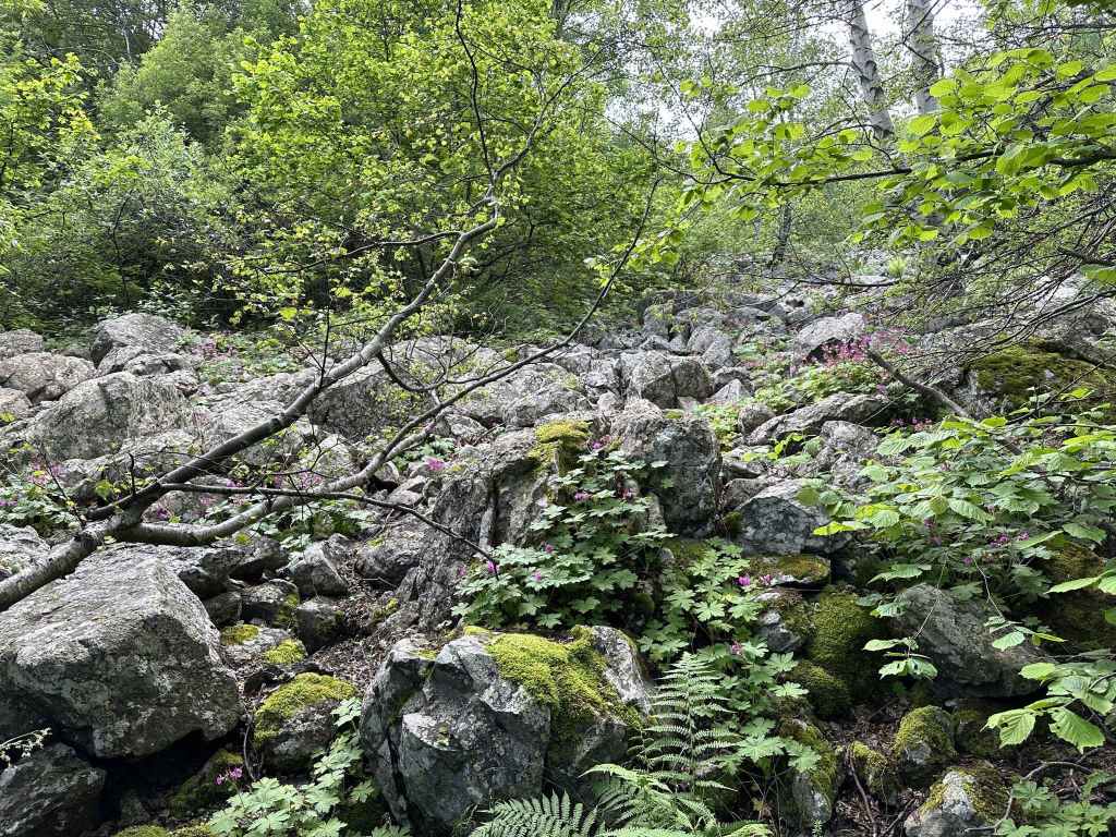
A small moraine river between Kamen Del and Kikish.
Kikish hut.
Boyana River between Momina Skala and the waterfall.
The view of Sofia from the path back to Kopitoto.
When the path ends, go right and in ten minutes you will be back at the hotel.
This was my first walk on Vitosha back in 2003, so it’s a very special walk for me. It takes you to the three mountain huts that overlook Sofia from the front of Vitosha: Esperanto, Kamen Del, and Kikish. There are huts further up or around the mountain, but these are the first I visited.
When you look at the mountain from Sofia, there are certain things you notice. One of them is the golf ball on top of the mountain, which is in fact a radar station on the second highest peak of Vitosha, Golyam Rezen. But unmissable in the west is the large TV tower (186 m) and, next to it, a hotel building, both named after the rocky outcrop they stand on: Kopitoto (“The Hoof”). This walk starts at the hotel. To get there by car, you take the road through Boyana (which is actually a continuation of the main thoroughfare heading south of the centre, Bulgaria Boulevard – after you pass under the ring road, this road affords excellent views of the tower and hotel) and continue until you reach the Dendrarium on your right. There is then a turning on your left, which ends at the hotel after 2.7 kilometres. If travelling by bus no. 63, you will have to get off at the Dendrarium and walk the rest of the way. After 1.3 kilometres, you will pass a turning on your right to Planinets, the start of another walk, and after another kilometre you will pass the TV tower on your left before reaching the hotel in another 400 metres.
What makes this walk so special is the sudden transition from the world of concrete (the hotel) to the world of nature. You are literally immersed. The path starts on the right of the hotel. It immediately divides, a branch on the left heading back down to Boyana. Ignore this branch and continue up some steps, past a marble bench, into a wonderful avenue of trees that lean towards each other in the canopy, forming what looks like the nave of a cathedral. Large boulders are strewn on the right, resembling strange creatures. After approximately ten minutes, a path diverges on your left to Boyana Waterfall. This is the path you will return on. Ignore it for now and continue straight in the direction of Cherni Vrah/Momina Skala. After ten minutes, you will come to a crossroads. You want to go left here, still in the direction of Cherni Vrah/Momina Skala, but I’m going to let you in on a secret. A few metres away is my favourite spot on the mountain, a magical place I walked past for many years without knowing it was there. To get there, you need to make a small detour: at the crossroads, turn right towards Karpuzov Valog. Continue for a couple of minutes past some trees on your left until you reach a picnic table out in the open. Leave the path and walk to the picnic table. From here, you have the most outstanding view of south-west Bulgaria. My wife and I watched the sunset here one New Year’s Eve. It is such a peaceful place for a moment of mindfulness.
Now go back to where you were – the crossroads – but this time go left in the direction of Cherni Vrah/Momina Skala. After about five minutes, you will hear Boyana River, the river that forms Boyana Waterfall further down, on your left. In another ten minutes, you will reach Momina Skala, a large, open field with tables and shelters, a restaurant and large antenna, which features in many of these walks. Skirt the lefthand side of the field, leaving it behind you, and descend to Momina Skala hut in the trees. The river is in front of you. There is a small bridge, which you need to cross.
A path on your right goes uphill to Cherni Vrah. It is possible to reach the last of the mountain huts on this walk, Kikish, more directly by taking this path and then a left fork that goes to Kikish via Sredets, but we are going to take the path on the left that goes downhill and is signposted for all three mountain huts and Boyana Waterfall. In five minutes, the path divides. Go right, again in the direction of the three huts. After five minutes, a path joins from the left. This is the path you will go back on, but keep going downhill and in five minutes you will reach the first of the huts, Esperanto. It is currently abandoned and a little overgrown. There is a swing attached to a tree.
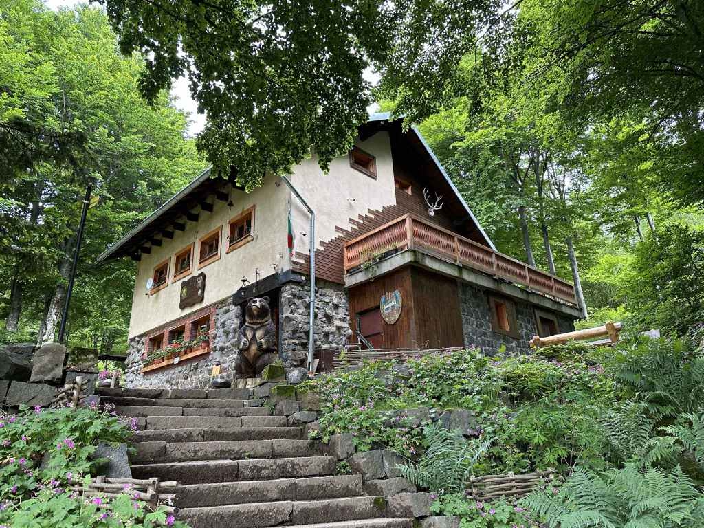
Keep going on the same path and in ten minutes you will come to the second hut, Kamen Del. The view of Sofia from here is memorable. The hut itself is friendly and offers good food. It’s a perfect place to take some refreshment. I went one rainy day and was incredibly grateful for the free herb tea that was served with every meal. If you feel you have gone far enough, you can now turn around and head back in the direction of Kopitoto.
The last hut, Kikish, is another twenty minutes away on the same path. After ten minutes, the path from Momina Skala via Sredets joins from the right. In another five minutes, there is a small moraine river on your right, and soon the hut itself appears. The reason for going this far is to connect the dots – another walk from Bay Krastyo (Dragalevtsi) approaches Kikish from the other direction, so you will have covered most of the front of the mountain. It’s up to you. Continuing to Kikish will add another 45 minutes to your walk.
Leaving Kikish, return to Kamen Del and then Esperanto, but be careful you don’t take the path on the left that goes to Momina Skala via Sredets. Five minutes after you walk back past Esperanto, again avoid the path to Momina Skala on your left (the path you came on). In a few more minutes, another path on your left leads to Momina Skala, while a path on the right leads to Boyana Waterfall. Keep straight. You will soon cross Boyana River as it tumbles down towards the waterfall, little knowing (or perhaps knowing all too well) what lies in store for it.
Five minutes after the bridge, there is a grassy clearing and then a path, again signposted for Boyana Waterfall, on your right. It’s worth taking this path for just a hundred metres in order to admire the view of Sofia. Come back to the path you were on and follow it until it ends in another five minutes. This is the path you ignored when you left Kopitoto. Now turn right and in ten minutes you will be back at the hotel.
Transport: by car, or by bus no. 66 to the stop for Dragalevtsi Monastery
The cobbled road with the road to Dragalevtsi Monastery on the left, the car park next to it, and the bus stop on the right (the red sign marks the shared trail to Boyana).
The path as it leaves the cobbled road.
The large boulder on the path.
The impressive forest.
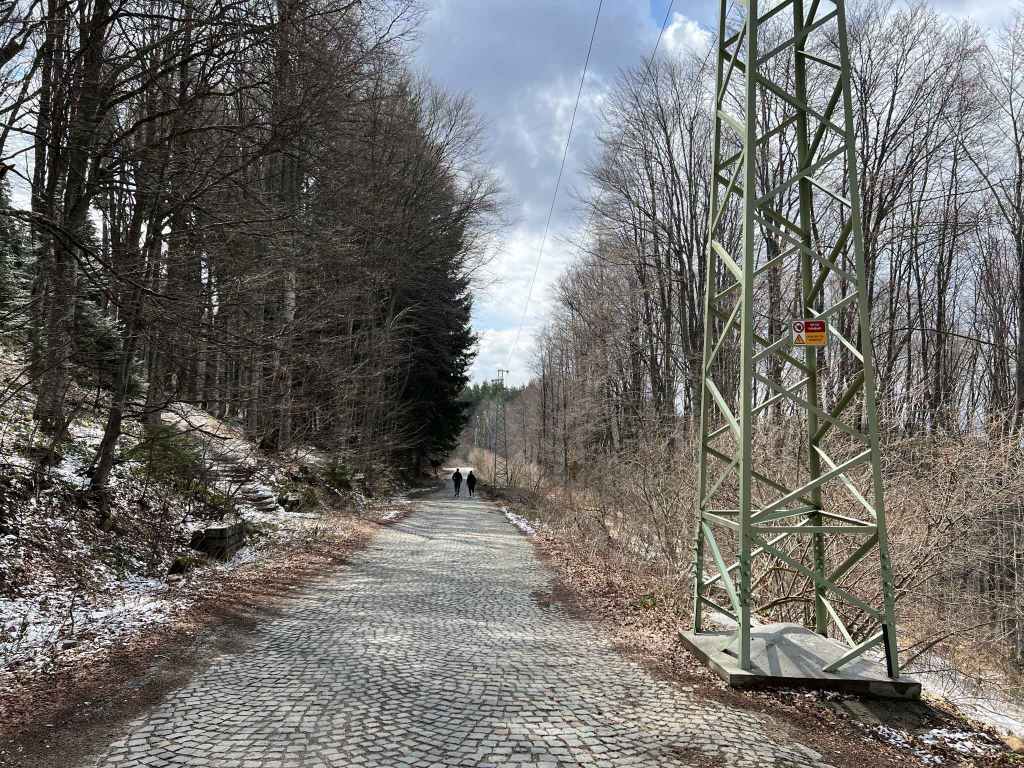
The road is clearly visible from the path.
The road as it performs its large loop, with Sofia in the background.
The fountain next to the first moraine river.
The second moraine river.
The third moraine river, which has a clear view of Sofia.
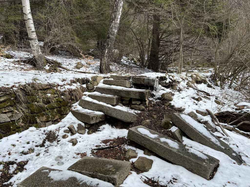
The stone plinth.
This grassy area has a wonderful view of Kopitoto with its distinctive TV tower.
The path descends to the lake.
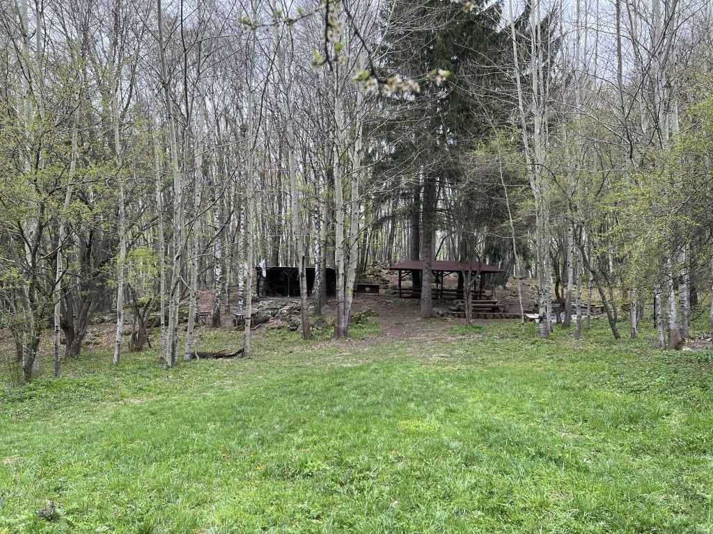
Another grassy area has two shelters. People use this area to light barbecues.
The lake through the trees.
A view from the west side of the lake.
A view from the east side.
The bus stop for returning to Sofia. The stop (“for Dragalevtsi Monastery”) is marked in red.
This is the first of several walks for which you need to access the mountain via the district/village of Dragalevtsi, south of Sofia. The walk follows the path that links Boyana and Dragalevtsi. It is fairly flat and, were it not for the distance (7.3 km), I would classify it as easy.
Dragalevtsi is famous for the fourteenth-century Dragalevtsi Monastery of the Dormition of the Mother of God, which can be reached by a cobbled road from the central square. As you are going up this cobbled road, there is a turning on the left marked “Vodenitsata”, a traditional Bulgarian restaurant next to the start of the Dragalevtsi chair lift (no longer running). If you take this turning, you come to a roundabout, where you turn right, and in a short while you come to the monastery gates. Keep on this side road, and you come to a large car park behind the monastery.
If you continue on the cobbled road and do not take the turning to “Vodenitsata”, the road does a big loop and in three kilometres you reach the same car park from the other direction. Park the car here, or alternatively get off bus no. 66 at the stop “for Dragalevtsi Monastery” (the third to last stop on this route, an optional stop, you must inform the driver you want to get off). The monastery is on the other side of the car park, behind the trees. The bus will continue up the mountain in the direction of Aleko, where there is a ski slope and from where you can set out for the summit, Cherni Vrah.
The path to Boyana Lake is a shared trail (for walkers and cyclists) marked “Boyana” which leaves the road almost next to the bus stop. It climbs a little, passes a large and interesting boulder, and then continues in a north-westerly direction more or less on the same level all the way to Boyana Lake (3.5 km away). You pass through beautiful beech forest and cross several moraine rivers (moraines are large glacial boulders and form a common feature of Vitosha). At the first moraine river, after fifteen minutes, there is a fountain on the right. In another fifteen minutes, you come to the third moraine river, from where there is a wonderful view of Sofia. In another fifteen minutes, there is an open grassy area on the right with a stone plinth and an excellent view further west towards Kopitoto (“the Hoof”, where there is a hotel next to the TV tower, both visible from Sofia). It is an ideal spot for a picnic.
At this point, the path begins to descend gently towards the lake. You pass another grassy area on the right, where there are two shelters used for barbecues, and in twenty minutes you reach the lake on your left. From here, the path continues north towards Boyana Village. Another path heads west from the lake in the direction of Boyana Waterfall. You can walk all around the lake. In May, it is full of croaking frogs! If you have a dog, I advise not letting your dog drink the water, since it is pretty stagnant.
Once you’ve enjoyed admiring the lake from different angles, you simply head back up the path you came on and retrace your steps to the cobbled road with the bus stop and the car park. This should take less than an hour.
This walk will easily fit into an afternoon. If you are feeling keen, you can easily combine it with a walk from the same starting point (Dragalevtsi Monastery car park/bus stop), but going in the opposite direction, eastwards towards Aleko Waterfall and Simeonovo Lakes. Both walks skirt the mountain at more or less the same elevation (1000 m). This walk is described in a separate text.
Transport: by car, or by bus no. 63 to the Dendrarium
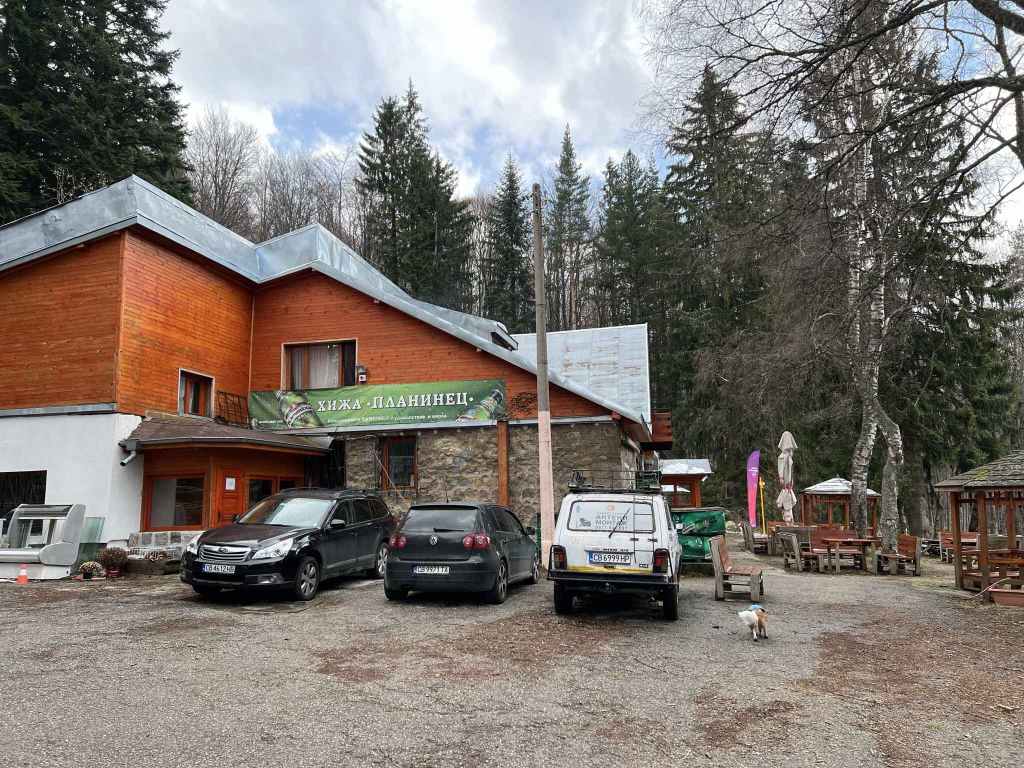
Planinets mountain hut and restaurant.
The beginning of the path.
After ten minutes, the path divides. Keep left.
At the large stone steps, turn right.
Water flowing down the mountainside, with ice in April.
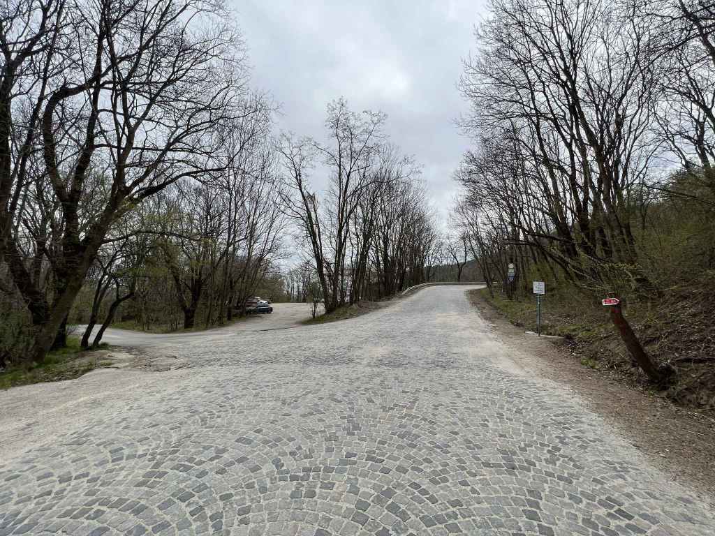
The cobbled road that connects Momina Skala and Zlatni Mostove.
After a short descent, turn left and climb for forty minutes.
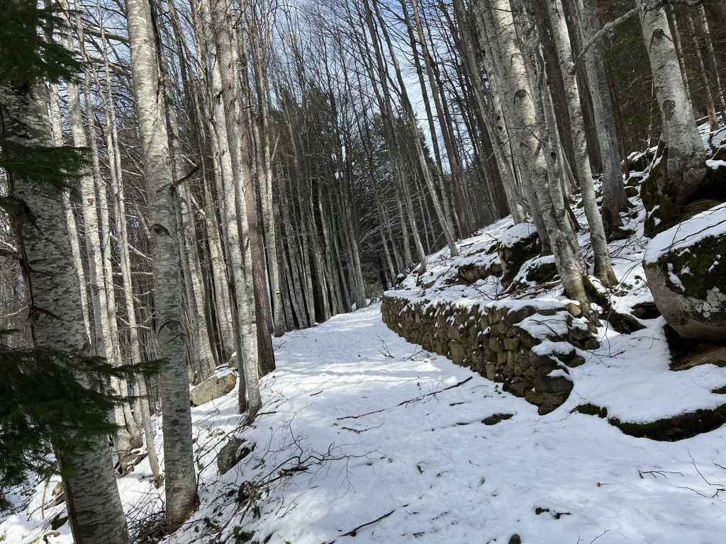
On this path, there is a stone wall.
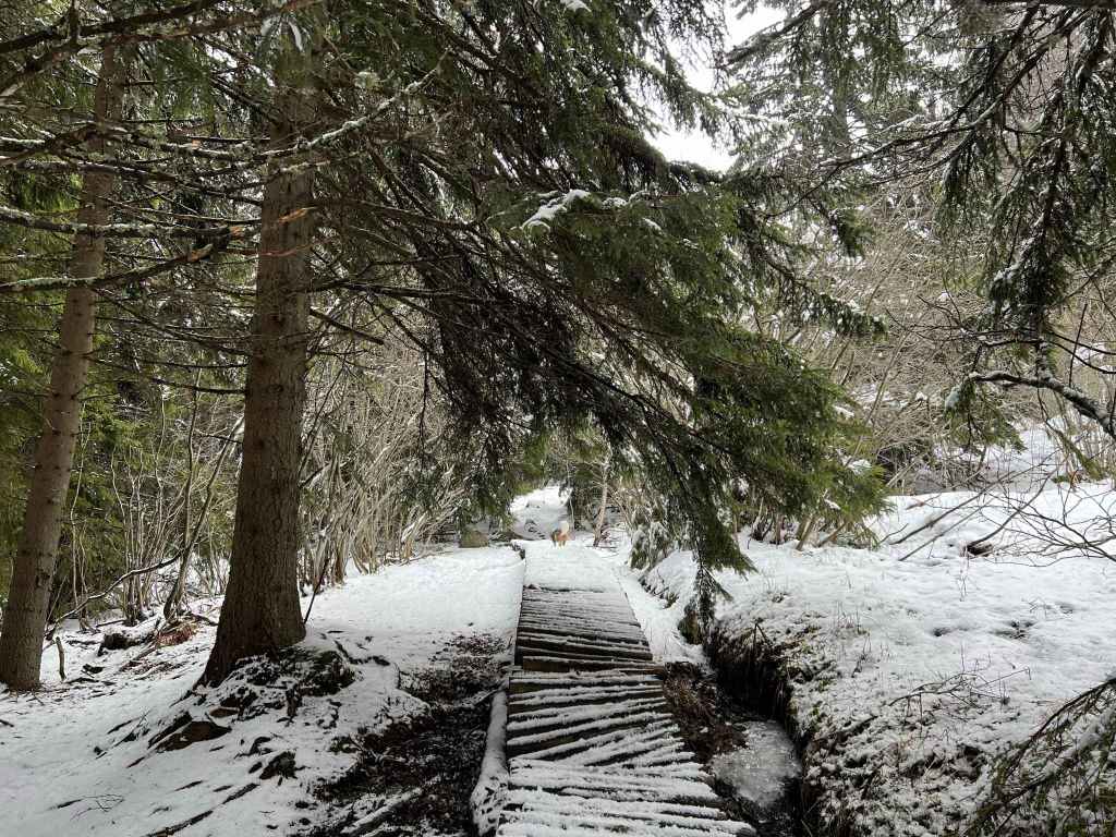
There is also a broken wooden walkway where the ground is wet.
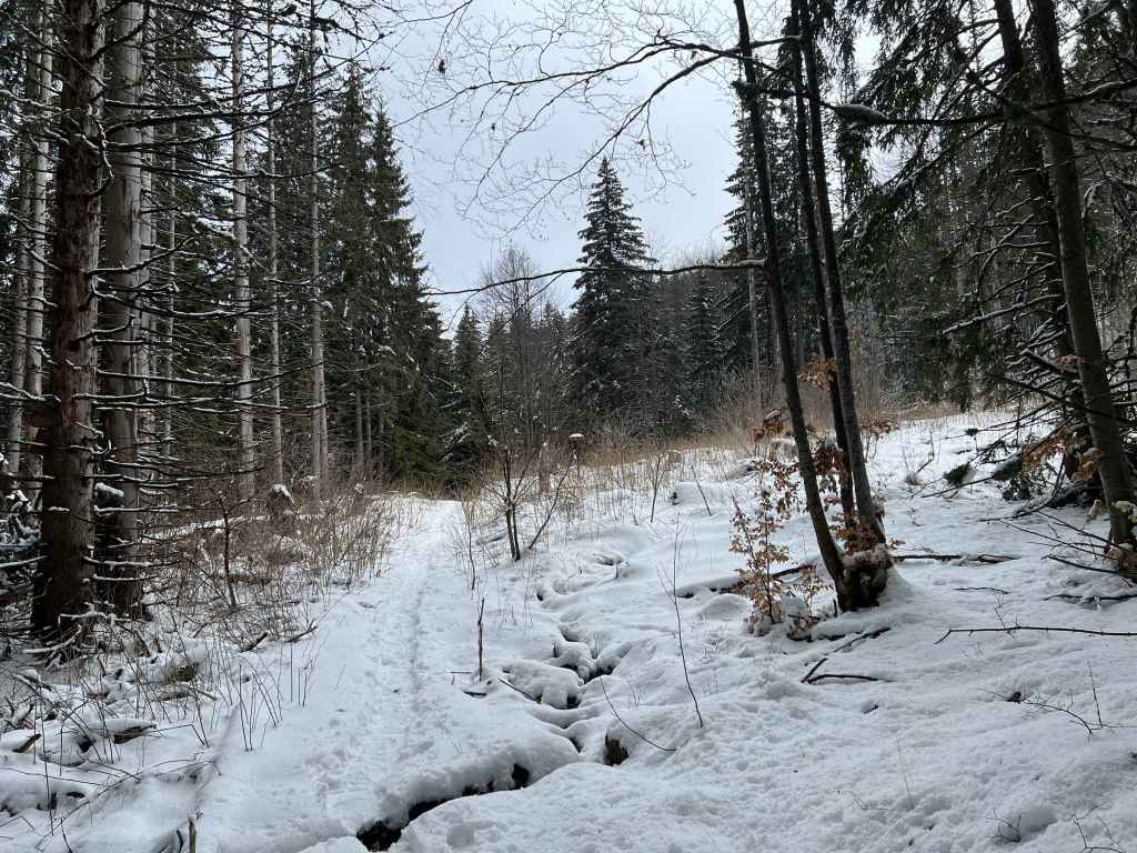
At the top of this path, you come to a clearing.
On joining another path, turn left and after a few metres you will come to Boyana River, a good resting-place.
On the other side of the bridge over the river is Bor mountain hut. Turn left and take the road or the path to its left (which is more direct).
You descend some steps to Rodina mountain hut.
Boyana River as it descends from Momina Skala (it will shortly become Boyana Waterfall).
The meadow in Momina Skala.
Head west and go downhill to rejoin the road to Planinets.
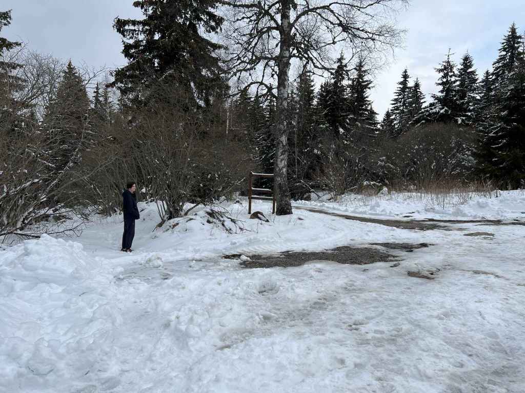
Where you rejoin the road to Planinets, there is a disused fountain.
When you reach the road, Planinets is just on your left.
This is a wonderful, circular walk that starts and ends at the mountain hut and restaurant Planinets. To get there, you need a car. The alternative is to take bus no. 63 to the Dendrarium and to walk from there, but this will add at least an hour.
You take the road to Vitosha that goes through the village of Boyana, follow the road up the mountain. Immediately after you pass the Dendrarium on your right, there is a turning on the left to Kopitoto (where there is a hotel and a television tower). Take this turning. Before you get to Kopitoto, there is a turning on the right to Planinets. Take this smaller road, but be careful, it is full of potholes. The mountain hut/restaurant is at the end.
To start the walk, go past the mountain hut on your left and take the path that descends directly in front of you. After a short descent, this path begins to climb gradually through beautiful forest. It divides after about ten minutes. Take the left fork. A trunk has fallen across the path, so you have to bow your head. Continue for another ten minutes until you reach some large stone steps. At the top of these steps, turn right and after five minutes you will come to the cobbled road that goes from Momina Skala on your left to Zlatni Mostove on your right. Cross the road, climb the steps directly opposite and join the path that connects Momina Skala and Zlatni Mostove. Go right, the path descends steeply for a few minutes. At the bottom, take the path that climbs directly on your left (the road is on your right, and Zlatni Mostove is in front of you). You will now stay on this path for forty minutes or thereabouts.
The path climbs steeply for ten minutes (this is the hardest part of the walk, but nothing too strenuous). Ignore the crossroads, with a hotel (Elitsa) on your left. Keep going straight. After a few minutes, ignore the turning to Septemvri on your left. Keep straight. The path levels out, you cross little streams and pass large boulders called moraines. Eventually you will come to a clearing with plants. Here you join another path coming from Planinarska Pesen. Go left, and in a few metres you will reach a bridge over Boyana River. This attractive river tumbles down the mountainside and further down becomes Boyana Waterfall. This is an ideal spot to have a rest. It is also about halfway through the walk. From now on, the walk is downhill.
When you are rested and have enjoyed one of my favourite spots on the mountain, cross the bridge over the river. There is a mountain hut on your right, Bor. You want to go left (not straight). You can walk on the road, or better take the path that is on the left of the road. On the path, you will keep crossing the road as it winds down the mountain (the path is more direct). After a few minutes, cross the road, and then you will reach the mountain hut Tintyava. Immediately after the hut, turn left, with the building on your left. Cross the road again, and you will descend some steps to the mountain hut Rodina. Go straight past the building on your left. Cross the road again, and now you are on the path to Momina Skala. After fifteen minutes, a path joins the path you are on from the right. At the bottom, turn left and cross the bridge over the same river, Boyana River, you were sitting by earlier, except that now you are further downstream. Pass the mountain hut Momina Skala on your left and climb the short path to a large open area where there is a meadow and places to sit. This is Momina Skala, a popular destination in summer.
Cross the meadow (do not take the path that veers off on your right, this goes to Kopitoto). On the far side of the meadow is a restaurant. Pass the restaurant on your right and a hundred metres away, on the other side of a parking area, is a path marked “Planinets” heading west. This path goes straight down the hill and has wonderful views west of the mountain. Keep going straight down the hill. After ten minutes, you will cross a path connecting Zlatni Mostove and Kopitoto, but do not take it. Keep going downhill. Towards the end of the day, the light here is very attractive as the sun begins to set. Twenty minutes after leaving the restaurant in Momina Skala you will reach the road to Planinets. The mountain hut is just on your left.
This is one of my very favourite walks on Vitosha, but it can be shortened. When you get to the cobbled road, instead of going right, you can go left. The path will take you straight to the meadow in Momina Skala, and from there you can head downhill to the road leading to Planinets. This will shorten the walk by several kilometres, but I recommend the longer route.