Pod Kamiko

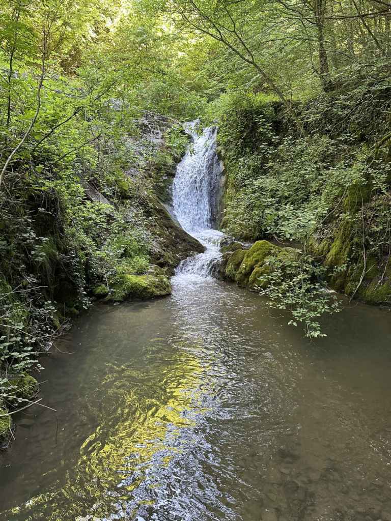
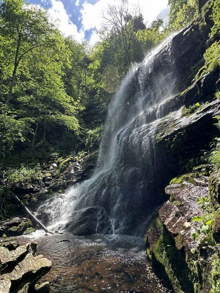
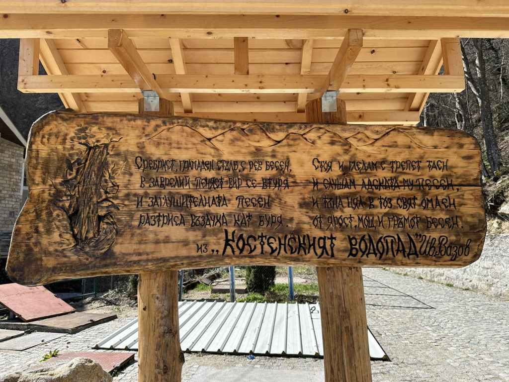
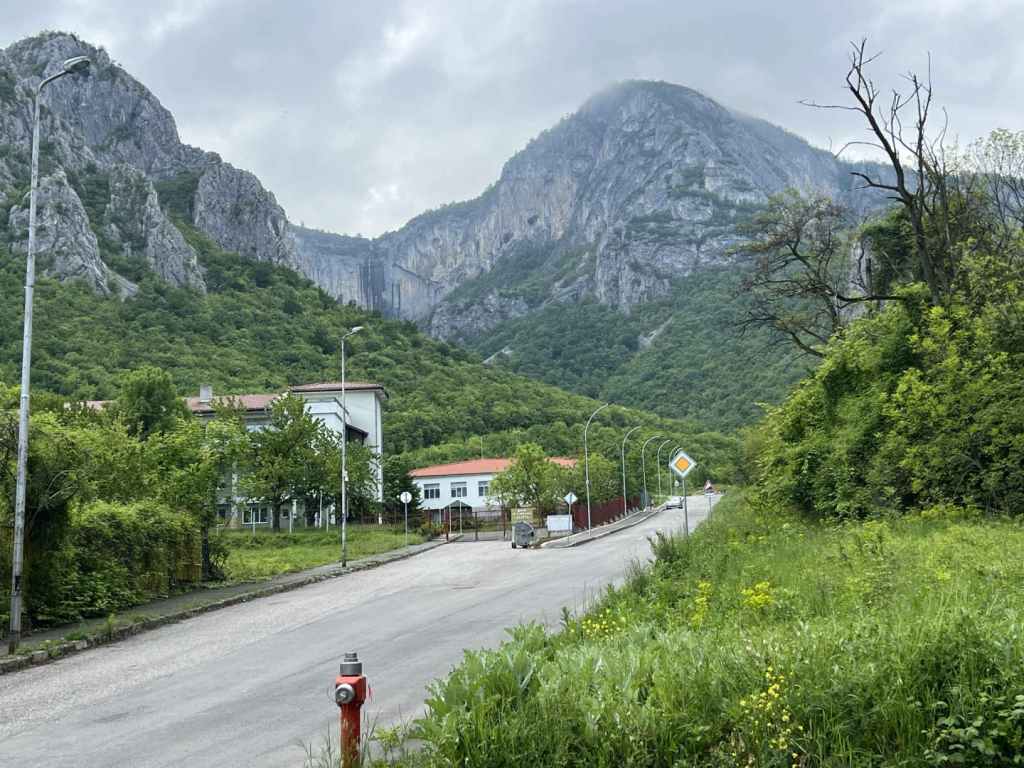
Bovska Skaklya, because of its height and dramatic setting, is perhaps better known, but Pod Kamiko is no less beautiful and worth every bit as much effort. There is a good ecopath that takes you from the stadium in Gara Bov to the waterfall, which is on the outskirts of the village of Bov. The walk to the waterfall takes you along the valley of the River Bov, and there are many smaller waterfalls along the way, some of them quite beautiful. The return takes you along the top of the gorge and back to the stadium from the east. The scenery is spectacular, and the waterfall one of the most beautiful I have seen.

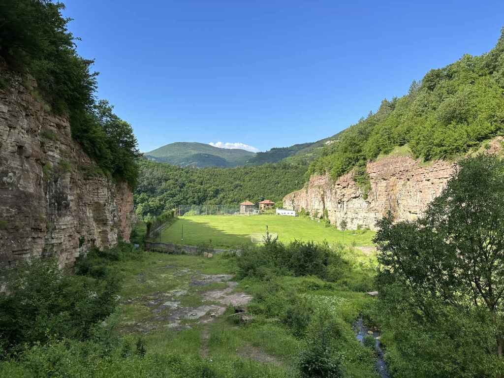
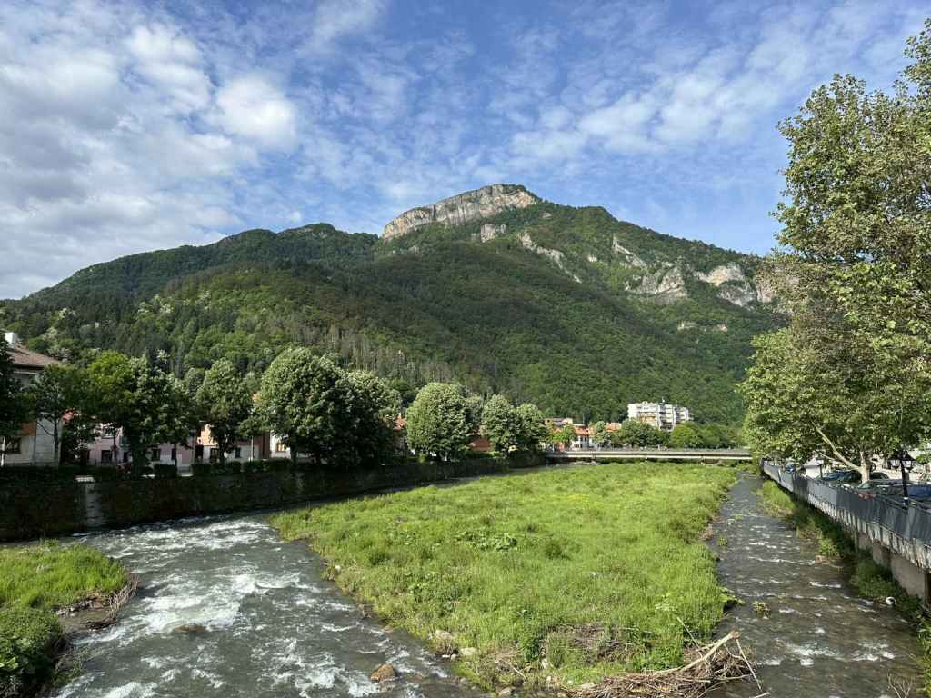
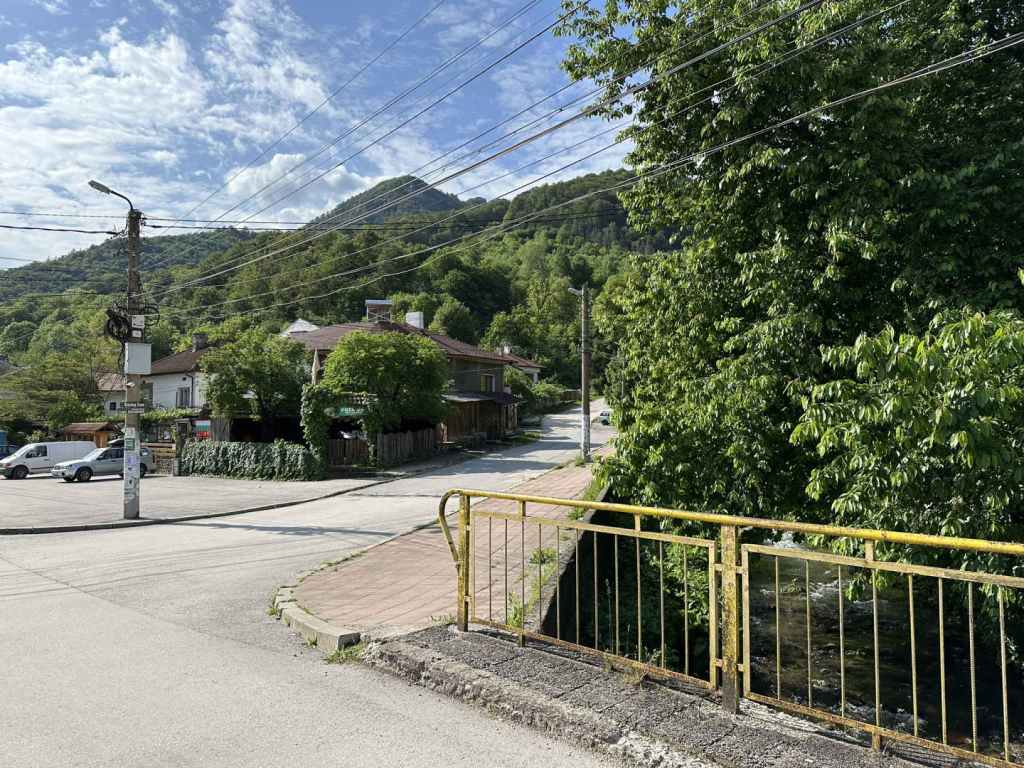
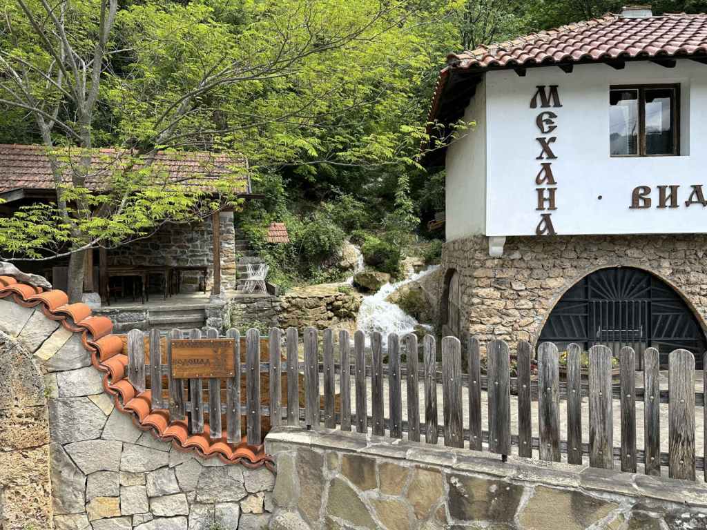
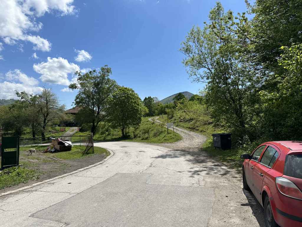
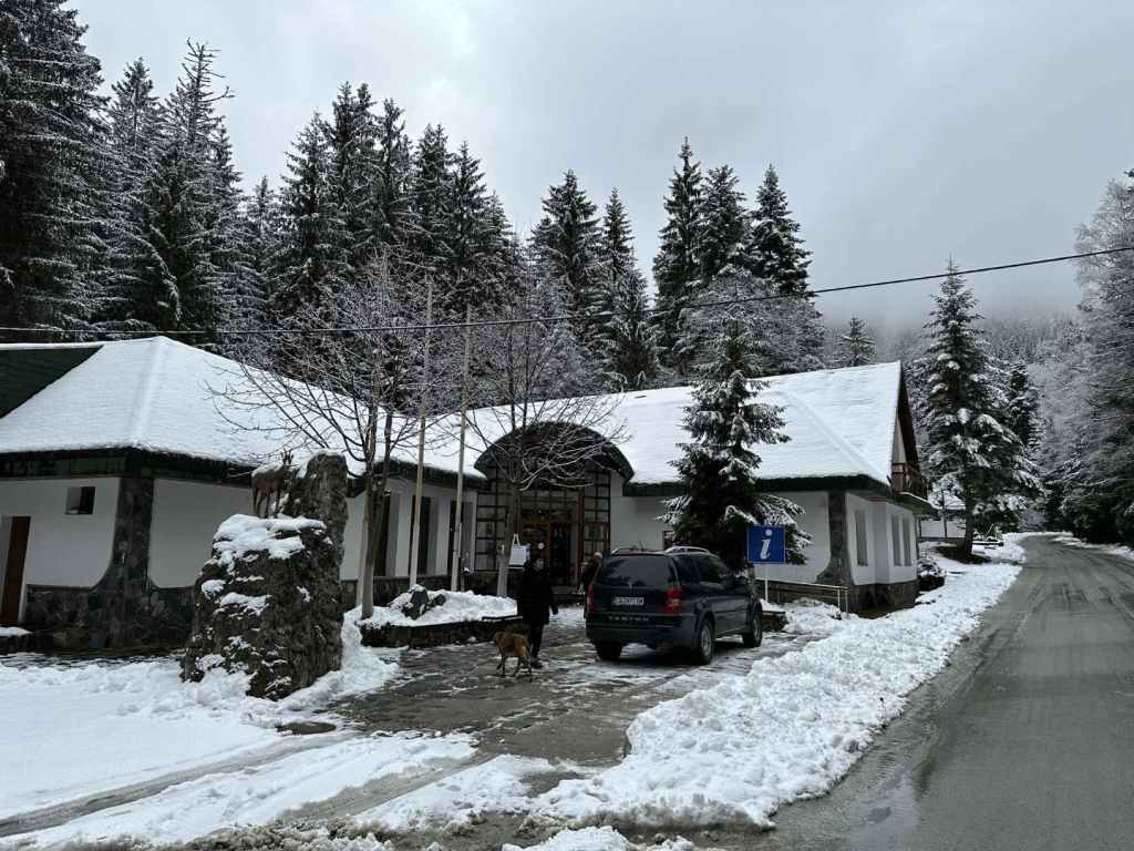
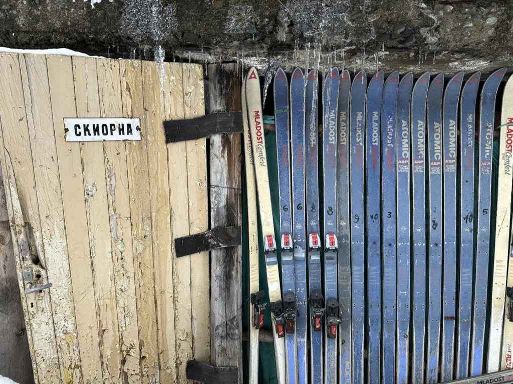
Again, to reach Gara Bov, you must take the II-16 from Sofia in the direction of Novi Iskar, Svoge and Mezdra. This road is very windy as it follows the course of the magnificent River Iskar on its way to the Danube, so even though the distance is not great, it takes its time, and there are several speed cameras. Eight kilometres after the picturesque town of Svoge – with its turning to Iskrets (from where you can reach Dobravitsa Waterfall) – you pass the sign for Bov. 1.1 kilometres after this sign, there is a turning on the right, signposted for Gara Bov (1 km) and Bov (4 km). Take this turning. You will drive along the railway, go left under the railway, pass the railway station again on your left. Continue uphill. As the road veers left, immediately on the right is the stadium. Park the car here. If you have travelled by train, exit the station, join the road as it goes uphill and in 800 metres you will be at the stadium.

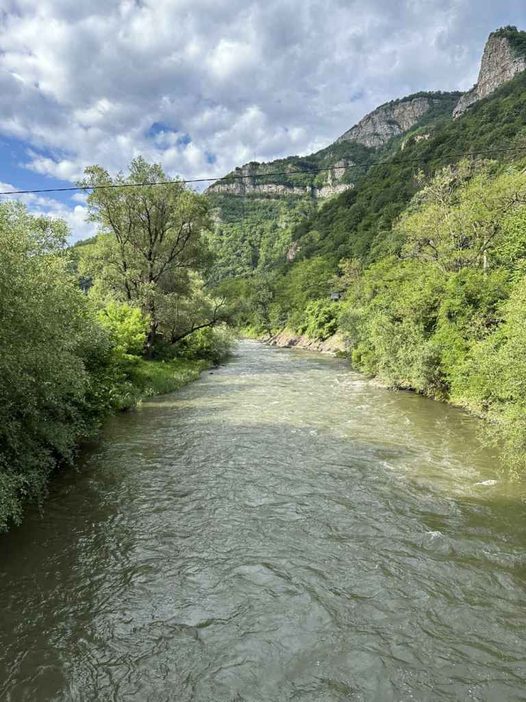
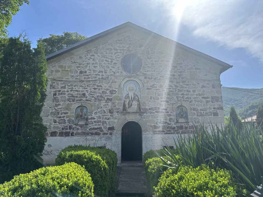
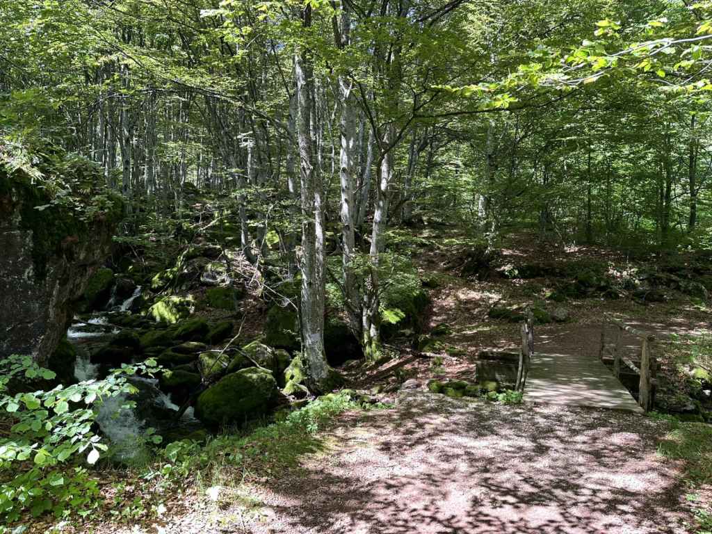
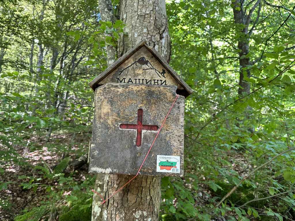
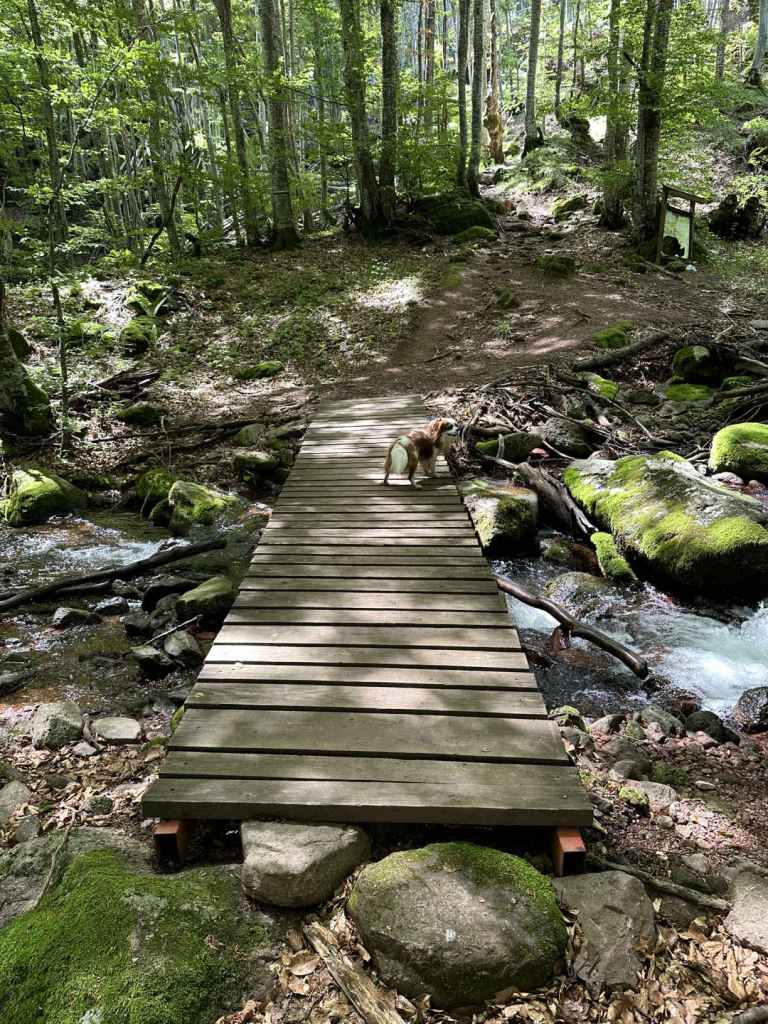
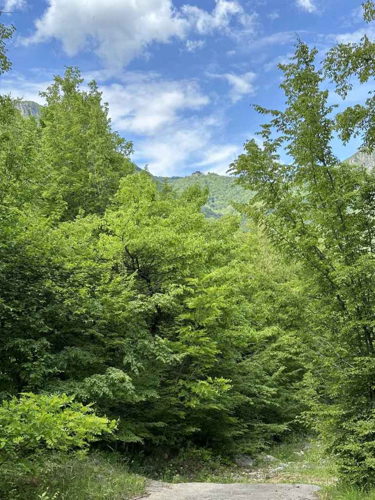
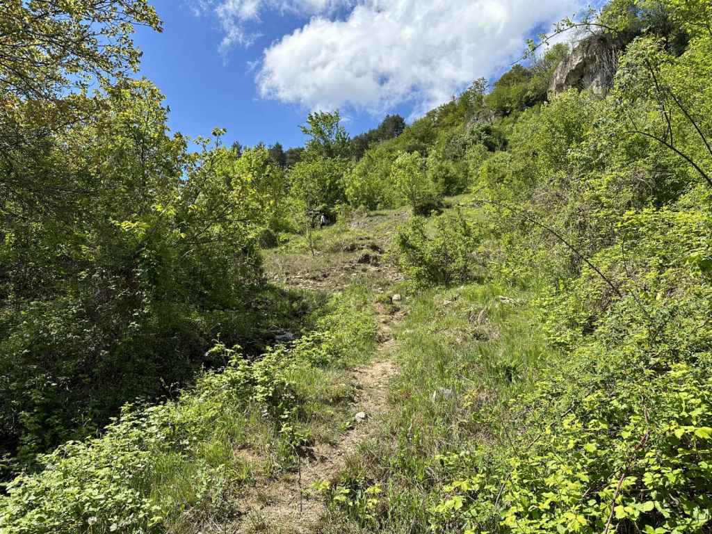
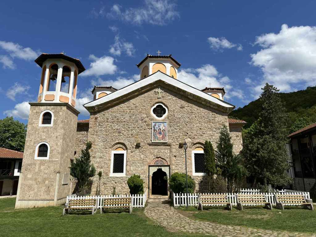
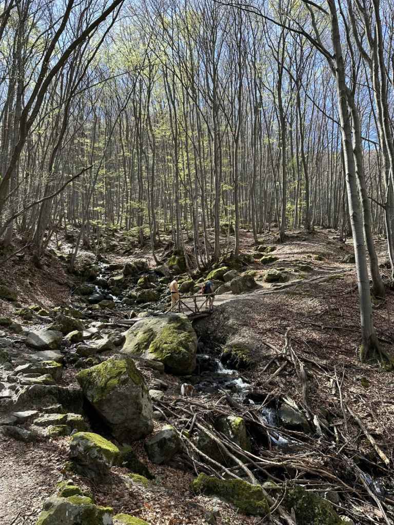
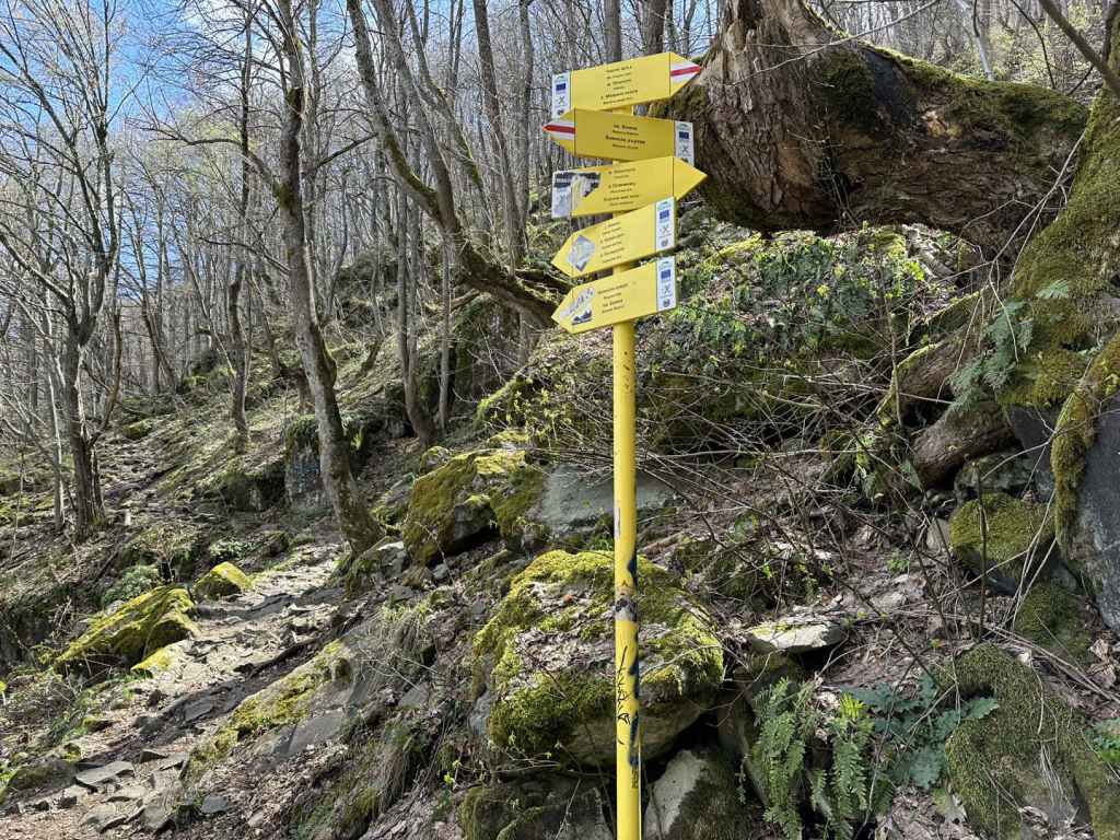
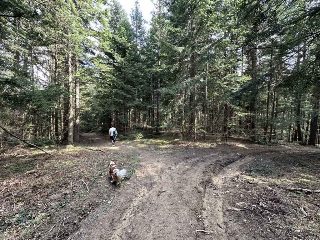
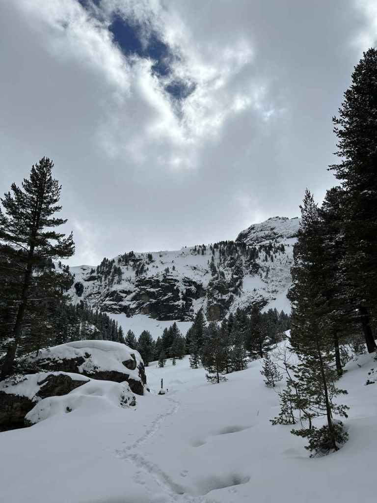
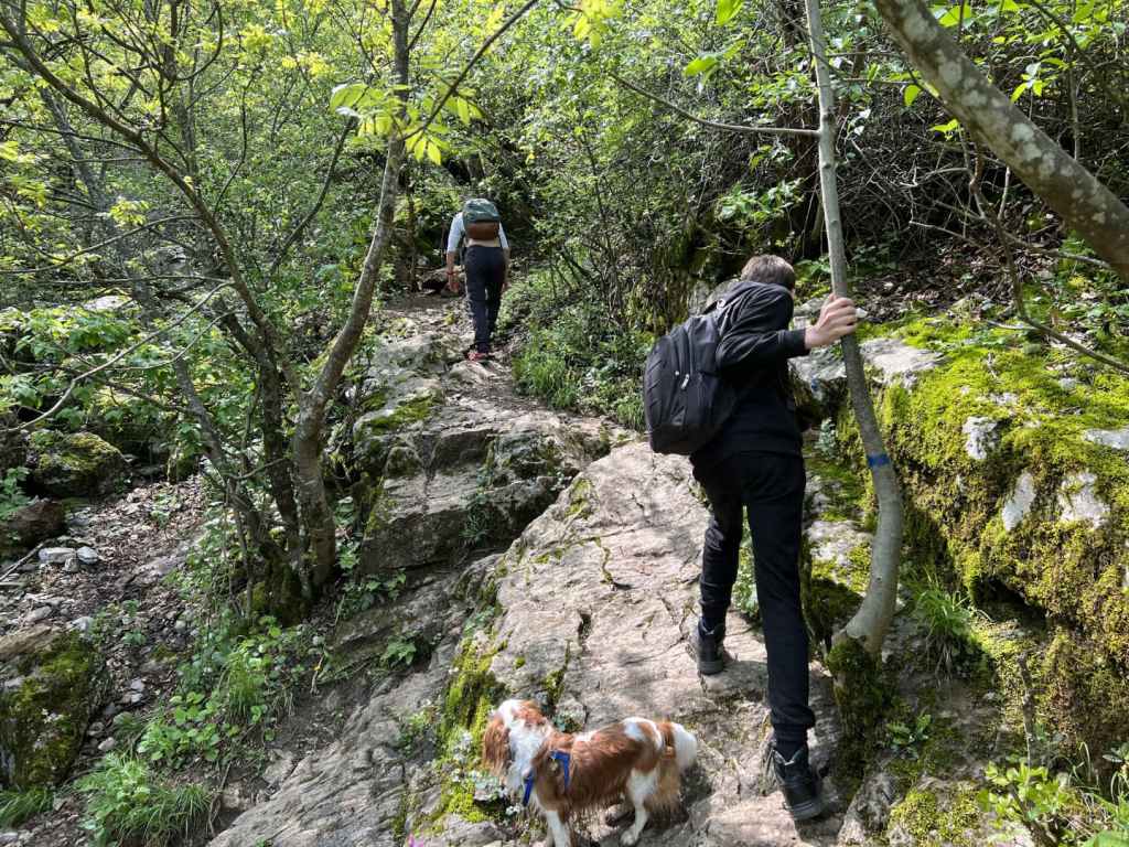
The ecopath heads north-east, along the course of the River Bov. It passes along the lefthand side of the football pitch and then immediately goes over a wooden bridge. Follow the green markers. The path is very well marked. It begins to climb, with the river on your left. After 700 metres, there is a turning on the right for a monastery, but continue straight. You will see a small waterfall on the left, and then the path again crosses a bridge. Keep following the course of the river, which is now on your right.

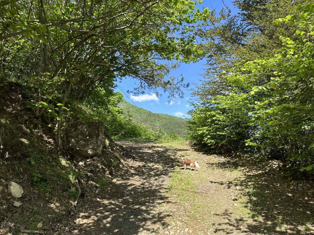
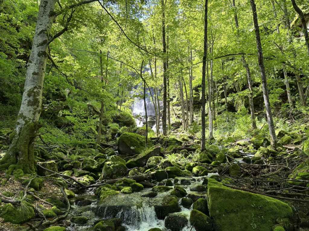
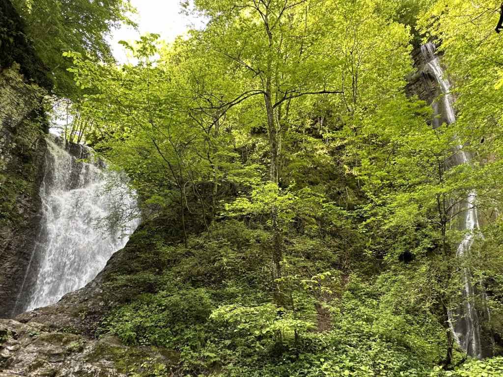
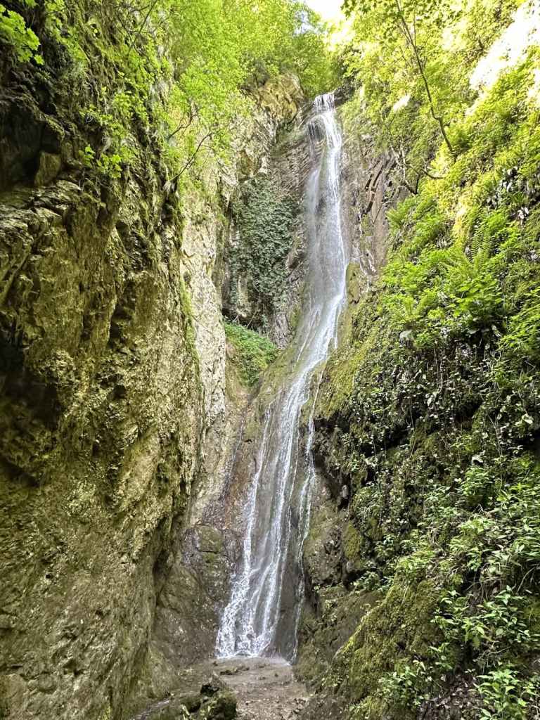
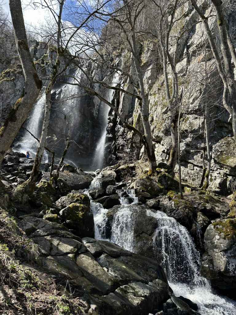
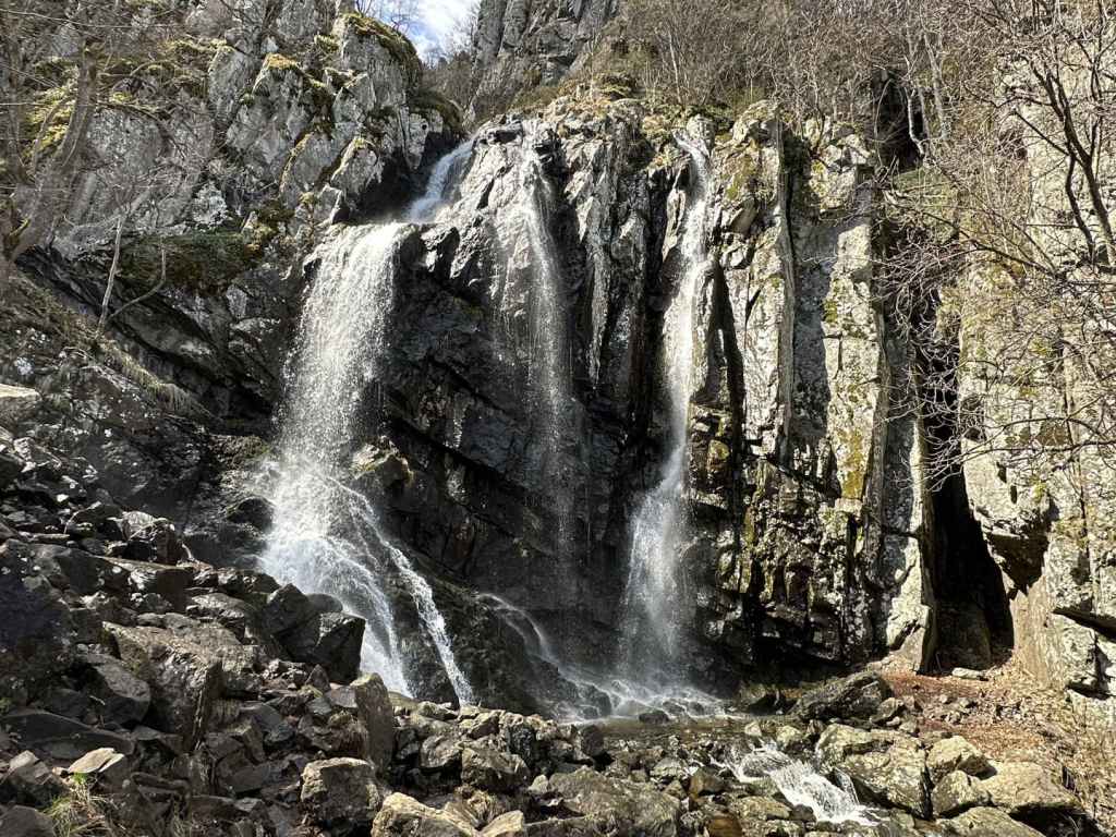
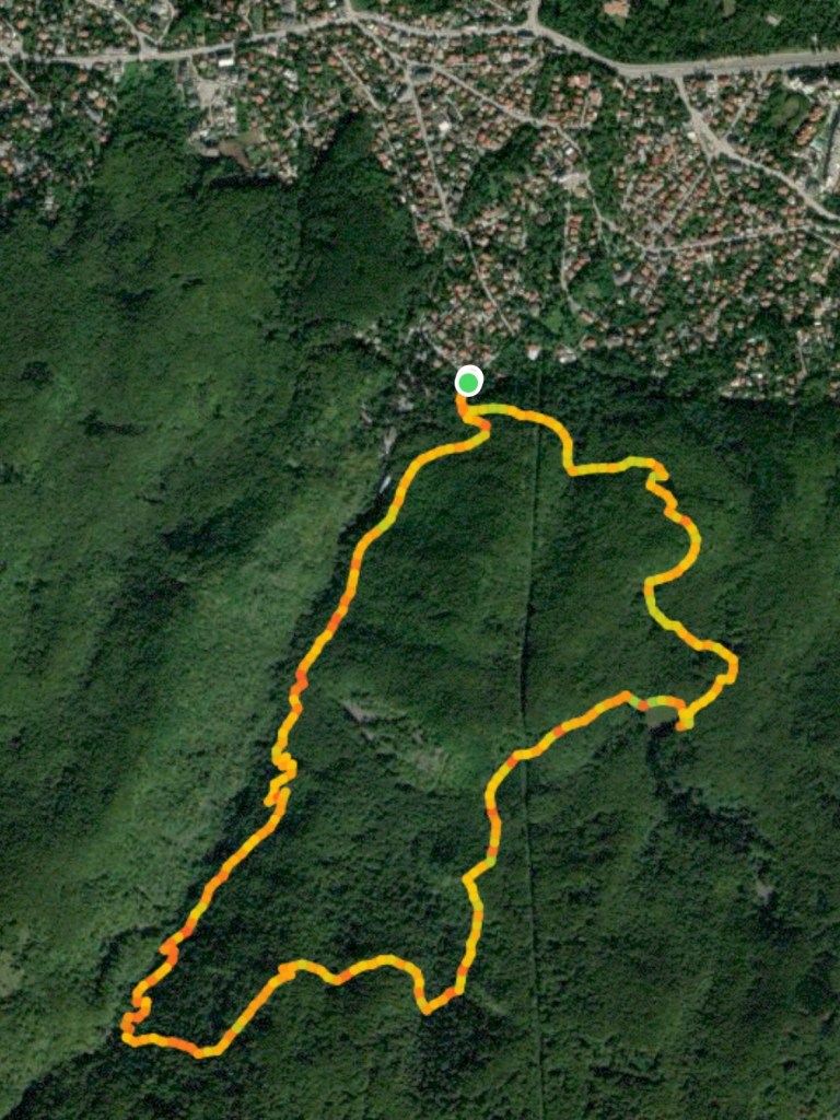
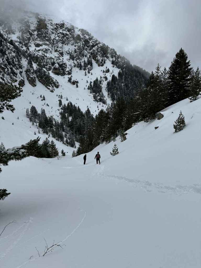
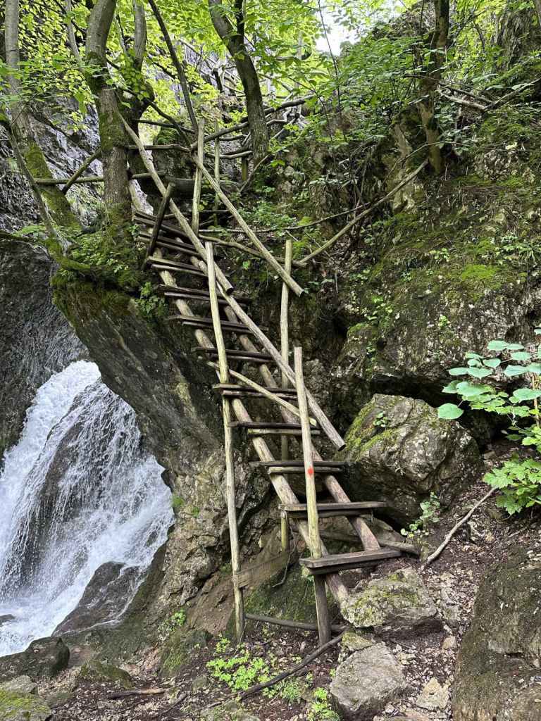
You will pass three more small waterfalls, then come out onto a flat rocky area next to the river. More small waterfalls follow on the right (a particularly beautiful one, 280 metres after the rocky area). A few more hundred metres, and you will again cross the river, using a stepping stone. The path now becomes a track and heads away from the river, but only for a short while before veering left again and bringing you out into the open, with the river down below you on your left. The path descends, crosses another bridge and climbs up the other side. When it reaches the top, turn right. In 200 metres, you will cross a small tributary, which immediately plummets down to the river on your right. The path does a zigzag. 340 metres after the tributary, a path on the left leads to the top of the waterfall. You will come back this way, but for now continue straight. You will cross a second tributary and, in less than a hundred metres, see the waterfall straight ahead. The distance from the stadium to the waterfall is 2.9 km and takes about an hour.

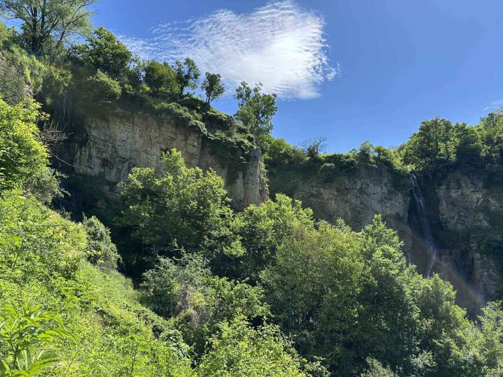
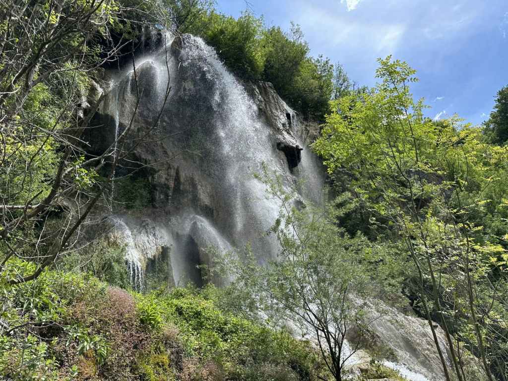
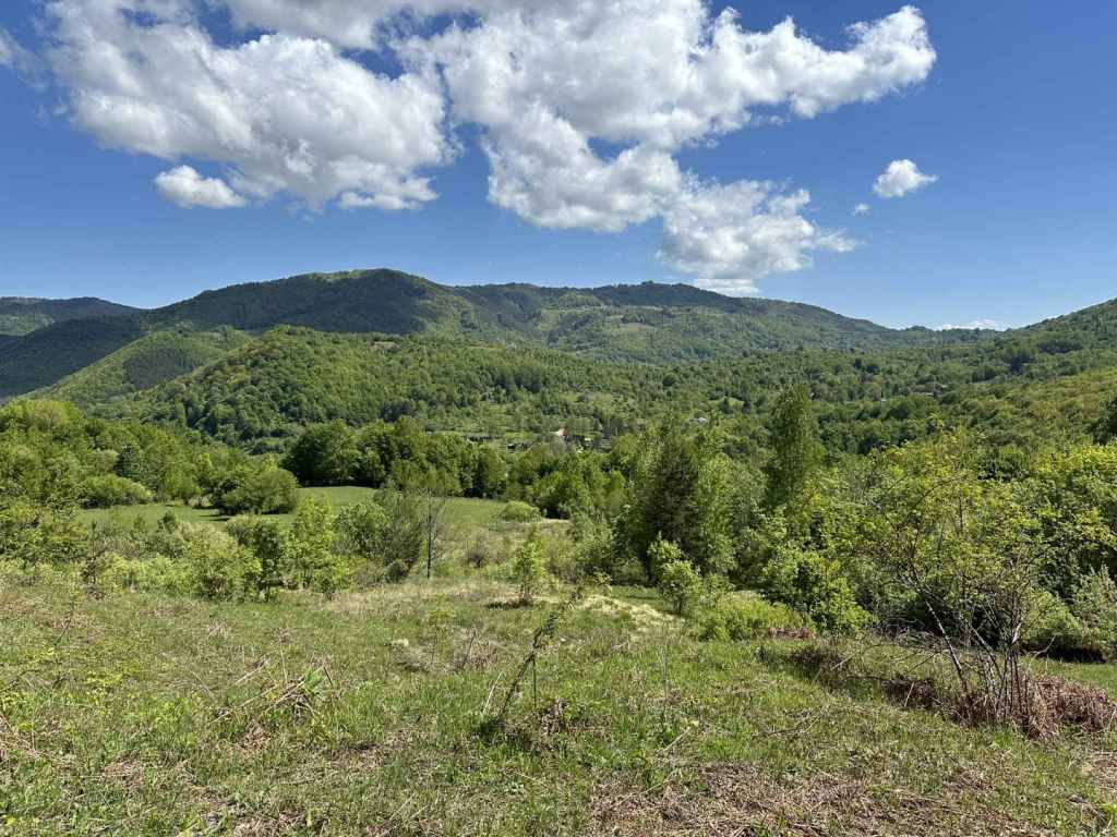
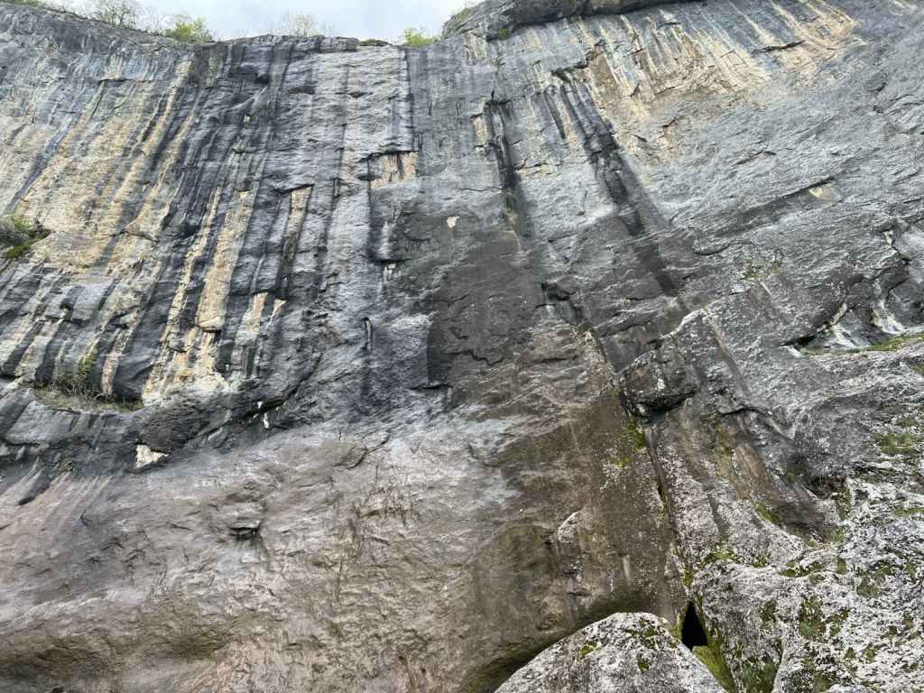
The waterfall is magnificent, especially if you go in spring or after heavy rainfall. There is a second, smaller waterfall to the left of this one, which you can see as you climb to the top of the gorge. So, when you have had your fill, return on the same path and take the path that diverges, now on your right, to the top of the waterfall. It is marked “above the waterfall”. It climbs steeply, offering views of both waterfalls, Pod Kamiko and the smaller one to its left, before taking you around the rocks, with views back to Gara Bov and Bovska Skaklya in the distance, and up to the village of Bov. You will not enter the village, but skirt along the top of the gorge. When I went in May, the path here was very overgrown. You basically want to head back in the direction of Pod Kamiko. The path takes you over the top of the smaller waterfall and joins a track. Go right here, and in a short while it will bring you to the top of Pod Kamiko. There is a wooden bridge on the left. Please do not go too close to the edge.

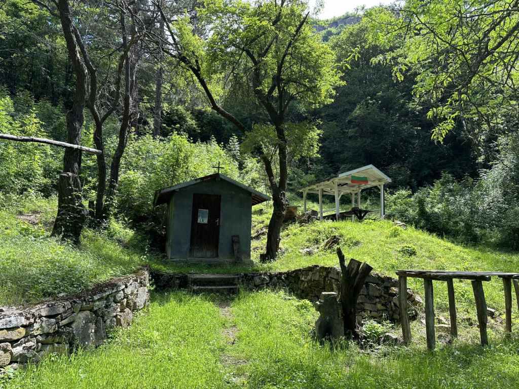
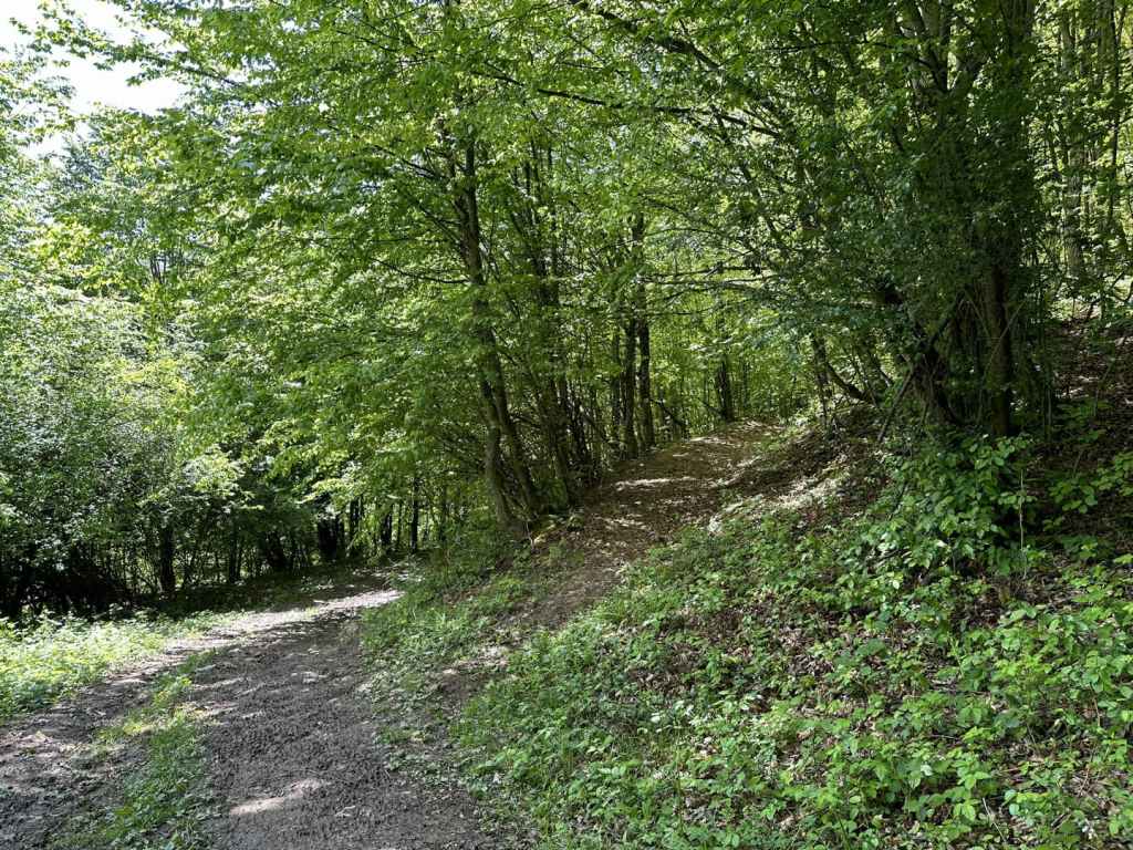
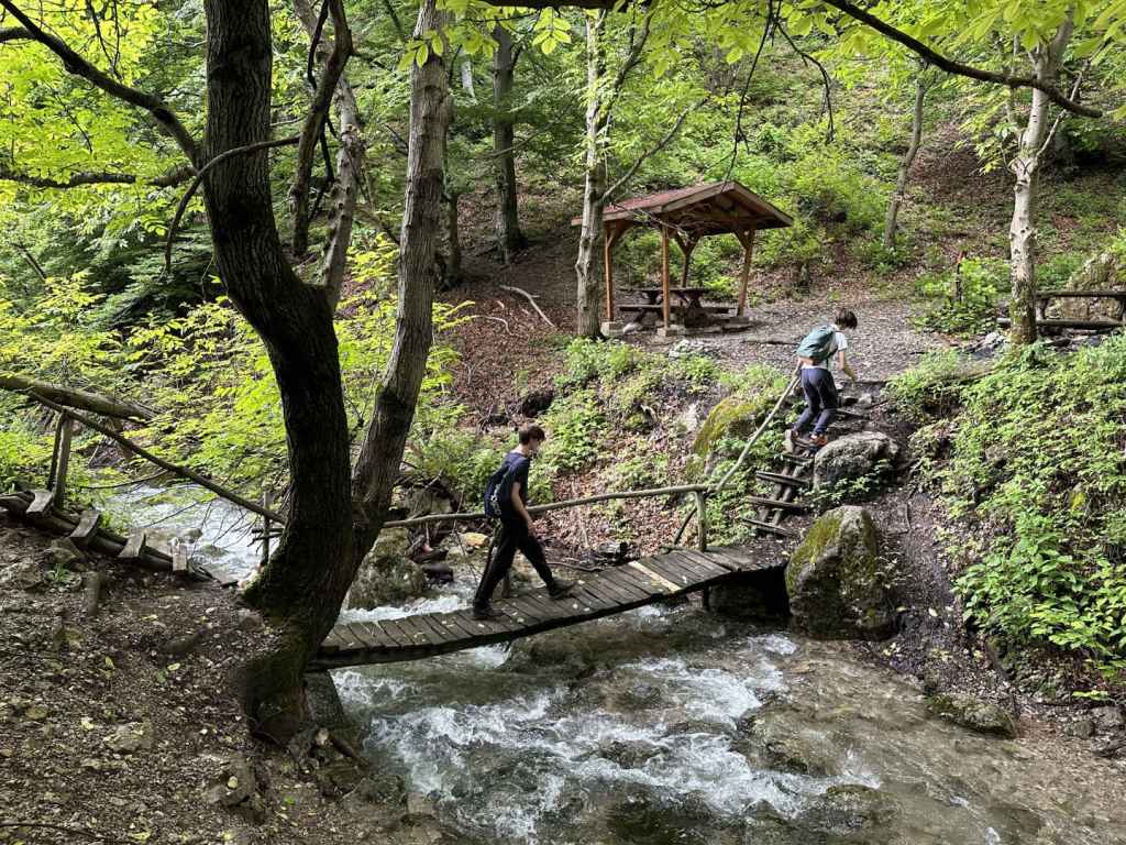
When you are ready, continue along the track, which passes a house on the left. When I was here, the track was blocked by cows and their calves, so I had to make a detour through one of the fields and rejoin the track a little further on with my dog. In 750 metres, the track passes a fountain on the left and then enters a field on the left, but you want to continue between a picnic area on the right and a stone cross on the left. In another 200 metres, you will come to a blue gate. Stay on this track, again avoiding the temptation to enter fields on your left.

In 370 metres, there is another fountain next to a ruined house. The path now enters a field and then continues on the right. As it descends, you will have views of Tserovo (the village before Bov) on the left. Keep descending through the forest. The path zigzags, left-right-left, and in 800 metres reaches a larger picnic area with a small chapel. This is a good place to rest. From here, the path continues left. In 750 metres, it joins a larger track by the River Treskavetz. Go right here, and in one kilometre you will be back at the stadium. The whole route is 7.6 kilometres and took me 3½ hours with ample breaks.

The River Iskar as it passes by Bov.
Gara Bov, the railway station.
The stadium in Gara Bov.
The most beautiful of the smaller waterfalls on the way.
One of the wooden bridges.
Pod Kamiko Waterfall.
A view of the top, the water glistening in the sunlight.
A view of both waterfalls (the smaller one is just visible on the far left).
The rocks at the top of the gorge.
The track leading to the top of Pod Kamiko.
The view from the top of Pod Kamiko.
Cows blocking the road!
The blue gate.
The chapel and picnic area.

Chiprovtsi

Chiprovtsi is a small town in north-west Bulgaria, between Belogradchik and Montana. It is situated on the northern side of the Balkan Mountains, very close to the Serbian border. It is famous for its carpets, but also for its waterfall, one of the most beautiful in Bulgaria. The first time I visited this waterfall, it was raining so much the air was full of water, and it was as if the waterfall was the whole forest.

The drive from Sofia takes three hours. You must take the II-81 road in the direction of Kostinbrod and Montana. You pass through the picturesque village of Gintsi before driving up and over the Balkan at Petrohan Pass. You then descend to Barzia before passing the turning to Berkovitsa, another waterfall, on your left. Ten kilometres before Montana, you leave the II-81 and turn left where it is signposted for Chiprovtsi (35 km). You immediately cross a railway, and then the road veers left (if you go straight, you will end up in the village of Borovtsi). After fifteen kilometres, you reach a T-junction. Again, turn left for Chiprovtsi (18 km). In another ten kilometres, just after the pretty village of Beli Mel, again there is a turning on the left for Chiprovtsi (now 10 km).

Four kilometres along this road, there is a turning on the right for Chiprovtsi Monastery (which is set back 500 m from the road). I recommend a visit to this monastery. I went before the waterfall, when it was still early, and the sunlight and spring flowers were very warming. The monastery is dedicated to Bulgaria’s most famous saint, the tenth-century hermit St John of Rila, who founded Rila Monastery.

Having returned to the road, continue in the same direction, and after 4.5 kilometres you will pass the sign for Chiprovtsi itself. 300 m after this sign, you must again turn left to enter the town (otherwise you will bypass it). You are now on Petar Parchevich Boulevard. Continue along here for 1.3 km and, after you pass the school of the same name on the right, turn left down Petar Bogdan Street (both these Peters were Roman Catholic Archbishops!). Continue for 200 m, turn right onto 23 Septemvri Street for 100 m, then left onto Tocho Voyvoda Street for another 100 m, then right onto Balkanska Street. This is the street that will take you to the beginning of the walk to the waterfall. (If you find this difficult, you can simply ask Google Maps for directions from your location to Chiprovtsi Waterfall, which should lead you through the town and out the other side. The important thing is to end up on Balkanska Street.)

This street leaves Chiprovtsi, heading west. You must drive along it for 4.5 kilometres, at which point the road in front of you becomes a track, and the road itself turns back on itself in the direction of Jar Hut. You do not need to go there unless you want to. Park the car on the grassy verge. You are ready to start your walk.

The walk to the waterfall is 3.2 kilometres and takes about an hour. Follow the track for 1.5 kilometres, at which point it divides. The left branch goes to Jar Hut, as you might expect, but you want the right branch. You will soon hear, and then see, the river on your right. This is the river that forms the waterfall higher up. Continue on the track for another 700 m, at which point there is a bridge over the river. The track now doubles back and descends on the other side, but you want to continue upstream, which means taking a path on the far (west) side of the river. There is a box with a first-aid kit and a picnic table directly after the bridge. The path is on your left after this.

You should now have the river on your left. Walk upstream. In 200 m, a bridge of planks crosses a small tributary. Keep following the course of the other river. The path gets steeper, and at one point comes out into the open (I noticed a lot of fallen trees in May). So long as you keep the river on your left, you will not get lost. In another 300 m, there is a second plank bridge, this time over the river, taking you back to the east side. Now the river is on your right. Another 400 m, and there is a third plank bridge taking you back over to the west side, but by now the waterfall is visible through the trees. I sat with my dog for an hour and a half, and I can say the time just disappeared as I marvelled at the drops of spray, the rocks that make up the waterfall (a waterfall is water and rock), little flowers gleaming in the sunlight in far, out-of-the-way places that I could never reach. It was wonderful.

You are now only a few kilometres from the Serbian border. On the Serbian (south) side of the Balkan, there are also waterfalls, I understand, and a national park. When you have had your fill, simply go back the way you have come.

Chiprovtsi Monastery in the early-morning sunlight.
The turning for Petar Bogdan Street, with the mountains (and the waterfall) behind.
The walk to the waterfall begins 4.5 km south-west of Chiprovtsi. Simply follow Balkanska Street until the road doubles back on itself.
The track as it approaches the river.
The bridge over the river.
The first-aid kit.
The first of three plank bridges (this one over a tributary).
The second plank bridge, taking you back to the east side of the river.
One of several interesting rocks on the way to the waterfall.
Two lovers kissing!
The waterfall through the trees.
Chiprovtsi Waterfall.
A view from higher up.

Glozhene-Teteven

This makes for a cracking day, because you get to visit three waterfalls, two in the charming town of Teteven and one in Glozhene. It is then possible to visit the remarkable Glozhene Monastery and even to walk to Morovitsa Cave. For this reason, we got up early and left Sofia at 7.30 in the morning. We were back at 6.30 in the evening. But a word of caution: both Teteven and Glozhene waterfalls are a little famous for not always working at full capacity. We made sure to visit them in May, the ‘waterfall month’, once the snow had started melting and after a few days of rain. This made for a real spectacle.

As for Yamna, which is not far from Teteven as the crow flies, you want to take the A2 motorway from Sofia in the direction of Varna. You go past the exit for Pravets/Etropole and continue to the exit for Dzhurovo and Etropole. Shortly after leaving the motorway, you turn right to Dzhurovo and continue on this road for two kilometres until you reach a T-junction. Turn left here, which is signposted for Golyam Izvor (4 km). After another two kilometres, take a turning on the right (signposted for Golyam Izvor, still 4 km, and Teteven, 15 km). Drive through the pretty village of Golyam Izvor, staying on this road. After leaving the village, you will pass a dirt track on your left, which goes to Glozhene Monastery, our final destination. Keep straight, and in another five kilometres you will enter Teteven.

300 metres after you enter Teteven, the road veers left over a bridge, and immediately there is a T-junction. Turn right here (left will take you to Glozhene, where we will be going later). You now have the River Vit, which flows through Teteven, on your right. Drive into the centre of Teteven. In six kilometres, there is a bridge over the Vit on your right which is signposted for the waterfall, Skoka Waterfall, but do not take this turning. Keep going with the river on your right. You will pass a second bridge over the river, and then a third. Take this third one (500 metres after the first). You will cross the river and pass the town’s market on your left. Keep going straight for 300 metres. There is a little bridge, and immediately a turning on the right signposted for Skoka Waterfall. Turn right here.

Keep going on this road (avoid the temptation to go straight back over the river you have just crossed), and after 2.8 kilometres you will reach a little car park on your right. Park here. The ecopath to the two waterfalls begins here.

You are in for a treat. The distance to the waterfalls is short – 650 metres – and takes only a quarter of an hour, but the path is very pretty, you pass a smaller waterfall, which is still fairly impressive, and at the end of the path there is a hut with the two waterfalls behind it. Skoka is on your left and attracts most of the attention, but don’t miss the much taller Praskalo on your right. If you have chosen to go in spring after the snow melt and some rain, you will not be disappointed. It is very unusual to find two such pretty waterfalls at such a short distance from each other. I kept going from one to the other. I liked Praskalo more, it was less noisy and very spiritual. We spent about 1¼ hour walking to and from the waterfalls.

Once you are back at the car, turn around and return the way you have come. Glozhene Waterfall, called Vara because of the limestone, is 13.5 kilometres away. You retrace your route, but having left the centre of Teteven behind, you continue on the 358, ignoring the turning to Golyam Izvor, and 2.4 kilometres after officially leaving Teteven, you will come to a lay-by on the right, next to a mehana or restaurant called Vidrite (‘The Otters’). Park here. In front of the restaurant, next to the road, there is a little sign that says ‘Glozhene Waterfall’. Yes, but the little fall you see in front of you is not Glozhene Waterfall proper, and I dread to think how many people have arrived, taken a photograph and driven off without actually seeing the waterfall itself. To reach the waterfall, you must continue along the road on foot for 120 metres. Next to a STOP sign, there is a partially tarmacked track that doubles back on your right. Follow this track, and in 150 metres you will reach the course of the river. The waterfall is above you, on your left. To reach it, you must now follow a barely visible path on the lefthand side of the river. Just plunge into the trees, you will find it, and this path will take you in 90 metres to the base of the waterfall, one of the most spectacular waterfalls in Bulgaria. I include a map below, showing the lay-by, the restaurant Vidrite (which was closed) and the route from the road 358 to the waterfall. It’s not that difficult, but it does seem to create a lot of confusion!

As you are returning on the track, you will catch a glimpse of Glozhene Monastery on the mountain opposite, our next destination. There is a path from Glozhene Village to the monastery, but most people approach by car from Malak Izvor (the smaller version of Golyam Izvor). To do this, continue on the 358 into Glozhene and after 2.3 kilometres turn left over the River Vit (signposted for the monastery, Yablanitsa, 9 km, and Sofia, 92 km). Continue for 8 kilometres until you reach a turning on your left (signposted for the monastery and Malak Izvor, 2 km). Drive through the village and, after 2.5 kilometres, there is a turning on the left for the monastery.

The distance from here to the monastery is 5.5 kilometres. The road gets steadily worse, and it is difficult for two vehicles to pass each other going in opposite directions. On the way up, we got stuck behind a bus (!) and, on the way down, we got stuck in a hailstorm. But never mind. As you approach the monastery, there is a car park on the left (for which we had to pay 3 leva). There is then a second car park a little further on, and the road stops.

Glozhene Monastery is said to have been founded by a prince from Kiev called George Glozh (who gave his name to the village below) in the thirteenth century. Originally, the monastery, which is dedicated to St George, was down in the village, but the icon of St George kept disappearing and reappearing on top of the hill (a wonderful site with stunning views), so in the end the monks got the message and moved the monastery uphill. You are unlikely to come across a more dramatically located monastery, which helped keep it protected during Ottoman rule. There even used to be a secret tunnel connecting the monastery with the village below, but it was destroyed during an earthquake. You can enter the church and light a candle. There is also a restaurant serving food.

You may find that the day’s excursion has been long enough, but if you still have energy, there is a cave called Morovitsa, one of the longest in Bulgaria, the path to which begins at the gate of the monastery. It is a six-kilometre round trip, which took us 2¼ hours. The path heads right from the monastery and soon becomes a muddy track. In little under one kilometre, this track brought us out into the open, next to a picnic hut. Be careful. You need to join a track that is higher up, on your right. After one kilometre, a path leaves this track on the left, clearly signposted for the cave. The path crosses a stream and then descends rather steeply to the cave. Be careful, because it is slippery. I wouldn’t say this part of the visit is essential – it really depends on your priorities.

To return to Sofia, drive back through Malak Izvor. On reaching the road from Glozhene, go left (signposted for Yablanitsa, 1 km). You will pass under the motorway. Drive into Yablanitsa until you reach a T-junction. Turn left here (signposted for Sofia, 80 km). At the next T-junction, again turn left (signposted for Sofia, 76 km). You will leave Yablanitsa and almost immediately reach the slip road for the motorway. Drive safely!

I had already visited the waterfalls in Teteven and wasn’t planning to include them because we went too early, in winter, before the snow melt. It makes such a difference going in May. Together with Vara Waterfall in Glozhene, they were magical, majestic and mystical.

A general view of the River Vit passing through Teteven.
The turning for Skoka Waterfall.
The car park for Skoka Waterfall.
The beginning of the ecopath to Skoka Waterfall.
Teteven’s two waterfalls, Skoka and Praskalo, at the end of the ecopath.
Skoka Waterfall in May.
The spiritual Praskalo Waterfall.
The lay-by before the restaurant Vidrite.
The sign for ‘Glozhene Waterfall’, which is actually much higher up.
The partially tarmacked track that leaves the 358 a short distance away.
Glozhene Waterfall.
The view from the track towards Glozhene Monastery.
The gate to Glozhene Monastery.
The church in Glozhene Monastery.
Morovitsa Cave.
A map showing how to get from the lay-by next to Vidrite to Glozhene Waterfall above.

Yamna

Yamna is a beautiful village located after the town of Etropole, 95 kilometres north-east of Sofia. The waterfall is called ‘Vranya Voda’, meaning ‘Crow Water’ – legend has it some monks were looking to found a monastery in the vicinity of Etropole and looked at this spot, when a crow alighted. The crow took off, however, and flew to the nearby site of the present-day monastery, but the event – and the name – stuck. It is not a particularly tall waterfall, but it more than makes up for any lack of height by its beauty and the beauty of the surrounding landscape. The waterfall is covered in green and yellow moss, and this makes it quite distinctive.

To reach Yamna, you must take the A2 motorway from Sofia in the direction of Varna. After Botevgrad, leave the motorway where it is signposted for Pravets and Etropole and follow the signs for Etropole, ignoring the signs for Pravets centre. You will pass Pravets Golf Club on your right. Keep going straight. After 3.3 kilometres, turn right for Etropole (still 16 km away). In another 3 kilometres on this road, you will see a sign for Pravets Monastery on your right. Keep going. After another 7 kilometres, again turn right for Etropole (now 3 km) and in 900 metres you will enter the town.

Having entered Etropole, continue on this road for 2 kilometres, where there is a sharp turning on the left, signposted for Etropole Monastery, Yamna and Teteven. Turn left here. The road takes you back on yourself. In 3 kilometres, you reach the village of Ribaritsa, which is where Etropole Monastery is situated. This was an important monastery during Ottoman times, an important scriptorium – many manuscripts were copied here. For now, keep going to Yamna, which is another 5 kilometres. 500 metres after you enter the village of Yamna, the road turns sharply left, and a dirt track diverges from the road on the right. This is the walk to the waterfall. There is a convenient verge just before the dirt track where you can park.

Yamna Waterfall is only half an hour’s walk. In ten minutes (470 metres), a path diverges from the track on the right. This path goes to Etropole Monastery and is said to take 1 hour and 50 minutes. Immediately after this path, there is a second path on the right, with yellow markers. This path will take you to the bottom of the waterfall. If you continue on the track and ignore the two paths, you will come to a field.

Take the second path. The path skirts the forest, which is above you on your right. In five minutes, it crosses a little stream, with views of Yamna on the left. In another ten minutes (1.12 km from the start of the walk), you come to a stream with a limestone bed. This is the stream that flows from the waterfall. The waterfall is up on your right. There is no set path that takes you there – you must walk on one or other bank of the stream, and in 5-10 minutes you will reach the base of the waterfall.

It is only a small area where you can stand, but it is really a privilege to be in front of a wonder of nature, the drops of water sparkling in a clear sky, the moss so soft and intricate. We really enjoyed it. We had lunch further down by the stream. The journey back to where you parked the car will take not much more than twenty minutes.

On the way back, it is imperative that you pay a visit to Etropole Monastery from Ribaritsa village. The diversion is 2.5 kilometres and well worth the effort. Not only does Etropole Monastery have an important history and provide an oasis of peace in the middle of nature, there is a second waterfall behind the monastery called Varovitets! Behind the nineteenth-century church, there is a small door in the wall of the monastery, through which you can gain access to the waterfall, which is only ten minutes away, by following the yellow signs (or the course of the river). It makes for an excellent day trip from Sofia. Not far away is Glozhene Monastery, which also has a waterfall nearby.

500 metres after you enter Yamna, the road veers left and a dirt track diverges on the right. Park here.
The track, which you follow for ten minutes (470 metres).
Take the second path on the right. This goes to the bottom of the waterfall. The track leads to a field.
A view of Yamna on the left.
The path as it arrives at the stream formed by the waterfall.
The waterfall is up on the right, a short climb away.
Yamna Waterfall.
The sparkling water.
The waterfall with the landscape behind.
The moss, a feature of this waterfall!
The katholikon (main church) of Etropole Monastery, built in 1858.
Varovitets Waterfall behind Etropole Monastery.

Boyana Village – Boyana Waterfall – Boyana Lake – Boyana Village

Starting Coordinates: 42.64278, 23.26402

Distance: 6.9 km

Elevation Gain: 490 m

Time: 3¼ hours

Difficulty: moderate-hard

Transport: by car, or by bus no. 64 and 107 to Boyana Village


The start of this walk is very near the famous Boyana Church, one of the principal tourist attractions in Sofia, a World Heritage Site with medieval frescoes dating from 1259. The church is open every day during normal working hours and, although you only get about ten minutes inside (due to conservation measures), it is well worth a visit.

Both the 64 and the 107 buses stop near the church. For the 64 bus, which continues to the next village east, Dragalevtsi, you want to get off at the stop “Boyansko Hanche”, a restaurant on Sborishte Square. The 107 bus will take you all the way to the church, since this is its last stop. By car, you approach Boyana on Bulgaria Boulevard (from where you can see the waterfall on the side of the mountain), go under the ring road and, 200 metres after entering the village, you come to a roundabout. Go left here and, at the traffic lights, turn left. After 400 metres, you will cross Boyana River (which, higher up, forms the waterfall) and, in another 200 metres, Boyana Church will be signposted on the right. Park somewhere near the square.

To reach the church, you go past All Seasons Residence Hotel and continue uphill. The church is about five minutes away and can be visited before or after the walk. To reach the start of the walk, with the entrance to Boyana Church in front of you, go right and continue further uphill. At the top, turn left and, in a couple of minutes, you will reach some stone steps and the entrance to Vitosha Nature Park.

The walk consists of three parts – a stiff climb to the waterfall (1¼ hr, 2.9 km); a gradual descent to the lake (50 mins, 2.3 km); and a return to the starting point (30 mins, 1.7 km). These three parts have red, green and blue markers respectively. As you enter the park (“protected territory since 1934”), you will see a military installation on your right. Follow the red markers. The path takes you uphill and then behind the military installation. You will soon see the river on your right. You will now follow the course of the river all the way to the waterfall. After 1 km, a bridge crosses a tributary from the left. In another 350 metres, a path goes down to the river on the right, but keep left (uphill). The path starts to zigzag and, when you double back on yourself and are facing north, quite often there are pretty views of Sofia through the trees. As you approach the waterfall, the river starts to tumble. There are one or two mini-waterfalls before the waterfall itself. The path here has a metal railing, and at certain points you need to be careful with your footing. There is a rising sense of anticipation as you near the waterfall. It soon appears and is a sight to behold, especially if you go in early spring (during or after the snow melt).

The waterfall reminds me of the Communion of the Apostles in Orthodox churches. It is remarkable how a bubbling stream has now become a burning star pouring forth rays of light. There’s a certain amount of tomfoolery, people taking their shirts off and standing beneath the spray or taking selfies.

After you have taken your fill, you can of course return down the mountain, but I recommend you continue to Boyana Lake. It doesn’t take much longer, and the lake is pretty. Take the path that climbs next to the waterfall, but instead of continuing uphill (south), take the path that immediately forks left (east), which is signposted for Boyana Lake and has green markers. This path meanders around rather than up the mountain. After 350 metres, a path joins from the right. Keep going east. The path begins to descend. In another 300 metres, you will reach a T-junction. Go left here, signposted for Boyana Lake and Dragalevtsi. You will soon cross another tributary of Boyana River. After 1 km, a path joins from the right. Keep going in the same direction (which is now more or less northwards). Several paths diverge to the left. Ignore them. Keep right, and you will soon come to a ruined building, behind which is the lake.

Continue to the north side of the lake, where there are some rocks and people have barbecues. A separate walk approaches the lake from Dragalevtsi Monastery further east. It is normally full of croaking frogs, who like to make their presence felt, but I wouldn’t recommend letting any animals with you drink the water, it’s a little stagnant. Once you’ve had your fill, leave the lake and head north/north-west. A path with blue markers descends the mountain, with the lake behind you/to your left. Follow this path, and in half an hour you will be back where you started!

This walk is an excellent introduction to Vitosha Mountain. It also enables you to visit one of the most famous sites in Bulgaria, Boyana Church. Also in Boyana is the National Historical Museum, which has some impressive exhibits. It is also possible to visit Boyana Waterfall from Kopitoto further up the mountain – in this case, you descend rather than climb to the waterfall, and this is what I did for many years, but I have to say I find the climb from Boyana Village very rewarding. The fact you’re by the river all the way – it’s like she’s taken you by the hand and led you there herself.

Kostenets

Kostenets is actually two waterfalls. There is Kostenets Waterfall in the village of Kostenets, and then the higher Skalovitets Waterfall at a distance of six kilometres. Both waterfalls are accessed from the village of Kostenets, not the town. Travelling from Sofia, you need to take the A1 motorway in the direction of Plovdiv and take the exit after Ihtiman, which is signposted for Muhovo and Kostenets. After leaving the motorway, you pass through Mirovo (where there is a turning for the Gate of Trajan, a mountain pass that formed the border between Thrace and Macedonia and the site of a famous tenth-century battle between the Bulgarians and the Byzantines, which the Bulgarians under Tsar Samuil won) and then the spa resort of Momin Prohod. Be careful along here because there are lots of speed traps. You then enter the town of Kostenets.

1.2 kilometres after you enter Kostenets, take the turning on your left. This turning takes you under the road you were on and under the railway. Immediately after the railway, take the first turning on the left, which is signposted for the villas and village of Kostenets. Stay on this road, which veers right after the railway station and heads towards the village, five kilometres further south-west. On entering the village, continue past the church and the main square until you reach a roundabout after 1.7 kilometres. Turn left at the roundabout and take the road going uphill. It crosses the Chavcha River and ends at the first of the waterfalls you have come to visit, Kostenets. There are parking spaces on the right of the road.

Kostenets Waterfall is small, but very pretty. There is a wooden sign containing part of a poem written about the waterfall by Ivan Vazov and, on the left, Therma Kostenetz, which has mineral pools. The waterfall itself is at the top of some steps. To visit Skalovitets Waterfall, you now have a choice: to walk six kilometres or to drive as far as Gurgulitsa Hut, which shortens the walk considerably. The walk took us an hour and a half. At the wooden sign, cross the river and take the road going uphill, which leads directly to Gurgulitsa Hut. The road loops and meanders, and there are paths through the forest that act as shortcuts, but they are not always obvious, so we stayed on the road most of the time. 2.2 kilometres after you leave the river behind, there is a picnic spot – at this point, we cut through the forest, but before long we were back on the road again. In another 1.4 kilometres, you come to a sort of crossroads. Gurgulitsa Hut is in the trees on your left. This is the distance you will save if you decide to drive to the hut.

Go past the hut on your right, and you come to a barrier, behind which is a field. You now need to turn right (east) and take the path entering the forest. There are numerous arrows, all of which are pointing towards the waterfall, I think. After 350 metres, the path, now a track, descends on the right, but the path to the waterfall diverges on the left. Go down the path on the left, and in another 800 metres of fairly steep descent you come to a bench with a branch of the river behind it. This is not the waterfall. Turn left (again, there is an arrow), after 200 metres cross this branch of the river and continue right, along a dirt track. In another 600 metres, you reach the other branch of the river, where the waterfall is located. There is a picnic shelter. The waterfall is 150 metres upstream.

The two branches of the river become one further downstream. They then join the Chavcha river, which itself joins the Maritsa on its way to Plovdiv and the Aegean. Rivers have their own way of doing things, and it seems to me they’re pretty content to do them, so long as we let them.

There are two other waterfalls on the northern slopes of the magnificent Rila Mountain. They are both further west – Sapareva Banya (Rilska Skakavitsa) and Ovchartsi (Goritsa) – and easily accessible by car from Sofia.

The entrance to the village of Kostenets, with a stork on a pylon.
The wooden sign in front of Kostenets Waterfall, with a fragment of the poem ‘Kostenets Waterfall’ by Ivan Vazov.
Kostenets Waterfall (12 m).
The road to Gurgulitsa Hut, which is fit for vehicles.
The picnic place next to the road, where there is a shortcut through the forest.
3.6 km after the river, the road comes to a crossroads – Gurgulitsa Hut is in the trees on the left.
Gurgulitsa Hut.
At the field, turn right.
The path then enters forest.
After 350 m, it divides. Go left.
Another 800 m, and you come to a bench with one branch of the river (not the waterfall!) behind it. Turn left.
After a short descent, follow the sign for Skalovitets.
You will soon reach the waterfall, which is on the right of the track.
Skalovitets Waterfall (25 m).
The walk to and from Skalovitets Waterfall is twelve kilometres and has an elevation gain of 550 m! This can be reduced considerably by driving as far as Gurgulitsa Hut.

Sapareva Banya

Further east towards Samokov, but also on the north side of Rila Mountain, is Rilska Skakavitsa – ‘Rila Waterfall’ – the highest waterfall in Rila at 70 metres. It is situated south of the spa town of Sapareva Banya, very near the famous Seven Rila Lakes, which are further south (the closest lake to the waterfall is the fifth lake, the ‘Kidney’). I have visited this waterfall at different times of year – in thick snow during March, when there were very few people about except snowboarders, and surrounded by lush vegetation in July. They make for very different experiences!

To visit this waterfall, you must take the A3 motorway that connects Sofia and the border with Greece at Kulata. You are going to go as far as Dupnitsa, a distance of 60 kilometres. To reach Dupnitsa, you must leave the motorway six kilometres before the town and follow the old national road into the town itself, past a series of car dealers. 600 metres after entering Dupnitsa, just before the OMV petrol station, turn right (it is signposted for Sapareva Banya). At the bottom, go left under the national road and over a railway. After 300 metres, turn left at the traffic lights (signposted for Samokov and Sapareva Banya), and follow this road along the north side of Rila Mountain.

After 11 kilometres, there is a turning for Sapareva Banya on the right. You will need to go through the town and continue to the resort of Panichishte. After entering the town, go right at the roundabout and follow this road, which then veers left. At the stop sign, take the road diagonally opposite and continue uphill. At another stop sign, turn left. You are now on the road to Panichishte, which is ten kilometres from Sapareva Banya. On entering Panichishte, ignore the hotel signposts pointing left. Continue on the same road, and you will pass a tourist information centre on the left. Keep going for another 3.8 kilometres, until you reach a turning on the right that goes uphill to a place called Zeleni Preslap. You need to park the car here and continue on foot.

The walk is 11.5 kilometres, there and back, and in the snow in March it took us five hours. Factoring in the driving, that meant a day trip from Sofia of nine hours. The elevation gain is 475 metres, and there is quite a steep climb between Zeleni Preslap and Skakavitsa Hut, as you go through the forest, but the waterfall is eerily magical and well worth the effort. Just the fact you are a short distance from the Seven Rila Lakes is enthralling.

After 850 metres, you reach the rest house at Zeleni Preslap. Keep the rest house on your right and take the path that heads due south, to the left of some information boards. Continue on this path, with trees on either side, for 1.5 kilometres, then take the path on the right, signposted for Skakavitsa Hut and Kabul Peak. This path climbs gently at first, then more steeply. After two kilometres, a path on the right diverges to Kabul Peak. Keep left, and in 150 metres you will reach Skakavitsa Hut. The hut is open for refreshments in the summer, but not in March, when the ground is covered in thick snow and the only creatures we came across were a crestfallen guard dog and a large, standing wooden bear. The path to the waterfall is another 1.5 kilometres further south and takes about 40 minutes (in the snow). There are wonderful views of the waterfall and surrounding cliff faces as you approach.

The road from Panichishte continues to Pionerska Hut, where there is a controversial lift that makes it much easier for daytrippers to access the Lakes. Purists, and I’m inclined to agree with them, would say you should do the walk on foot, but no doubt the lift serves a purpose. The name of the mountain, Rila, comes from a Thracian word meaning ‘watery’. You will notice this when you are on the mountain – you often seem to be stepping in water. The Galician word for ‘kidney’ is ril – it seems to me that Rila, the main water divide separating the Black Sea and the Aegean Sea drainage systems, functions as Bulgaria’s kidney, and indeed the waterfall resembles a kidney, as does the glacial lake nearest to it.

The tourist information centre in Panichishte. Continue for another 3.8 kilometres, until you reach the turning for Zeleni Preslap.
The turning for Zeleni Preslap. The signposts are rather confusing, but there is one for Skakavitsa Hut.
The rest house at Zeleni Preslap.
After passing the rest house on your right, take the path between the trees heading due south.
After 1.5 kilometres, a path on the right, signposted for Skakavitsa Hut and Kabul Peak, climbs through the forest.
The path in the forest.
Skis at Skakavitsa Hut.
Skakavitsa Hut.
The waterfall is forty minutes further south.
As you approach the waterfall, it is visible on the far left (the dark patch shaped like a kidney!).
Rilska Skakavitsa.
The descent from 1972 m., in the snow.
The walk to the waterfall, with the Seven Rila Lakes further south.

Zgorigrad

This is an astonishing walk, but it is not for the faint-hearted! To get to the bottom of the waterfall, known as ‘Borov Kamak’ (‘Pine Stone’), it is necessary to climb fourteen ladders, some of which are quite steep, and to cross from side to side of the river Varteshnitsa. We were with a small dog and had to carry him up and down the ladders. Also, in reviews online, a lot of people express their disappointment at the waterfall having no water. We went in the second half of June after heavy rains, and I can say that this was not the case! The waterfall was working at full capacity, and a couple of times, where there was no bridge, it was necessary to wade across the river.

That said, this is one of the most beautiful places I have been to in Bulgaria, and the waterfall is memorable. You get what you put in, I suppose. To reach the old mining village of Zgorigrad, you must first travel to Vratsa. Coming from Mezdra on the E79, you enter the town of Vratsa and keep going straight, following the signs for Ledenika Cave. After three kilometres, you pass the turning on the left for Vratsa Waterfall (directly after the hospital). After another kilometre, ignore the turning right that goes to the centre and follow the sign for Ledenika. In 300 metres, take the turning on the left to Ledenika and Zgorigrad. You leave Vratsa and go through the dramatic Vratsa Pass. After 2.2 kilometres, there is a sign for Ledenika at a distance of thirteen kilometres on the right, but you continue straight and enter Zgorigrad village. Keep going straight, pass through the centre (with the river Varteshnitsa on your right) and, as the road begins to loop, 2.2 kilometres after the centre of Zgorigrad, you come to the start of the ecopath that leads to the waterfall. Park your car on the grassy verge. The river is now on your left.

The walk to the waterfall takes about two hours. If you factor in another hour to visit the top of the waterfall, you will need to allow five hours to go and come back. The ecopath climbs the grassy verge and quickly enters forest. On your left is an old tailings pond, used to store waste material from the extraction of metal ore. This tailings pond caused a terrible flood (almost half a million cubic metres) in 1966, with significant loss of life in the nearby village. There is a short film about the disaster by Robart Nikolchev on YouTube. In about twenty minutes, you cross the first of several bridges taking you from side to side of the river. After the third bridge, we were tempted to go straight, but you must go right, uphill, following the course of the river. If you find yourself moving away from the river at any point, then you have gone wrong. Keep an eye on the red markers.

After the fourth bridge, the ladders start in earnest. There are eight ladders in the space of half an hour. After the fifth bridge, we again went slightly wrong and started moving away from the river. Follow the red markers and stay close to the river. Another three ladders, and then comes the fun part. You are required to cross to the lefthand side of the river, but there is no bridge, presumably because there isn’t normally so much water and it’s possible to hop from rock to rock. In our case, the river was roaring down, and this wasn’t possible! We tried taking off our shoes and socks, but the water was so cold we didn’t get very far! In the end, we just waded across. I carried our dog.

Another fifteen minutes, and you come to the bottom of the waterfall, which is 63 metres high. It’s a wonderful location. If you want to visit the top of the waterfall, you need again to cross the river without the help of a bridge. We again got soaked! But it was worth it. There is a picnic table under the eaves of the rocks on the righthand side of the river. You can stop here for lunch and admire the waterfall. We certainly did.

If you decide to continue the top, you must follow the path in front of you, which soon goes left. You must climb another four ladders to reach the top, but the view is amazing and the sensation of watching the river tumble over the edge is exhilarating. There is a place to stand, with a railing, but please be careful. The river before it cascades over the edge is much calmer. You can continue upstream. Having crossed a bridge, in about twenty minutes you will reach a mountain shelter and an open meadow. This is as far as we got.

Beware that descending the ladders is perhaps more difficult than going up (especially when you are responsible for a small creature!). We had heard that the walk to Vratsa Waterfall is quite steep, but found this walk to be more difficult, albeit more beautiful. ‘Borov Kamak’ easily ranks in my top five, along with waterfalls like Hristo Danovo and Polska Skakavitsa.

The ecopath starts 2.2 kilometres after the centre of Zgorigrad village.
It passes through forest, with the river Varteshnitsa on your left.
The first of several bridges.
Crossing back to the other side.
The ladders begin in earnest.
There is a wooden walkway with views towards Zgorigrad.
The ladders get steeper!
The river Varteshnitsa as it descends through the forest.
The first crossing without a bridge!
‘Borov Kamak’ Waterfall.
The picnic table on the righthand side of the waterfall.
The waterfall seen from the right.
The top of the waterfall.
The view from the top of the waterfall towards Zgorigrad.
The meadow further upstream.

Vratsa

Vratsa is a town north of Sofia, midway between Sofia and the river Danube. It is famous for its caves (in particular, Ledenika), waterfalls and rock formations. To the south-west of Vratsa is the Vrachanski Balkan Nature Park, established in 1989. This is where Vratsa Waterfall is situated, together with another waterfall, Borov Kamak, which can be accessed from the village of Zgorigrad. It is also where the Bulgarian revolutionary and poet Hristo Botev was killed in 1876, fighting against the Ottomans in an uprising that would be brutally crushed, but would sow the seeds for the liberation of Bulgaria from Ottoman rule two years later. Vratsa is also famous for the Rogozen Treasure, the largest haul of Thracian treasure ever found in Bulgaria, dating to the fourth century BC, part of which can be seen in the Regional Historical Museum.

Vratsa is connected to Sofia by railway (for train times, see the Bulgarian State Railways website: https://www.bdz.bg/en). To reach Vratsa from Sofia by car, take the A2 motorway, which connects Sofia with Varna on the Black Sea coast, north-east as far as Botevgrad and then head north-west on the E79 road to Vratsa via Mezdra. The journey takes about two hours. On entering Vratsa, keep going straight and in three kilometres, immediately after passing City Hospital on your left, there is a street, also on your left, called Belasitsa. You need to take this turning. This street continues for 800 metres and then abruptly ends next to an old people’s home, Zora. This is where the path to the waterfall begins (there are several places to park your car).

The walk from here to the bottom of the waterfall takes about an hour, but it is steep and slippery. It is not an easy path. Follow the path and, after a few minutes, there is a large gateway on your left with the words ‘Welcome to Vrachanski Karst’ written on it in Bulgarian. This is the name of the reserve, which forms part of the Vrachanski Balkan Nature Park. Do not be tempted to follow the track that climbs the hill directly in front of you, but go left, over the riverbed and under this gate. The riverbed will now be on your right. After five minutes, you will come to a shelter on your right, an ideal place to rest. The path starts to climb, and in another five or ten minutes you come to some benches and a fountain on your left. The path then crosses the riverbed, which was completely dry when we visited. You need now to follow the blue markers (they are sometimes red), ignoring a level path on the right and heading straight uphill. Bear in mind the elevation gain from the start of the walk to the waterfall is about 300 metres. If you stay on this path and observe the blue markers, you will reach the bottom of the waterfall in half an hour.

At 141 metres, Vratsa Waterfall, also known as ‘Vrachanska Skaklya’, is one of the highest in Bulgaria, but the flow of water is very little. There are some boulders at the bottom, and an enormous rock face. But where Vratsa Waterfall really stands out is with the views! I heartily recommend that you continue to the top of the waterfall, an elevation gain of another 200 metres, which takes about 45 minutes. As you face the waterfall, the path with the blue markers continues on your left (that is, it continues eastwards). Follow the path and, before reaching the top, you will pass a cave on your right, which you can investigate. Once you reach the top, the path heads right through some trees and then comes to a clearing. If you continue in the same direction, skirting the cliff face on your right, in five minutes you will come to the stream that feeds the waterfall. The views – of the waterfall and rock face as you climb; of Vratsa and Dabnika Reservoir in the distance – are spectacular and well worth the extra effort. The descent from the top of the waterfall to the start of the path took us about an hour.

All in all, you need to allow at least four hours for the hike itself. The climb to a large rock face, followed by a further climb to the top of the waterfall, is reminiscent of the visit to Bovska Skaklya north of Svoge, on the other side of the Vratsa Balkan, only this waterfall is higher.

The turning after the hospital, Belasitsa Street, ends next to an old people’s home. The path begins here. The waterfall is the dark patch on the rocks behind.
After a few minutes, turn left and pass through the gateway, which says ‘Welcome to Vrachanski Karst’.
A rock on the right.
A picnic shelter in ideal surroundings.
The path starts to climb.
After crossing the riverbed, the path becomes steep.
Vratsa Waterfall from below.
As we continue to the top, the views of the waterfall and Vratsa are wonderful!
A view of Vratsa from inside the cave.
At the top, the path heads through some trees.
And you come to a clearing.
In another five minutes, you reach the stream that forms the waterfall.
A view of Vratsa and Dabnika Reservoir from the top of the waterfall.