Sapareva Banya

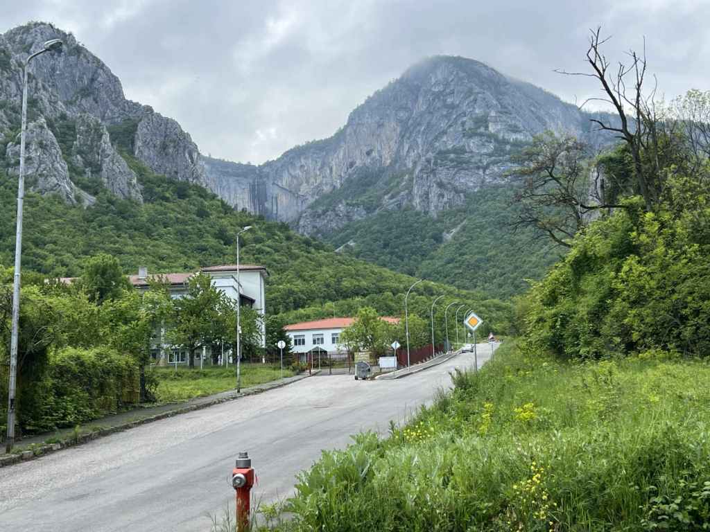
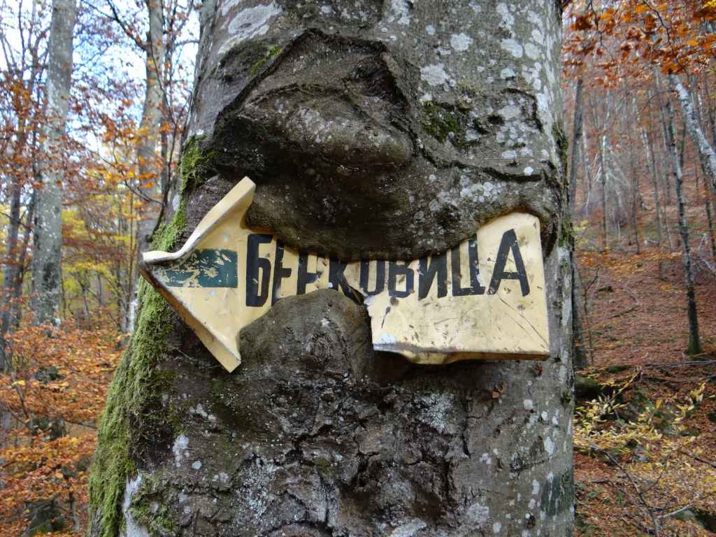
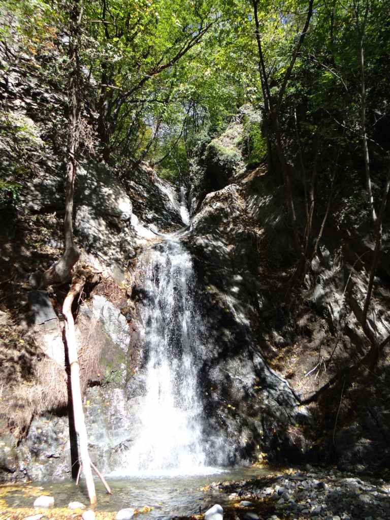
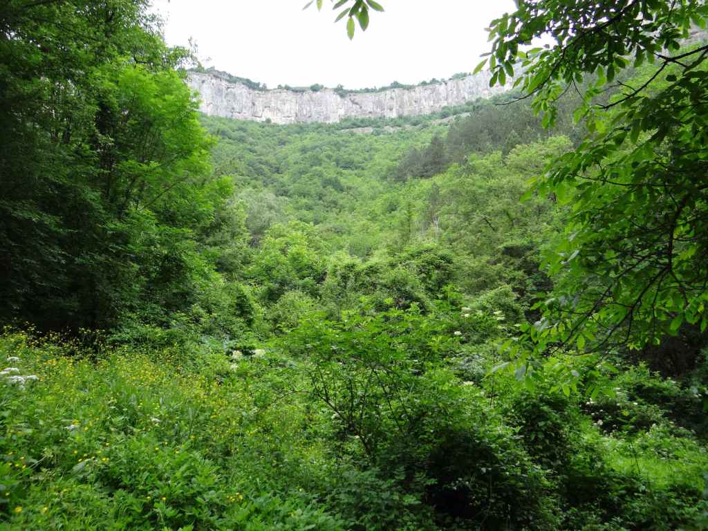
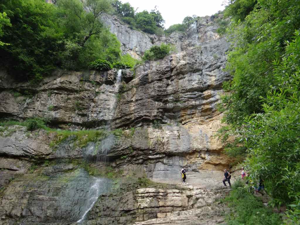
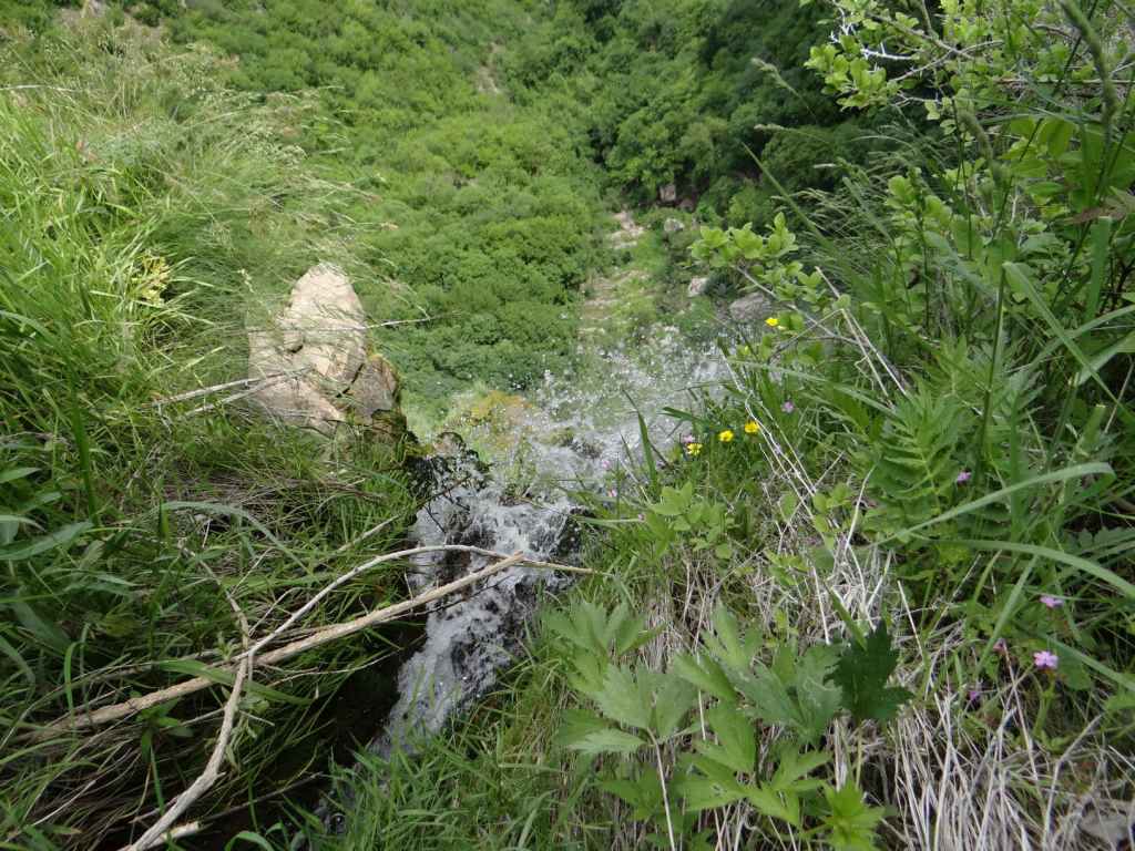
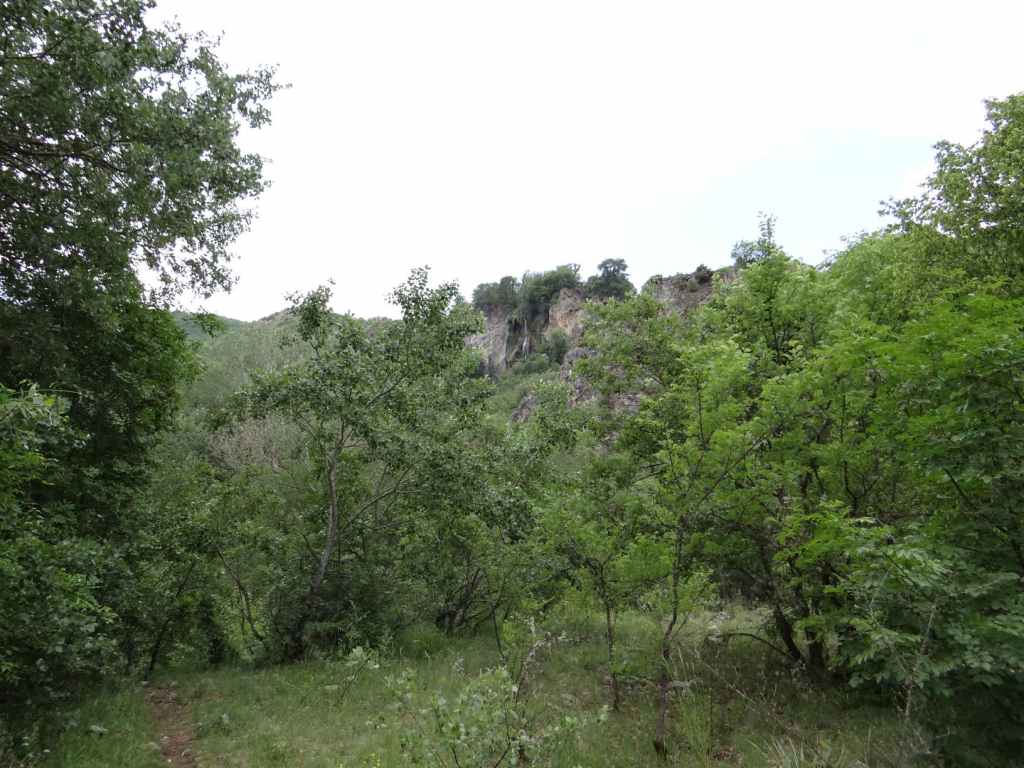
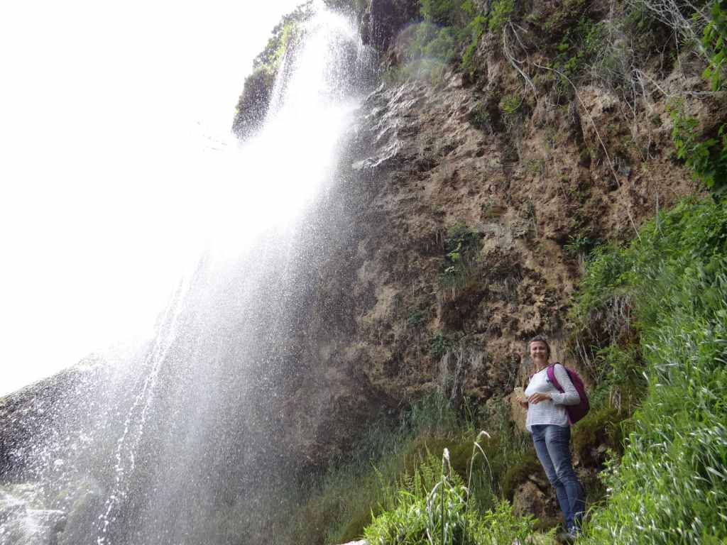
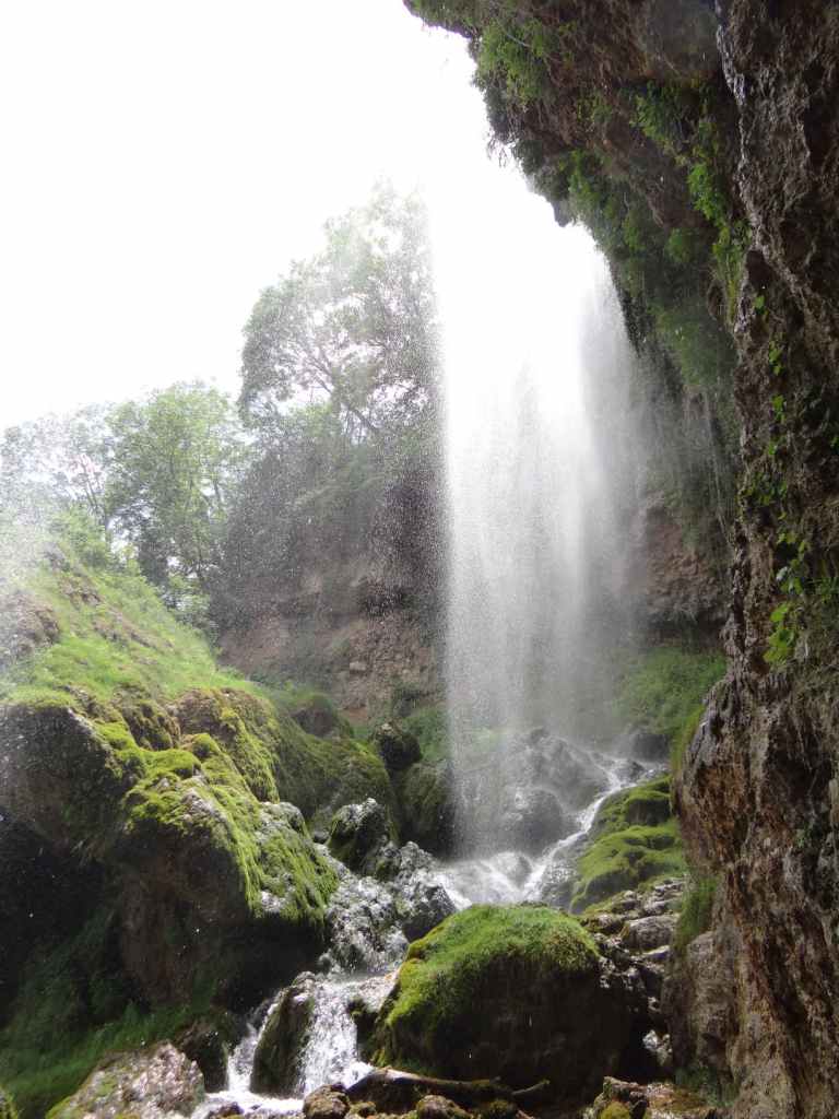
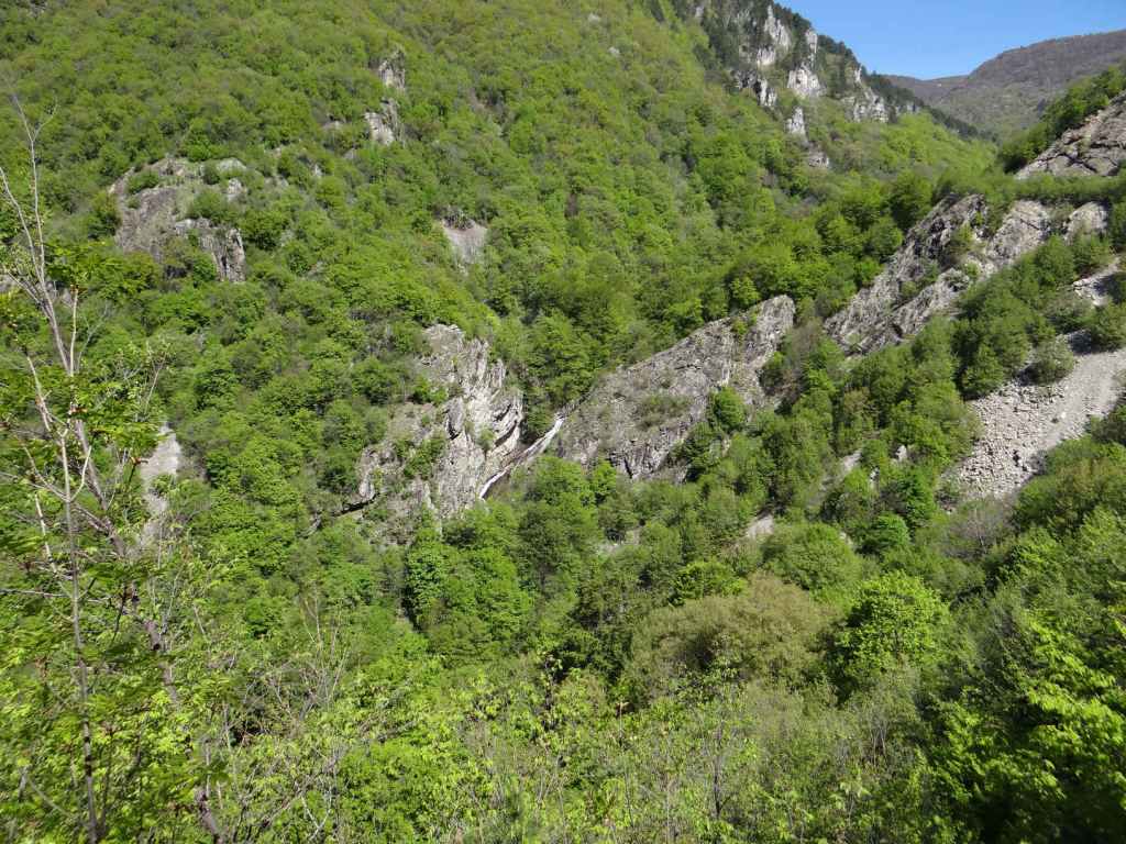
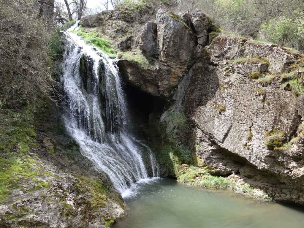
Further east towards Samokov, but also on the north side of Rila Mountain, is Rilska Skakavitsa – ‘Rila Waterfall’ – the highest waterfall in Rila at 70 metres. It is situated south of the spa town of Sapareva Banya, very near the famous Seven Rila Lakes, which are further south (the closest lake to the waterfall is the fifth lake, the ‘Kidney’). I have visited this waterfall at different times of year – in thick snow during March, when there were very few people about except snowboarders, and surrounded by lush vegetation in July. They make for very different experiences!

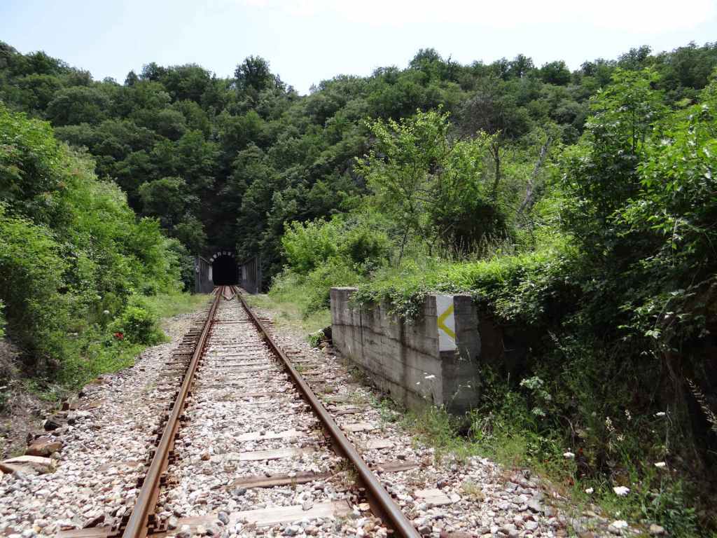
To visit this waterfall, you must take the A3 motorway that connects Sofia and the border with Greece at Kulata. You are going to go as far as Dupnitsa, a distance of 60 kilometres. To reach Dupnitsa, you must leave the motorway six kilometres before the town and follow the old national road into the town itself, past a series of car dealers. 600 metres after entering Dupnitsa, just before the OMV petrol station, turn right (it is signposted for Sapareva Banya). At the bottom, go left under the national road and over a railway. After 300 metres, turn left at the traffic lights (signposted for Samokov and Sapareva Banya), and follow this road along the north side of Rila Mountain.

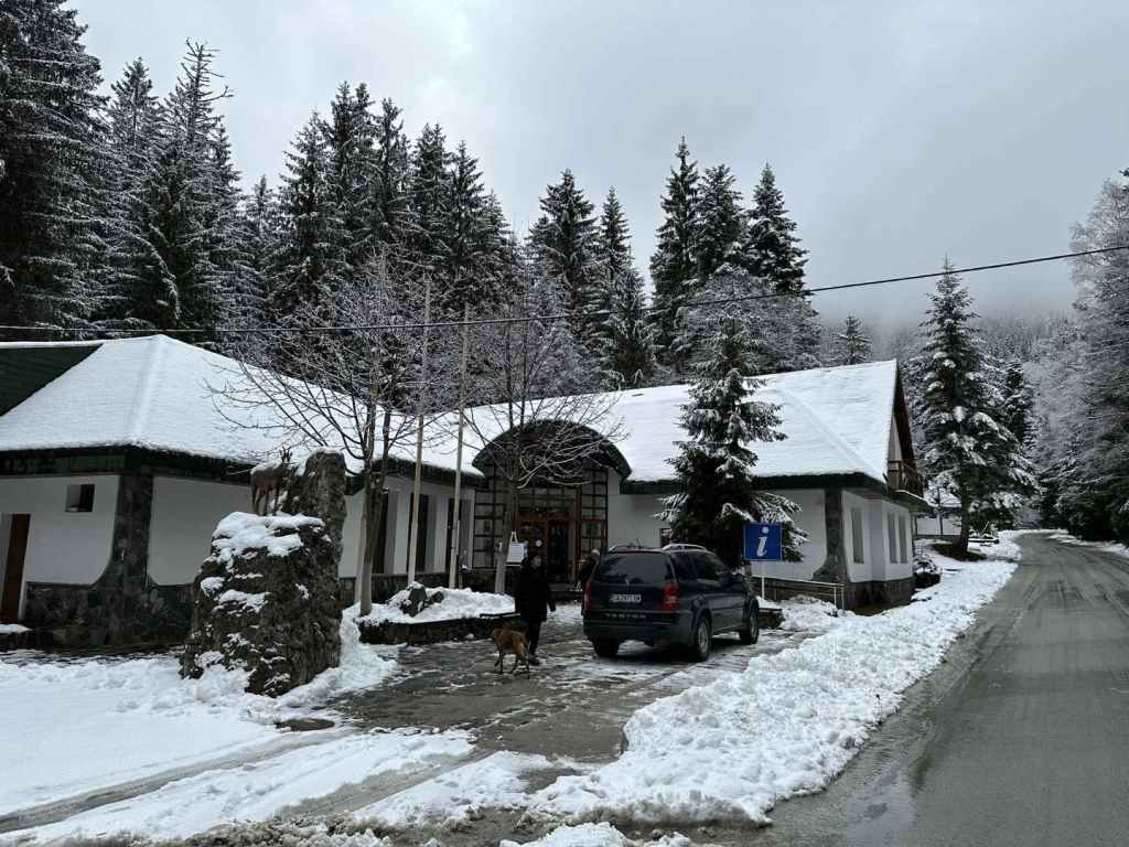
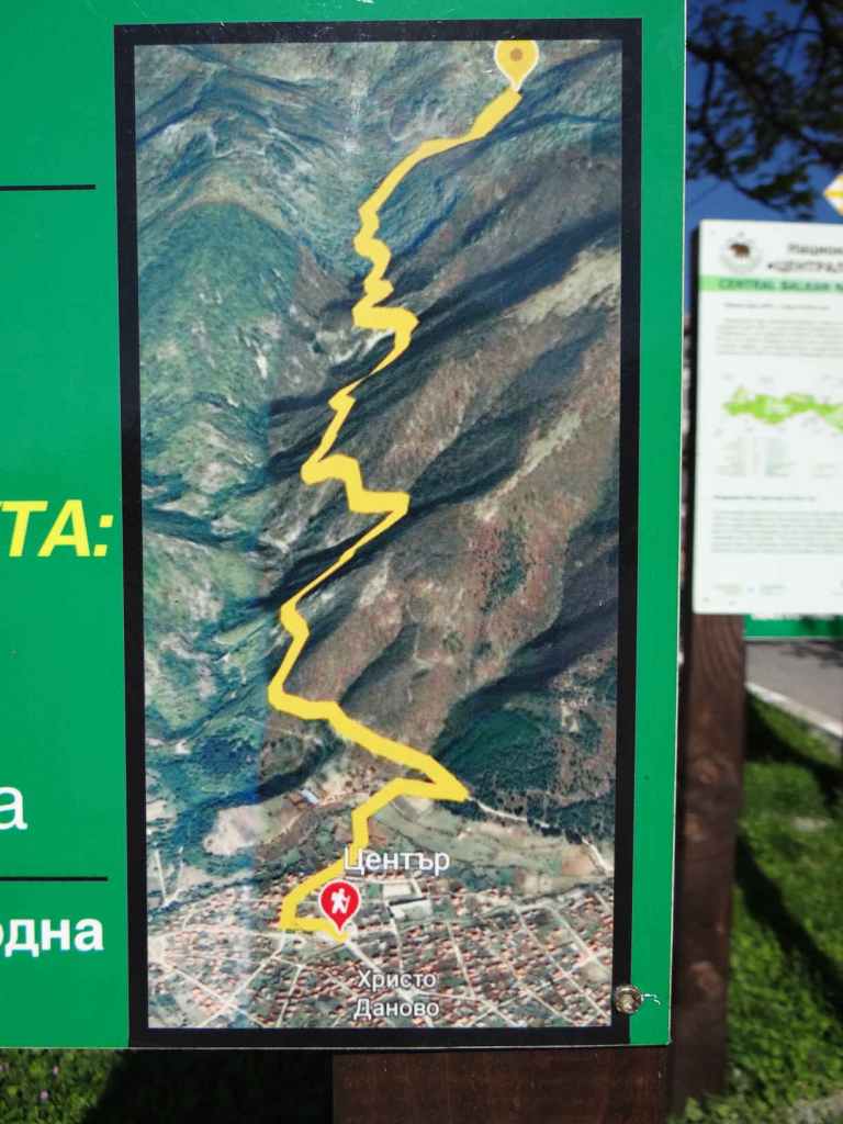
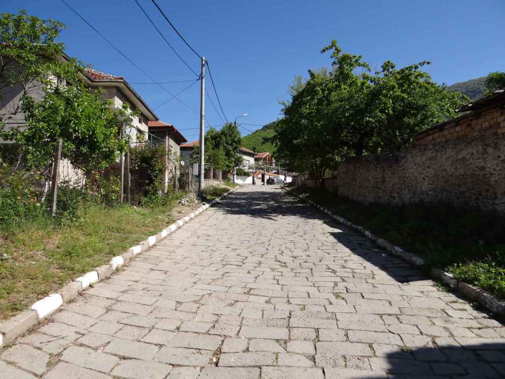
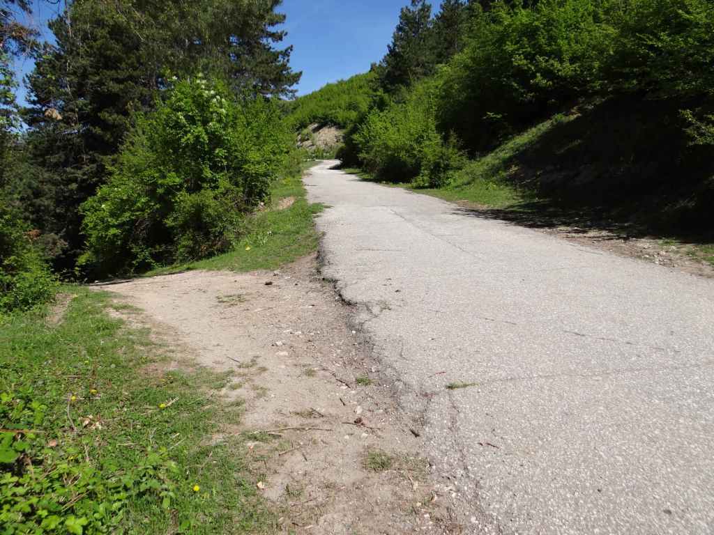
After 11 kilometres, there is a turning for Sapareva Banya on the right. You will need to go through the town and continue to the resort of Panichishte. After entering the town, go right at the roundabout and follow this road, which then veers left. At the stop sign, take the road diagonally opposite and continue uphill. At another stop sign, turn left. You are now on the road to Panichishte, which is ten kilometres from Sapareva Banya. On entering Panichishte, ignore the hotel signposts pointing left. Continue on the same road, and you will pass a tourist information centre on the left. Keep going for another 3.8 kilometres, until you reach a turning on the right that goes uphill to a place called Zeleni Preslap. You need to park the car here and continue on foot.

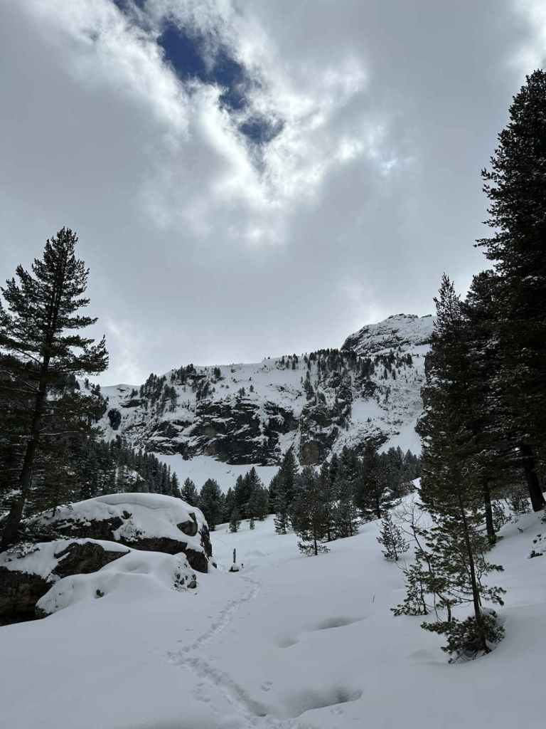
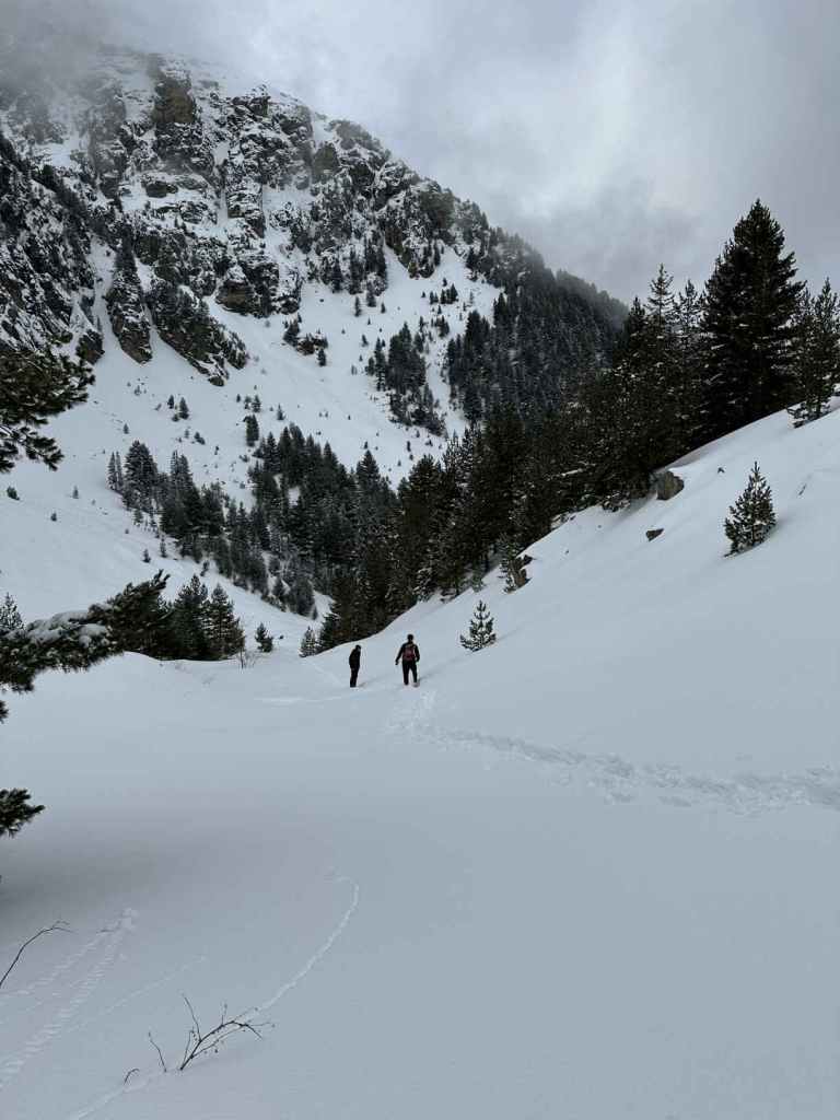
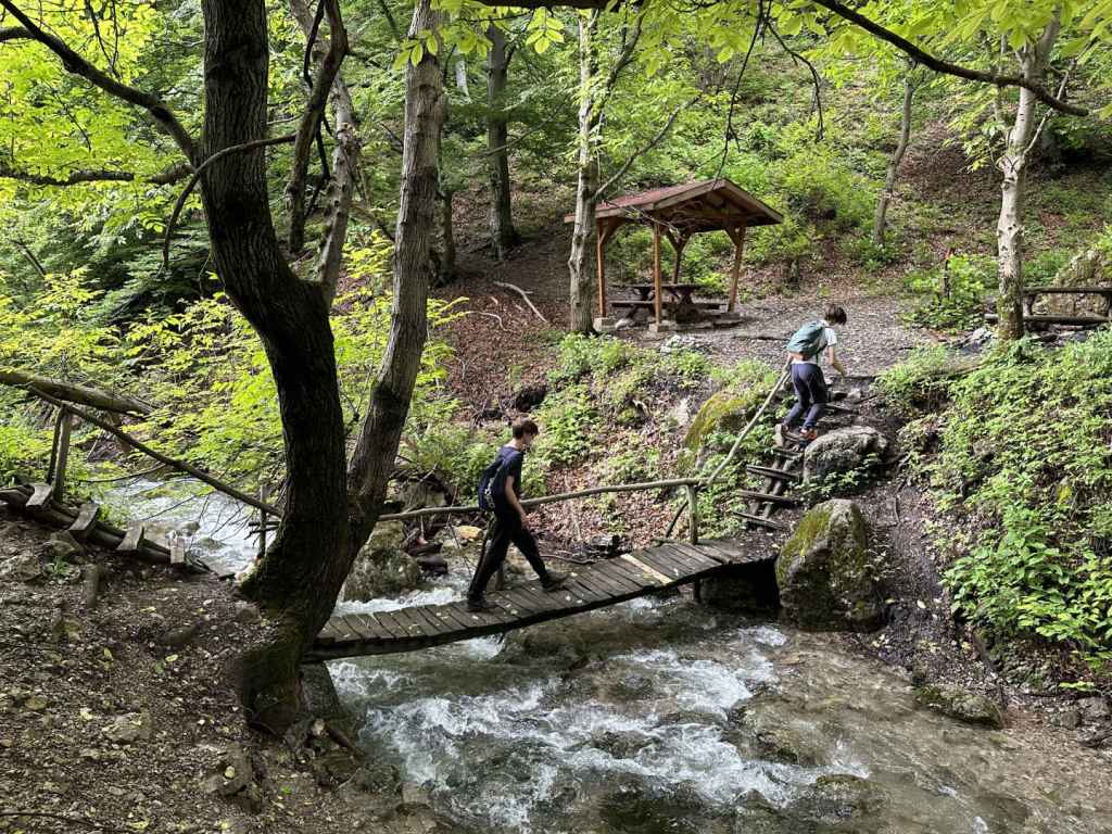
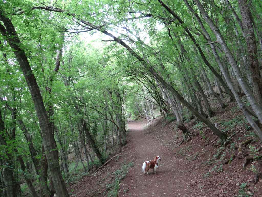
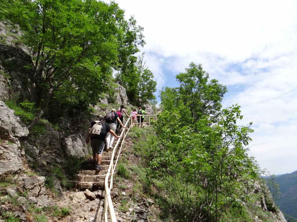
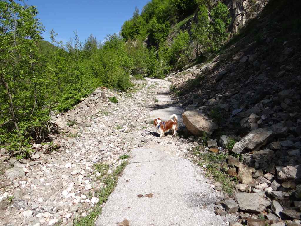
The walk is 11.5 kilometres, there and back, and in the snow in March it took us five hours. Factoring in the driving, that meant a day trip from Sofia of nine hours. The elevation gain is 475 metres, and there is quite a steep climb between Zeleni Preslap and Skakavitsa Hut, as you go through the forest, but the waterfall is eerily magical and well worth the effort. Just the fact you are a short distance from the Seven Rila Lakes is enthralling.

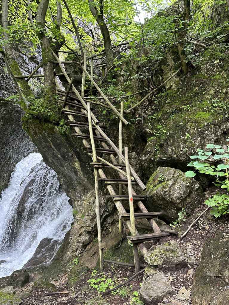
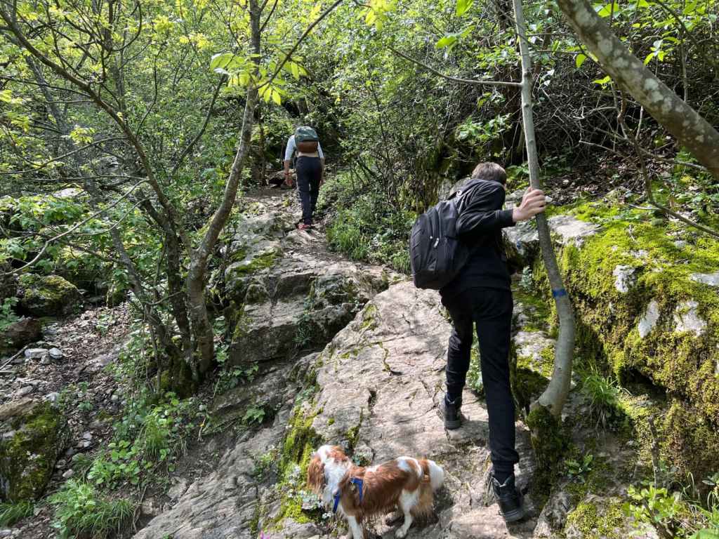
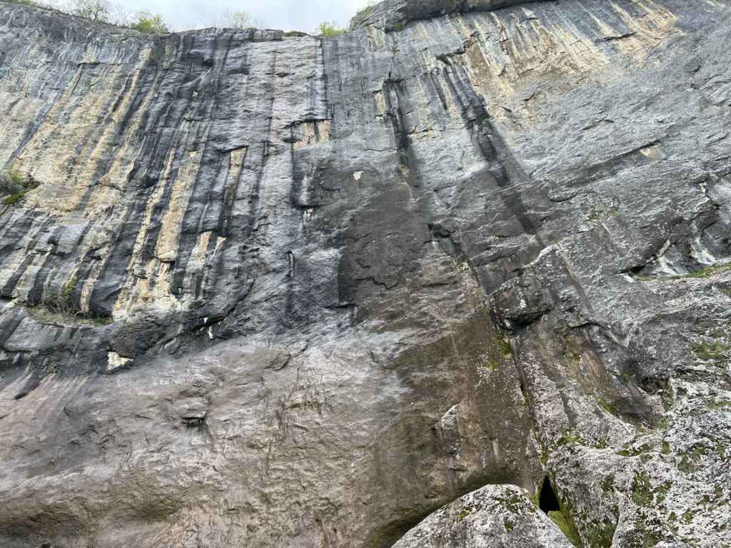
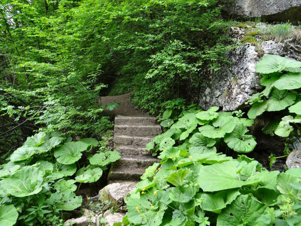
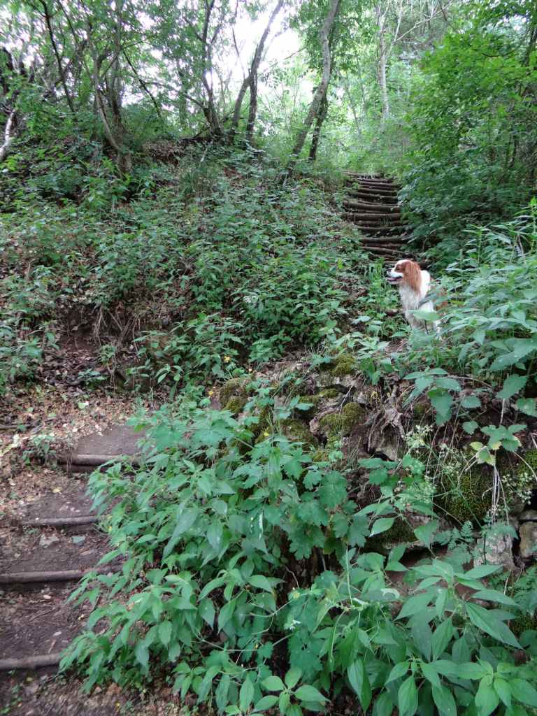
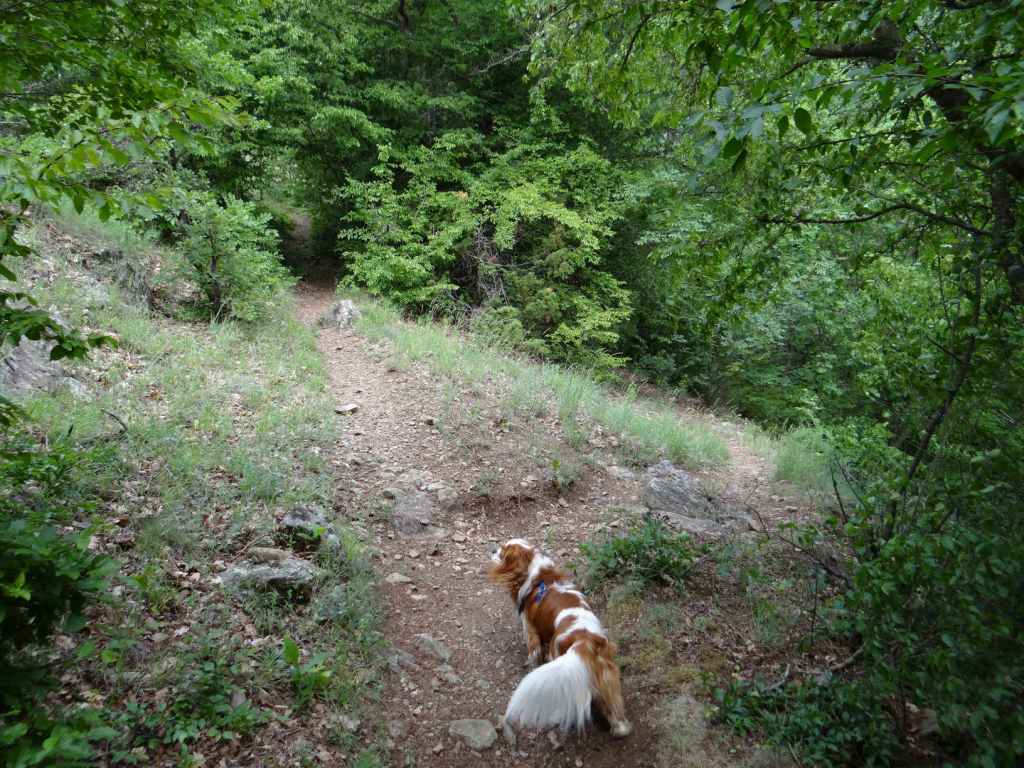
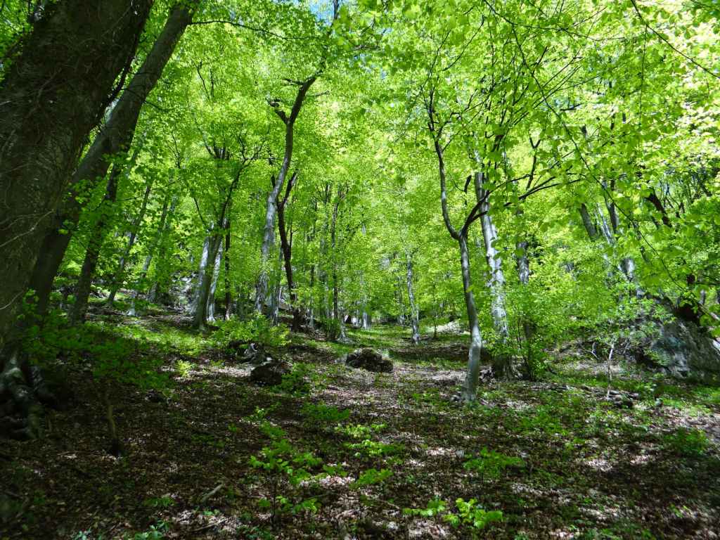
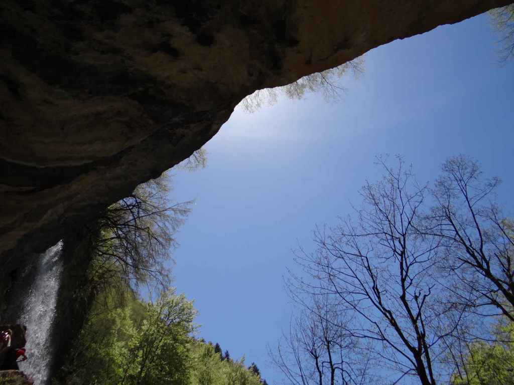
After 850 metres, you reach the rest house at Zeleni Preslap. Keep the rest house on your right and take the path that heads due south, to the left of some information boards. Continue on this path, with trees on either side, for 1.5 kilometres, then take the path on the right, signposted for Skakavitsa Hut and Kabul Peak. This path climbs gently at first, then more steeply. After two kilometres, a path on the right diverges to Kabul Peak. Keep left, and in 150 metres you will reach Skakavitsa Hut. The hut is open for refreshments in the summer, but not in March, when the ground is covered in thick snow and the only creatures we came across were a crestfallen guard dog and a large, standing wooden bear. The path to the waterfall is another 1.5 kilometres further south and takes about 40 minutes (in the snow). There are wonderful views of the waterfall and surrounding cliff faces as you approach.

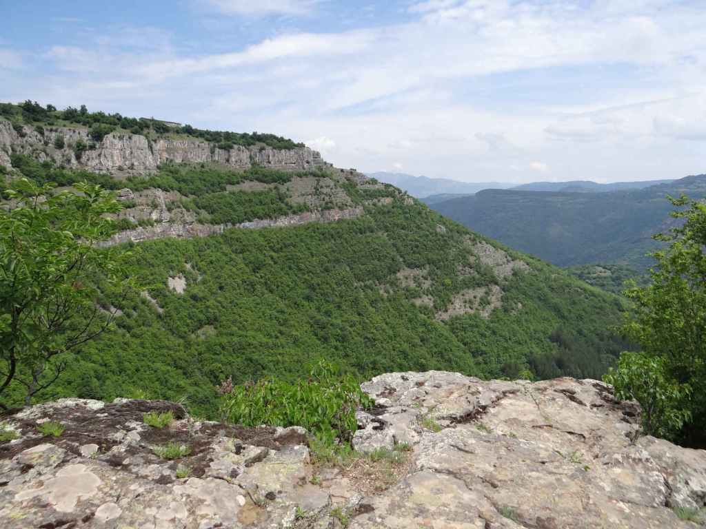
The road from Panichishte continues to Pionerska Hut, where there is a controversial lift that makes it much easier for daytrippers to access the Lakes. Purists, and I’m inclined to agree with them, would say you should do the walk on foot, but no doubt the lift serves a purpose. The name of the mountain, Rila, comes from a Thracian word meaning ‘watery’. You will notice this when you are on the mountain – you often seem to be stepping in water. The Galician word for ‘kidney’ is ril – it seems to me that Rila, the main water divide separating the Black Sea and the Aegean Sea drainage systems, functions as Bulgaria’s kidney, and indeed the waterfall resembles a kidney, as does the glacial lake nearest to it.

The tourist information centre in Panichishte. Continue for another 3.8 kilometres, until you reach the turning for Zeleni Preslap.
The turning for Zeleni Preslap. The signposts are rather confusing, but there is one for Skakavitsa Hut.
The rest house at Zeleni Preslap.
After passing the rest house on your right, take the path between the trees heading due south.
After 1.5 kilometres, a path on the right, signposted for Skakavitsa Hut and Kabul Peak, climbs through the forest.
The path in the forest.
Skis at Skakavitsa Hut.
Skakavitsa Hut.
The waterfall is forty minutes further south.
As you approach the waterfall, it is visible on the far left (the dark patch shaped like a kidney!).
Rilska Skakavitsa.
The descent from 1972 m., in the snow.
The walk to the waterfall, with the Seven Rila Lakes further south.

Zgorigrad

This is an astonishing walk, but it is not for the faint-hearted! To get to the bottom of the waterfall, known as ‘Borov Kamak’ (‘Pine Stone’), it is necessary to climb fourteen ladders, some of which are quite steep, and to cross from side to side of the river Varteshnitsa. We were with a small dog and had to carry him up and down the ladders. Also, in reviews online, a lot of people express their disappointment at the waterfall having no water. We went in the second half of June after heavy rains, and I can say that this was not the case! The waterfall was working at full capacity, and a couple of times, where there was no bridge, it was necessary to wade across the river.

That said, this is one of the most beautiful places I have been to in Bulgaria, and the waterfall is memorable. You get what you put in, I suppose. To reach the old mining village of Zgorigrad, you must first travel to Vratsa. Coming from Mezdra on the E79, you enter the town of Vratsa and keep going straight, following the signs for Ledenika Cave. After three kilometres, you pass the turning on the left for Vratsa Waterfall (directly after the hospital). After another kilometre, ignore the turning right that goes to the centre and follow the sign for Ledenika. In 300 metres, take the turning on the left to Ledenika and Zgorigrad. You leave Vratsa and go through the dramatic Vratsa Pass. After 2.2 kilometres, there is a sign for Ledenika at a distance of thirteen kilometres on the right, but you continue straight and enter Zgorigrad village. Keep going straight, pass through the centre (with the river Varteshnitsa on your right) and, as the road begins to loop, 2.2 kilometres after the centre of Zgorigrad, you come to the start of the ecopath that leads to the waterfall. Park your car on the grassy verge. The river is now on your left.

The walk to the waterfall takes about two hours. If you factor in another hour to visit the top of the waterfall, you will need to allow five hours to go and come back. The ecopath climbs the grassy verge and quickly enters forest. On your left is an old tailings pond, used to store waste material from the extraction of metal ore. This tailings pond caused a terrible flood (almost half a million cubic metres) in 1966, with significant loss of life in the nearby village. There is a short film about the disaster by Robart Nikolchev on YouTube. In about twenty minutes, you cross the first of several bridges taking you from side to side of the river. After the third bridge, we were tempted to go straight, but you must go right, uphill, following the course of the river. If you find yourself moving away from the river at any point, then you have gone wrong. Keep an eye on the red markers.

After the fourth bridge, the ladders start in earnest. There are eight ladders in the space of half an hour. After the fifth bridge, we again went slightly wrong and started moving away from the river. Follow the red markers and stay close to the river. Another three ladders, and then comes the fun part. You are required to cross to the lefthand side of the river, but there is no bridge, presumably because there isn’t normally so much water and it’s possible to hop from rock to rock. In our case, the river was roaring down, and this wasn’t possible! We tried taking off our shoes and socks, but the water was so cold we didn’t get very far! In the end, we just waded across. I carried our dog.

Another fifteen minutes, and you come to the bottom of the waterfall, which is 63 metres high. It’s a wonderful location. If you want to visit the top of the waterfall, you need again to cross the river without the help of a bridge. We again got soaked! But it was worth it. There is a picnic table under the eaves of the rocks on the righthand side of the river. You can stop here for lunch and admire the waterfall. We certainly did.

If you decide to continue the top, you must follow the path in front of you, which soon goes left. You must climb another four ladders to reach the top, but the view is amazing and the sensation of watching the river tumble over the edge is exhilarating. There is a place to stand, with a railing, but please be careful. The river before it cascades over the edge is much calmer. You can continue upstream. Having crossed a bridge, in about twenty minutes you will reach a mountain shelter and an open meadow. This is as far as we got.

Beware that descending the ladders is perhaps more difficult than going up (especially when you are responsible for a small creature!). We had heard that the walk to Vratsa Waterfall is quite steep, but found this walk to be more difficult, albeit more beautiful. ‘Borov Kamak’ easily ranks in my top five, along with waterfalls like Hristo Danovo and Polska Skakavitsa.

The ecopath starts 2.2 kilometres after the centre of Zgorigrad village.
It passes through forest, with the river Varteshnitsa on your left.
The first of several bridges.
Crossing back to the other side.
The ladders begin in earnest.
There is a wooden walkway with views towards Zgorigrad.
The ladders get steeper!
The river Varteshnitsa as it descends through the forest.
The first crossing without a bridge!
‘Borov Kamak’ Waterfall.
The picnic table on the righthand side of the waterfall.
The waterfall seen from the right.
The top of the waterfall.
The view from the top of the waterfall towards Zgorigrad.
The meadow further upstream.

Vratsa

Vratsa is a town north of Sofia, midway between Sofia and the river Danube. It is famous for its caves (in particular, Ledenika), waterfalls and rock formations. To the south-west of Vratsa is the Vrachanski Balkan Nature Park, established in 1989. This is where Vratsa Waterfall is situated, together with another waterfall, Borov Kamak, which can be accessed from the village of Zgorigrad. It is also where the Bulgarian revolutionary and poet Hristo Botev was killed in 1876, fighting against the Ottomans in an uprising that would be brutally crushed, but would sow the seeds for the liberation of Bulgaria from Ottoman rule two years later. Vratsa is also famous for the Rogozen Treasure, the largest haul of Thracian treasure ever found in Bulgaria, dating to the fourth century BC, part of which can be seen in the Regional Historical Museum.

Vratsa is connected to Sofia by railway (for train times, see the Bulgarian State Railways website: https://www.bdz.bg/en). To reach Vratsa from Sofia by car, take the A2 motorway, which connects Sofia with Varna on the Black Sea coast, north-east as far as Botevgrad and then head north-west on the E79 road to Vratsa via Mezdra. The journey takes about two hours. On entering Vratsa, keep going straight and in three kilometres, immediately after passing City Hospital on your left, there is a street, also on your left, called Belasitsa. You need to take this turning. This street continues for 800 metres and then abruptly ends next to an old people’s home, Zora. This is where the path to the waterfall begins (there are several places to park your car).

The walk from here to the bottom of the waterfall takes about an hour, but it is steep and slippery. It is not an easy path. Follow the path and, after a few minutes, there is a large gateway on your left with the words ‘Welcome to Vrachanski Karst’ written on it in Bulgarian. This is the name of the reserve, which forms part of the Vrachanski Balkan Nature Park. Do not be tempted to follow the track that climbs the hill directly in front of you, but go left, over the riverbed and under this gate. The riverbed will now be on your right. After five minutes, you will come to a shelter on your right, an ideal place to rest. The path starts to climb, and in another five or ten minutes you come to some benches and a fountain on your left. The path then crosses the riverbed, which was completely dry when we visited. You need now to follow the blue markers (they are sometimes red), ignoring a level path on the right and heading straight uphill. Bear in mind the elevation gain from the start of the walk to the waterfall is about 300 metres. If you stay on this path and observe the blue markers, you will reach the bottom of the waterfall in half an hour.

At 141 metres, Vratsa Waterfall, also known as ‘Vrachanska Skaklya’, is one of the highest in Bulgaria, but the flow of water is very little. There are some boulders at the bottom, and an enormous rock face. But where Vratsa Waterfall really stands out is with the views! I heartily recommend that you continue to the top of the waterfall, an elevation gain of another 200 metres, which takes about 45 minutes. As you face the waterfall, the path with the blue markers continues on your left (that is, it continues eastwards). Follow the path and, before reaching the top, you will pass a cave on your right, which you can investigate. Once you reach the top, the path heads right through some trees and then comes to a clearing. If you continue in the same direction, skirting the cliff face on your right, in five minutes you will come to the stream that feeds the waterfall. The views – of the waterfall and rock face as you climb; of Vratsa and Dabnika Reservoir in the distance – are spectacular and well worth the extra effort. The descent from the top of the waterfall to the start of the path took us about an hour.

All in all, you need to allow at least four hours for the hike itself. The climb to a large rock face, followed by a further climb to the top of the waterfall, is reminiscent of the visit to Bovska Skaklya north of Svoge, on the other side of the Vratsa Balkan, only this waterfall is higher.

The turning after the hospital, Belasitsa Street, ends next to an old people’s home. The path begins here. The waterfall is the dark patch on the rocks behind.
After a few minutes, turn left and pass through the gateway, which says ‘Welcome to Vrachanski Karst’.
A rock on the right.
A picnic shelter in ideal surroundings.
The path starts to climb.
After crossing the riverbed, the path becomes steep.
Vratsa Waterfall from below.
As we continue to the top, the views of the waterfall and Vratsa are wonderful!
A view of Vratsa from inside the cave.
At the top, the path heads through some trees.
And you come to a clearing.
In another five minutes, you reach the stream that forms the waterfall.
A view of Vratsa and Dabnika Reservoir from the top of the waterfall.

Berkovitsa

Sofia irradiates roads. I discuss the three that go to the Black Sea in my description of Sopot Waterfall. Then there’s the II-16 that takes you north along the Iskar Gorge to Bov and Dobravitsa. And the E79 (or the A3 motorway) that takes you south to Ovchartsi and then Greece. The E871 heading south-west in the direction of Polska Skakavitsa and Kyustendil. And don’t forget the II-63 that takes you west to Tran on the Serbian border (I still remember visiting Bilintsi Monastery along this road and meeting the abbot, who gave us tea next to an open pit and had taken it upon himself to ‘improve’ the ancient frescoes in the church).

Well, here we are going to take the II-81, which also heads north from Sofia in the direction of Montana and Lom. It is as if Sofia has antlers – the II-81 on the left, and the II-16 on the right. What makes the II-81 famous is Petrohan Pass, which you must pass over in order to reach north-west Bulgaria (Vidin and Romania). You leave Sofia through the district of Nadezhda and cross the ring road. The II-81 starts gently enough, passing through Kostinbrod and Buchin Prohod (from here you can turn right and cut across to the II-16 if you’re suddenly overwhelmed by a desire to visit Dobravitsa Waterfall).

After Buchin Prohod, ignore the turning to Godech on the left (though this, for me, is a very attractive part of Bulgaria with the wonderful Razboishte Rock Monastery) and the ‘Historical Road’ (the main road continues left), and pass through the pretty village of Gintsi, much favoured by artists and beekeepers. The road then begins to twist and turn as it climbs Petrohan Pass. The pass is often closed in winter because of snow, but the rest of the year it’s normally fine. The top of the pass is 65 km north of Sofia. There’s a large reservoir, which I understand was once a fish farm.

The road then descends on the other side. More twists and turns (try not to get stuck behind a van!). Ten more kilometres, and you reach what in my parlance would be called a ‘roadside caff’ on the other side of the road, a restaurant much favoured by my father-in-law, I am told (he was a famous opera singer and his family hailed from Vidin) – you can always stop here to try the kebabs and meatballs. Another six kilometres, and you enter Barzia, the Gintsi of the north, so to speak. From here, a road heads right to Klisura Monastery, well worth a visit, if you have the time.

But we must continue to the town of Berkovitsa in order to reach Haidushki Waterfall. So stay on the main road. Three kilometres out of Barzia, you will see a turning on the left, marked ‘Berkovitsa, 2 km’. Take this turning, climb the hill, and soon you will reach an OMV petrol station. I have a particular fondness for this petrol station, because this is where I bought Timon, the meerkat who features in The Lion King and was once my son’s favourite teddy.

You can stop here for petrol or a coffee. After OMV, the road goes right, alongside the railway. After 1000 m, the road goes right again, over the railway, but you go left. This turning is marked ‘x. Kom, 17 km’. Another 700 m, and you must take a turning right, marked ‘Kom Peak, 14 km’. Continue along here for 2½ km, passing a stadium on your right, until you reach a fork in the road. Take the right turning, and now you have a decision.

The road you are now on leads directly to the waterfall. I can’t tell you the distance, because I parked the car by the marble (‘mramor’) factory which is in front of you and walked. But plenty of people take the car further, there being lots of picnic places and several summer houses along the way. So you have a choice. How far do you want to walk?

The car journey from Sofia to this point is about 1 hour 45 minutes (90 km). The walk in front of you is the same, 1 hour along the flat, and then 45 minutes gently climbing the mountain. You never leave the road, though it becomes progressively more rutted and covered in leaves, and I wouldn’t want to think what happens if you’re on the mountain and meet a car coming the other way. You’ve also got the question of having to turn around. So it’s really the 1 hour on the flat that can be shortened. Plenty of people drive this distance, leaving the car as the road begins to climb (this point is marked by the beginning of an ecopath, for which there is a rusty yellow sign).

If you leave the car by the marble factory, you will have a 4½-hour outing there and back, including a lunch stop. You walk alongside the marble factory for ten minutes, the road then appears to fork – actually it continues on the left (this is where many people park), while a track heads right, up the hillside. After that, you can’t get lost, unless you want to. All along the road, there are picnic spots. It’s up to you how far you take the car. But after an hour’s walking, when the road begins to climb and the waterfall is only 45 minutes away, it really is time to leave the car behind and enjoy the nature.

We went at the end of October. Haidushki Waterfall is a series of beautiful short waterfalls, and one of the few waterfalls it doesn’t matter if you go in the spring (after the snow melt) or in the autumn. Leaves carpeted the ground. The river below the waterfalls shone black. Other leaves that hadn’t reached the ground yet seemed to rain down on us, but it was the river that kept drawing my attention. Sometimes the leaves on its surface meant you didn’t know it was there, and it was easy to put your foot in it – in fact, I did precisely this: I became part of the waterfall for a moment.

It is clear when you reach the waterfall, because there are several signs. You have to descend a little. There is a shelter with some benches, a small mirador, and then the waterfall in front of you, but don’t forget the other waterfall on your right, hidden around the corner. They’re both beautiful.

If you continue upriver or downriver, no doubt you will come across other cascades. The traffic coming back into Sofia was dense, I had to drive with only one sock (the other was wet), but we had had our adventure. Life is not a choice, we only think it is – it is an experience.

The OMV petrol station in Berkovitsa (the road goes right).
After 700 m, you take a turning right, marked ‘Kom Peak, 14 km’.
The stadium in Berkovitsa.
The fork in the road – the road on your right leads all the way to the waterfall, but becomes progressively more rutted and leaf-strewn.
The marble factory on your right – we parked here.
After ten minutes, the road continues on your left, while a track heads uphill.
Autumnal colours.
The road through the trees.
One of the picnic places.
Yellow sign indicating the start of an ecopath – the road begins to climb the mountain.
The river with leaves on its surface.
The road on the mountain.
A landscape painting.
Arrival at the waterfall (which can be seen bottom left).
The roof of the shelter.
Haidushki Waterfall (left).
Haidushki Waterfall (right).
The road back to Berkovitsa (being eaten by a tree).

Sopot

The E871 is one of my favourite roads in Bulgaria. It’s even a little difficult to find. There are three roads heading east from Sofia. They all go to the sea. The E83/772 goes to Varna via the medieval capital, Veliko Tarnovo, running north of the Balkan Mountains. The E80/773 goes to Burgas via Bulgaria’s second city, Plovdiv. The E871 doesn’t seem to go anywhere, though it does in fact drop down at the last moment and join the E773 on its way into Burgas – but only at the very last moment. Apart from that, it travels on the warmer side of the Balkan Mountains, the south side, and offers wonderful views of this beast that is the Balkan, scratching its belly (the mountain, I mean) in the early autumn sun.

I say it’s difficult to find because you leave Sofia in the east and if you’re not careful, you end up going to Varna. You have to hang a right, passing through the suburb of Dolni Bogrov, which always at weekends has lines of cars in the slow lane, parked for a market that takes place there and seems very well attended. Once past Dolni Bogrov, you again have to take a right (otherwise you’ll end up going to Varna), and then the journey begins. The road stretches in front of you, like a tree’s shadow, long and straight. You must up and over three hills (the second containing a bust of Bulgaria’s nineteenth-century freedom fighter, Vasil Levski, at its base). You then pass the turning for Chavdar, the first of the waterfalls along this road, which I described in an earlier post. You drive at under 50 km/h through the towns of Zlatitsa and Pirdop, twins joined at the hip. And then the fun starts. Numerous bridges, all with little bumps (I thought I counted five or seven on every bridge), from which people organize bungee jumps when it’s not too windy. Today was extremely windy, so there was nobody in sight (plus it’s the Bulgarian elections).

Just before Karnare, you pass the turning for the second of the waterfalls located near this wonderful road – Hristo Danovo, a stunning straight line like a windpipe. But be careful in Karnare – this is where Bulgaria’s freedom fighter Vasil Levski was betrayed to the Turks by a local priest, Pop Krustio! It’s also where a road dares to cross the Balkan Mountain from south to north, as if it’s suddenly decided to switch sides, passing through Troyan, the third most important Bulgarian monastery after Rila and Bachkovo.

One is not diverted, however, but continues along on the E871 (wonderful road that it is!) and after Anevo, just before entering Sopot proper, you will see a turning on the left for Anevo Fortress (2 km), followed immediately by another turning on the left for Sopot Lift (I think it was written ‘Lift Sopot’, 1 km). This is the turning you need. But you are not going to the lift. You actually need to head to one of Sopot’s two monasteries, the one dedicated to the Ascension of Jesus, which is situated at a distance of 1.2 km from the E871.

So when you see a sign for Sopot Lift (or Lift Sopot) saying ‘200 m’, don’t go there. Continue right and just around the corner the monastery will come into view. There is an open area where you can park the car.

With the monastery in front of you, look to the left. A narrow path hugs the wall of the monastery enclosure before, in theory, heading up the valley to the waterfall. You need to take this path. But this is where things get difficult. Let me explain.

In the past, a nice path ran all the way to the waterfall, passing a small chapel before reaching the waterfall after only 30 minutes. To our amazement, today no path was visible. It ended abruptly at the bridge just behind the monastery and had been replaced by an abyss, a drop down to the riverbed. There is no path anymore. A flash flood – or something like it – appears to have swept away not only the path that used to meander nicely among the trees, but also the very riverbank. There is no riverbank. I am not joking. You are forced to drop down to the riverbed and then to walk along the riverbed. So this outing is not for the fainthearted. But before you become discouraged, let me tell you an hour after we arrived at the waterfall, a gaggle of children all aged under ten arrived as well – I can’t believe how many there were, they started lobbing heavy stones into the pool at the foot of the waterfall – so it can’t have been all that difficult.

But let me repeat: there is no path. There isn’t even any earth. You are on the riverbed, jumping over rocks, threading your way through fallen trees. It took us an hour and a half (a little less coming back – my wife asked me why it’s always easier coming back, I thought it was perhaps because you already know the way). And here’s the lesson from our outing today.

As we walked beside the monastery wall, a glum-faced gentleman in his elder years droned that there was no point going on, the path ended after the bridge. He and his companions had evidently turned around.

Once we were on the riverbed, but still at the beginning, a younger couple (he looked particularly sporty, she was more elegant) also warned us against continuing. Ten minutes, and they had had to turn around.

If we had listened, we would have got back in the car and missed the most amazing beauty. So don’t listen when people try to dissuade you, when they try to make you lose faith. Listen only to your inner voice. It’s like Christ says in John chapter 8, the last day of the Festival of Booths: just believe.

It’s lucky our dog was there to help us choose the best route. I felt like Arthur Morgan in the computer game Red Dead Redemption 2, turning on eagle eye, which enables him to see the trail left by a cart or an animal. You find your way through, you continue up the riverbed (it’s actually very beautiful being this close to the river!), you ignore the gainsayers (don’t go, it’s not worth it!), and at the end you witness incredible beauty.

Because Sopot Waterfall is a heart. It is a spring of water gushing up to eternal life (John 4:14 – have you read John’s Gospel? It is a fantastic book of short stories, of intimate encounters). Hristo Danovo is purity. Polska Skakavitsa, southwest of Sofia, is baptism – you cannot help but get immersed. Sopot is love, and so it ranks among my top waterfalls (even if there is no path, even if you have to walk through the air to get there). The water makes the shape of a heart. It is like a knot. A heart is a knot, two interlocked fingers.

And don’t let anybody tell you any different.

The path (it doesn’t last long) follows the wall of the Monastery of the Ascension.
It then abruptly ends. Here you can see how the riverbank has been obliterated – all that is left is the riverbed.
Miraculously, the path does reappear at one moment.
The magic of water.
Here you get a good idea of the terrain that you must cross to get to the waterfall.
The ruined chapel.
A pile of leaves – underwater!
In the absence of a path, people have taken to stacking stones when they reach the waterfall.
Sopot Waterfall.
A close-up of the heart.
The waterfall also resembles an hourglass.
The Monastery of the Ascension, which you can visit on your return.

Bovska Skaklya

At 85 metres, Bovska Skaklya (‘Bov Waterfall’) is one of the highest in Bulgaria. Like Polska Skakavitsa, it can easily be reached by train from Sofia. The journey takes an hour, and there are regular services during the day (see the excellent Bulgarian State Railways website for train times, https://www.bdz.bg/en).

Bovska Skaklya is located at the halfway point between the villages of Bov (down below) and Zasele (up above). An ecopath has been built between these two villages to incorporate the waterfall and is named after the famous Bulgarian poet Ivan Vazov, who apparently used to enjoy walks in this area. There is some suggestion that you should descend from the village of Zasele, make your way down to the waterfall and the village of Bov and then climb back up again. Since it seems to me to make more sense to get the climbing in early in the day, I suggest starting in Bov. Also, Bov is the stop on the railway line from Sofia and is on the main road from Svoge to Mezdra, the II-16.

If you insist on starting in Zasele, located above the waterfall, then you will need a car. As you leave the village of Tserovo, five kilometres after Svoge, there is a turning left signposted for Zasele (7 km). Follow this winding road uphill until you come to the centre of Zasele, where there is a tarmac square. The ecopath starts from here.

Otherwise, continue to Bov, three kilometres after Tserovo. Ignore the turning right, signposted Gara Bov (‘Bov Station’), and continue on the main road for another 400 metres, taking a turning left signposted for Skaklya. This narrow road continues for 1.4 km to the start of the ecopath, but be careful. 200 metres before the end of the road, the road divides – keep left, going uphill, until you come to a small area next to a house, with the river on your right, where you can park the car. For those travelling by train, alight at Gara Bov and walk 400 metres down to the main road (leave the station, turn right, go under the railway and follow the road as it veers right and crosses the River Iskar). Once you reach the main road, turn right, continue for 400 metres until you reach the turning for Skaklya and then follow the previous directions.

From where you park the car, you have a forty-minute steady climb through the forest to the bottom of the waterfall. The forest is magical, and there are some wonderful views back the way you have come. Once you reach the waterfall, another forty-minute climb, slightly stiffer this time, will take you to the top. As you get higher, there are steps and a railing to hold onto. You really get an impression of the height of the waterfall because you are climbing it! At the top is an open area of grass with several picnic tables. Continue to the village of Zasele, perched on top of the rock, and you will come across one or two restaurants and guest houses if you wish to stay the night (though I understand you have to book ahead).

The best time for visiting waterfalls is immediately after the snow melts – second half of April, first half of May. This is when the flow of water is at its strongest. We went at the beginning of June, so already the flow had declined somewhat. In autumn, it becomes a trickle. We first visited the waterfall ten years ago, in November. There wasn’t much water left, but the autumnal colours of the trees more than made up for the lack of watery fireworks!

Bovska Skaklya is not far as the crow flies from another waterfall, Dobravitsa (except that for Dobravitsa, you have to leave the main road in Svoge and follow the signs for Iskrets and Breze). From Gara Bov, another ecopath takes you to the waterfall Pod Kamiko. This ecopath starts from the stadium in Gara Bov and is circular, so you don’t have to come back the way you went (see the map on the road outside the station).

Gara Bov.
The turning for Skaklya. There is also a sign saying ‘Touristic Road “Vazov’s Path”, 1.4 km’.
200 metres before the ecopath begins, the road divides – keep left here.
There is a small area to park the car where the road peters out and the ecopath begins.
A view from the ecopath of the rocks up above.
The path as it passes through the forest.
The waterfall in the distance.
Arriving at the waterfall.
Bovska Skaklya, seen from below.
From here, the path continues to the top of the waterfall and the village of Zasele.
This path has steps and a railing.
The view near the top.
The top of the waterfall – the stream passes under the bridge and tumbles down 85 metres.
The water as it becomes airborne.
The view back to Bov.
Bovska Skaklya.

Polska Skakavitsa

Undoubtedly one of the most beautiful waterfalls in Bulgaria. The journey to the waterfall reminded me a little of the 1970 film The Railway Children since it involves travelling by train and then walking along the railway line for a short distance. You can travel by car to the villages of Ruzhdavitsa and Polska Skakavitsa, after which the waterfall is named, but I understand the road is not good and then you have a long hike to get to the waterfall. By far the better option is to travel by train! The stop for the waterfall is called ‘Skakavica’ and it is on the line from Sofia to Kyustendil. The journey from Sofia to Skakavica is two and a quarter hours, and there are trains about every two hours. The trains are very pleasant and they run on time! I direct you to the wonderful Bulgarian State Railways website: https://www.bdz.bg/en. Here you will find up-to-date information on train times and other destinations in Bulgaria.

Not all trains are direct, sometimes it’s necessary to change in Radomir, but don’t worry, the connecting train waits for the train you are on to arrive. We drove to Radomir and took the train from there. A return ticket Radomir-Skakavica-Radomir cost a little over 2 euros! The stop before Skakavica is Zemen, where there is a famous Monastery of St John the Theologian. The train then travels along a gorge created by the Struma, a stunning river that rises on the southern slopes of Mt Vitosha (the mountain that overlooks Sofia) and then travels to Greece, entering the Aegean Sea at the ancient site of Amphipolis. There are interesting rock formations. After fifteen minutes, you reach Skakavica station. Alight here, wait for the train to leave and then continue along the railway line in the same direction the train has just gone in (that is, south). It’s quite safe. This is a single-track railway, so there is no immediate danger of a train coming the other way. After fifteen minutes of walking along the railway, you will come to a short tunnel. Go through the tunnel and, before you reach the iron bridge crossing the river Struma and entering a second tunnel, on your right you will see a low concrete wall. The path to the waterfall starts here, at the end of the concrete wall.

Follow the path, which runs alongside the river Struma on your left – admire the river! – and in about fifteen minutes you will reach a signpost indicating a picnic area to the left (‘МЯСТО ЗА БИВАК’) and the waterfall to the right (‘КЪМ ВОДОПАДА’). Go right here. The path climbs a little, and you reach a wooden bridge over a stream on your left. This is the way to the waterfall. The wooden bridge is somewhat destroyed, but you can cross the stream just above the bridge. You must now climb some steps, which will take you to a small terrace, where you get a view of the gorge and the Struma on its implacable way to Greece. Continue uphill. The first turning on the left takes you to the bottom of the waterfall. If you continue uphill, you will come to an area just below the top of the waterfall. In both places, you are likely to get wet! But who cares, right? The experience is invigorating.

At the top of the waterfall is a small chapel dedicated to St Demetrius. This can be seen from below. Near the wooden bridge is a map of the area and a description of the local wildlife, with a couple of picnic tables in the shade. While we rested here, a bird kept us company with an astonishing succession of melodies and trills. This is Bulgarian nature at its best. It took us only forty minutes to get from the station to the top of the waterfall, and the walk is very pleasant. The waterfall in its entirety is seventy metres high. It is formed by the Shiroki Dol river, which then joins the Struma below on its journey to Greece. At a distance of about six kilometres from the waterfall is an old chapel dedicated to the Assumption of the Virgin Mary, near the village of Ruzhdavitsa, which we didn’t go to. All in all, a fantastic day out.

A note of warning: when you head back to Skakavica station, allowing about an hour to get there, so you have plenty of time, the path along the Struma back to the railway line divides at one point, and it is very tempting to take the left branch that heads uphill (and, for all I know, goes to the railway station), but if you want to go back the way you came, you must take the right branch. In a couple of minutes, you’ll be back at the railway. Provided you’ve left enough time, there is no danger of coinciding with the train, but obviously caution is required.

The path alongside the railway, after you leave Skakavica station.
The tunnel.
The low concrete wall. The path to the waterfall starts here.
The waterfall in the distance.
Fifteen minutes after you leave the railway, the path divides. Head right to the waterfall (‘КЪМ ВОДОПАДА’).
The steps leading up to the waterfall.
The small terrace overlooking the gorge formed by the Struma River.
The top of the waterfall.
The view from the top of the waterfall, with the Struma River in the distance.
The bottom of the waterfall.
Polska Skakavitsa Waterfall.
Heading back to the railway, the path divides. Keep right in order to reach the railway!
The path as it descends to the railway.

Hristo Danovo

If you’re travelling to this waterfall from Sofia, you’ll need an early start. It’s a ten-hour day – a two-hour drive in both directions, a two-hour walk in both directions and two hours to spend at the waterfall. Is it worth it? Well, you will get a real taste of the Balkan and will visit what for me is the most beautiful waterfall in Bulgaria. So, yes.

You need to take the E871 east of Sofia, in the direction of Burgas. This is one of my favourite roads. It starts very straight, then it climbs and winds over a couple of forested hills, passing a monument to Bulgaria’s freedom fighter Vasil Levski, after which it seems to pass through a landscape straight out of The Hobbit, as if elevated fifty feet in the air. The road hugs the southern slopes of the Balkan, the ‘Old Mountain’ as it’s known in Bulgarian. It’s like an arrow flying east.

Leave Sofia on the road for Varna/Burgas, but then follow the signs for Burgas. Having passed through the outlying village of Dolni Bogrov (where there always seems to be a market at the weekend, and lots of cars parked at both sides of the road), you turn right, and the E871 stretches out in front of you. The drive from Sofia to the village of Hristo Danovo is 130 km. About halfway, you pass the turning for another waterfall, Chavdar, to the south, then you go through the more industrial towns of Zlatitsa-Pirdop (it’s difficult to distinguish them) and after Rozino, just as you are about to enter Karnare (from where there is a road that memorably crosses the Balkan north to Troyan), there is a turning on the left marked Hristo Danovo, 4 km. Take this turning until you reach the central square of Hristo Danovo, where there are signs for the waterfall (known as ‘Suvcharsko Praskalo’) and the Balkan Central National Park which it is part of. Park the car.

Above the village is an old tarmac road that will take you all the way to the waterfall. Some people drive their cars some of the way, but it’s really not necessary (and also the road is not very good). Enough with the driving. You leave the square along a short road to the right of all the signs and immediately turn right and climb a paved road. This road becomes a track. Keep on climbing out of the village. After ten minutes, the track divides, you head right, next to a field with a view over the village, and in another five minutes you reach the tarmac road. Avoid the temptation to continue along the dirt track opposite, and turn left along the tarmac road.

Savour the views of the Balkan Mountain. On your left is a deep gorge formed by the Damladere River (the same that forms the waterfall). After forty-five minutes, you will see a smaller waterfall. In another twenty minutes, you will reach an orange barrier, followed by a table and benches, which is an ideal spot to stop and take a rest. Exactly an hour and a half after leaving the village, the road veers to the left over a concrete bridge that crosses the Damladere – this is where you part ways. Immediately after the bridge, a narrow track heads upstream through the forest. You continue along the left bank of the river for five minutes, and then you are forced to climb (not to follow the course of the river, which is protected). Fifteen minutes after leaving the bridge, you will reach the waterfall. Prepare yourself for a wonderful sight. The waterfall is a straight line falling 54 metres, like a windpipe between two lungs. The water glistens in the sun, throwing off drops that bombard your face. Let them.

I have been to more than thirty waterfalls in Bulgaria, including the more famous Raysko Praskalo a little further east, also in the Central Balkan National Park. Hristo Danovo is my favourite. You have a sense of the power and purity of nature. You also learn a little bit about the Balkan Mountain. One of the amazing things about Bulgaria is how distinct its mountain ranges are from each other – the Balkan, Vitosha, Rila, Pirin, Rhodope… Not one of them is alike. I am actually a fan of Vitosha, because this is the mountain I visit most often from Sofia (it overlooks Sofia from the south), but they are all remarkable. My wife says Bulgaria is in the perfect location – far enough north for the mountains not to be dry, far enough south for them not to be cold. Of course, she’s right!

Hristo Danovo main square, with the signs for the waterfall and the Central Balkan National Park. The road for walking to the waterfall is on your right.
The route to the waterfall!
The paved road leading up out of the village.
Before reaching the tarmac road, the track divides. Go right.
The track reaches the tarmac road. Follow the tarmac road north-west.
A view back over the village of Hristo Danovo.
The road is not exactly suitable for driving!
After forty-five minutes, a waterfall on your left.
In another twenty minutes, you reach an orange barrier.
An hour and a half after leaving the village, you reach a concrete bridge over the Damladere River. Leave the road immediately after the bridge and follow the left bank of the river.
A narrow path takes you through a magical forest to the waterfall.
Hristo Danovo Waterfall – a windpipe between two lungs.
After falling 54 metres, the water lands with an almighty crash.
A view of the upper part of the waterfall.
A view from the side.
A view from under the rock.

Vishovgrad

The third waterfall in terms of distance north-west of Veliko Tarnovo is Vishovgrad (‘Zarapovo’). Hotnitsa (because of the turquoise waters) and Emen (because of the canyon that precedes the waterfall) may take the fame, but do not underestimate the charms of this waterfall 3 km east of Vishovgrad, on the road between this village and the village of Emen. This waterfall can be visited on the same day as Emen since Emen is only 4 km further east.

To get there, follow the instructions for getting to the village of Emen. Once you arrive in the main square in Emen, continue for another 200 m, until you reach a crossroads. The road to Vishovgrad is on the right. After 400 m, you will see the dirt track leading to the start of the ecopath to Emen Waterfall on the right. Stay on the main road. After another 3 km, you will pass a factory on your right, and 600 m later, where there is a bend in the road, you will see two white signs on the right, with a dirt track leading into the forest. This is Zarapovo. You can park the car on the verge. The ‘ecopath’ (any path in nature seems to be termed thus) heads to the right and in only five minutes takes you to the waterfall.

The path divides. The left fork takes you through some trees to the bottom of the waterfall. The right fork takes you round the rock and over a wooden bridge to the top of the waterfall. The area below the waterfall is ideal for rest and relaxation. There are even several smaller falls further downstream.

These three waterfalls are all worth a visit – Hotnitsa because of its turquoise waters and the ‘ecopath’ up the gorge; Emen because of the canyon; and Vishovgrad because of its charm. I found Vishovgrad the most restful. Even though there were lots of people about (on a Saturday), everybody was very friendly!

If you’re travelling to or from Sofia, there is no need to go via Emen and Veliko Tarnovo. Travelling east on the E772, 14 km after Sevlievo, there is a turning on the left for Dobromirka (4 km) and Pavlikeni/Suhindol (25 km). Take this turning, ignore the signs for Suhindol, follow the signs for Pavlikeni. Vishovgrad is situated 11 km before Pavlikeni. Turn right here, at the main square of the village, and in 3 km you will reach the waterfall.

The ecopath from the road to the waterfall is so short you can see the end, where the tree is.
At the end, you are standing on a rock above the river. Down below is the wooden bridge that takes you to the top of the waterfall.
On your left is the path through some trees to the bottom of the waterfall.
The waterfall, which seems to me to resemble a seated figure.
Vishovgrad Waterfall.
A smaller fall further downstream – looking back up to the main waterfall.
A view of the wooden bridge from the other side of the river, and the rock where you arrive after you leave your car.