Polska Skakavitsa

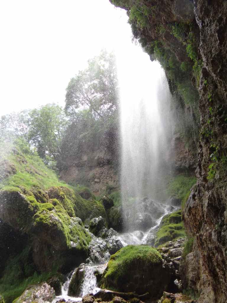
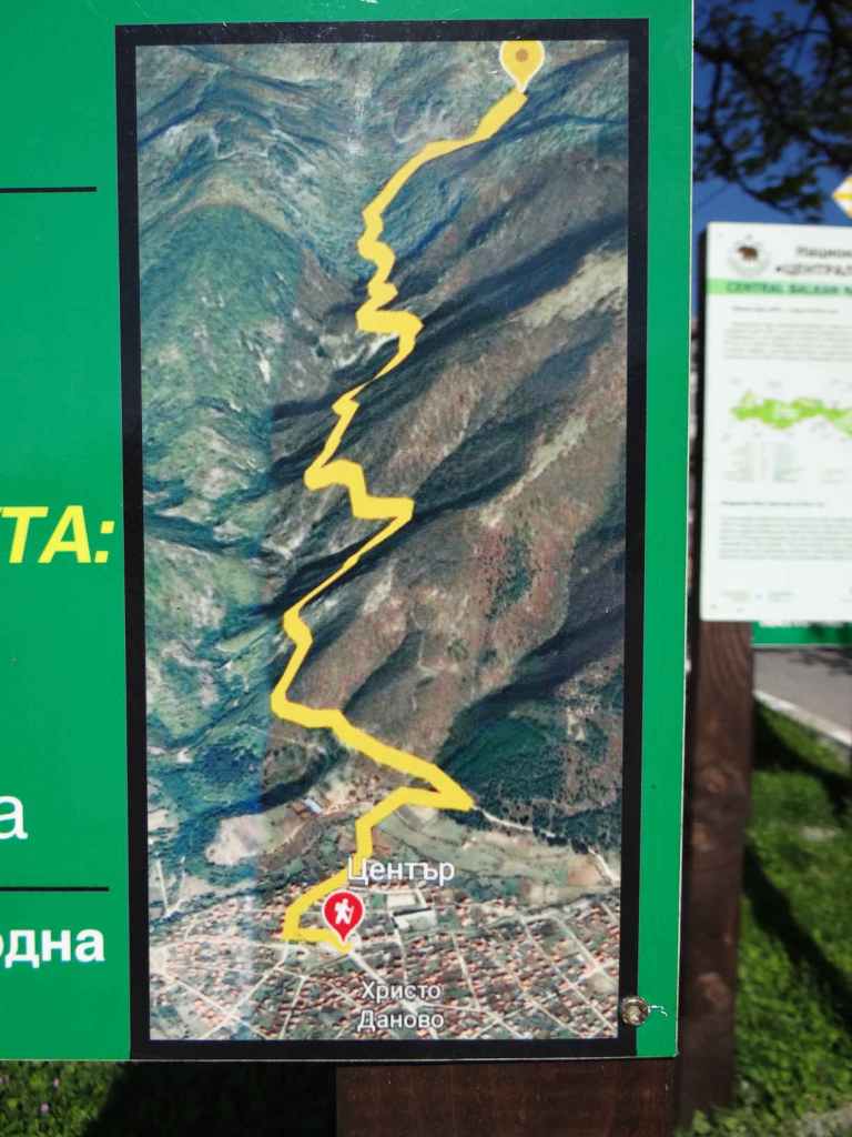
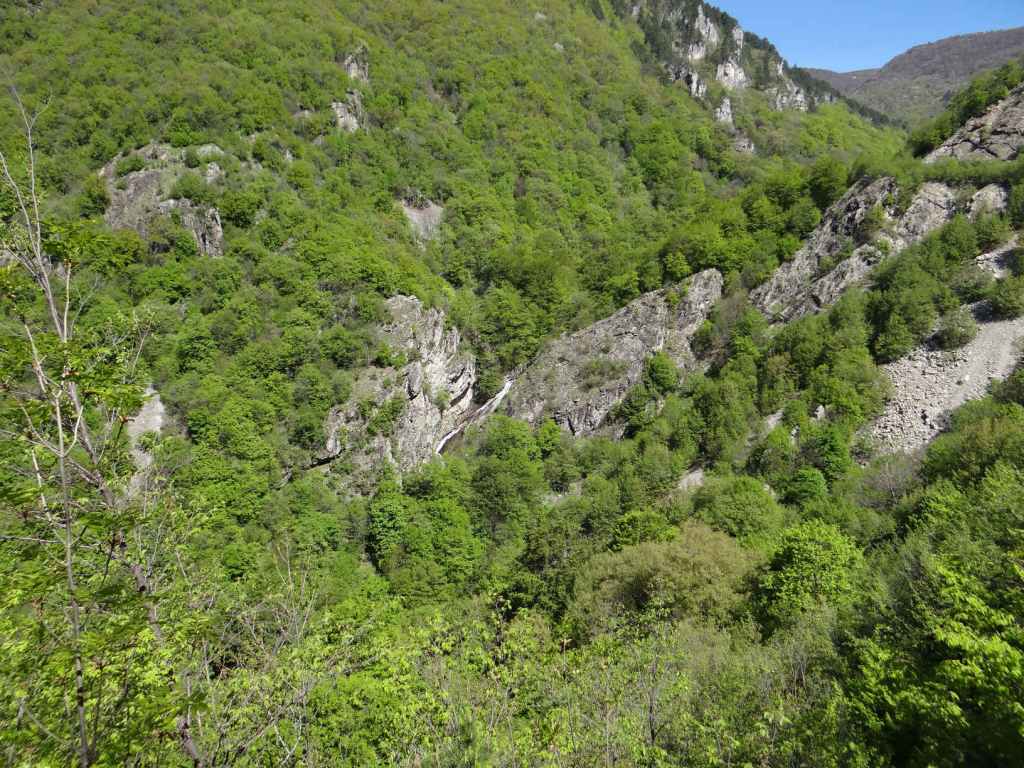
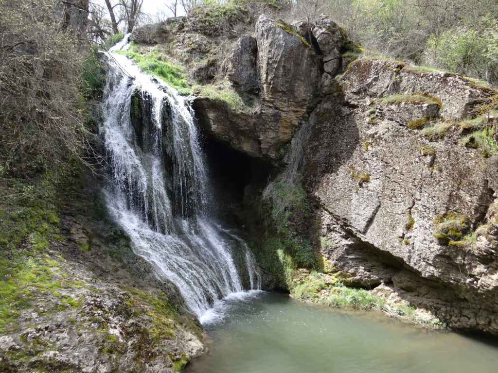
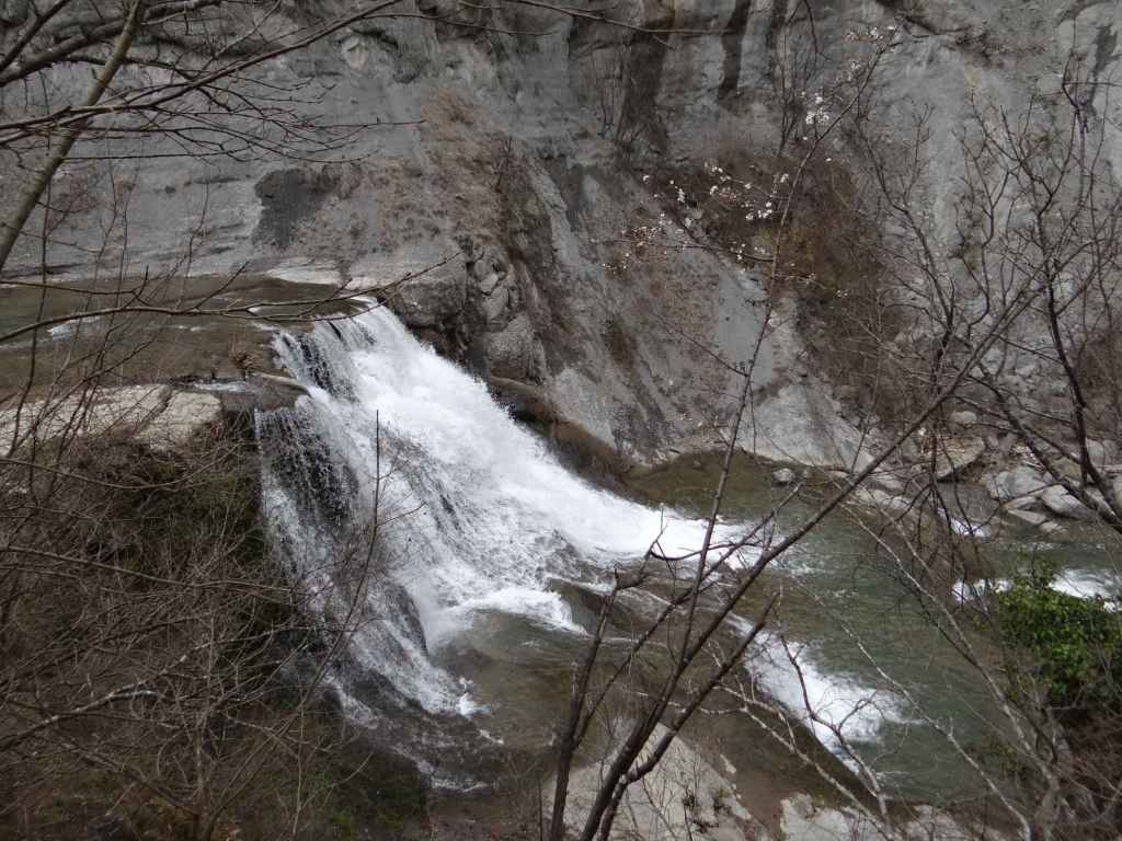
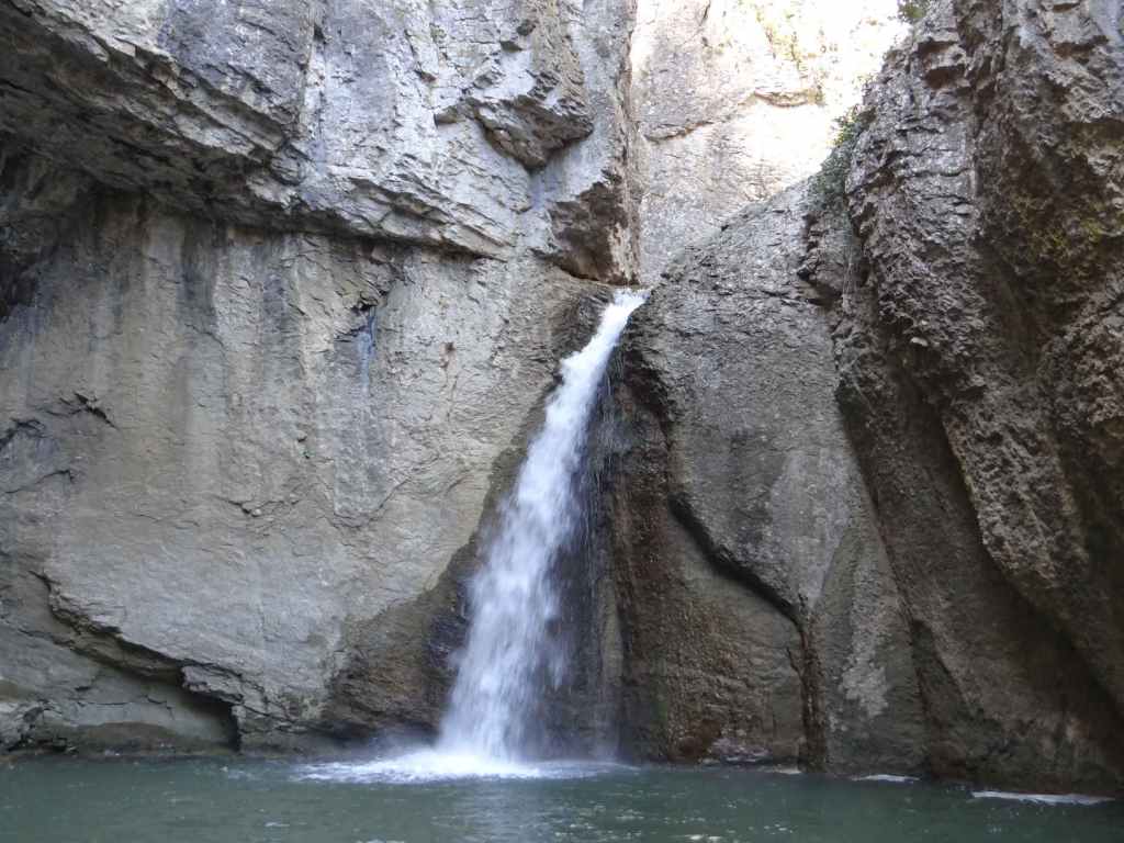
Undoubtedly one of the most beautiful waterfalls in Bulgaria. The journey to the waterfall reminded me a little of the 1970 film The Railway Children since it involves travelling by train and then walking along the railway line for a short distance. You can travel by car to the villages of Ruzhdavitsa and Polska Skakavitsa, after which the waterfall is named, but I understand the road is not good and then you have a long hike to get to the waterfall. By far the better option is to travel by train! The stop for the waterfall is called ‘Skakavica’ and it is on the line from Sofia to Kyustendil. The journey from Sofia to Skakavica is two and a quarter hours, and there are trains about every two hours. The trains are very pleasant and they run on time! I direct you to the wonderful Bulgarian State Railways website: https://www.bdz.bg/en. Here you will find up-to-date information on train times and other destinations in Bulgaria.

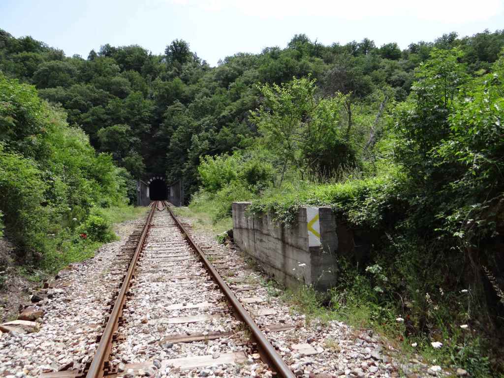
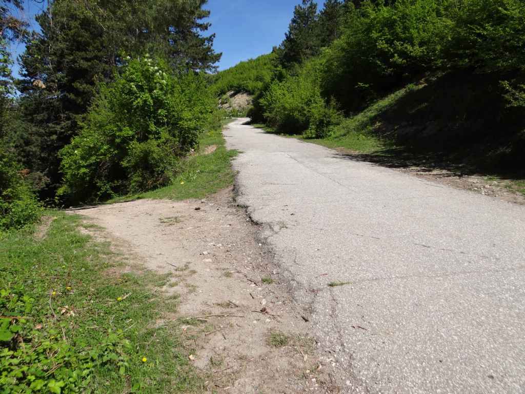
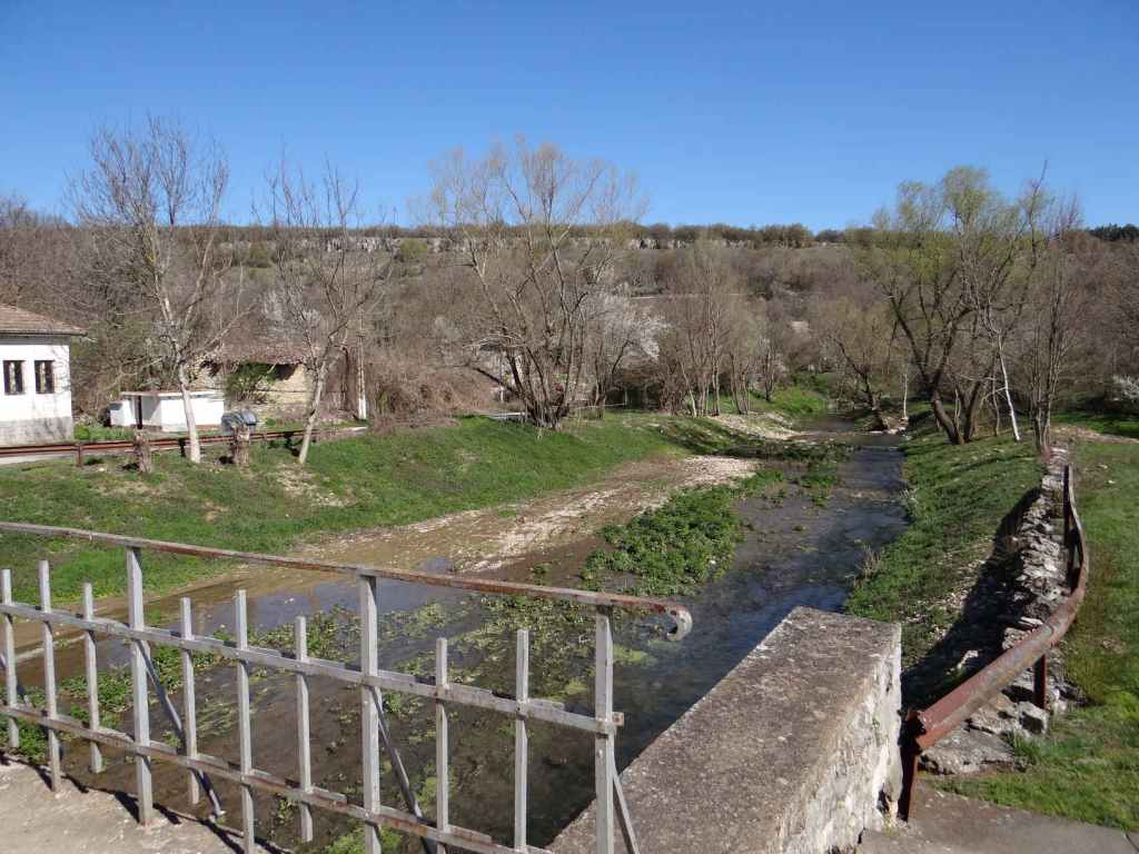
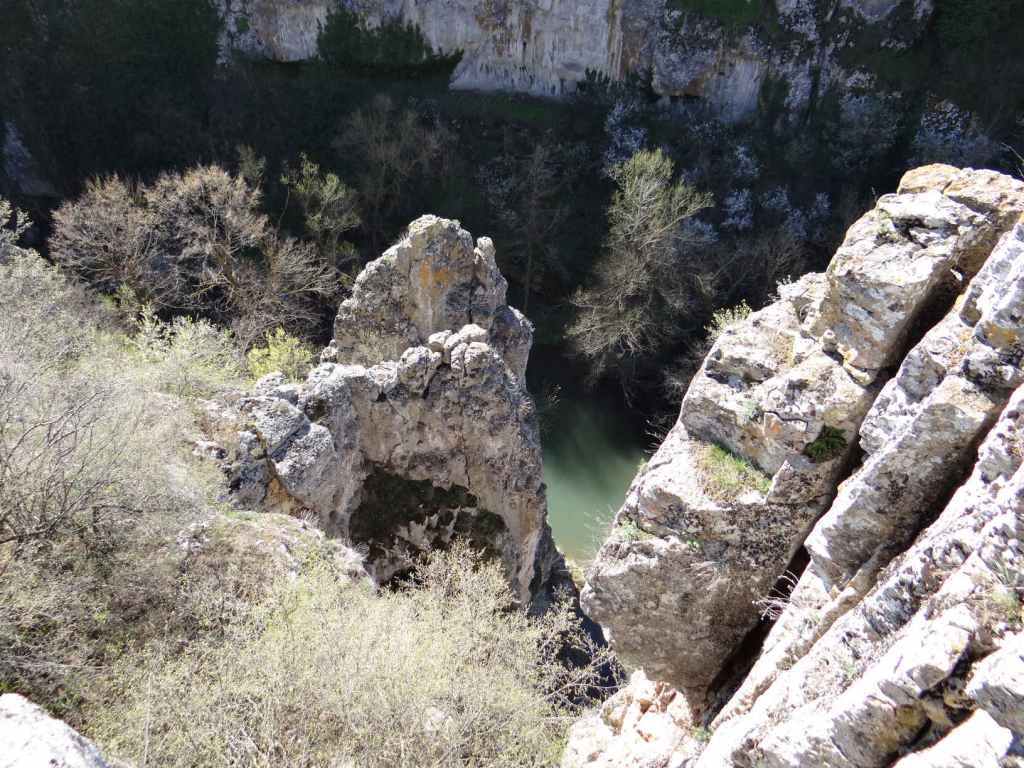
Not all trains are direct, sometimes it’s necessary to change in Radomir, but don’t worry, the connecting train waits for the train you are on to arrive. We drove to Radomir and took the train from there. A return ticket Radomir-Skakavica-Radomir cost a little over 2 euros! The stop before Skakavica is Zemen, where there is a famous Monastery of St John the Theologian. The train then travels along a gorge created by the Struma, a stunning river that rises on the southern slopes of Mt Vitosha (the mountain that overlooks Sofia) and then travels to Greece, entering the Aegean Sea at the ancient site of Amphipolis. There are interesting rock formations. After fifteen minutes, you reach Skakavica station. Alight here, wait for the train to leave and then continue along the railway line in the same direction the train has just gone in (that is, south). It’s quite safe. This is a single-track railway, so there is no immediate danger of a train coming the other way. After fifteen minutes of walking along the railway, you will come to a short tunnel. Go through the tunnel and, before you reach the iron bridge crossing the river Struma and entering a second tunnel, on your right you will see a low concrete wall. The path to the waterfall starts here, at the end of the concrete wall.

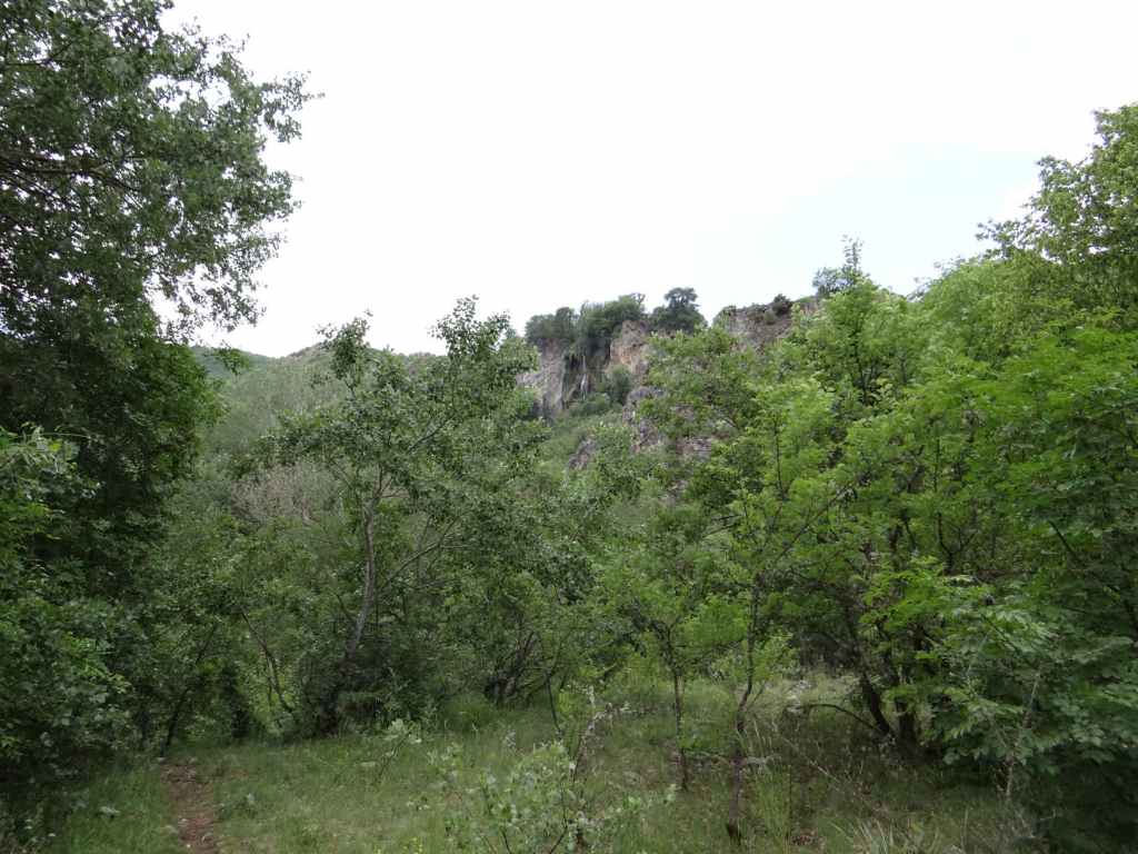
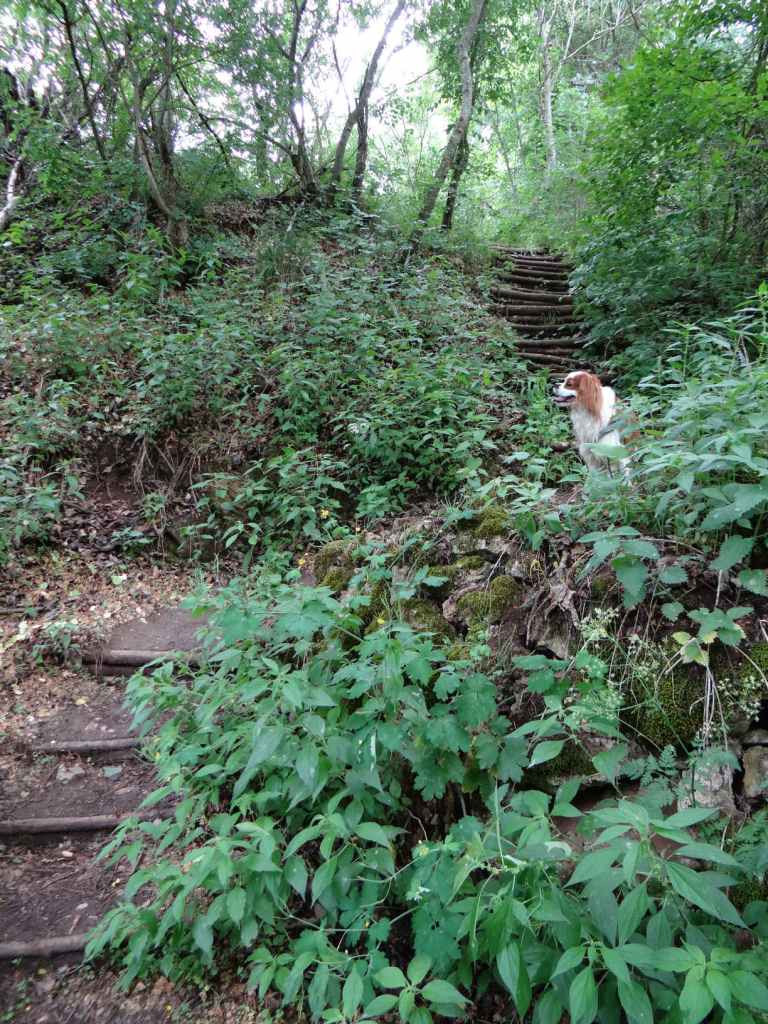
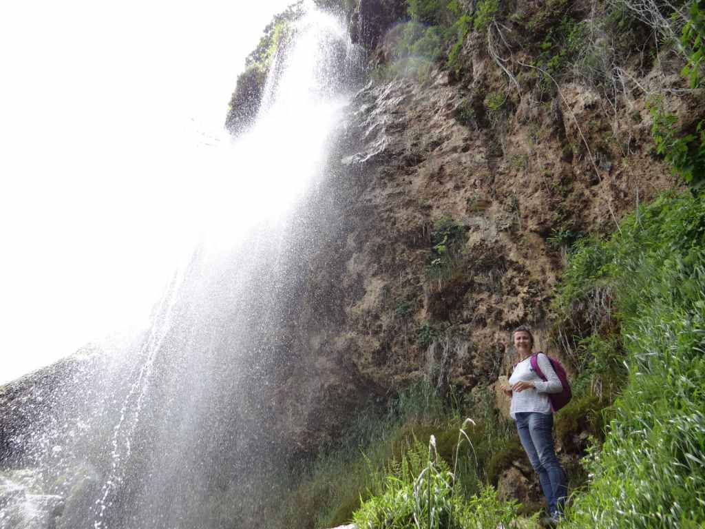
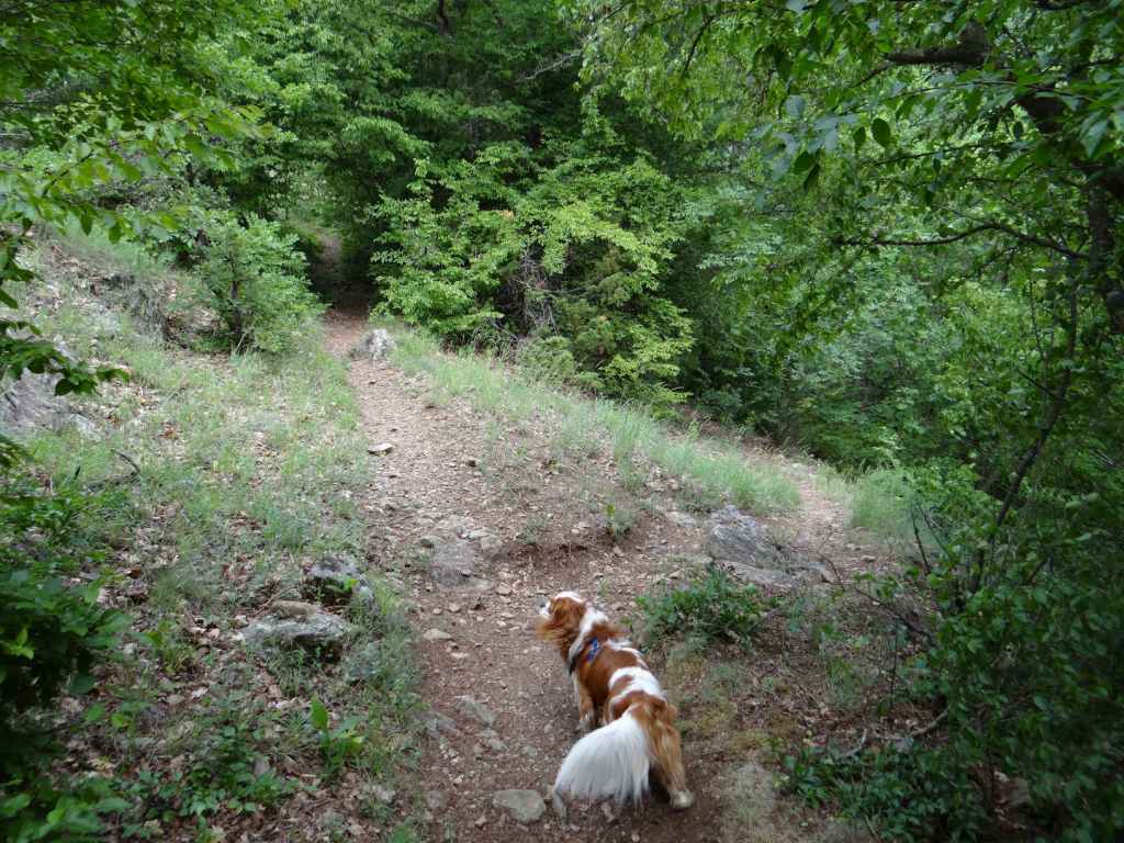
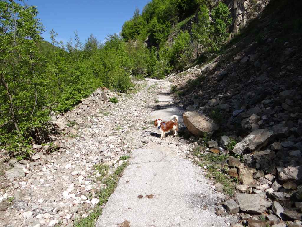
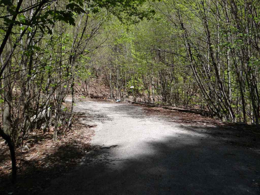
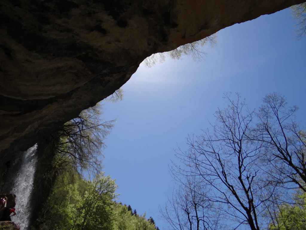
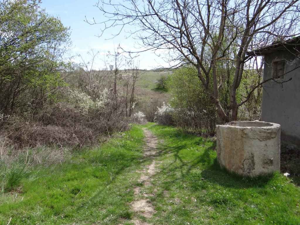
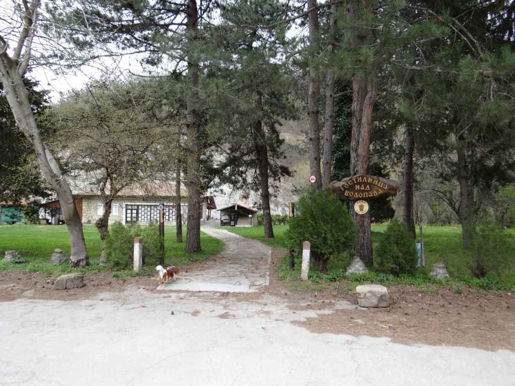
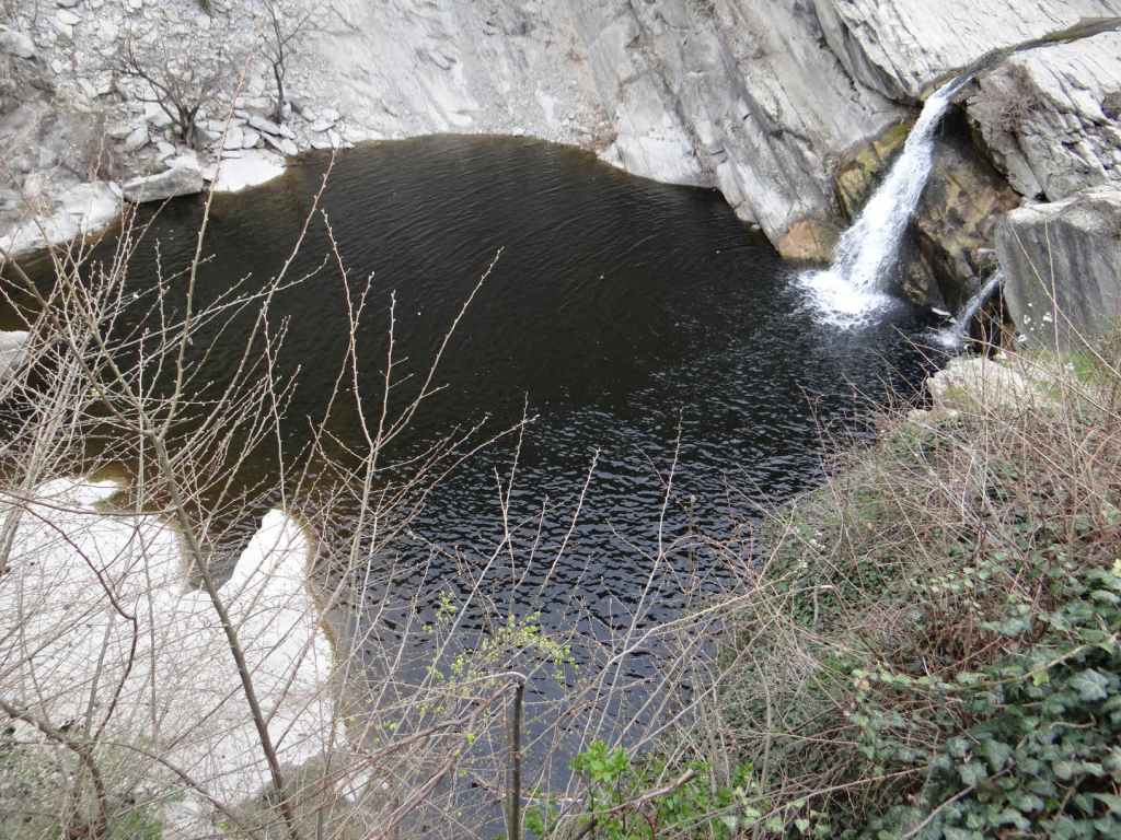
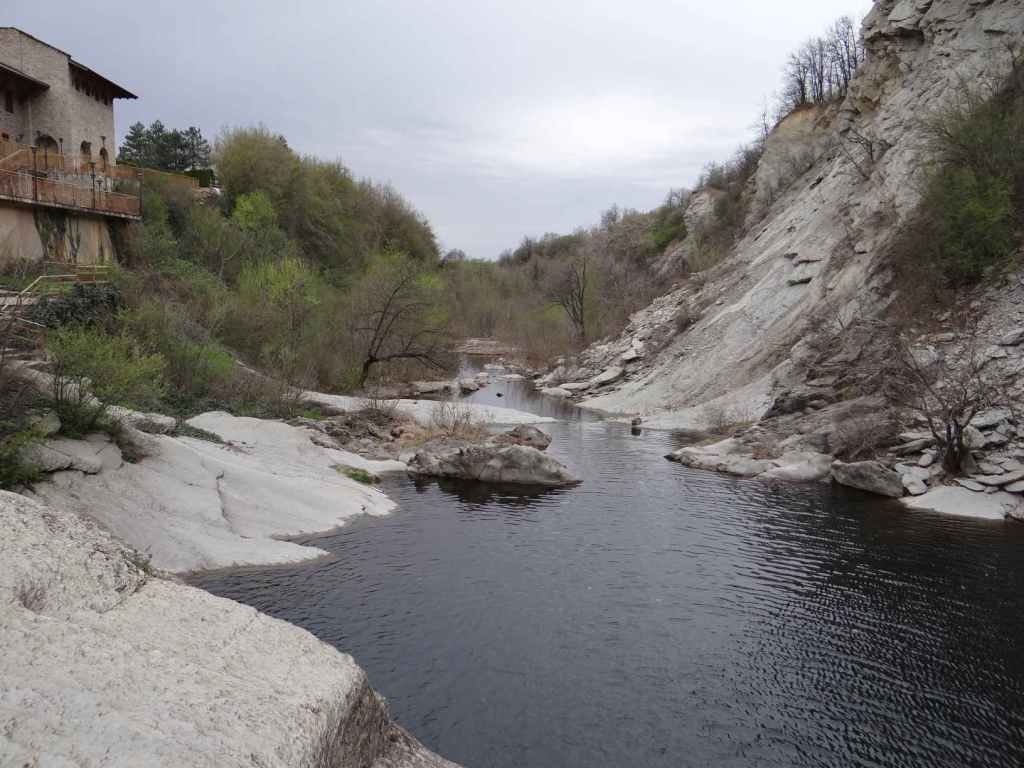
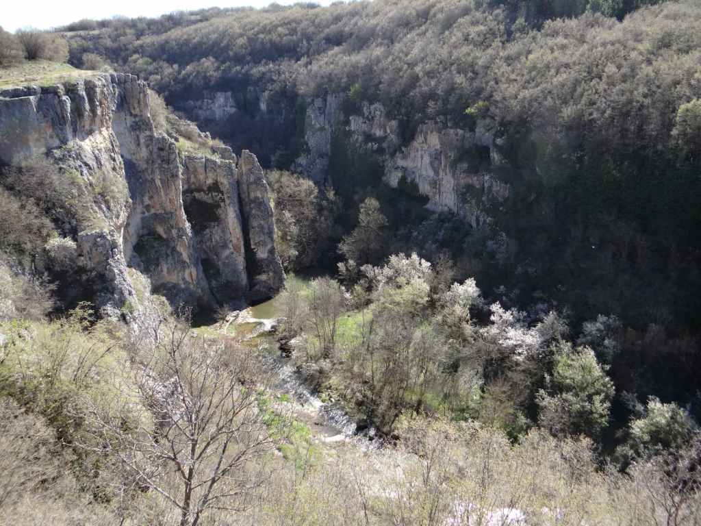
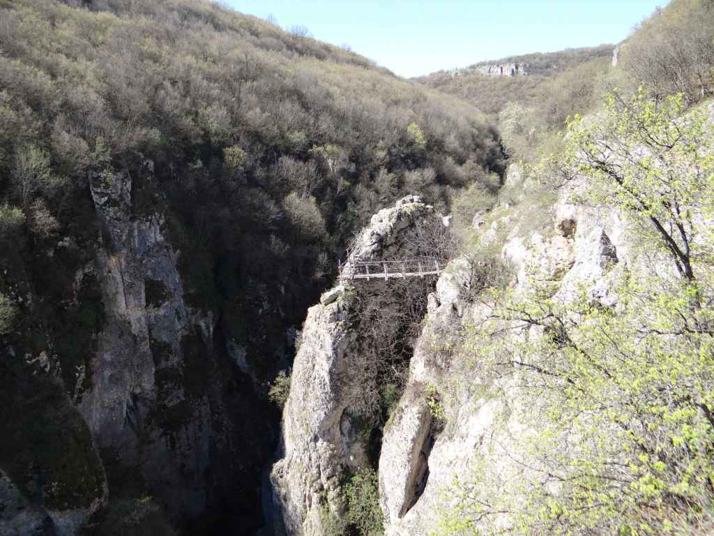
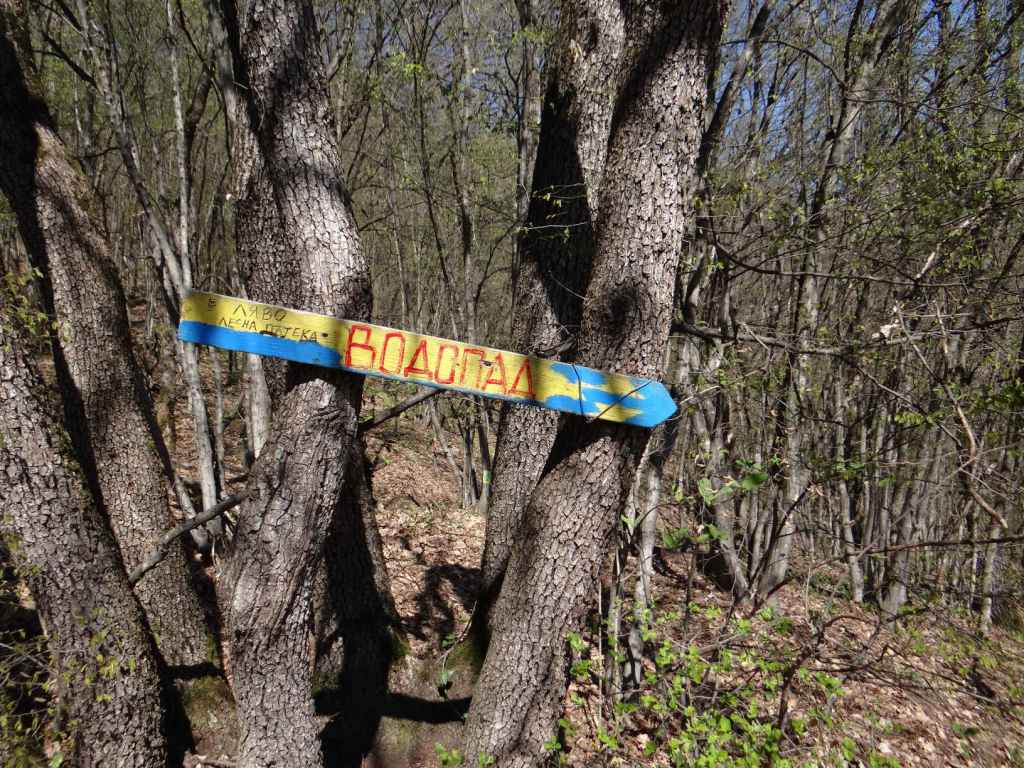
Follow the path, which runs alongside the river Struma on your left – admire the river! – and in about fifteen minutes you will reach a signpost indicating a picnic area to the left (‘МЯСТО ЗА БИВАК’) and the waterfall to the right (‘КЪМ ВОДОПАДА’). Go right here. The path climbs a little, and you reach a wooden bridge over a stream on your left. This is the way to the waterfall. The wooden bridge is somewhat destroyed, but you can cross the stream just above the bridge. You must now climb some steps, which will take you to a small terrace, where you get a view of the gorge and the Struma on its implacable way to Greece. Continue uphill. The first turning on the left takes you to the bottom of the waterfall. If you continue uphill, you will come to an area just below the top of the waterfall. In both places, you are likely to get wet! But who cares, right? The experience is invigorating.

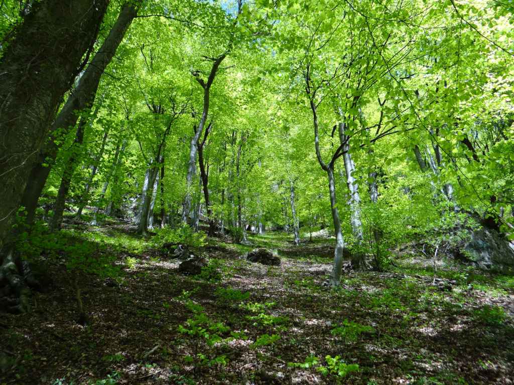
At the top of the waterfall is a small chapel dedicated to St Demetrius. This can be seen from below. Near the wooden bridge is a map of the area and a description of the local wildlife, with a couple of picnic tables in the shade. While we rested here, a bird kept us company with an astonishing succession of melodies and trills. This is Bulgarian nature at its best. It took us only forty minutes to get from the station to the top of the waterfall, and the walk is very pleasant. The waterfall in its entirety is seventy metres high. It is formed by the Shiroki Dol river, which then joins the Struma below on its journey to Greece. At a distance of about six kilometres from the waterfall is an old chapel dedicated to the Assumption of the Virgin Mary, near the village of Ruzhdavitsa, which we didn’t go to. All in all, a fantastic day out.

A note of warning: when you head back to Skakavica station, allowing about an hour to get there, so you have plenty of time, the path along the Struma back to the railway line divides at one point, and it is very tempting to take the left branch that heads uphill (and, for all I know, goes to the railway station), but if you want to go back the way you came, you must take the right branch. In a couple of minutes, you’ll be back at the railway. Provided you’ve left enough time, there is no danger of coinciding with the train, but obviously caution is required.

The path alongside the railway, after you leave Skakavica station.
The tunnel.
The low concrete wall. The path to the waterfall starts here.
The waterfall in the distance.
Fifteen minutes after you leave the railway, the path divides. Head right to the waterfall (‘КЪМ ВОДОПАДА’).
The steps leading up to the waterfall.
The small terrace overlooking the gorge formed by the Struma River.
The top of the waterfall.
The view from the top of the waterfall, with the Struma River in the distance.
The bottom of the waterfall.
Polska Skakavitsa Waterfall.
Heading back to the railway, the path divides. Keep right in order to reach the railway!
The path as it descends to the railway.
Video

Theological English (4): Connections – Same Letters, Same Order

In this fifth video on “Theological English”, Jonathan Dunne begins to look at word connections in the English language – that is, the spiritual content of language, meaning inside words. Unlike etymology, which is the study of how words have evolved over time, the spiritual content of language hasn’t been put there by us – it is meaning the words themselves contain, whether we like it or not. Hence the spiritual content of language can be said to be “outside” or “behind” time. It is vertical rather than horizontal (“over” time). Here, Jonathan looks at the simplest word connections – connections between words that don’t involve making substantial changes to the letters or their order.

To access all the videos in this course, use the drop-down menu “Theological English (Video Course)” above. The videos can be watched on Vimeo and YouTube.

Theological English (3): The Alphabet

In this fourth video on “Theological English”, Jonathan Dunne looks at the twenty-six letters that make up the Latin alphabet as it is used in English – h, five vowels, three semi-vowels, fourteen consonants, and three “redundant” letters (c, q and x) – and sees how these letters are used to represent the three elements of speech which are also the three elements of creation: breath, water, and flesh.

To access all the videos in this course, use the drop-down menu “Theological English (Video Course)” above. The videos can be watched on Vimeo and YouTube.

Hristo Danovo

If you’re travelling to this waterfall from Sofia, you’ll need an early start. It’s a ten-hour day – a two-hour drive in both directions, a two-hour walk in both directions and two hours to spend at the waterfall. Is it worth it? Well, you will get a real taste of the Balkan and will visit what for me is the most beautiful waterfall in Bulgaria. So, yes.

You need to take the E871 east of Sofia, in the direction of Burgas. This is one of my favourite roads. It starts very straight, then it climbs and winds over a couple of forested hills, passing a monument to Bulgaria’s freedom fighter Vasil Levski, after which it seems to pass through a landscape straight out of The Hobbit, as if elevated fifty feet in the air. The road hugs the southern slopes of the Balkan, the ‘Old Mountain’ as it’s known in Bulgarian. It’s like an arrow flying east.

Leave Sofia on the road for Varna/Burgas, but then follow the signs for Burgas. Having passed through the outlying village of Dolni Bogrov (where there always seems to be a market at the weekend, and lots of cars parked at both sides of the road), you turn right, and the E871 stretches out in front of you. The drive from Sofia to the village of Hristo Danovo is 130 km. About halfway, you pass the turning for another waterfall, Chavdar, to the south, then you go through the more industrial towns of Zlatitsa-Pirdop (it’s difficult to distinguish them) and after Rozino, just as you are about to enter Karnare (from where there is a road that memorably crosses the Balkan north to Troyan), there is a turning on the left marked Hristo Danovo, 4 km. Take this turning until you reach the central square of Hristo Danovo, where there are signs for the waterfall (known as ‘Suvcharsko Praskalo’) and the Balkan Central National Park which it is part of. Park the car.

Above the village is an old tarmac road that will take you all the way to the waterfall. Some people drive their cars some of the way, but it’s really not necessary (and also the road is not very good). Enough with the driving. You leave the square along a short road to the right of all the signs and immediately turn right and climb a paved road. This road becomes a track. Keep on climbing out of the village. After ten minutes, the track divides, you head right, next to a field with a view over the village, and in another five minutes you reach the tarmac road. Avoid the temptation to continue along the dirt track opposite, and turn left along the tarmac road.

Savour the views of the Balkan Mountain. On your left is a deep gorge formed by the Damladere River (the same that forms the waterfall). After forty-five minutes, you will see a smaller waterfall. In another twenty minutes, you will reach an orange barrier, followed by a table and benches, which is an ideal spot to stop and take a rest. Exactly an hour and a half after leaving the village, the road veers to the left over a concrete bridge that crosses the Damladere – this is where you part ways. Immediately after the bridge, a narrow track heads upstream through the forest. You continue along the left bank of the river for five minutes, and then you are forced to climb (not to follow the course of the river, which is protected). Fifteen minutes after leaving the bridge, you will reach the waterfall. Prepare yourself for a wonderful sight. The waterfall is a straight line falling 54 metres, like a windpipe between two lungs. The water glistens in the sun, throwing off drops that bombard your face. Let them.

I have been to more than thirty waterfalls in Bulgaria, including the more famous Raysko Praskalo a little further east, also in the Central Balkan National Park. Hristo Danovo is my favourite. You have a sense of the power and purity of nature. You also learn a little bit about the Balkan Mountain. One of the amazing things about Bulgaria is how distinct its mountain ranges are from each other – the Balkan, Vitosha, Rila, Pirin, Rhodope… Not one of them is alike. I am actually a fan of Vitosha, because this is the mountain I visit most often from Sofia (it overlooks Sofia from the south), but they are all remarkable. My wife says Bulgaria is in the perfect location – far enough north for the mountains not to be dry, far enough south for them not to be cold. Of course, she’s right!

Hristo Danovo main square, with the signs for the waterfall and the Central Balkan National Park. The road for walking to the waterfall is on your right.
The route to the waterfall!
The paved road leading up out of the village.
Before reaching the tarmac road, the track divides. Go right.
The track reaches the tarmac road. Follow the tarmac road north-west.
A view back over the village of Hristo Danovo.
The road is not exactly suitable for driving!
After forty-five minutes, a waterfall on your left.
In another twenty minutes, you reach an orange barrier.
An hour and a half after leaving the village, you reach a concrete bridge over the Damladere River. Leave the road immediately after the bridge and follow the left bank of the river.
A narrow path takes you through a magical forest to the waterfall.
Hristo Danovo Waterfall – a windpipe between two lungs.
After falling 54 metres, the water lands with an almighty crash.
A view of the upper part of the waterfall.
A view from the side.
A view from under the rock.
Video

Theological English (2): The Holy Trinity

In this third video on “Theological English”, Jonathan Dunne looks at another Christian paradox, the concept of the Holy Trinity – God as “three in one”. How is it possible for God to be three and one? Surely he is one or the other. The answer can be found in language.

To access all the videos in this course, use the drop-down menu “Theological English (Video Course)” above. The videos can be watched on Vimeo and YouTube.

Video

Theological English (1): Away from the Line – AIO

Having looked at the line, which represents the ego in English (I) and the number 1, in this second video on “Theological English”, Jonathan Dunne looks at the three ways of moving away from the line – the triangle, the cross and the circle. Truth is paradoxical, so while a cross represents suffering, it is also a plus-sign. This is the meaning of Christ’s injunction to lose our life in order to find it.

To access all the videos in this course, use the drop-down menu “Theological English (Video Course)” above. The videos can be watched on Vimeo and YouTube.

Vishovgrad

The third waterfall in terms of distance north-west of Veliko Tarnovo is Vishovgrad (‘Zarapovo’). Hotnitsa (because of the turquoise waters) and Emen (because of the canyon that precedes the waterfall) may take the fame, but do not underestimate the charms of this waterfall 3 km east of Vishovgrad, on the road between this village and the village of Emen. This waterfall can be visited on the same day as Emen since Emen is only 4 km further east.

To get there, follow the instructions for getting to the village of Emen. Once you arrive in the main square in Emen, continue for another 200 m, until you reach a crossroads. The road to Vishovgrad is on the right. After 400 m, you will see the dirt track leading to the start of the ecopath to Emen Waterfall on the right. Stay on the main road. After another 3 km, you will pass a factory on your right, and 600 m later, where there is a bend in the road, you will see two white signs on the right, with a dirt track leading into the forest. This is Zarapovo. You can park the car on the verge. The ‘ecopath’ (any path in nature seems to be termed thus) heads to the right and in only five minutes takes you to the waterfall.

The path divides. The left fork takes you through some trees to the bottom of the waterfall. The right fork takes you round the rock and over a wooden bridge to the top of the waterfall. The area below the waterfall is ideal for rest and relaxation. There are even several smaller falls further downstream.

These three waterfalls are all worth a visit – Hotnitsa because of its turquoise waters and the ‘ecopath’ up the gorge; Emen because of the canyon; and Vishovgrad because of its charm. I found Vishovgrad the most restful. Even though there were lots of people about (on a Saturday), everybody was very friendly!

If you’re travelling to or from Sofia, there is no need to go via Emen and Veliko Tarnovo. Travelling east on the E772, 14 km after Sevlievo, there is a turning on the left for Dobromirka (4 km) and Pavlikeni/Suhindol (25 km). Take this turning, ignore the signs for Suhindol, follow the signs for Pavlikeni. Vishovgrad is situated 11 km before Pavlikeni. Turn right here, at the main square of the village, and in 3 km you will reach the waterfall.

The ecopath from the road to the waterfall is so short you can see the end, where the tree is.
At the end, you are standing on a rock above the river. Down below is the wooden bridge that takes you to the top of the waterfall.
On your left is the path through some trees to the bottom of the waterfall.
The waterfall, which seems to me to resemble a seated figure.
Vishovgrad Waterfall.
A smaller fall further downstream – looking back up to the main waterfall.
A view of the wooden bridge from the other side of the river, and the rock where you arrive after you leave your car.

Kapinovo-Ruhovtsi

There are two waterfalls south-east of Veliko Tarnovo, near the villages of Kapinovo and Ruhovtsi. They can be visited together.

Ruhovtsi is a village 5 km east of the town of Elena. The waterfall is named ‘Hristovski’ after a nearby settlement. Drive from Veliko Tarnovo along the E772 in the direction of Varna. After 10 km, turn right for Elena (33 km). Drive past Elena and continue for another 4 km until you reach the turning on the right for Ruhovtsi (1 km). When you reach the main square of the village, turn right and continue for 1.8 km. Just after crossing a river, you will see a sign for the waterfall on your right and an open space to park your car on the left. Follow the dirt track that leaves the road on your right for about 15 minutes. The dirt track veers left through the forest and then leads directly to the waterfall. This waterfall is attractive because of the width of its cascade.

To visit Kapinovo Waterfall, you need to go not to the village of Kapinovo, but to Kapinovo Monastery. The waterfall is in the grounds of the monastery. Drive back past Elena in the direction of the E772. 15 km after Elena, you will reach the village of Mindya. Turn left for Kapinovo. Drive straight through Kapinovo (ignore the sign for Kapinovo Monastery on your left, just before the main square, the road is not fit for normal vehicles), continue through the villages of Tserova Koria and Pchelishte, and then turn left at the sign for Velchevo (7 km). Drive straight through Velchevo and continue for another 6 km to Kapinovo Monastery. The grounds of the monastery have been turned into a campsite. On entering the monastery grounds, you will be able to park the car at a small roundabout. The waterfall is over on your left, by the rocks. There is a guesthouse overlooking the waterfall. The path to the waterfall descends to the right of the guesthouse.

Don’t forget to visit the church of Kapinovo Monastery, which is dedicated to St Nicholas and has an impressive fresco of ‘The Last Judgement’ on its façade. The church is a short distance from the waterfall and can be reached by following a subsidiary road.

Of course, it is possible to visit Kapinovo Waterfall without going to Elena and Ruhovtsi. In which case, all you need to do is to take the E85 south of Veliko Tarnovo in the direction of Debelets, Dryanovo and Gabrovo. After only 1 km, there will be a turning on your left for Prisovo, Kapinovo and Mindya. Take this turning. Drive through Prisovo and then turn right at the sign for Velchevo (7 km). Drive through Velchevo and continue to Kapinovo Monastery.

These waterfalls are not as impressive as the waterfalls north-west of Veliko Tarnovo – Hotnitsa, Emen and Vishovgrad – but they are still beautiful and worth a visit. There are numerous other monasteries in or near the surrounding villages of Kilifarevo, Prisovo, Plakovo (this monastery is just before Kapinovo Monastery), Merdanya, Maryan… Just remember while some monasteries are located in the village, most are some distance away – at the end of the road…

Mural in Elena.
The dirt track leaving the road for Ruhovtsi Waterfall.
The dirt track as it passes through the forest.
April blossom!
Ruhovtsi (‘Hristovski’) Waterfall.
Close-up of Ruhovtsi Waterfall.
The waterfall from the side.
The path to Kapinovo Waterfall in the monastery grounds (campsite). The path leads right of a guesthouse.
Kapinovo Waterfall from above.
Kapinovo Waterfall.
Close-up – the rock resembles a dog lapping water!
The peaceful view downstream.
The fresco ‘The Last Judgement’ in Kapinovo Monastery.

Emen

Emen is the second of three waterfalls that lie north-west of the medieval capital Veliko Tarnovo – Hotnitsa, Emen and Vishovgrad. What sets Emen apart is the canyon with the river Negovanka at its bottom. Just before the Negovanka forms a large reservoir, there is a ten-metre waterfall called ‘Momin Skok’, meaning ‘Maiden Jump’ – as with Ovchartsi Waterfall in Rila, this refers to the legend of young girls jumping to their death in order not to be forcibly converted to Islam during the Ottoman occupation of Bulgaria (14th-19th centuries).

To get there from Veliko Tarnovo, take the main road to Sofia (E772) and after 20 km turn right for the village of Balvan. Follow the road to the centre of this village and then turn right for Emen (8 km). Be careful because there is a sign for Emen in Balvan that has been turned back to front and seems to indicate that you should go straight ahead when the road veers left. This is not the case. The road veers left and after a short while you reach the centre of the village.

Here you turn right and after 8 km arrive in Emen. The road takes you over a bridge on the river Negovanka and immediately you arrive at a small square opposite the town hall where you can park the car. There is also drinking water. A smaller road leads to the right, following the left bank of the river. The road becomes a dirt track and then a path. After fifteen minutes, you reach a wooden suspension bridge over the river, but you stay on the left bank. The path climbs up to another dirt track, which then leads on your right to the beginning of the ecopath, where there is a cave. The cave is 3 km long and is home to various species of bat. In communist times, it was used as an arms depot for a military base located directly above it.

The ecopath is said to have been the first in Bulgaria and was created in 1992, shortly after the fall of communism. I think the initial idea was to follow the course of the river at the bottom of the gorge, but the wooden bridges crisscrossing the river have long since succumbed to the elements, which is a shame, and now the ‘ecopath’ actually runs along the top of the canyon on the left. From the beginning of the ecopath, where the cave is, to the waterfall is about forty minutes. The path takes you up to the top of the canyon and then winds along the edge, in amongst trees. After about thirty minutes, the path divides, but it doesn’t matter which branch you take – one continues among the trees, the other skirts the precipice. The path then descends to the left (this is clearly marked by blue arrows) to rejoin the river at the bottom. Turn right, and you will arrive at the waterfall in five minutes. You can hear the waterfall from the top of the gorge.

It is possible to drive to the start of the ecopath. Continue past the main square in Emen and after about 200 m you will reach a crossroads. Turn right, and just as you are leaving Emen, a dirt track forks off to the right, leading to the ecopath. Continue along this road, without taking the dirt track on your right, and in a short while you will reach the waterfall of Vishovgrad, ‘Zarapovo’. Both waterfalls can easily be visited on the same day since they are only a short distance apart.

The Negovanka River as it passes through Emen.
The wooden suspension bridge in Emen.
The path on the left bank of the river joins the dirt track leading to the start of the ecopath.
The start of the ecopath – steps leading up to the cave, the 17th longest in Bulgaria at just over 3 km.
The start of the ecopath, after the cave.
Having immediately climbed to the top of the canyon, view of the canyon itself.
Cragged rocks.
View up the canyon.
The path divides – either branch will lead to the waterfall.
The remnants of the ecopath clinging on for dear life!
A blue sign indicates the beginning of the descent from the top of the gorge to the waterfall below.
Emen Waterfall.
Close-up of the waterfall.
Panoramic view of the waterfall.
If you decide to drive to the start of the ecopath, you need to take the dirt track on the right. Continue along the asphalt road, and you will soon reach Vishovgrad Waterfall.