In this ninth video on “Theological English”, Jonathan Dunne looks at the order of letters in the alphabet and how this can be used to make word connections. It was foreign workers in Egypt in the second millennium BC who came up with the idea of using not hieroglyphs for writing (hieroglyphs represented words or syllables), but letters that represented individual sounds, a much more cost-effective way of writing, since you only need 20-30 letters to write down the different words, but hundreds of hieroglyphs. This idea was taken on by the Phoenicians, the traders of the ancient world, from where it passed to Greece and Rome, becoming the Latin alphabet we use today.
To access all the videos in this course, use the drop-down menu “Theological English (Video Course)” above. The videos can be watched on Vimeo and YouTube.
In this eighth video on “Theological English”, Jonathan Dunne continues looking at the spiritual content of language – this time, word connections made by changing the consonants, the “flesh” of language (consonants are produced by obstructing the breath with the lips or tongue, that is with the flesh). The devil would make us differ, while the father would gather us together. Human law is to protect private property, while divine law is to love God and to love our neighbour. God is love (eros-zero).
To access all the videos in this course, use the drop-down menu “Theological English (Video Course)” above. The videos can be watched on Vimeo and YouTube.
In this seventh video on “Theological English”, Jonathan Dunne continues looking at the spiritual content of language. Speech, like creation (Genesis 2:6-7), is made up of three elements: breath (the letter “h”), water (the vowels – hold a vowel sound and water will collect in your mouth) and flesh (the consonants, made by obstructing the passage of breath with the lips or tongue – that is, with the flesh). Here we see examples of word connections made by changing the vowels according to where they are pronounced in the mouth.
To access all the videos in this course, use the drop-down menu “Theological English (Video Course)” above. The videos can be watched on Vimeo and YouTube.
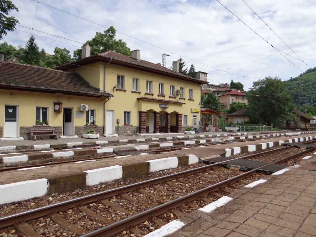
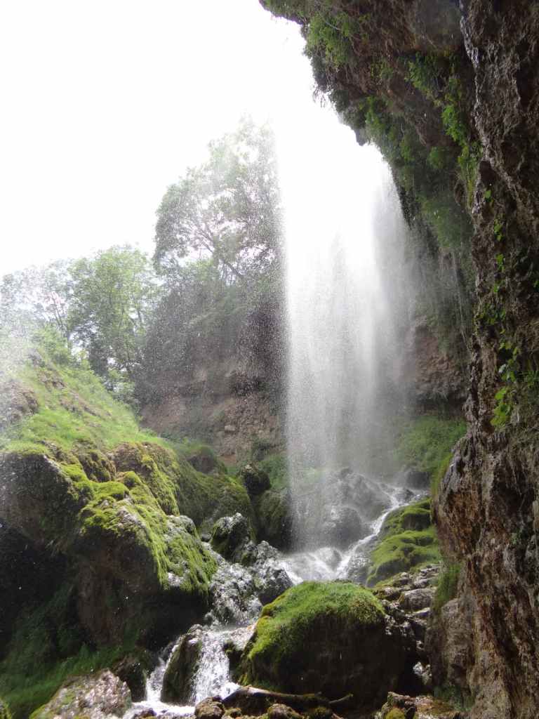
At 85 metres, Bovska Skaklya (‘Bov Waterfall’) is one of the highest in Bulgaria. Like Polska Skakavitsa, it can easily be reached by train from Sofia. The journey takes an hour, and there are regular services during the day (see the excellent Bulgarian State Railways website for train times, https://www.bdz.bg/en).
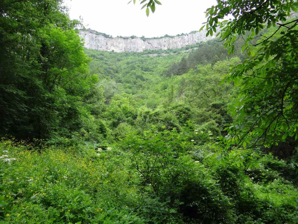
Bovska Skaklya is located at the halfway point between the villages of Bov (down below) and Zasele (up above). An ecopath has been built between these two villages to incorporate the waterfall and is named after the famous Bulgarian poet Ivan Vazov, who apparently used to enjoy walks in this area. There is some suggestion that you should descend from the village of Zasele, make your way down to the waterfall and the village of Bov and then climb back up again. Since it seems to me to make more sense to get the climbing in early in the day, I suggest starting in Bov. Also, Bov is the stop on the railway line from Sofia and is on the main road from Svoge to Mezdra, the II-16.
If you insist on starting in Zasele, located above the waterfall, then you will need a car. As you leave the village of Tserovo, five kilometres after Svoge, there is a turning left signposted for Zasele (7 km). Follow this winding road uphill until you come to the centre of Zasele, where there is a tarmac square. The ecopath starts from here.
Otherwise, continue to Bov, three kilometres after Tserovo. Ignore the turning right, signposted Gara Bov (‘Bov Station’), and continue on the main road for another 400 metres, taking a turning left signposted for Skaklya. This narrow road continues for 1.4 km to the start of the ecopath, but be careful. 200 metres before the end of the road, the road divides – keep left, going uphill, until you come to a small area next to a house, with the river on your right, where you can park the car. For those travelling by train, alight at Gara Bov and walk 400 metres down to the main road (leave the station, turn right, go under the railway and follow the road as it veers right and crosses the River Iskar). Once you reach the main road, turn right, continue for 400 metres until you reach the turning for Skaklya and then follow the previous directions.
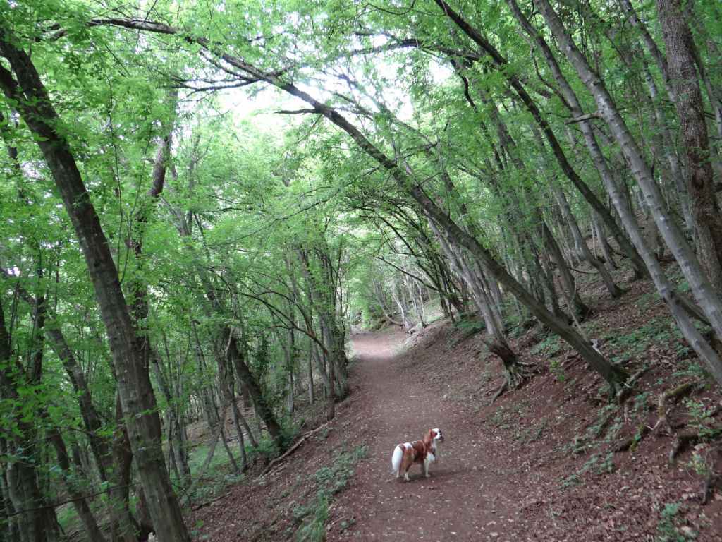
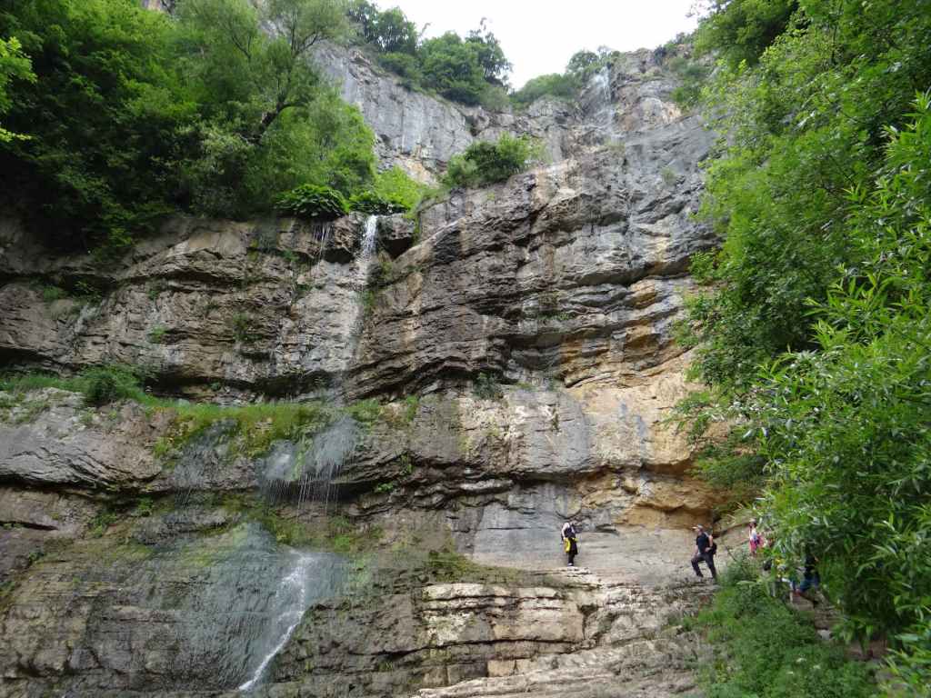
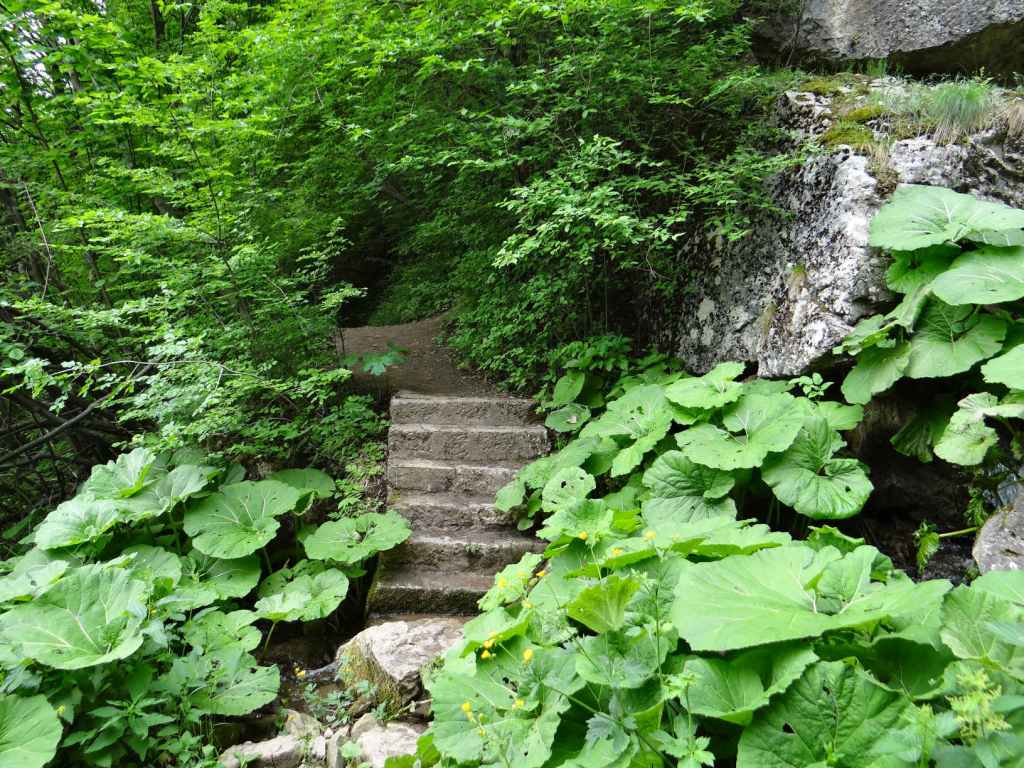
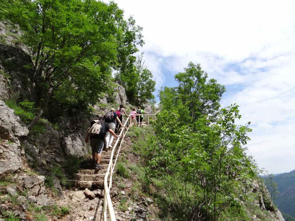
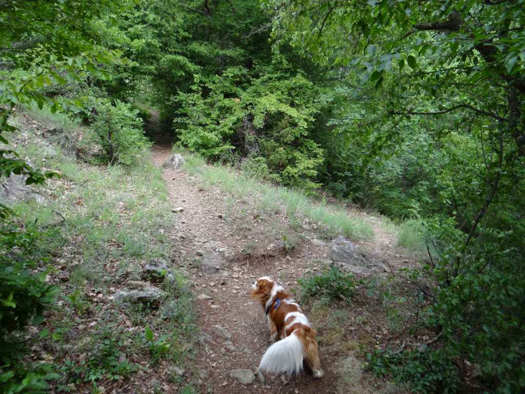
From where you park the car, you have a forty-minute steady climb through the forest to the bottom of the waterfall. The forest is magical, and there are some wonderful views back the way you have come. Once you reach the waterfall, another forty-minute climb, slightly stiffer this time, will take you to the top. As you get higher, there are steps and a railing to hold onto. You really get an impression of the height of the waterfall because you are climbing it! At the top is an open area of grass with several picnic tables. Continue to the village of Zasele, perched on top of the rock, and you will come across one or two restaurants and guest houses if you wish to stay the night (though I understand you have to book ahead).
The best time for visiting waterfalls is immediately after the snow melts – second half of April, first half of May. This is when the flow of water is at its strongest. We went at the beginning of June, so already the flow had declined somewhat. In autumn, it becomes a trickle. We first visited the waterfall ten years ago, in November. There wasn’t much water left, but the autumnal colours of the trees more than made up for the lack of watery fireworks!
Bovska Skaklya is not far as the crow flies from another waterfall, Dobravitsa (except that for Dobravitsa, you have to leave the main road in Svoge and follow the signs for Iskrets and Breze). From Gara Bov, another ecopath takes you to the waterfall Pod Kamiko. This ecopath starts from the stadium in Gara Bov and is circular, so you don’t have to come back the way you went (see the map on the road outside the station).
Gara Bov.
The turning for Skaklya. There is also a sign saying ‘Touristic Road “Vazov’s Path”, 1.4 km’.
200 metres before the ecopath begins, the road divides – keep left here.
There is a small area to park the car where the road peters out and the ecopath begins.
A view from the ecopath of the rocks up above.
The path as it passes through the forest.
The waterfall in the distance.
Arriving at the waterfall.
Bovska Skaklya, seen from below.
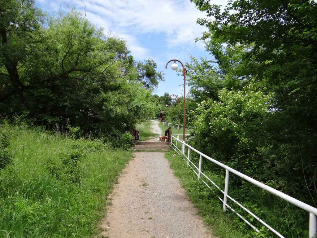
From here, the path continues to the top of the waterfall and the village of Zasele.
This path has steps and a railing.
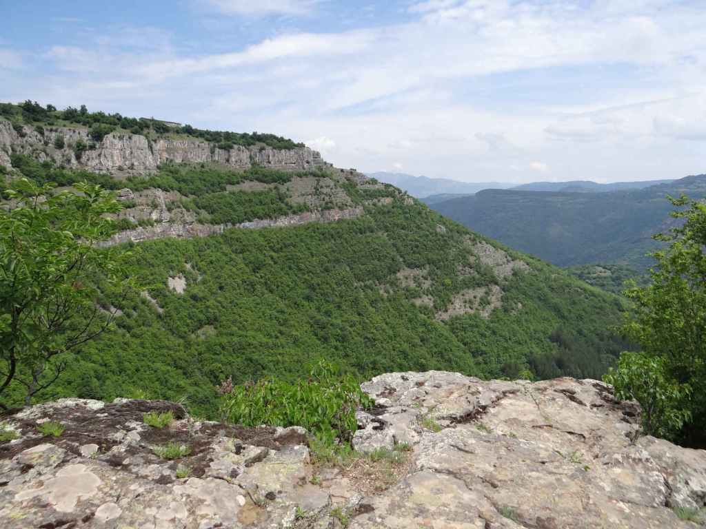
The view near the top.
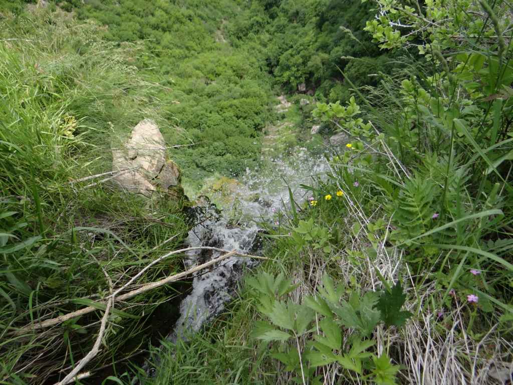
The top of the waterfall – the stream passes under the bridge and tumbles down 85 metres.
In this sixth video on “Theological English”, Jonathan Dunne continues looking at connections between words in the English language, again using the same letters, but this time changing their order, rearranging the letters. Once we rearrange the letters, sometimes reading the words back to front, we can no longer claim that the connection is because of etymology, the evolution of words over time, with us as the cause of their development. Spiritual meaning is hidden, so in order to discover this meaning we must be willing to make slight changes to the words – changes, however, that always follow a fixed set of rules (phonetics, alphabet, appearance).
To access all the videos in this course, use the drop-down menu “Theological English (Video Course)” above. The videos can be watched on Vimeo and YouTube.
Undoubtedly one of the most beautiful waterfalls in Bulgaria. The journey to the waterfall reminded me a little of the 1970 film The Railway Children since it involves travelling by train and then walking along the railway line for a short distance. You can travel by car to the villages of Ruzhdavitsa and Polska Skakavitsa, after which the waterfall is named, but I understand the road is not good and then you have a long hike to get to the waterfall. By far the better option is to travel by train! The stop for the waterfall is called ‘Skakavica’ and it is on the line from Sofia to Kyustendil. The journey from Sofia to Skakavica is two and a quarter hours, and there are trains about every two hours. The trains are very pleasant and they run on time! I direct you to the wonderful Bulgarian State Railways website: https://www.bdz.bg/en. Here you will find up-to-date information on train times and other destinations in Bulgaria.
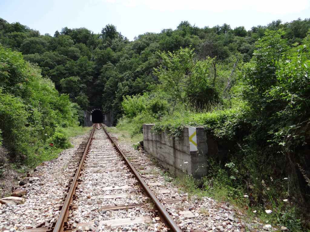
Not all trains are direct, sometimes it’s necessary to change in Radomir, but don’t worry, the connecting train waits for the train you are on to arrive. We drove to Radomir and took the train from there. A return ticket Radomir-Skakavica-Radomir cost a little over 2 euros! The stop before Skakavica is Zemen, where there is a famous Monastery of St John the Theologian. The train then travels along a gorge created by the Struma, a stunning river that rises on the southern slopes of Mt Vitosha (the mountain that overlooks Sofia) and then travels to Greece, entering the Aegean Sea at the ancient site of Amphipolis. There are interesting rock formations. After fifteen minutes, you reach Skakavica station. Alight here, wait for the train to leave and then continue along the railway line in the same direction the train has just gone in (that is, south). It’s quite safe. This is a single-track railway, so there is no immediate danger of a train coming the other way. After fifteen minutes of walking along the railway, you will come to a short tunnel. Go through the tunnel and, before you reach the iron bridge crossing the river Struma and entering a second tunnel, on your right you will see a low concrete wall. The path to the waterfall starts here, at the end of the concrete wall.
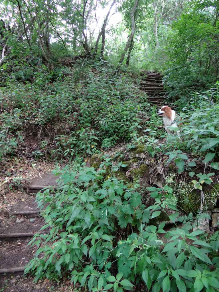
Follow the path, which runs alongside the river Struma on your left – admire the river! – and in about fifteen minutes you will reach a signpost indicating a picnic area to the left (‘МЯСТО ЗА БИВАК’) and the waterfall to the right (‘КЪМ ВОДОПАДА’). Go right here. The path climbs a little, and you reach a wooden bridge over a stream on your left. This is the way to the waterfall. The wooden bridge is somewhat destroyed, but you can cross the stream just above the bridge. You must now climb some steps, which will take you to a small terrace, where you get a view of the gorge and the Struma on its implacable way to Greece. Continue uphill. The first turning on the left takes you to the bottom of the waterfall. If you continue uphill, you will come to an area just below the top of the waterfall. In both places, you are likely to get wet! But who cares, right? The experience is invigorating.
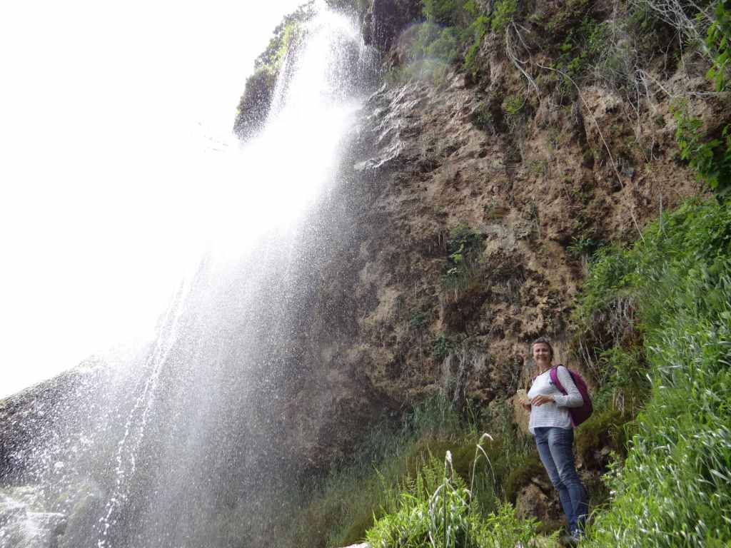
At the top of the waterfall is a small chapel dedicated to St Demetrius. This can be seen from below. Near the wooden bridge is a map of the area and a description of the local wildlife, with a couple of picnic tables in the shade. While we rested here, a bird kept us company with an astonishing succession of melodies and trills. This is Bulgarian nature at its best. It took us only forty minutes to get from the station to the top of the waterfall, and the walk is very pleasant. The waterfall in its entirety is seventy metres high. It is formed by the Shiroki Dol river, which then joins the Struma below on its journey to Greece. At a distance of about six kilometres from the waterfall is an old chapel dedicated to the Assumption of the Virgin Mary, near the village of Ruzhdavitsa, which we didn’t go to. All in all, a fantastic day out.
A note of warning: when you head back to Skakavica station, allowing about an hour to get there, so you have plenty of time, the path along the Struma back to the railway line divides at one point, and it is very tempting to take the left branch that heads uphill (and, for all I know, goes to the railway station), but if you want to go back the way you came, you must take the right branch. In a couple of minutes, you’ll be back at the railway. Provided you’ve left enough time, there is no danger of coinciding with the train, but obviously caution is required.
The path alongside the railway, after you leave Skakavica station.
The tunnel.
The low concrete wall. The path to the waterfall starts here.
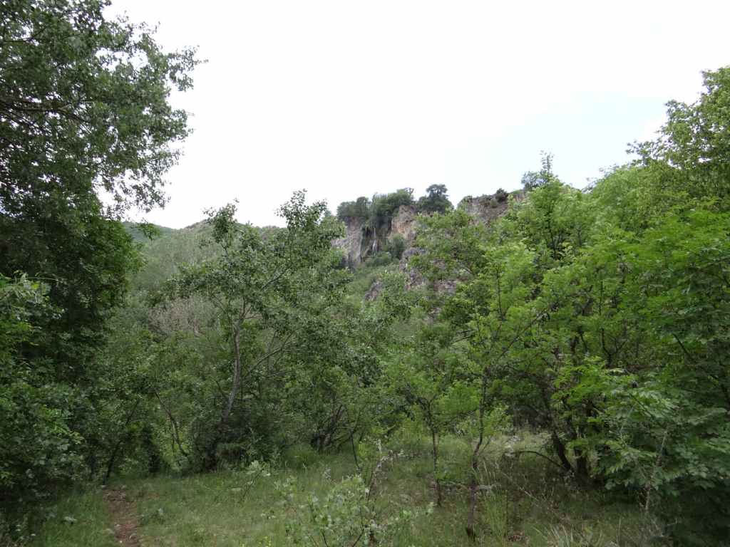
The waterfall in the distance.
Fifteen minutes after you leave the railway, the path divides. Head right to the waterfall (‘КЪМ ВОДОПАДА’).
The steps leading up to the waterfall.
The small terrace overlooking the gorge formed by the Struma River.
The top of the waterfall.
The view from the top of the waterfall, with the Struma River in the distance.
The bottom of the waterfall.
Polska Skakavitsa Waterfall.
Heading back to the railway, the path divides. Keep right in order to reach the railway!